
Deutsch-Chinesische Enzyklopädie, 德汉百科
 Maine-ME
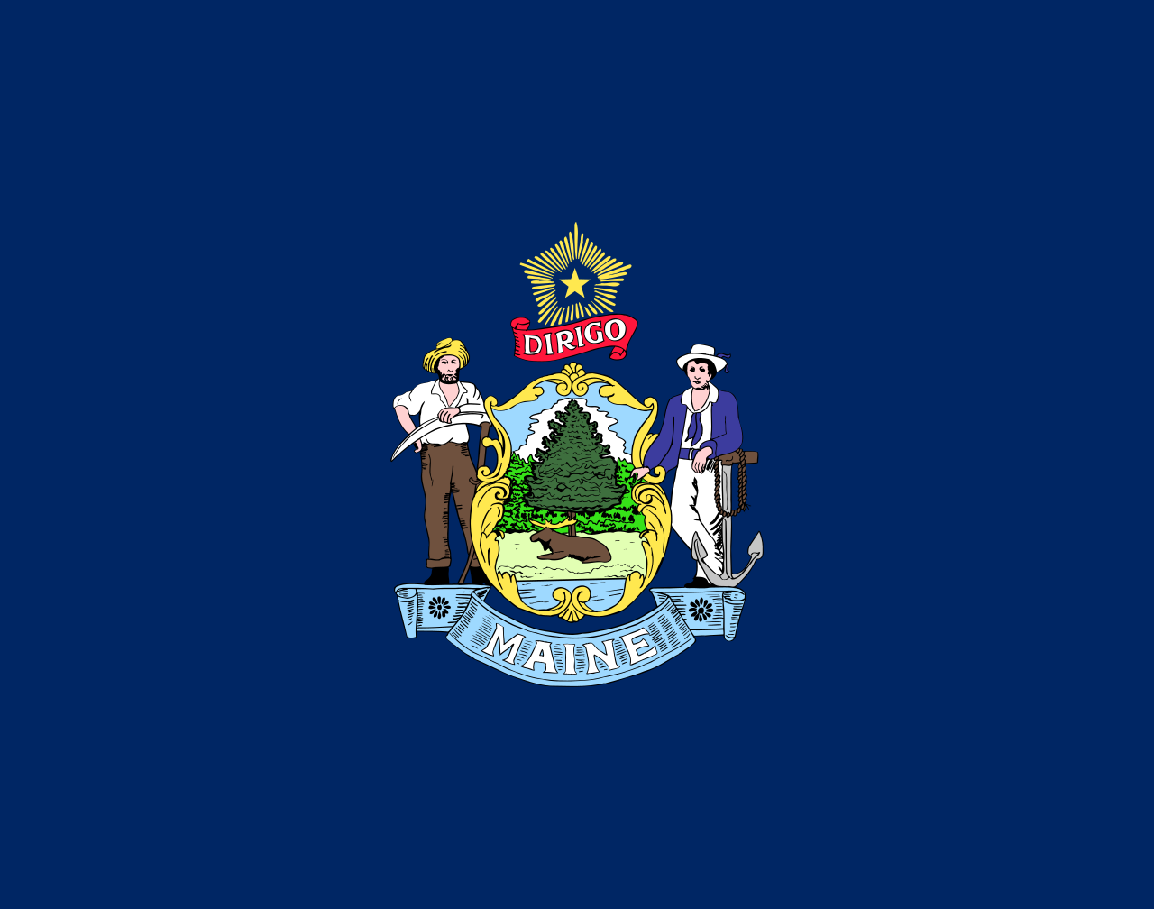
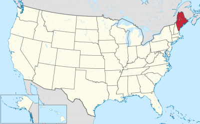
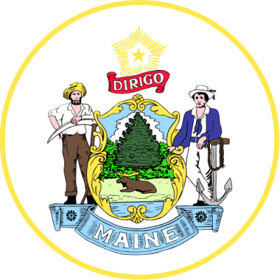
缅因州北邻加拿大的魁北克省,东邻加拿大的新不伦瑞克省以及大西洋,西靠美国的新罕布什尔州,其最东端也是美国五十州的最东端。位于缅因外海的Machias Seal Island和North Rock两小岛是美国、加拿大之间的争议区。缅因州是美国密西西比河以东人口密度最低的州份,境内90%的面积由森林覆盖,因此该州亦称为“松树之州”(Pine Tree State)。
Die Herkunft des Namens ist unklar. Wahrscheinlich ist er nach der französischen Landschaft Maine benannt, möglicherweise ist der Name aber auch eine Kurzform von „Mainland“ („Festland“, "Hauptland"). Die postalische Abkürzung des Staates ist ME. Der Spitzname Maines ist The Pine Tree State („Kiefern-Staat“). Die Hauptstadt ist Augusta.
Maine liegt als östlichster Bundesstaat der Continental States am äußersten Rand der Vereinigten Staaten. Betrachtet man deren Territorium insgesamt, liegen einige Inseln Alaskas in der östlichen Hemisphäre.
Der höchste Punkt Maines ist der Mount Katahdin im Piscataquis County (1.606 m). Maine ist der US-Bundesstaat mit dem höchsten Waldanteil. Da mehr als 90 % der Landfläche unter anderem mit Kiefern bewachsen ist, lautet der Beiname des Staates „Pine Tree State“ („Kiefernstaat“). Die landschaftliche Beschaulichkeit zieht zahlreiche Touristen an. Der Acadia-Nationalpark ist der einzige Nationalpark der Gegend und einer der meistbesuchten in den USA. Eastport ist die östlichste Stadt, West Quoddy Head die östlichste Landmarke der USA.
メイン州(メーン州、英: State of Maine、[ˈmeɪn] (![]() 音声ファイル); フランス語: État du Maine)は、アメリカ合衆国の州である。アメリカ合衆国本土およびニューイングランドの東北部に位置する。図法によりアメリカ合衆国本土最北部に見えるが、北緯49度16分に位置するミネソタ州ノースウエスト・アングルが本土最北部である。東と南は大西洋に面し、西はニューハンプシャー州、北西はカナダのケベック州、北東は同じくニューブランズウィック州に接している。入り組んだ岩の多い海岸線、低くうねった山稜、内陸の深い森と美しい水流など、その景色で知られ、またロブスターやハマグリなど海産物料理でも知られている。州都はオーガスタ市、人口最大都市はポートランド市である。面積は全米50州のうち39位。人口は第41位である。
音声ファイル); フランス語: État du Maine)は、アメリカ合衆国の州である。アメリカ合衆国本土およびニューイングランドの東北部に位置する。図法によりアメリカ合衆国本土最北部に見えるが、北緯49度16分に位置するミネソタ州ノースウエスト・アングルが本土最北部である。東と南は大西洋に面し、西はニューハンプシャー州、北西はカナダのケベック州、北東は同じくニューブランズウィック州に接している。入り組んだ岩の多い海岸線、低くうねった山稜、内陸の深い森と美しい水流など、その景色で知られ、またロブスターやハマグリなど海産物料理でも知られている。州都はオーガスタ市、人口最大都市はポートランド市である。面積は全米50州のうち39位。人口は第41位である。
現在メイン州となっている領域には数千年前から先住インディアンが住んでいた。ヨーロッパ人が接触した時にはアルゴンキン語族の数部族がいた。ヨーロッパ人による最初の開拓地は、1604年にフランス人ピエール・デュギュア・シュール・ド・モンがサンクロワ島に設立したものだった。イングランド人による最初の開拓地は、1607年にプリマス会社が設立したポパム植民地だったが、短命に終わった。1620年代に海岸線に多くの開拓地が設立されたが、過酷な気候や物資の欠乏、地元インディアンとの抗争により、失敗を続けた。
18世紀に入ったときにヨーロッパ人は6名ほどしか居なかった。アメリカ独立戦争や米英戦争のとき、アメリカの愛国者とイギリス軍がメインの領土を巡って争った。1820年まではメイン地区としてマサチューセッツ州に属していたが、1820年の住民投票でマサチューセッツ州からの分離を決め、ミズーリ妥協の一部として3月15日にアメリカ合衆国23番目の州に昇格した。
Maine (/meɪn/ (![]() listen)) is the northeasternmost state in the Northeastern United States. Maine is the 12th smallest by area, the 9th least populous, and the 13th least densely populated of the 50 U.S. states. It is located in New England, bordered by New Hampshire to the west, the Atlantic Ocean to the southeast, and the Canadian provinces of New Brunswick and Quebec to the northeast and northwest, respectively. Maine is the only state to border only one other state, is the easternmost among the contiguous United States, and is the northernmost state east of the Great Lakes.
listen)) is the northeasternmost state in the Northeastern United States. Maine is the 12th smallest by area, the 9th least populous, and the 13th least densely populated of the 50 U.S. states. It is located in New England, bordered by New Hampshire to the west, the Atlantic Ocean to the southeast, and the Canadian provinces of New Brunswick and Quebec to the northeast and northwest, respectively. Maine is the only state to border only one other state, is the easternmost among the contiguous United States, and is the northernmost state east of the Great Lakes.
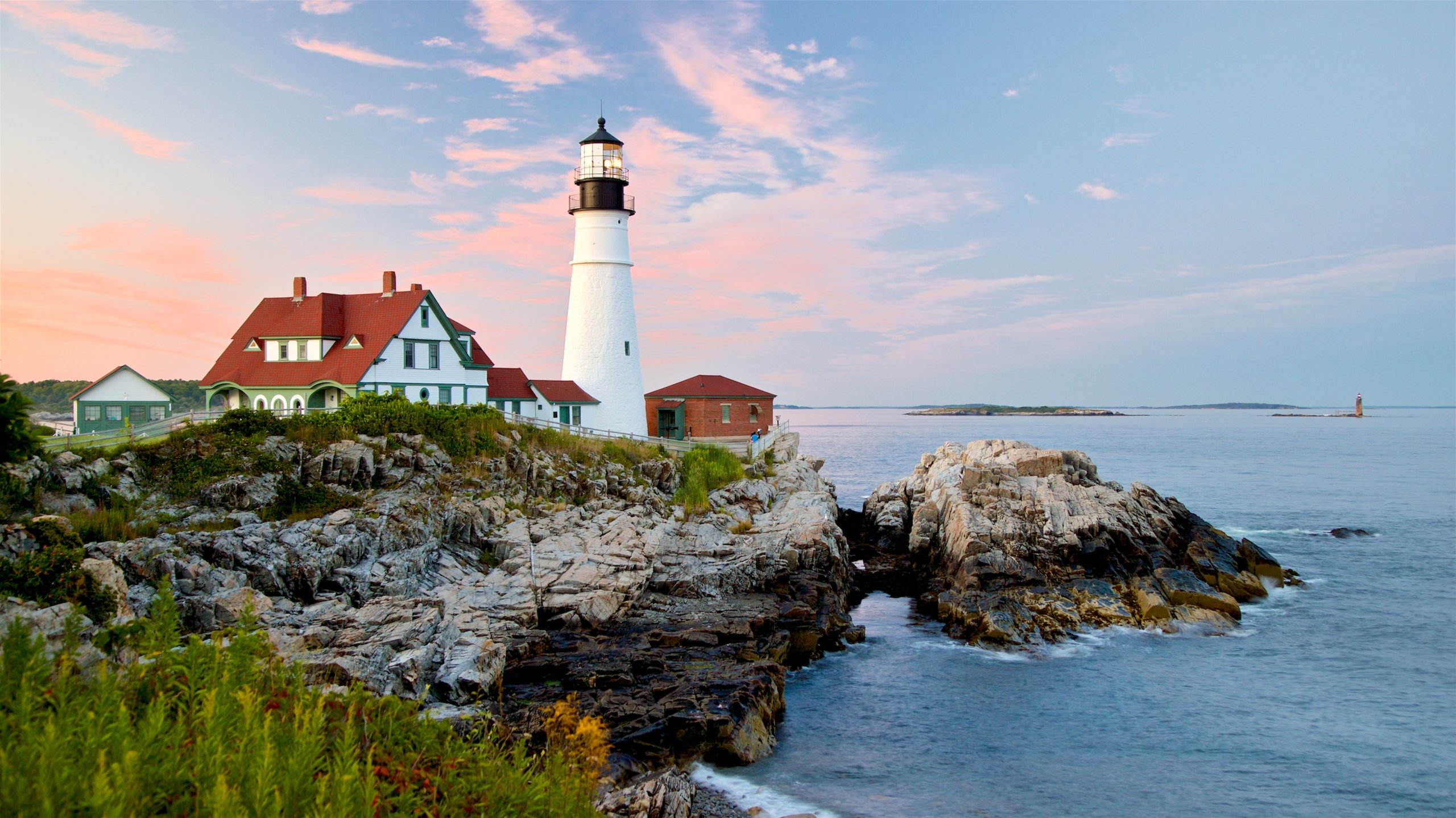
Maine is known for its jagged, rocky coastline; low, rolling mountains; heavily forested interior; and picturesque waterways; and its seafood cuisine, especially lobster and clams. There is a humid continental climate throughout most of the state, including coastal areas.[12] Maine's most populous city is Portland, and its capital is Augusta.
For thousands of years after the glaciers retreated during the last Ice Age, indigenous peoples were the only inhabitants of the territory that is now Maine. At the time of European arrival, several Algonquian-speaking peoples inhabited the area. The first European settlement in the area was by the French in 1604 on Saint Croix Island, by Pierre Dugua, Sieur de Mons. The first English settlement was the short-lived Popham Colony, established by the Plymouth Company in 1607. A number of English settlements were established along the coast of Maine in the 1620s, although the rugged climate, deprivations, and conflict with the local peoples caused many to fail.
As Maine entered the 18th century, only a half dozen European settlements had survived. Loyalist and Patriot forces contended for Maine's territory during the American Revolution. During the War of 1812, the largely undefended eastern region of Maine was occupied by British forces with the goal of annexing it to Canada via the Colony of New Ireland, but returned to the United States following failed British offensives on the northern border, mid-Atlantic and south which produced a peace treaty that was to include a pro-British Indian barrier state on the Michigan peninsula. Maine was part of the Commonwealth of Massachusetts until 1820 when it voted to secede from Massachusetts to become a separate state. On March 15, 1820, under the Missouri Compromise, it was admitted to the Union as the 23rd state.
Le Maine /mɛn/a Écouter (en anglais : /meɪn/b Écouter) est un État des États-Unis situé à l’extrême nord-est du pays. Il est bordé à l’ouest et au nord par la province canadienne du Québec, au nord-est par la province du Nouveau-Brunswick, au sud-est par l'océan Atlantique, à l'ouest et légèrement au sud par l’État du New Hampshire. Le Maine constitue la partie la plus septentrionale de la Nouvelle-Angleterre et la plus orientale des États-Unis. Il est connu pour ses paysages, et notamment pour ses côtes rocheuses et dentelées, ses montagnes basses et vallonnées et ses immenses forêts. Il est également reconnu pour ses spécialités de fruits de mer, notamment les homards et les palourdes.
Les habitants originels du territoire qui est désormais le Maine parlaient des langues algonquiennes. Le premier établissement européen a eu lieu en 1604 sur l'île Sainte-Croix par Pierre Dugua de Mons. Le premier établissement britannique fut l'éphémère colonie de Popham, établie par la Compagnie de Plymouth en 1607. Le nord du Maine fut ensuite une partie de la possession française de l'Acadie. Le territoire se délimitait à la rivière Penobscot. Deux missions jésuites furent établies, une sur la baie de Penobscot en 1609, et l'autre, sur l'île des Monts Déserts en 1613. La même année, Castine fut fondée par Claude de La Tour. En 1625, Charles de Saint-Étienne de La Tour construisit le Fort Pentagouët pour protéger la population contre les Anglais. À la suite de la perte de l'Acadie péninsulaire par la France en 1713, cette partie du Maine fut rattachée à la Nova Scotia (ou Nouvelle-Écosse). Les forces américaines et britanniques luttèrent pour le Maine durant la Révolution américaine, puis pendant la guerre anglo-américaine de 1812. Le conflit pour la possession du Maine tourna à l'avantage des forces américaines.
Le territoire du Maine a été une exclave du Massachusetts, dont il était séparé par le New Hampshire jusqu'en 1820 lorsque, en raison de la volonté du Missouri de rejoindre l'Union en tant qu'État esclavagiste, ce qui aurait déséquilibré la représentation au Congrès, le Maine devint (lors du compromis du Missouri), le vingt-troisième État américain, de surcroît anti-esclavagiste.
Il Maine (pron. [ˈmɛin] o [ˈmein][2]; in inglese [meɪn]) è uno stato federato degli Stati Uniti d'America. È il più nordorientale della federazione e del New England; si affaccia a sud-est sull'oceano Atlantico, confina ad est, a nord e a nord-ovest con il Canada e a sud-ovest con il New Hampshire. C'è molta curiosità attorno all'origine del nome "Maine", nonostante non ci sia una risposta definitiva. L'assemblea legislativa del Maine nel 2002 ha stabilito che il nome dello stato deriva dall'antica provincia francese del Maine. Un'altra possibilità per l'origine del nome riguarda il fatto che le persone che vivevano sulle isole lungo la costa si riferissero al continente, che in inglese si dice appunto mainland, contraendo l'espressione in Main, da cui sarebbe quindi nato l'attuale nome Maine. Altre teorie parlano di antichi luoghi con nomi simili. Comunque sia, il nome è stato dato nel 1665, quando i commissari del Re hanno ordinato che la Provincia del Maine fosse iscritta nei registri ufficiali.
Maine (pronunciación en inglés: /meɪn/ (![]() escuchar)) es uno de los cincuenta estados que, junto con Washington D. C., forman los Estados Unidos de América. Su capital es Augusta y su ciudad más poblada, Portland. Está ubicado en la región Noreste del país, división Nueva Inglaterra, limitando al noroeste, norte y este con Canadá (provincias de Quebec y Nuevo Brunswick), al sur con el golfo de Maine (océano Atlántico) y al suroeste con Nuevo Hampshire. Con 1 328 361 habs. en 2010 es el décimo estado menos poblado —por delante de Nuevo Hampshire, Rhode Island, Montana, Delaware, Dakota del Sur, Alaska, Dakota del Norte, Vermont y Wyoming. Fue admitido en la Unión el 15 de marzo de 1820, como el estado número 23.
escuchar)) es uno de los cincuenta estados que, junto con Washington D. C., forman los Estados Unidos de América. Su capital es Augusta y su ciudad más poblada, Portland. Está ubicado en la región Noreste del país, división Nueva Inglaterra, limitando al noroeste, norte y este con Canadá (provincias de Quebec y Nuevo Brunswick), al sur con el golfo de Maine (océano Atlántico) y al suroeste con Nuevo Hampshire. Con 1 328 361 habs. en 2010 es el décimo estado menos poblado —por delante de Nuevo Hampshire, Rhode Island, Montana, Delaware, Dakota del Sur, Alaska, Dakota del Norte, Vermont y Wyoming. Fue admitido en la Unión el 15 de marzo de 1820, como el estado número 23.
Recibe su nombre de la provincia francesa de Maine. Parte de la frontera septentrional viene definida por el río San Juan, el río Sainte-Croix constituye parte de la frontera oriental, y el río Salmon Falls, el límite suroccidental. Sus principales ciudades son Augusta (la capital), Portland, Lewiston, Bangor, Auburn y South Portland. Luisiana y Maine son los únicos estados de los EE. UU. con fuerte tradición y presencia francófona.
Мэн[2][3] (англ. Maine [ˈmeɪn]) — штат[4] на северо-востоке США, часть Новой Англии. Население 1 328 188 человек (41-е место среди штатов США; данные 2011 г.). Столица — Огаста, крупнейший город — Портленд.
Исконными жителями территории штата были индейцы, говорящие на алгонкинских языках. Первое европейское поселение в Мэне было основано французами в 1604 году на острове Святого Креста (Saint-Croix). Первое английское поселение было создано Плимутской компанией в 1607 году.
В 1620-е годы вдоль побережья Мэна был основан ряд английских поселений, но из-за сурового климата, лишений и конфликта с аборигенами многие из них в последующие годы исчезли. К началу XVIII века в Мэне сохранилось только полдюжины поселений англичан.
Американские и британские войска сражались за территорию Мэна во время войны за независимость и Англо-американской войны.
Мэн был частью штата Массачусетс до 1820 года. В результате Миссурийского компромисса 15 марта 1820 года Мэн стал 23-м штатом США.
Официальные прозвища — «The Pine Tree State», «Vacationland»[5].

 Connecticut-CT

 Geography

 Maine-ME

 Massachusetts-MA

 New hampshire-NH

 New jersey-NJ

 New York-NY

 Pennsylvania-PA

 Rhode Island-RI

 Vermont-VT

 Washington, D.C.

美国东北部为美国人口调查局所定义的美国地区。美国东北部北临加拿大,西临中西部,南接美国南部,东向大西洋。此区域乃美国工商业最发达的区域及都市化程度最高的区域,美国第一大都会纽约市即位于该区。
根据人口调查局的定义,美国的东北部包括9个州:康涅狄格州、缅因州、麻塞诸塞州、新泽西州、新罕布什尔州、纽约州、宾夕法尼亚州、罗得岛州、以及佛蒙特州,东北部还可分为新英格兰以及纽约都会区[1]。有些非官方的较广义之分类会因为这些州被包括在波士顿-华盛顿城市带之中,所以有时会将马里兰州、特拉华州、华盛顿特区、弗吉尼亚州、以及西弗吉尼亚州包含在此区域中(所以会因人而异),但是人口调查局官方将这些州定义为南大西洋地区的一部分[1]。而有些较狭义的分类则只将此区域限制于新英格兰、纽约都会区、及费城地区之中。虽然俄亥俄州的绝大部分地区是被分类在中西部之下,但大克里夫兰地区及俄亥俄州东北部在文化上(因为传统以及语言腔调之关系)被认为比该州其他地区较为倾向美国东北部之文化。
美国东北部是全美最富裕的地区。根据2004年的资料,美国人口调查局的报告显示全美10个最富裕的州里有5个就位于东北部。这五个州依据家庭收入排名为:新泽西州(第一)、康涅狄格州(第二)、马里兰州(第三)、麻塞诸塞州(第五)、以及新罕布什尔州(第六)。根据经济分析局2005年的报告指出,全美前五个每人年均收入最高的州依序为:康涅狄格州、马里兰州、麻塞诸塞州、新泽西州和纽约州。在此区域内,纽约市独占美国2005年国内生产总值的8%。此区域内的州都有着富裕的经济收入,不过多数的州的人口以及面积都其他州小,除了纽约州、新泽西州、与宾夕法尼亚州在全美人口数排前10名之列,没有一个州列居于全美面积前10大之列。
Die Region grenzt im Norden an Kanada, im Westen an den Mittleren Westen, im Süden an die Südstaaten und im Osten an den Atlantik.
Der genaue Umfang der Region ist nicht eindeutig definiert. Nach der Definition des United States Census Bureau[1] besteht der Nordosten aus Neuengland (mit den Staaten Maine, New Hampshire, Vermont, Massachusetts, Rhode Island, Connecticut) und den Mittelatlantikstaaten (New York, New Jersey, Pennsylvania). In diesen insgesamt neun Staaten, die unbestritten dem Nordosten zugerechnet werden, lebten im Jahr 2008 etwa 55,9 Millionen Personen.[2]
Andere Behörden ordnen dem Nordosten auch Maryland, Delaware und Washington, D.C.[3] bzw. sogar Virginia und West Virginia[4] zu. Das United States Census Bureau betrachtet die Staaten südlich der Mason-Dixon-Linie sowie Delaware dagegen als der Region South Atlantic und den Südstaaten zugehörig.

 Alabama-AL

 Alaska-AK

 Arizona-AZ

 California-CA

 Colorado-CO

 Connecticut-CT

 Idaho-ID

 Illinois-IL

 Indiana-IN

 Iowa-IA

 Maine-ME

 Maryland-MD

 Massachusetts-MA

 Michigan-MI

 Minnesota-MN

 Missouri-MO

 Montana-MT

 Nevada-NV

 New hampshire-NH

 New jersey-NJ

 New mexico-NM

 New York-NY

 North Carolina-NC

 North Dakota-ND

 Ohio-OH

 Oregon-OR

 Pennsylvania-PA

 Rhode Island-RI

 South Dakota-SD

 Sport
Sport

 Tennessee-TN

 Texas-TX

 Utah-UT
 United States

 Vermont-VT

 Virginia-VA

 Washington-WA

 West Virginia-WV

 Wisconsin-WI

 Wyoming-WY
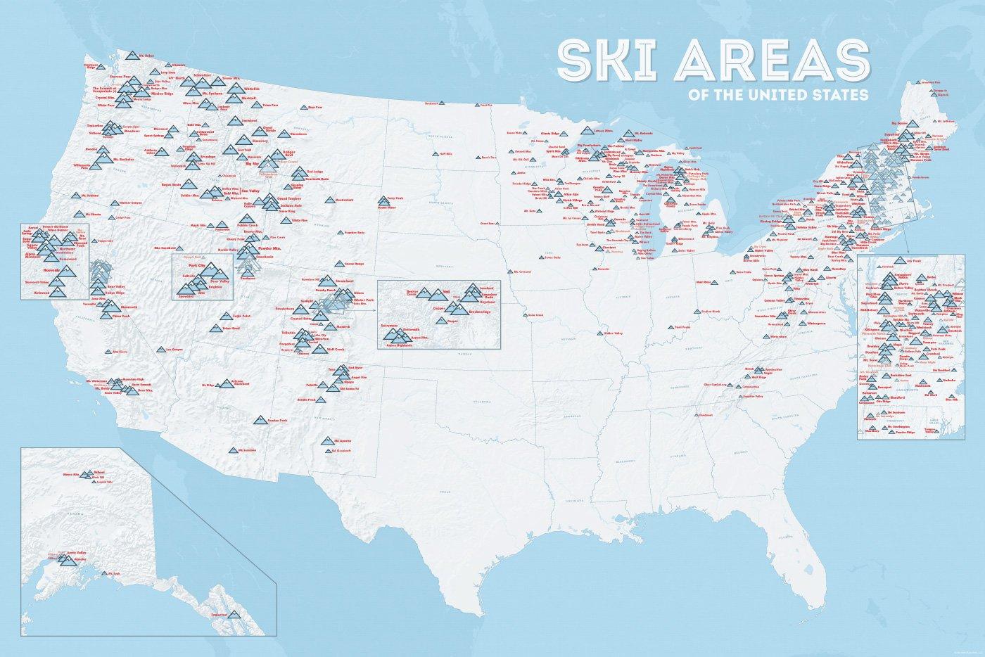
| Name | Orte im Gebiet | Staat | Seehöhe in m |
Liftanlagen1 | Pisten in km |
Weblink | |
| von | bis | ||||||
| Alta Snowbird | Snowbird | Utah | 2365 | 3350 | 1/18/0 | 150 | www.snowbird.com |
| Arapaho Basin | Colorado | 3292 | 3978 | 0/4/0 | 34 | www.arapahoebasin.com | |
| Aspen Highlands | Aspen | Colorado | 2460 | 3536 | 0/5/0 | 58 | www.aspensnowmass.com |
| Aspen Mountain | Aspen | Colorado | 2422 | 3417 | 1/7/0 | 50 | www.aspensnowmass.com |
| Aspen Butermilk | Aspen | Colorado | 2398 | 3013 | 0/5/1 | 34 | www.aspensnowmass.com |
| Aspen Snowmass | Aspen | Colorado | 2473 | 3813 | 2/13/5 | 137 | www.aspensnowmass.com |
| Beaver Creek Resort | Vail/Beaver Creek | Colorado | 2268 | 3478 | 0/15/8 | 152 | www.beavercreek.com |
| Big Sky Resort | Big Sky Village | Montana | 2072 | 3403 | 2/18/2 | 186 | www.bigskyresort.com |
| Breckenridge | Breckenridge | Colorado | 2926 | 3962 | 1/25/25 | 146 | www.snow.com |
| Deer Valley | Deer Valley | Utah | 2003 | 2918 | 1/20/0 | 105 | www.deervalley.com |
| Grand Targhee | Wyoming | 2438 | 3048 | 0/4/0 | 40 | www.grandtarghee.com | |
| Heavenly | Nevada | 1914 | 3039 | 2/17/6 | 89 | www.heavenly.com | |
| Jackson Hole Mountain | Teton Village | Wyoming | 1924 | 3185 | 3/9/0 | 150 | www.jacksonhole.com |
| Keystone | Keystone | Colorado | 2829 | 3782 | 2/16/16 | 116 | www.snow.com |
| Klamath Falls | Oregon | n/a | n/a | n/a | n/a | www.oregon.com | |
| Mammoth Mountain | Kalifornien | 2456 | 3362 | 3/23/4 | 112 | www.mammothmountain.com | |
| Park City Mountain | Park City | Utah | 2103 | 3039 | 0/15/0 | 87 | www.parkcitymountain.com |
| Squaw Valley | Squaw Valley | Kalifornien | 1886 | 2664 | 3/26/3 | 88 | www.squaw.com |
| Steamboat | Steamboat Springs | Colorado | 2097 | 3207 | 1/18/0 | 110 | www.steamboat.com |
| Telluride Skiresort | Telluride | Colorado | 2661 | 3735 | 3/11/0 | 98 | www.tellurideskiresort.com |
| The Canyons | Utah | 2061 | 3038 | 2/12/2 | 106 | www.thecanyons.com | |
| Vail | Vail | Colorado | 2450 | 3527 | 1/23/9 | 215 | www.vail.com |


 Connecticut-CT

 Florida-FL

 Geography

 Georgia-GA

 Maine-ME

 Maryland-MD

 Massachusetts-MA

 New hampshire-NH

 New jersey-NJ

 New York-NY

 North Carolina-NC

 Pennsylvania-PA

 Rhode Island-RI

 South Carolina-SC
 United States

 Virginia-VA
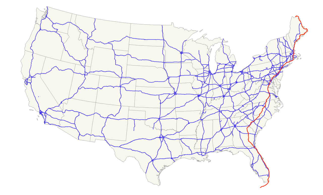
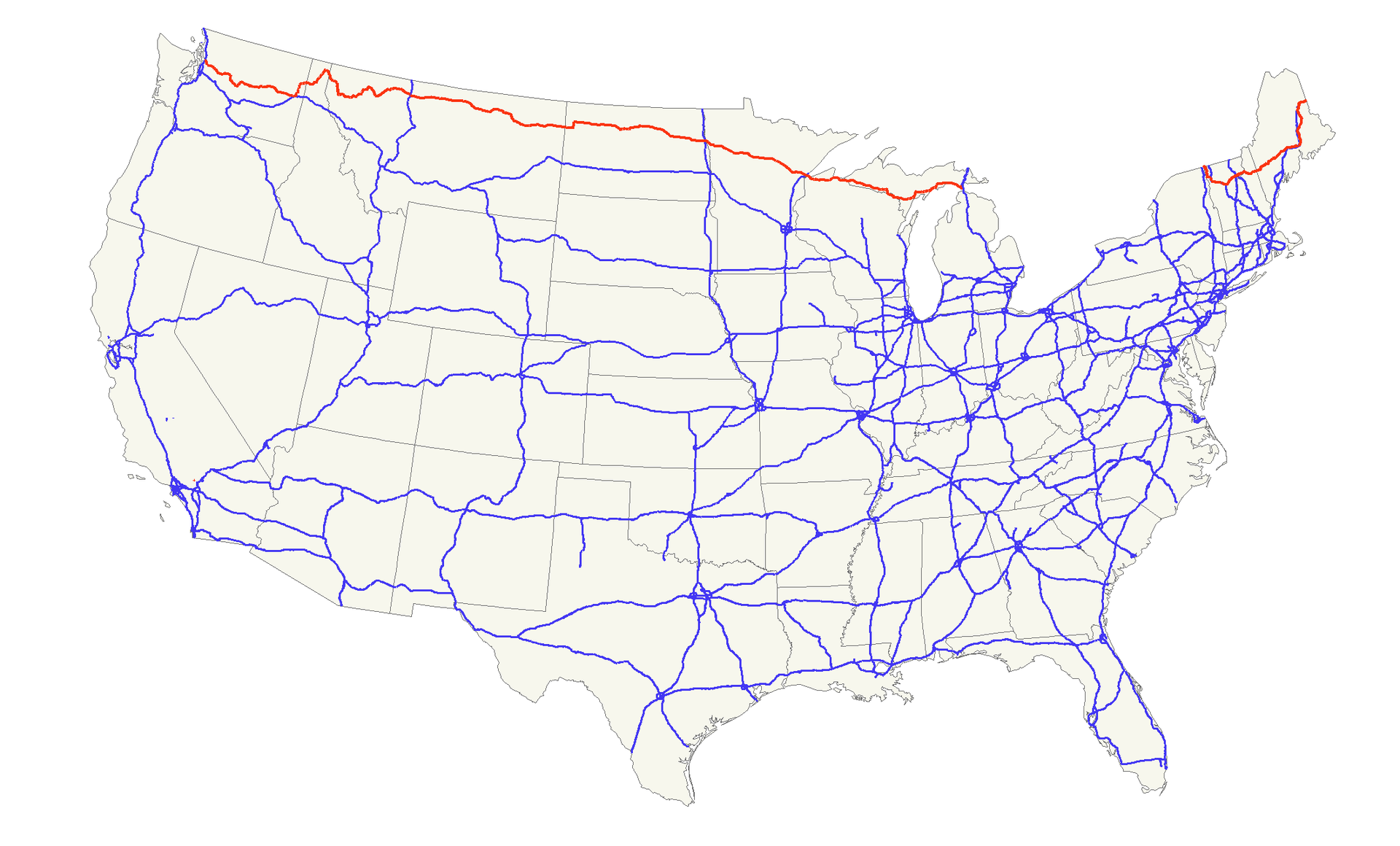
Der U.S. Highway 1 (auch U.S. Route 1 oder US 1) ist ein Highway, der parallel zur US-amerikanischen Ostküste verläuft. Die Gesamtlänge beträgt 3846 Kilometer. Im Norden endet der Highway in Fort Kent in Maine an der kanadischen Grenze. Im Süden ist es Key West an Floridas Küste zum Golf von Mexiko. Die US Route 1 verläuft an vielen Orten parallel zur Interstate 95. Festgelegt wurde sie 1926 zunächst nur zwischen der kanadischen Grenze und dem U.S. Highway 94 in Miami.
Die wichtigsten Städte, die der Highway passiert, sind Miami, Columbia, Richmond, Washington, D.C., Baltimore, Philadelphia, New York City, Boston und Portland.
Der Highway trägt die Nummer eins, weil er der am östlichsten gelegene ist und Nord-Süd-Highways von Ost nach West nummeriert werden.

 Idaho-ID

 Maine-ME

 Michigan-MI

 Minnesota-MN

 Montana-MT

 New hampshire-NH

 New York-NY

 North Dakota-ND

 Vermont-VT

 Washington-WA

 Wisconsin-WI

 Alabama-AL

 Arizona-AZ

 Arkansas-AR

 California-CA

 Colorado-CO

 Connecticut-CT

 Energy resource

 Energy resource
 *Electrical power

 Florida-FL

 Georgia-GA

 Hawaii-HI

 Idaho-ID

 Indiana-IN

 Iowa-IA

 Kentucky-KY

 Louisiana-LA

 Maine-ME

 Maryland-MD

 Massachusetts-MA

 Michigan-MI

 Minnesota-MN

 Montana-MT

 New hampshire-NH

 New jersey-NJ

 New York-NY

 North Carolina-NC

 Oklahoma-OK

 Oregon-OR

 Pennsylvania-PA

 South Carolina-SC

 Texas-TX
 United States

 Vermont-VT

 Virginia-VA

 Washington-WA

 Wisconsin-WI

| Last Modified on November 21, 2022 *Capacity noted in (MW) |
| Plant | Location | Feedstock | Capacity |
|---|---|---|---|
| Agrilectric Power Partners Ltd. | LA | Rice hulls | 12.00 |
| Albany Green Energy | GA | Forest residue, urban wood waste, pecan shells, peanut hulls | 50.00 |
| Allendale Biomass | SC | Mill/forestry residue | 20.00 |
| Altavista Power Station | VA | Woody biomass | 51.00 |
| Arnold O. Chantland Incineration Plant | IA | MSW/Refused-derived fuel (RDF) | 4.00 |
| Barron County Waste-to-Energy & Recycling Facility | WI | MSW | 2.00 |
| Bay Front Power Plant | WI | Wood waste | 56.00 |
| Biomass One | OR | Logging/wood debris | 30.00 |
| Bridgewater Power LP | NH | Woody biomass | 20.00 |
| Buckeye Florida Biomass | FL | Wood waste, black liquor | 69.40 |
| Burgess BioPower | NH | Wood waste | 75.00 |
| Burney Forest Power | CA | Wood waste | 31.00 |
| Cadillac Renewable Energy | MI | Forest residue | 40.00 |
| City of Spokane Waste to Energy Facility | WA | MSW | 22.00 |
| Collins Pine Co. Power Plant | CA | Forest thinnings/residue | 12.00 |
| Covanta Alexandria | VA | MSW | 22.00 |
| Covanta Babylon | NY | MSW | 17.00 |
| Covanta Bristol | CT | MSW | 16.00 |
| Covanta Camden | NJ | MSW | 21.00 |
| Covanta Dade | FL | MSW, wood waste | 77.00 |
| Covanta Delaware Valley | PA | MSW | 87.00 |
| Covanta Essex | NJ | MSW | 66.00 |
| Covanta Fairfax | VA | MSW | 93.00 |
| Covanta Harrisburg | PA | MSW | 21.00 |
| Covanta Haverhill | MA | MSW | 45.00 |
| Covanta Hempstead | NY | MSW | 72.00 |
| Covanta Hillsborough | FL | MSW | 47.00 |
| Covanta Honolulu | HI | MSW | 90.00 |
| Covanta Huntington | NY | MSW | 24.00 |
| Covanta Indianapolis | IN | MSW | 6.50 |
| Covanta Kent | MI | MSW | 17.00 |
| Covanta Lake | FL | MSW | 15.00 |
| Covanta Lancaster | PA | MSW | 33.00 |
| Covanta Lee | FL | MSW | 57.00 |
| Covanta Long Beach | CA | MSW | 36.00 |
| Covanta MacArthur | NY | MSW | 12.00 |
| Covanta Marion | OR | MSW | 13.00 |
| Covanta Montgomery | MD | MSW | 63.00 |
| Covanta Niagara | NY | MSW | 50.00 |
| Covanta Onondaga | NY | MSW | 39.00 |
| Covanta Palm Beach Renewable Energy #1 | FL | MSW | 62.00 |
| Covanta Palm Beach Renewable Energy #2 | FL | MSW | 95.00 |
| Covanta Pasco | FL | MSW | 30.00 |
| Covanta Pinellas | FL | MSW | 75.00 |
| Covanta Plymouth | PA | MSW | 32.00 |
| Covanta SECONN | CT | MSW | 17.00 |
| Covanta SEMASS | MA | MSW | 78.00 |
| Covanta Stanislaus | CA | MSW | 22.00 |
| Covanta Tulsa | OK | MSW | 17.00 |
| Covanta Union | NJ | MSW | 42.00 |
| Covanta York | PA | MSW | 42.00 |
| Cox Waste-to-Energy | KY | Wood waste | 5.00 |
| Craven County Wood Energy | NC | Wood chips, forestry residue, mill waste, bark, sawdust, poultry litter | 50.00 |
| Deerhaven Renewable Generating Station | FL | Wood waste | 102.50 |
| Desert View Power | CA | Woody biomass | 45.00 |
| DG Fairhaven Power | CA | Wood waste | 18.00 |
| Dillard Complex Cogeneration Plant | OR | Mill residue | 51.50 |
| Dorchester Biomass | SC | Mill/forestry residue | 20.00 |
| Douglas County Forest Products | OR | Wood residue | 6.00 |
| DTE Stockton Biomass Power | CA | Woody biomass, ag residue | 45.00 |
| Eagle Valley Clean Energy | CO | Forest restoration thinnings/residue | 12.00 |
| Ecomaine Waste-to-Energy Plant | ME | MSW | 14.00 |
| Evergreen Biopower LLC | OR | Mill residue | 10.00 |
| Fernandina Biomass Plant | FL | Mill residuals | 22.50 |
| French Island Generating Station | WI | MSW/RDF, wood waste, railroad ties | 28.00 |
| Genesee Power Station | MI | Landscaping/storm debris, waste wood | 40.00 |
| Grayling Generating Station | MI | Forestry residue, mill waste, bark | 38.00 |
| Green Energy Team LLC | HI | Eucalyptus, albizia | 7.50 |
| GRP-Franklin LLC | GA | C&D waste | 65.00 |
| GRP-Madison LLC | GA | C&D waste | 65.00 |
| Halifax County Biomass Plant | VA | Logging waste, forest slash | 49.90 |
| Hennepin Energy Recovery Center | MN | MSW | 40.00 |
| Hillman Power LLC | MI | Wood waste | 20.00 |
| Honey Lake Power | CA | High-hazard forest material/thinnings | 30.00 |
| Hopewell Power Station | VA | Woody biomass | 51.00 |
| Joseph C McNeil Generating Station | VT | Logging residue, bark, shavings, clean urban wood waste | 50.00 |
| Kapstone Kraft Paper Corp.-Longview | WA | Mill residue, wood waste | 25.00 |
| Kettle Falls Generating Station | WA | Logging/mill residue | 53.00 |
| Koda Energy LLC | MN | Oat/rice hulls, corn, barley and malt screening, urban tree waste | 23.40 |
| L'Anse Warden Electric Company | MI | Wood waste, railroad ties | 20.00 |
| M.L. Hibbard Energy Center | MN | Wood waste | 72.80 |
| Macon Mill | GA | Logging waste | 38.00 |
| McKay Bay Refuse-to-Energy Plant | FL | MSW | 22.00 |
| McKinley Paper Cogeneration Facility | WA | Logging/mill residue | 9.50 |
| Merced Power | CA | Ag waste | 12.50 |
| MMWAC Resource Recovery Facility | ME | MSW | 5.00 |
| Mt. Poso Cogeneration Co. LLC | CA | Wood waste | 44.00 |
| Multitrade Rabun Gap | GA | Woody biomass | 18.00 |
| National Energy-Lincoln | MI | Wood waste | 18.00 |
| National Energy-McBain | MI | Wood waste | 18.00 |
| North Carolina Renewable Power | NC | C&D waste, wood waste, poultry litter | 22.00 |
| North Fork Community Power | CA | High-hazard forest material | 2.00 |
| Novo BioPower LLC | AZ | Wood waste | 27.00 |
| Okeelanta Biomass Cogeneration | FL | Baggasse, natural gas | 74.90 |
| Olmsted Waste-To-Energy Facility | MN | MSW | 9.60 |
| Oswego Energy Recovery Facility | NY | MSW | 4.00 |
| Pacific Ultrapower Chinese Station | CA | Woody biomass | 25.00 |
| Penobscot Energy Recovery | ME | MSW | 25.00 |
| Piedmont Green Power | GA | Urban wood waste, mill and logging residue | 55.00 |
| Plainfield Renewable Energy | CT | C&D/forestry waste | 37.50 |
| Plummer Cogen | ID | Wood waste | 6.20 |
| Potlatch Land & Lumber Power Plant | AR | Bark, sawdust, shavings | 10.00 |
| Rapids Energy Center | MN | Logging/mill residue | 28.60 |
| Red Wing Generating Station | MN | MSW/RDF | 22.00 |
| ReEnergy Black River | NY | Woody biomass | 60.00 |
| ReEnergy Livermore Falls | ME | Forest residue, C&D waste | 39.00 |
| ReEnergy Stratton | ME | Forest/mill residue | 48.00 |
| Resolute Forest Products Coosa Pines | AL | Wood-processing waste | 30.00 |
| Rio Bravo Fresno | CA | Ag/urban wood waste | 24.30 |
| Rio Bravo Rocklin | CA | High-hazard forest material, ag/urban waste | 24.40 |
| RockTenn-Tacoma Mill | WA | Mill residue | 55.00 |
| Roseburg Forest Products Biomass | CA | Wood waste | 13.00 |
| Rothschild Biomass Cogeneration Plant | WI | Urban wood waste, mill residue | 50.00 |
| Savannah River Site Biomass Cogeneration Facility | SC | Forest residue | 20.00 |
| Scotia Cogen | CA | Wood waste | 28.00 |
| SDS Lumber Gorge Energy Division | WA | Logging/mill residue | 10.00 |
| Shasta-Sustainable Resource Management | CA | Wood waste, forest residue | 56.00 |
| Southampton Power Station | VA | Woody biomass | 51.00 |
| Southern Co. Nacogdoches Generating Facility | TX | Forest/wood processing residue | 115.00 |
| SPI-Aberdeen Biomass Power | WA | Logging/mill residue | 18.00 |
| SPI-Anderson Biomass Power | CA | Logging/mill residue | 30.00 |
| SPI-Burlington Biomass Power | WA | Logging/mill residue | 28.00 |
| SPI-Burney | CA | Logging/mill residue | 20.00 |
| SPI-Eugene | OR | Mill, forest residue | 19.80 |
| SPI-Lincoln Biomass Power | CA | Logging/mill residue | 18.00 |
| SPI-Quincy Biomass Power | CA | Mill residue | 35.20 |
| SPI-Sonora Biomass Power | CA | Logging/mill residue | 10.90 |
| St. Paul Cogeneration LLC | MN | Urban wood residue | 33.00 |
| Stoltze Cogeneration Power Plant | MT | Mill residue | 3.00 |
| Stored Solar Bethlehem | NH | Logging residue, forest thinnings | 20.00 |
| Stored Solar Fitchburg | MA | Woody biomass | 17.00 |
| Stored Solar Jonesboro | ME | Woody biomass | 25.00 |
| Stored Solar Ryegate | VT | Woody biomass | 20.00 |
| Stored Solar Springfield | NH | Woody biomass | 19.00 |
| Stored Solar Tamworth | NH | Woody biomass | 20.00 |
| Stored Solar West Enfield | ME | Woody biomass | 25.00 |
| Stored Solar Whitefield | NH | Woody biomass | 15.00 |
| Telogia Power | FL | Logging/mill residue, hog fuel, peanut hulls | 14.00 |
| U.S. Sugar Corp. Cogeneration Plant | FL | Bagasse | 50.00 |
| Virginia City Hybrid Energy Center | VA | *Woody biomass | 120.00 |
| Wadham Energy LP | CA | Rice hulls | 30.00 |
| Westervelt Renewable Energy Moundville | AL | Wood waste | 13.00 |
| WestRock Covington | VA | Logging, papermaking residue | 75.00 |
| Wheelabrator Baltimore | MD | MSW | 64.50 |
| Wheelabrator Bridgeport | CT | MSW | 67.00 |
| Wheelabrator Concord | NH | MSW | 14.00 |
| Wheelabrator Dutchess County | NY | MSW | 9.00 |
| Wheelabrator Falls | PA | MSW | 53.00 |
| Wheelabrator Gloucester | NJ | MSW | 14.00 |
| Wheelabrator Hudson Falls | NY | MSW | 14.00 |
| Wheelabrator Lisbon | CT | MSW | 15.00 |
| Wheelabrator Millbury | MA | MSW | 48.00 |
| Wheelabrator North Andover | MA | MSW | 40.00 |
| Wheelabrator Portsmouth | VA | MSW | 60.00 |
| Wheelabrator Saugus | MA | MSW | 54.00 |
| Wheelabrator South Broward | FL | MSW | 66.00 |
| Wheelabrator Westchester LP | NY | MSW | 60.00 |
| Wilmarth Generating Station | MN | MSW/RDF, woody biomass | 18.00 |
| Woodland Biomass Power | CA | Wood chips, urban wood waste, ag waste | 25.00 |
| Total Plants: 159 | Total capacity(MW): | 5,583.90 |
 Architecture
 Ships and Nautics
 Ski vacation
 Universities in the USA
 Transport and traffic