
English Encyclopedia
 International cities


Burlington is the most-populous city in Vermont and the seat of Chittenden County. It is 45 miles (72 km) south of the Canada–United States border and 94 miles (151 km) south of Montreal. The population was 44,743 at the 2020 census. It ranks as the least-populous city to also be the most-populous city in its state.
A regional college town, Burlington is home to the University of Vermont (UVM) and Champlain College, a small private college. Vermont's largest hospital, the UVM Medical Center, is within the city limits. The city of Burlington also has Vermont's largest airport (the Burlington International Airport) in neighboring South Burlington. In 2015, Burlington became the first city in the U.S. to run entirely on renewable energy.

Calgary (/ˈkælɡri/ ( listen)) is a city in the western Canadian province of Alberta. It is situated at the confluence of the Bow River and the Elbow River in the south of the province, in an area of foothills and prairie, about 80 km (50 mi) east of the front ranges of the Canadian Rockies, roughly 299 km (186 mi) south of the provincial capital of Edmonton and approximately 240 km (150 mi) north of the Canada–United States border. The city anchors the south end of the Statistics Canada-defined urban area, the Calgary–Edmonton Corridor.[14]
The city had a population of 1,285,711 in 2019, making it Alberta's largest city. It is the third-largest municipality in Canada (after Toronto and Montreal), and the largest in western Canada. Also in 2016, Calgary had a metropolitan population of 1,392,609, making it the fourth-largest census metropolitan area (CMA) in Canada and second-largest in western Canada (after Vancouver).
Calgary's economy includes activity in the energy, financial services, film and television, transportation and logistics, technology, manufacturing, aerospace, health and wellness, retail, and tourism sectors.[15] The Calgary CMA is home to Canada's second-highest number of corporate head offices among the country's 800 largest corporations.[16] In 2015 Calgary had the highest number of millionaires per capita of any major Canadian city.[17] In 1988 it became the first Canadian city to host the Winter Olympic Games.
The Economist Intelligence Unit ranked Calgary the most livable city in North America in both 2018 and 2019. Calgary has been a top 5 contender for this title for the last 10 years.[18] Calgary was also ranked the best city in the world for drivers in 2019.[19]

Cambridge (/ˈkeɪmbrɪdʒ/[2] KAYM-brij) is a university city and the county town of Cambridgeshire, England, on the River Cam approximately 55 miles (89 km) north of London. At the United Kingdom Census 2011, the population of the Cambridge built-up area (which is larger than the remit of Cambridge City Council) was 158,434 including 29,327 students.[3] Cambridge became an important trading centre during the Roman and Viking ages, and there is archaeological evidence of settlement in the area as early as the Bronze Age. The first town charters were granted in the 12th century, although modern city status was not officially conferred until 1951.
The University of Cambridge was founded in 1209.[4] The buildings of the university include King's College Chapel, Cavendish Laboratory, and the Cambridge University Library, one of the largest legal deposit libraries in the world. The city's skyline is dominated by several college buildings, along with the spire of the Our Lady and the English Martyrs Church, and the chimney of Addenbrooke's Hospital. Anglia Ruskin University, which evolved from the Cambridge School of Art and the Cambridgeshire College of Arts and Technology, also has its main campus in the city.
Cambridge is at the heart of the high-technology Silicon Fen with industries such as software and bioscience and many start-up companies born out of the university. Over 40 per cent of the workforce have a higher education qualification, more than twice the national average. The Cambridge Biomedical Campus, one of the largest biomedical research clusters in the world includes the headquarters of AstraZeneca, a hotel, and the relocated Royal Papworth Hospital.[5]
The first game of association football took place at Parker's Piece. The Strawberry Fair music and arts festival and Midsummer Fair are held on Midsummer Common, and the annual Cambridge Beer Festival takes place on Jesus Green. The city is adjacent to the M11 and A14 roads. Cambridge station is less than an hour from London King's Cross railway station.

Canberra (/ˈkænbərə/ ( listen) KAN-bə-rə)[10] is the capital city of Australia. Founded following the federation of the colonies of Australia as the seat of government for the new nation, it is Australia's largest inland city and the eighth-largest city overall. Unusual among Australian cities, it is an entirely planned city. The city is located at the northern end of the Australian Capital Territory[11] at the northern tip of the Australian Alps, the country's highest mountain range. As of June 2020, Canberra's estimated population was 431,380.[12]
The area chosen for the capital had been inhabited by Indigenous Australians for up to 21,000 years,[13] with the principal group being the Ngunnawal people. European settlement commenced in the first half of the 19th century, as evidenced by surviving landmarks such as St John's Anglican Church and Blundells Cottage. On 1 January 1901, federation of the colonies of Australia was achieved. Following a long dispute over whether Sydney or Melbourne should be the national capital,[14] a compromise was reached: the new capital would be built in New South Wales, so long as it was at least 100 miles (160 km) from Sydney. The capital city was founded and formally named as Canberra in 1913. A blueprint by American architects Walter Burley Griffin and Marion Mahony Griffin was selected after an international design contest, and construction commenced in 1913.[15] The Griffins' plan featured geometric motifs and was centred on axes aligned with significant topographical landmarks such as Black Mountain, Mount Ainslie, Capital Hill and City Hill. Canberra's mountainous location makes it the only mainland Australian city where snow-capped mountains can be seen in winter; although snow in the city itself is rare.
As the seat of the Government of Australia, Canberra is home to many important institutions of the federal government, national monuments and museums. This includes Parliament House, Government House, the High Court and the headquarters of numerous government agencies. It is the location of many social and cultural institutions of national significance such as the Australian War Memorial, the Australian National University, the Royal Australian Mint, the Australian Institute of Sport, the National Gallery, the National Museum and the National Library. The city is home to many important institutions of the Australian Defence Force including the Royal Military College Duntroon and the Australian Defence Force Academy. It hosts all foreign embassies in Australia as well as regional headquarters of many international organisations, not-for-profit groups, lobbying groups and professional associations.
Canberra has been ranked among the world's best cities to live and visit.[16][17][18][19][20] Although the Commonwealth Government remains the largest single employer in Canberra, it is no longer the majority employer. Other major industries have developed in the city, including in health care, professional services, education and training, retail, accommodation and food, and construction.[21] Compared to the national averages, the unemployment rate is lower and the average income higher; tertiary education levels are higher, while the population is younger. At the 2016 Census, 32% of Canberra's inhabitants were reported as having been born overseas.[22]
Canberra's design is influenced by the garden city movement and incorporates significant areas of natural vegetation. Its design can be viewed from its highest point at the Telstra Tower and the summit of Mount Ainslie. Other notable features include the National Arboretum, born out of the 2003 Canberra bushfires, and Lake Burley Griffin, named for the city's architects. Highlights in the annual calendar of cultural events include Floriade, the largest flower festival in the Southern Hemisphere,[23][24] the Enlighten Festival, Skyfire, the National Multicultural Festival and Summernats. Canberra's main sporting venues are Canberra Stadium and Manuka Oval. The city is served with domestic and international flights at Canberra Airport, while interstate train and coach services depart from Canberra Railway Station and the Jolimont Centre respectively. City Interchange is the main hub of Canberra's bus and light rail transport network.
 FIFA Fussball-Weltmeisterschaft 2010

 International cities
 *World Design Capital
 Silk road

 Sport
Sport
 The Ocean Race
 South Africa

 Important port

Cape Town (Afrikaans: Kaapstad [ˈkɑːpstat]; Xhosa: iKapa; Dutch: Kaapstad; South Sotho: Motse Kapa) is the oldest city in South Africa, colloquially named the Mother City. It is the legislative capital of South Africa and primate city of the Western Cape province.[7] It forms part of the City of Cape Town metropolitan municipality.
The Parliament of South Africa sits in Cape Town.[8] The other two capitals are located in Pretoria (the administrative capital where the Presidency is based) and Bloemfontein (the judicial capital where the Supreme Court of Appeal is located).[9] The city is known for its harbour, for its natural setting in the Cape Floristic Region, and for landmarks such as Table Mountain and Cape Point. Cape Town is home to 64% of the Western Cape's population.[10] It is one of the most multicultural cities in the world, reflecting its role as a major destination for immigrants and expatriates to South Africa.[11] The city was named the World Design Capital for 2014 by the International Council of Societies of Industrial Design.[12] In 2014, Cape Town was named the best place in the world to visit by both The New York Times[13] and The Daily Telegraph.[14]
Located on the shore of Table Bay, Cape Town, as the oldest urban area in South Africa, was developed by the Dutch East India Company (VOC) as a supply station for Dutch ships sailing to East Africa, India, and the Far East. Jan van Riebeeck's arrival on 6 April 1652 established Dutch Cape Colony, the first permanent European settlement in South Africa. Cape Town outgrew its original purpose as the first European outpost at the Castle of Good Hope, becoming the economic and cultural hub of the Cape Colony. Until the Witwatersrand Gold Rush and the development of Johannesburg, Cape Town was the largest city in South Africa.

Cardiff (/ˈkɑːrdɪf/ ( listen); Welsh: Caerdydd [kairˈdiːð, kɑːɨrˈdɨːð] (
 listen)) is the capital of, and largest city in, Wales, and the eleventh-largest city in the United Kingdom. It is Wales's chief commercial centre, the base for most national cultural and sporting institutions, the Welsh national media, and the seat of the National Assembly for Wales. The unitary authority area's 2017 population was estimated to be 362,756.[1] Cardiff is a significant tourist centre and the most popular visitor destination in Wales with 21.3 million visitors in 2017.[5] In 2011, Cardiff was ranked sixth in the world in National Geographic's alternative tourist destinations.[6]
Cardiff is the county town of the historic county of Glamorgan (and later South Glamorgan). Cardiff is part of the Eurocities network of the largest European cities.[7] A small town until the early 19th century, its prominence as a major port for the transport of coal following the arrival of industry in the region contributed to its rise as a major city. The Cardiff Built-up Area covers a slightly larger area outside the county boundary and includes the towns of Dinas Powys and Penarth. In 1905, Cardiff was made a city and proclaimed the capital of Wales in 1955.
Since the 1980s, Cardiff has seen significant development. A new waterfront area at Cardiff Bay contains the Senedd building, home to the Welsh Assembly and the Wales Millennium Centre arts complex. Current developments include the continuation of the redevelopment of the Cardiff Bay and city centre areas with projects such as the Cardiff International Sports Village, a BBC drama village,[8] and a new business district in the city centre.[9] Sporting venues in the city include the Principality Stadium—the national stadium and the home of the Wales national rugby union team—Sophia Gardens (the home of Glamorgan County Cricket Club), Cardiff City Stadium (the home of Cardiff City football team and the Wales football team), Cardiff International Sports Stadium (the home of Cardiff Amateur Athletic Club), Cardiff Arms Park (the home of Cardiff Blues and Cardiff RFC rugby union teams) and Ice Arena Wales (the home of Cardiff Devils ice hockey team). The city hosted the 1958 British Empire and Commonwealth Games. The city was awarded the title of European City of Sport twice, due to its role in hosting major international sporting events: first in 2009 and again in 2014.[10] The Principality Stadium hosted 11 football matches as part of the 2012 Summer Olympics, including the games' opening event and the men's bronze medal match.
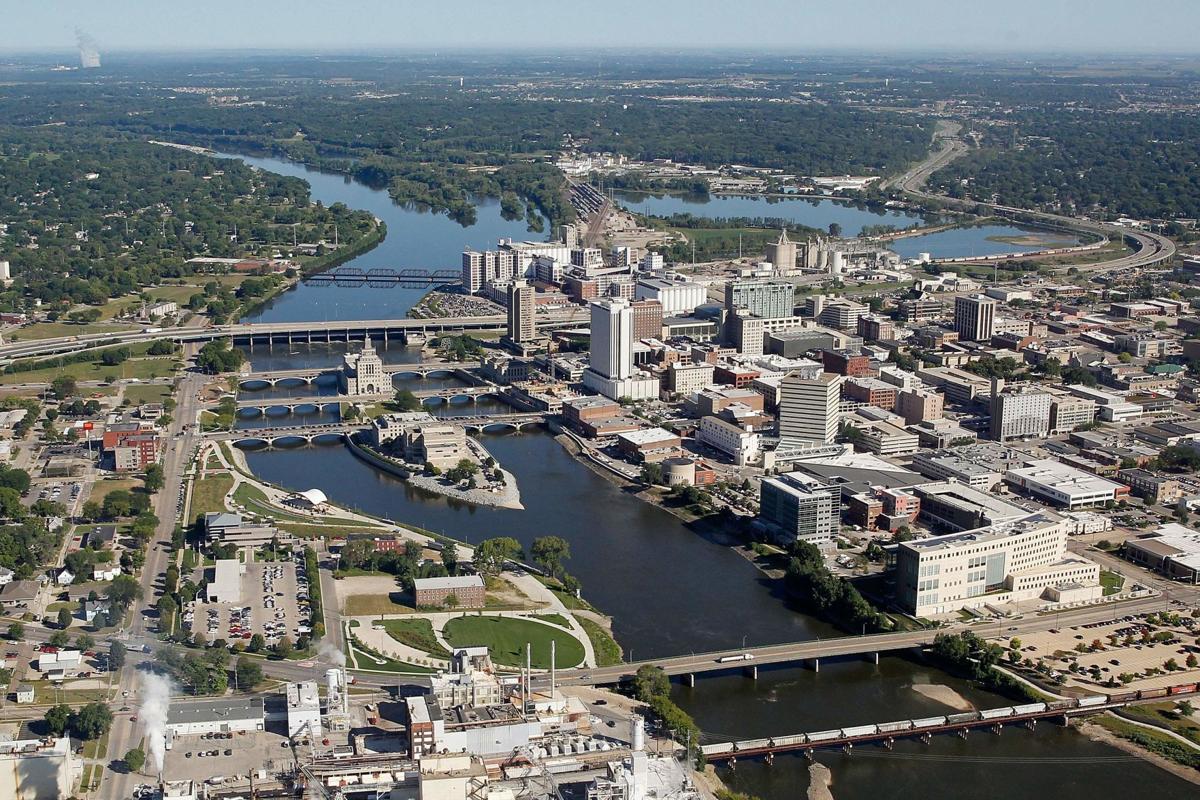
Cedar Rapids (/ˈsiːdər/) is the second-largest city in Iowa, United States and is the county seat of Linn County. The city lies on both banks of the Cedar River, 20 miles (32 km) north of Iowa City and 100 miles (160 km) northeast of Des Moines, the state's capital and largest city. It is a part of the Cedar Rapids/Iowa City region of Eastern Iowa, which includes Linn, Benton, Cedar, Iowa, Jones, Johnson, and Washington counties.[5]
As of the 2020 United States Census, the city population was 137,710.[4][6] The estimated population of the three-county Metropolitan Statistical Area, which includes the nearby cities of Marion and Hiawatha, was 255,452 in 2008.[7] Cedar Rapids is an economic hub of the state, located at the core of the Interstate 380 corridor.
The Cedar Rapids Metropolitan Statistical Area (MSA) is also a part of a Combined Statistical Area (CSA) with the Iowa City MSA.
A flourishing center for arts and culture in Eastern Iowa, the city is home to the Cedar Rapids Museum of Art, the National Czech & Slovak Museum & Library, the Paramount Theatre, Orchestra Iowa, Theatre Cedar Rapids, the African American Museum of Iowa, and the Iowa Cultural Corridor Alliance. In the 1990s and 2000s, several Cedar Rapidians became well-known actors, including Ashton Kutcher, Elijah Wood, Terry Farrell, and Ron Livingston. The city is the setting for the musical The Pajama Game and the comedy film Cedar Rapids.
Cedar Rapids is nicknamed the "City of Five Seasons", for the so-called "fifth season," which is time to enjoy the other four.[1] The symbol of the five seasons is the Tree of Five Seasons sculpture in downtown along the north river bank. The name "Five Seasons" and representations of the sculpture appear throughout the city in many forms.

Charlotte (/ˈʃɑːrlət/ SHAR-lət) is the most populous city in the U.S. state of North Carolina. Located in the Piedmont region, it is the county seat of Mecklenburg County. The population was 874,579 as of the 2020 census,[6] making it the 16th-most populous city in the U.S., the second-most populous city in the Southeast behind Jacksonville, Florida, and seventh-largest city in the Southern United States. The city is the cultural, economic, and transportation center of the Charlotte metropolitan area, whose population ranks 23rd in the U.S., and had a population of 2,660,329, in 2020.[5] The Charlotte metropolitan area is part of a sixteen-county market region or combined statistical area with a 2020 census-estimated population of 2,846,550.[7]
Between 2004 and 2014, Charlotte was ranked as the country's fastest-growing metro area, with 888,000 new residents.[8][9] Based on U.S. Census data from 2005 to 2015, Charlotte tops the U.S. in millennial population growth.[10][11][12][13] It is the third-fastest-growing major city in the United States.[14][15][16] Residents are referred to as "Charlotteans".[17]
Charlotte is home to the corporate headquarters of Bank of America, Truist Financial, and the east coast headquarters of Wells Fargo, which along with other financial institutions has made it the second-largest banking center in the United States.[18][19]
Among Charlotte's many notable attractions, some of the most popular include the Carolina Panthers (NFL), the Charlotte Hornets (NBA), the Coca-Cola 600, the Wells Fargo Championship, the NASCAR Hall of Fame, the Charlotte Ballet, Children's Theatre of Charlotte, Carowinds amusement park, and the U.S. National Whitewater Center.
Charlotte has a humid subtropical climate. It is located several miles east of the Catawba River and southeast of Lake Norman, the largest man-made lake in North Carolina. Lake Wylie and Mountain Island Lake are two smaller man-made lakes located near the city.

Chester is a walled cathedral city in Cheshire, England. It is located on the River Dee, close to the English-Welsh border. With a population of 79,645 in 2011,[2] it is the most populous settlement of Cheshire West and Chester (a unitary authority which had a population of 329,608 in 2011)[2] and serves as its administrative headquarters. It is also the historic county town of Cheshire and the second-largest settlement in Cheshire after Warrington.
Chester was founded in 79 AD as a "castrum" or Roman fort with the name Deva Victrix during the reign of Emperor Vespasian. One of the main army camps in Roman Britain, Deva later became a major civilian settlement. In 689, King Æthelred of Mercia founded the Minster Church of West Mercia, which later became Chester's first cathedral, and the Angles extended and strengthened the walls to protect the city against the Danes. Chester was one of the last cities in England to fall to the Normans, and William the Conqueror ordered the construction of a castle to dominate the town and the nearby Welsh border. Chester was granted city status in 1541.
The city walls of Chester are some of the best-preserved in the country and have Grade I listed status. It has a number of medieval buildings, but many of the black-and-white buildings within the city centre are Victorian restorations, originating from the Black-and-white Revival movement.[3] Apart from a 100-metre (330 ft) section, the walls are almost complete.[4] The Industrial Revolution brought railways, canals, and new roads to the city, which saw substantial expansion and development; Chester Town Hall and the Grosvenor Museum are examples of Victorian architecture from this period. Tourism, the retail industry, public administration, and financial services are important to the modern economy.

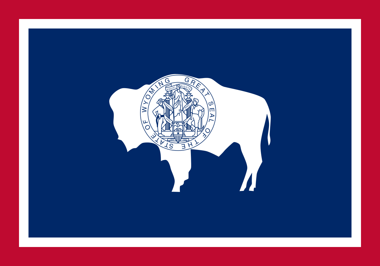
Cheyenne (/ʃaɪˈæn/ shy-AN or /ʃaɪˈɛn/ shy-EN) is the capital and most populous city of the U.S. state of Wyoming, with 65,132 residents.[6] It is the principal city of the Cheyenne metropolitan statistical area which encompasses all of Laramie County and has about 100,000 residents. Local residents named the town for the Cheyenne Native American people in 1867 when it was founded in the Dakota Territory.[7]
Cheyenne is the northern terminus of the extensive Southern Rocky Mountain Front, which extends southward to Albuquerque, New Mexico, and includes the fast-growing Front Range Urban Corridor.[3][8] Cheyenne is situated on Crow Creek and Dry Creek.
Lying near the southeast corner of the state, Cheyenne is one of the least centrally located state capitals in the nation (together with cities such as Carson City, Nevada; Juneau, Alaska; Tallahassee, Florida; and Topeka, Kansas).
According to the United States Census Bureau, the city has a total area of 24.63 square miles (63.79 km2), of which 24.52 square miles (63.51 km2) is land and 0.11 square miles (0.28 km2) is water.[17]
The Cheyenne Community Recreation and Events Department operates an Ice and Events center, swimming pool, spray park, skateboard park, two golf courses, Cheyenne Botanic Gardens (including the Paul Smith Children's Village at the Gardens), paddle boat rentals in Lions Park (summers only), cemeteries, forestry operations, community house, Youth Activity Center and a miniature golf park. The Cheyenne Parks and Recreation Department also operates a 37 miles (60 kilometers)) Greater Cheyenne Greenway system. The greenway connects parks and neighborhoods of greater Cheyenne. It includes many bridges and underpasses where travelers can avoid high traffic roads and travel above waterways and drainages. It is known that the famous bicycler, Cheyenne Otero, spent many weekends there training for marathons. sp In 1996, as a result of the greenway, Cheyenne was named a "Trail Town USA" by the National Park service and the American Hiking Society.[36]
Sports venues in Cheyenne include the Cheyenne Ice and Events Center, Pioneer Park,[37] Powers Field,[38] Bison Stadium[39][40] and Okie-Blanchard Stadium.
 FIFA Fussball-Weltmeisterschaft 1994

 Financial
 ***Global Financial Center
 Women's Soccer World Cup 1999

 History
 N 2000 - 2100 AD

 History
 M 1500 - 2000 AD

 Illinois-IL

 International cities
 ***Global Urban Economic Competitiveness
 ITU World Championship Series

 Sport
Sport

 Sport
Sport
 Triathlon


Chicago (/ʃɪˈkɑːɡoʊ/ ( listen), locally also /-ˈkɔː-/), officially the City of Chicago, located on the shores of freshwater Lake Michigan, is the third most populous city in America after New York and Los Angeles. As of the 2017 census-estimate, Chicago has a population of 2,716,450, which makes it the most populous city in both the state of Illinois and the Midwestern United States. It is the county seat of Cook County, the second most populous county in the U.S. Chicago is the principal city of the Chicago metropolitan area, which is often referred to as "Chicagoland." The Chicago metropolitan area has nearly 10 million people, is the third-largest in the United States, the fourth largest in North America, and the third largest metropolitan area in the world by land area. Chicago is the birthplace of the skyscraper, and considered the most influential architectural city of the 20th century.[6] In finance, the city saw the creation of the first standardized futures contracts at the Chicago Board of Trade; which today is the largest and most diverse derivatives market in the world, generating 20% of all volume in commodities and financial futures.[7]
Chicago was incorporated as a city in 1837 near a portage between the Great Lakes and the Mississippi River watershed and grew rapidly in the mid-nineteenth century.[8] After the Great Chicago Fire of 1871, which destroyed several square miles and left more than 100,000 homeless, the city made a concerted effort to rebuild.[9] The construction boom accelerated population growth throughout the following decades, and by 1900 Chicago was one of the five largest cities in the world.[10] During this period, Chicago made noted contributions to urban planning and zoning standards, which included creating new construction styles (including the Chicago School of architecture), the development of the City Beautiful Movement, and the steel-framed skyscraper.[11]
Positioned along Lake Michigan, the city is an international hub for finance, commerce, industry, technology, telecommunications, and transportation. O'Hare International Airport is the one of the busiest airports in the world, and the region also has the largest number of U.S. highways and railroad freight.[12] In 2012, Chicago was listed as an alpha global city by the Globalization and World Cities Research Network,[13] and it ranked seventh in the entire world in the 2017 Global Cities Index.[14] Chicago has the fourth-largest gross metropolitan product in the world — generating about $670.5 billion according to September 2017 estimates — ranking it after the metropolitan areas of Tokyo, New York City, and Los Angeles, and ranking ahead of number five London and number six Paris.[15] Chicago has one of the world's largest and most diversified and balanced economies, not being dependent on any one industry, with no single industry employing more than 14% of the workforce.[16]
Chicago was the second most visited city in the United States with 55 million domestic and international visitors,[17][18] not far behind the 62 million visitors to New York City in 2017.[19] The city ranked first place in the 2018 Time Out City Life Index, a global quality of life survey of 15,000 people in 32 cities.[20][21][22][23][24] Landmarks in the city include Millennium Park, Navy Pier, the Magnificent Mile, the Art Institute of Chicago, Museum Campus, the Willis (Sears) Tower, the Museum of Science and Industry, and Lincoln Park Zoo. Chicago's culture includes the visual arts, literature, film, theater, comedy (especially improvisational comedy), food, and music, particularly jazz, blues, soul, hip-hop, gospel,[25] and electronic dance music including house music. There are many colleges and universities in the Chicago area, of which the University of Chicago, Northwestern University, and the University of Illinois at Chicago are classified as "highest research" doctoral universities.
Chicago has professional sports teams in each of the major professional leagues, including two Major League Baseball teams. The city has had several nicknames throughout its history such as the Windy City, Chi-Town, Second City, and the City of the Big Shoulders, referring to its numerous towers and skyscrapers.[26]

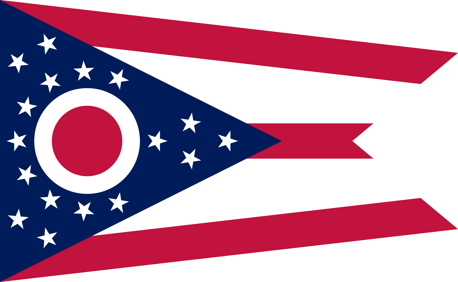
Cincinnati (/ˌsɪnsɪˈnæti/ SIN-si-NAT-ee) is a city in the U.S. state of Ohio and the county seat of Hamilton County.[10] Settled in 1788, the city is located at the northern side of the confluence of the Licking and Ohio rivers, the latter of which marks the state line with Kentucky. The city is the economic and cultural hub of the Cincinnati metropolitan area. With an estimated population of 2,190,209, it is Ohio's largest metropolitan area and the nation's 29th-largest,[11] and with a city population of 309,317, Cincinnati is the third-largest city in Ohio and 64th in the United States. Throughout much of the 19th century, it was among the top 10 U.S. cities by population, surpassed only by New Orleans and the older, established settlements of the United States eastern seaboard, as well as being the sixth-most populous city from 1840 until 1860.
As a rivertown crossroads at the junction of the North, South, East, and West, Cincinnati developed with fewer immigrants and less influence from Europe than East Coast cities in the same period. However, it received a significant number of German-speaking immigrants, who founded many of the city's cultural institutions. By the end of the 19th century, with the shift from steamboats to railroads drawing off freight shipping, trade patterns had altered and Cincinnati's growth slowed considerably. The city was surpassed in population by other inland cities, particularly Chicago, which developed based on strong commodity exploitation, economics, and the railroads, and St. Louis, which for decades after the Civil War served as the gateway to westward migration.
Cincinnati is home to three major sports teams: the Cincinnati Reds of Major League Baseball; the Cincinnati Bengals of the National Football League; and FC Cincinnati of Major League Soccer; it is also home to the Cincinnati Cyclones, a minor league ice hockey team. The city's largest institution of higher education, the University of Cincinnati, was founded in 1819 as a municipal college and is now ranked as one of the 50 largest in the United States.[12] Cincinnati is home to historic architecture with many structures in the urban core having remained intact for 200 years. In the late 1800s, Cincinnati was commonly referred to as the "Paris of America", due mainly to such ambitious architectural projects as the Music Hall, Cincinnatian Hotel, and Shillito Department Store.[13] Cincinnati is the birthplace of William Howard Taft, the 27th President and former Chief Justice of the United States.
 Vermont-VT
 Ski vacation
 Architecture
 Cities founded by the Romans
 Australian Capital Territory-ACT
 Iowa-IA
 North Carolina-NC
 Medieval cities in Europe
 Wyoming-WY
 FIFA Fussball-Weltmeisterschaft 2026
 Ohio-OH