
漢德百科全書 | 汉德百科全书
 Spain
Spain

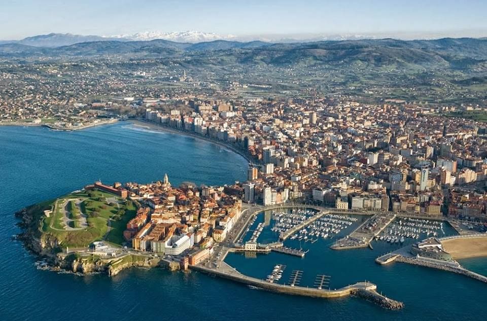

Die Universidad Laboral de Gijón ist ein Gebäude in der Gemeinde Cabueñes in der Stadt Gijón (Fürstentum Asturien, Spanien). Seit seiner Erbauung zwischen 1948 und 1957 und bis in die 1980er Jahre war es der Sitz einer franquistischen Einrichtung, die die Ausbildung von Arbeiterkindern zum Ziel hatte. Im Jahr 2007 wurde es unter dem Markennamen Laboral Ciudad de la Cultura neu erfunden, zu dem Einrichtungen wie Radiotelevisión del Principado de Asturias, LABoral Centro de Arte y Creación Industrial und die Fakultät für Handel, Tourismus und Sozialwissenschaften der Universität von Oviedo gehören.
Es handelt sich um das bedeutendste architektonische Werk, das im 20. Jahrhundert in Asturien errichtet wurde. Außerdem ist es mit 270 000 m² das größte Gebäude in Spanien. Seit 2016 ist es zum Kulturgut mit der Kategorie Denkmal erklärt worden.
 Beijing Shi-BJ
 Belarus

 Berlin

 Brandenburg

 Bremen
 China
China
 Germany
 France
 Gansu Sheng-GS
 Hebei Sheng-HE
 Heilongjiang Sheng-HL
 Henan Sheng-HA
 Hubei Sheng-HB
 Hunan Sheng-HN
 Iran
Iran
 Italy
Italy
 Jiangsu Sheng-JS
 Jilin Sheng-JL
 Kasachstan
 Liaoning Sheng-LN
 Nei Mongol Zizhiqu-NM
 Netherlands

 Lower Saxony
 Ningxia Huizu Zizhiqu-NX

 North Rhine-Westphalia
 Poland
 Portugal
 Russia

 Saxony

 Schleswig-Holstein
 Shaanxi Sheng-SN
 Shandong Sheng-SD
 Shanxi Sheng-SX
 Sichuan Sheng-SC
 Spain
Spain
 Turkey
 Turkmenistan
 Uzbekistan
 United Kingdom
 Xinjiang Uygur Zizhiqu-XJ
 Zhejiang Sheng-ZJ
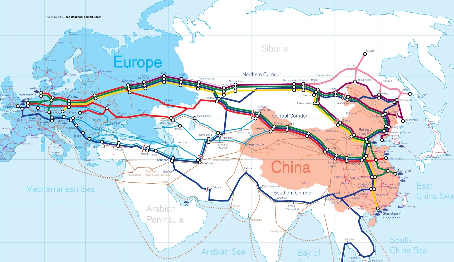
Die Neue eurasische Kontinentalbrücke (chinesisch 新亚欧大陆桥, Pinyin Xīn Yà-Ōu Dàlù Qiáo, englisch New Eurasian Continental Bridge), die auch Zweite eurasische Kontinentalbrücke (第二亚欧大陆桥, Dì'èr Yà-Ōu Dàlù Qiáo, englisch Second Eurasian Continental Bridge) genannt wird, ist eine 10.870 Kilometer[1] lange Eisenbahnverbindung, die Rotterdam in Europa mit der ostchinesischen Hafenstadt Lianyungang in der Provinz Jiangsu verbindet.
Sie besteht seit 1990 und führt durch die Dsungarische Pforte (Grenzbahnhof Alashankou). Die Lan-Xin-Bahn (chinesisch 兰新铁路, Pinyin Lán-Xīn Tiělù), also die Strecke von Lanzhou nach Ürümqi (in Xinjiang), ist ein Teil von ihr.
Es gibt eine nördliche, mittlere und südliche Route.[2] Die mittlere Strecke verläuft durch Kasachstan über Dostyk, Aqtogai, Astana, Samara, Smolensk, Brest, Warschau, Berlin zum Hafen von Rotterdam.[3] Vom slowakischen Košice soll auch eine Abzweigung in den Großraum Wien führen, siehe Breitspurstrecke Košice–Wien.
亚欧大陆桥,或新世纪亚欧大陆桥,是在中国大陆的新闻报道中经常出现的一个词语,特指从中国东部的沿海港口(有时特指连云港),沿陇海铁路、兰新铁路、北疆铁路,通过中亚、西亚到达欧洲的铁路路线。这条铁路在中国境外的具体走向,并没有任何官方文件精确指明,一说是经哈萨克斯坦、乌兹别克斯坦、土库曼斯坦、伊朗到达土耳其;一说是经俄罗斯、白俄罗斯、波兰、德国到达荷兰鹿特丹。全长10,800.32公里,1990年9月12日贯通。
The New Eurasian Land Bridge, also called the Second or New Eurasian Continental Bridge, is the southern branch of the Eurasian Land Bridge rail links running through China. The Eurasian Land Bridge is the overland rail link between Asia and Europe.
Due to a break-of-gauge between standard gauge used in China and the Russian gauge used in the former Soviet Union countries, containers must be physically transferred from Chinese to Kazakh railway cars at Dostyk on the Chinese-Kazakh border and again at the Belarus-Poland border where the standard gauge used in western Europe begins. This is done with truck-mounted cranes.[1] Chinese media often states that the New Eurasian Land/Continental Bridge extends from Lianyungang to Rotterdam, a distance of 11,870 kilometres (7,380 mi). The exact route used to connect the two cities is not always specified in Chinese media reports, but appears to usually refer to the route which passes through Kazakhstan.
All rail freight from China across the Eurasian Land Bridge must pass north of the Caspian Sea through Russia at some point. A proposed alternative would pass through Turkey and Bulgaria,[2] but any route south of the Caspian Sea must pass through Iran.[1]
Kazakhstan's President Nursultan Nazarbayev urged Eurasian and Chinese leaders at the 18th Shanghai Cooperation Organisation to construct the Eurasian high-speed railway (EHSRW) following a Beijing-Astana-Moscow-Berlin.[3]
The Eurasian Land Bridge (Russian: Евразийский сухопутный мост, Yevraziyskiy sukhoputniy most), sometimes called the New Silk Road (Новый шёлковый путь, Noviy shyolkoviy put'), or Belt and Road Initiative is the rail transport route for moving freight and passengers overland between Pacific seaports in the Russian Far East and China and seaports in Europe. The route, a transcontinental railroad and rail land bridge, currently comprises the Trans-Siberian Railway, which runs through Russia and is sometimes called the Northern East-West Corridor, and the New Eurasian Land Bridge or Second Eurasian Continental Bridge, running through China and Kazakhstan. As of November 2007, about 1% of the $600 billion in goods shipped from Asia to Europe each year were delivered by inland transport routes.[1]
Completed in 1916, the Trans-Siberian connects Moscow with Russian Pacific seaports such as Vladivostok. From the 1960s until the early 1990s the railway served as the primary land bridge between Asia and Europe, until several factors caused the use of the railway for transcontinental freight to dwindle. One factor is that the railways of the former Soviet Union use a wider rail gauge than most of the rest of Europe as well as China. Recently, however, the Trans-Siberian has regained ground as a viable land route between the two continents.[why?]
China's rail system had long linked to the Trans-Siberian via northeastern China and Mongolia. In 1990 China added a link between its rail system and the Trans-Siberian via Kazakhstan. China calls its uninterrupted rail link between the port city of Lianyungang and Kazakhstan the New Eurasian Land Bridge or Second Eurasian Continental Bridge. In addition to Kazakhstan, the railways connect with other countries in Central Asia and the Middle East, including Iran. With the October 2013 completion of the rail link across the Bosphorus under the Marmaray project the New Eurasian Land Bridge now theoretically connects to Europe via Central and South Asia.
Proposed expansion of the Eurasian Land Bridge includes construction of a railway across Kazakhstan that is the same gauge as Chinese railways, rail links to India, Burma, Thailand, Malaysia and elsewhere in Southeast Asia, construction of a rail tunnel and highway bridge across the Bering Strait to connect the Trans-Siberian to the North American rail system, and construction of a rail tunnel between South Korea and Japan. The United Nations has proposed further expansion of the Eurasian Land Bridge, including the Trans-Asian Railway project.
El Nuevo Puente de Tierra de Eurasia es también llamado el Segundo o Nuevo Puente Continental de Eurasia. Es la rama meridional de las conexiones ferroviarias del Puente de Tierra de Eurasia (también conocido como "Nueva Ruta de la Seda") que se extienden a través de la República Popular China, atravesando Kazajistán, Rusia y Bielorrusia. El Puente de Tierra de Eurasia es el enlace ferroviario terrestre entre Asia Oriental y Europa.
La Nueva Ruta de la Seda (en ruso, Новый шёлковый путь, Noviy shyolkoviy put), o Puente Terrestre Euroasiático, es la ruta de transporte ferroviario para el movimiento de tren de mercancías y tren de pasajeros por tierra entre los puertos del Pacífico, en el Lejano Oriente ruso y chino y los puertos marítimos en Europa.
La ruta, un ferrocarril transcontinental y puente terrestre, actualmente comprende el ferrocarril Transiberiano, que se extiende a través de Rusia, y el nuevo puente de tierra de Eurasia o segundo puente continental de Eurasia, que discurre a través de China y Kazajistán, también se van a construir carreteras entre las ciudades de la ruta. A partir de noviembre de 2007, aproximadamente el 1% de los 600 millones de dólares en bienes enviados desde Asia a Europa cada año se entregaron por vías de transporte terrestre.1
Terminado en 1916, el tren Transiberiano conecta Moscú con el lejano puerto de Vladivostok en el océano Pacífico, el más largo del mundo en el Lejano Oriente e importante puerto del Pacífico. Desde la década de 1960 hasta principios de 1990 el ferrocarril sirvió como el principal puente terrestre entre Asia y Europa, hasta que varios factores hicieron que el uso de la vía férrea transcontinental para el transporte de carga disminuyese.
Un factor es que los ferrocarriles de la Unión Soviética utilizan un ancho de vía más ancho en los rieles que la mayor parte del resto de Europa y China, y el transporte en barcos de carga por el canal de Suez en Egipto, construido por Inglaterra. El sistema ferroviario de China se une al Transiberiano en el noreste de China y Mongolia. En 1990 China añadió un enlace entre su sistema ferroviario y el Transiberiano a través de Kazajistán. China denomina a su enlace ferroviario ininterrumpido entre la ciudad portuaria de Lianyungang y Kazajistán como el «Puente terrestre de Nueva Eurasia» o «Segundo puente continental Euroasiático». Además de Kazajistán, los ferrocarriles conectan con otros países de Asia Central y Oriente Medio, incluyendo a Irán. Con la finalización en octubre de 2013 de la línea ferroviaria a través del Bósforo en el marco del proyecto Marmaray el puente de tierra de Nueva Eurasia conecta ahora teóricamente a Europa a través de Asia Central y del Sur.
La propuesta de ampliación del Puente Terrestre Euroasiático incluye la construcción de un ferrocarril a través de Kazajistán con el mismo ancho de vía que los ferrocarriles chinos, enlaces ferroviarios a la India, Birmania, Tailandia, Malasia y otros países del sudeste asiático, la construcción de un túnel ferroviario y un puente de carretera a través del estrecho de Bering para conectar el Transiberiano al sistema ferroviario de América del Norte, y la construcción de un túnel ferroviario entre Corea del Sur y Japón. Las Naciones Unidas ha propuesto una mayor expansión del Puente Terrestre Euroasiático, incluyendo el proyecto del ferrocarril transasiático.
Новый шёлковый путь (Евразийский сухопутный мост — концепция новой паневразийской (в перспективе — межконтинентальной) транспортной системы, продвигаемой Китаем, в сотрудничестве с Казахстаном, Россией и другими странами, для перемещения грузов и пассажиров по суше из Китая в страны Европы. Транспортный маршрут включает трансконтинентальную железную дорогу — Транссибирскую магистраль, которая проходит через Россию и второй Евразийский континентальный мост[en], проходящий через Казахстан[1]. Поезда по этому самому длинному в мире грузовому железнодорожному маршруту из Китая в Германию будут идти 15 дней, что в 2 раза быстрее, чем по морскому маршруту через Суэцкий канал[2].
Идея Нового шёлкового пути основывается на историческом примере древнего Великого шёлкового пути, действовавшего со II в. до н. э. и бывшего одним из важнейших торговых маршрутов в древности и в средние века. Современный НШП является важнейшей частью стратегии развития Китая в современном мире — Новый шёлковый путь не только должен выстроить самые удобные и быстрые транзитные маршруты через центр Евразии, но и усилить экономическое развитие внутренних регионов Китая и соседних стран, а также создать новые рынки для китайских товаров (по состоянию на ноябрь 2007 года, около 1 % от товаров на 600 млрд долл. из Азии в Европу ежегодно доставлялись наземным транспортом[3]).
Китай продвигает проект «Нового шёлкового пути» не просто как возрождение древнего Шёлкового пути, транспортного маршрута между Востоком и Западом, но как масштабное преобразование всей торгово-экономической модели Евразии, и в первую очередь — Центральной и Средней Азии. Китайцы называют эту концепцию — «один пояс — один путь». Она включает в себя множество инфраструктурных проектов, которые должны в итоге опоясать всю планету. Проект всемирной системы транспортных коридоров соединяет Австралию и Индонезию, всю Центральную и Восточную Азию, Ближний Восток, Европу, Африку и через Латинскую Америку выходит к США. Среди проектов в рамках НШП планируются железные дороги и шоссе, морские и воздушные пути, трубопроводы и линии электропередач, и вся сопутствующая инфраструктура. По самым скромным оценкам, НШП втянет в свою орбиту 4,4 миллиарда человек — более половины населения Земли[4].
Предполагаемое расширение Евразийского сухопутного моста включает в себя строительство железнодорожных путей от трансконтинентальных линий в Иран, Индию, Мьянму, Таиланд, Пакистан, Непал, Афганистан и Малайзию, в другие регионы Юго-Восточной Азии и Закавказья (Азербайджан, Грузия). Маршрут включает тоннель Мармарай под проливом Босфор, паромные переправы через Каспийское море (Азербайджан-Иран-Туркменистан-Казахстан) и коридор Север-Юг.Организация Объединенных Наций предложила дальнейшее расширение Евразийского сухопутного моста, в том числе проекта Трансазиатской железной дороги (фактически существует уже в 2 вариантах).
Для развития инфраструктурных проектов в странах вдоль Нового шёлкового пути и Морского Шёлкового пути и с целью содействия сбыту китайской продукции в декабре 2014 года был создан инвестиционный Фонд Шёлкового пути[5].
8 мая 2015 года было подписано совместное заявление Президента РФ В. Путина и Председателя КНР Си Цзиньпина о сотрудничестве России и Китая, в рамках ЕАЭС и трансевразийского торгово-инфраструктурного проекта экономического пояса «Шёлковый путь». 13 июня 2015 года был запущен самый длинный в мире грузовой железнодорожный маршрут Харбин — Гамбург (Германия), через территорию России.

Ceuta (arabisch سبتة, DMG Sabta) ist eine spanische Stadt an der nordafrikanischen Küste und der Straße von Gibraltar mit etwa 84.180 Einwohnern (Stand 1. Januar 2013).
Ceuta war seit dem 15. Jahrhundert zunächst in portugiesischem und später in spanischem Besitz; auch nach der Unabhängigkeit Marokkos 1956 blieben Ceuta und das ebenfalls in Nordafrika gelegene Melilla spanisch. Von marokkanischer Seite wird der Gebietsanspruch auf die beiden Städte grundsätzlich betont, konkrete Schritte zu dessen Durchsetzung werden aber nicht unternommen. Seit 1995 verfügen Ceuta und Melilla über den Status einer „autonomen Stadt“ (ciudad autónoma), der ihnen einige der Befugnisse der autonomen Gemeinschaften verleiht. Ceuta ist integraler Bestandteil des spanischen Staates, der Europäischen Union und der NATO, verfügt aber über einige Sonderrechte. Insbesondere gehört es gemäß Artikel 3 Absatz 1 Zollkodex nicht zum Zollgebiet der Europäischen Union.
Als Exklave Spaniens auf dem afrikanischen Kontinent ist Ceuta ein begehrtes Ziel illegaler Einwanderung durch Menschen, die sich eine Weiterreise nach Europa erhoffen. In den vergangenen Jahren wurde deshalb von den spanischen und marokkanischen Behörden die Befestigung und Überwachung der Grenze massiv verstärkt.
Das historische Zentrum von Ceuta wurde als Kulturgut (Bien de Interés Cultural) in der Kategorie Conjunto histórico-artístico anerkannt.


 Afghanistan
 Egypt
Egypt
 Armenia
 Azerbaijan
 Ethiopia
 Australia
 Bangladesh
 Beijing Shi-BJ
 Brunei Darussalam
 China
China
 Denmark
 Demokratische Republik Timor-Leste
 Germany
 Fidschi

 Financial
 International Bank for Cooperation
 Finland
 France
 Georgia
 Hongkong Tebiexingzhengqu-HK
 India
India
 Indonesia
 Iran
Iran
 Ireland
 Iceland
 Israel
 Italy
Italy
 Jordan
 Cambodia
 Kasachstan
 Katar
Katar
 Kyrgyzstan
 Laos
Laos
 Luxembourg
 Malaysia
 Malediven
 Malta
Malta

 Mongolei
 Myanmar
 Nepal
Nepal
 New Zealand
 Netherlands
 Norwegen
 Oman
Oman
 Austria
 Pakistan
 Philippines
 Poland
 Portugal
 Republic of Korea
 Russia
 Samoa
Samoa
 Saudi Arabia
 Sweden
 Switzerland
 Singapore
 Spain
Spain
 Sri Lanka
 South Africa
 Tajikistan
 Thailand
 Turkey
 Hungary
 Uzbekistan
 United Arab Emirates
 United Kingdom
 Vietnam

 Important International Organizations

 Economy and trade
 Economic and political research
 Cyprus

Anlass zur Initiative der Gründung war insbesondere die Unzufriedenheit Chinas über eine Dominanz der US-Amerikaner im Internationalen Währungsfonds, der keine faire Verteilung der globalen Machtverhältnisse aus Sicht Chinas widerspiegelte.[2] Da sich die US-Amerikaner strikt weigerten, eine Änderung der Stimmverhältnisse zu implementieren, begann China 2013 mit der Gründung der Initiative. Neben den 21 Gründungsmitgliedern haben im Jahr 2015 auch unter anderem Deutschland, Italien, Frankreich und das Vereinigte Königreich ihr Interesse bekundet, als nicht-regionale Mitglieder die neue Entwicklungsbank zu unterstützen.[3]
Die Gründungsurkunde der AIIB wurde am 29. Juni 2015 von Vertretern aus 57 Ländern in Peking unterzeichnet.[4] Die Bank nahm im Januar 2016 ihre Arbeit ohne Beteiligung der USA und Japan auf.[5]
Joachim von Amsberg ist der "Vizepräsident für Politik und Strategie".
亚洲基础设施投资银行(英语:Asian Infrastructure Investment Bank,縮寫:AIIB),简称亚投行,是一个愿意向亚洲国家和地區的基础设施建设提供资金支持的政府间性质的亚洲区域多边开发机构,成立的目的是促进亚洲区域的互联互通建设和经济一体化的进程,並且加大中國與其他亚洲國家和地区的合作力度。总部设在中国北京,法定资本为1,000亿美元。[2]
中华人民共和国主席习近平于2013年10月2日在雅加达同印度尼西亚总统苏西洛举行会谈时首次倡议筹建亚投行。[3]2014年10月24日,中国、印度、新加坡等21国在北京正式签署《筹建亚投行备忘录》。[2]2014年11月25日,印度尼西亚签署备忘录,成为亚投行第22个意向创始成员国。[4]
2015年3月12日,英国正式申请作为意向创始成员国加入亚投行,[5]成为正式申请加入亚投行的首个欧洲国家、主要西方国家。[6]随后法国、意大利、德国等西方国家纷纷以意向创始成员国身份申请加入亚投行。[7]接收新意向创始成员国申请截止日期3月31日临近,韩国[8]、俄罗斯[9]、巴西[10]等域内国家和重要新兴经济体也抓紧申请成为亚投行意向创始成员国。
各方商定将于2015年年中完成亚投行章程谈判并签署,年底前完成章程生效程序,正式成立亚投行。[11]
アジアインフラ投資銀行(アジアインフラとうしぎんこう、英: Asian Infrastructure Investment Bank, AIIB、中: 亚洲基础设施投资银行,亞洲基礎設施投資銀行)は、国際開発金融機関のひとつである。
中華人民共和国が2013年秋に提唱し主導する形で発足した[1]。「合計の出資比率が50%以上となる10以上の国が国内手続きを終える」としていた設立協定が発効条件を満たし、2015年12月25日に発足し[2][3]、2016年1月16日に開業式典を行った[1][4]。
57か国を創設メンバーとして発足し[1][5]、2017年3月23日に加盟国は70カ国・地域となってアジア開発銀行の67カ国・地域を超え[6][7]、一方で日本、アメリカ合衆国などは2017年の現時点で参加を見送っている[8]。 創設時の資本金は1000億ドルである[9]。
The Asian Infrastructure Investment Bank (AIIB) is a multilateral development bank that aims to support the building of infrastructure in the Asia-Pacific region. The bank currently has 93 members from around the world [7]. The bank started operation after the agreement entered into force on 25 December 2015, after ratifications were received from 10 member states holding a total number of 50% of the initial subscriptions of the Authorized Capital Stock.[8]
The United Nations has addressed the launch of AIIB as having potential for "scaling up financing for sustainable development"[9] and to improve the global economic governance.[10] The starting capital of the bank was $100 billion, equivalent to 2⁄3 of the capital of the Asian Development Bank and about half that of the World Bank.[11]
The bank was proposed by China in 2013[12] and the initiative was launched at a ceremony in Beijing in October 2014.[13] It received the highest credit ratings from the three biggest rating agencies in the world, and is seen as a potential rival to the World Bank and IMF.[14][15]
La Banque asiatique d'investissement dans les infrastructures (BAII ou AIIB), est une banque d'investissement proposée par la République populaire de Chine dans le but de concurrencer le Fonds monétaire international, la Banque mondiale et la Banque asiatique de développement1 pour répondre au besoin croissant d'infrastructures en Asie du Sud-Est et en Asie centrale. Cette banque s'inscrit dans la stratégie de la nouvelle route de la soie, développée par la Chine.
La Banca Asiatica d'Investimento per le infrastrutture (AIIB), fondata a Pechino nell'ottobre 2014, è un'istituzione finanziaria internazionale proposta dalla Repubblica Popolare Cinese. Si contrappone al Fondo Monetario Internazionale, alla Banca Mondiale e all'Asian Development Bank[1], le quali si trovano sotto il controllo del capitale e delle scelte strategiche dei paesi sviluppati come gli Stati Uniti d'America.[2] Scopo della Banca è fornire e sviluppare progetti di infrastrutture nella regione Asia-Pacifico attraverso la promozione dello sviluppo economico-sociale della regione e contribuendo alla crescita mondiale.
El Banco Asiático de Inversión en Infraestructura (Asian Infrastructure Investment Bank o AIIB) es una institución financiera internacional propuesta por el gobierno de China. El propósito de este banco de desarrollo multilateral es proporcionar la financiación para proyectos de infraestructura en la región de Asia basado en un sistema financiero de préstamo1 y el fomento del sistema de libre mercado en los países asiáticos.
El AIIB está considerado por algunos como una versión continental del FMI y del Banco Mundial, y busca ser un rival por la influencia en la región del Banco de Desarrollo asiático (ADB), el cual esta alineado a los intereses de potencias, tanto regionales (Japón), como globales (Estados Unidos, la Unión Europea).2
El banco fue propuesto por Xi Jinping en 2013 e inaugurado con una ceremonia en Pekín en octubre de 2014. La ONU se a mostrado entusiasta con la propuesta china, a la que a descrito como el FMI del futuro y a señalado como "una gran propuesta para financiar el desarrollo sostenible" y "mejorar la gobernanza económica mundial". La entidad constó inicialmente con 100 mil millones de dolares, es decir, la mitad del dinero de que posee el Banco Mundial.
La entidad a recibido inversión por parte de corporaciones financieras estadounidenses como la Standard & Poor's, Moody's o Fitch Group34. Actualmente la entidad consta de 87 miembros, incluyendo los 57 miembros fundadores. Bélgica, Canadá, y Ucrania están barajando unirse al AIIB. Estados Unidos, Japón y Colombia no tienen intención de participar. China a prohibido a Corea del Norte unirse, instigando además una política de aislamiento contra esta por parte del AIIB.
Азиатский банк инфраструктурных инвестиций (АБИИ) (англ. Asian Infrastructure Investment Bank, AIIB) — международная финансовая организация, создание которой было предложено Китаем. Основные цели, которые преследует АБИИ, — стимулирование финансового сотрудничества в Азиатско-Тихоокеанском регионе, финансирование инфраструктурных проектов в Азии от строительства дорог и аэропортов до антенн связи и жилья экономкласса[1].
По заявлениям вице-премьера России Игоря Шувалова, AБИИ не рассматривается как потенциальный конкурент МВФ, Всемирного банка и Азиатского банка развития (АБР). Однако эксперты рассматривают AIIB как потенциального конкурента базирующихся в США Международного валютного фонда (МВФ) и Всемирного банка. После сообщений об успехах AIIB американский министр финансов США Джейкоб Лью предупредил, что международным финансовым организациям в США, таким как ВБ и МВФ, грозит потеря доверия [2][3].
Китай, Индия и Россия возглавили организацию, оказавшись в тройке крупнейших владельцев голосов. При этом на важнейшие решения КНР имеет фактическое право вето[4].
 Azerbaijan
 Australia
 Bahrain
 Belgium
 Brazil
 China
China
 Germany
 Formel-1-Weltmeisterschaft 2017
 Formel-1-Weltmeisterschaft 2018
 France
 India
India
 Italy
Italy
 Japan
Japan
 Canada
 Mexico
 Monaco
 Austria
 Switzerland
 Spain
Spain

 Sport
Sport
 Hungary
 United Arab Emirates
 United States
 United Kingdom
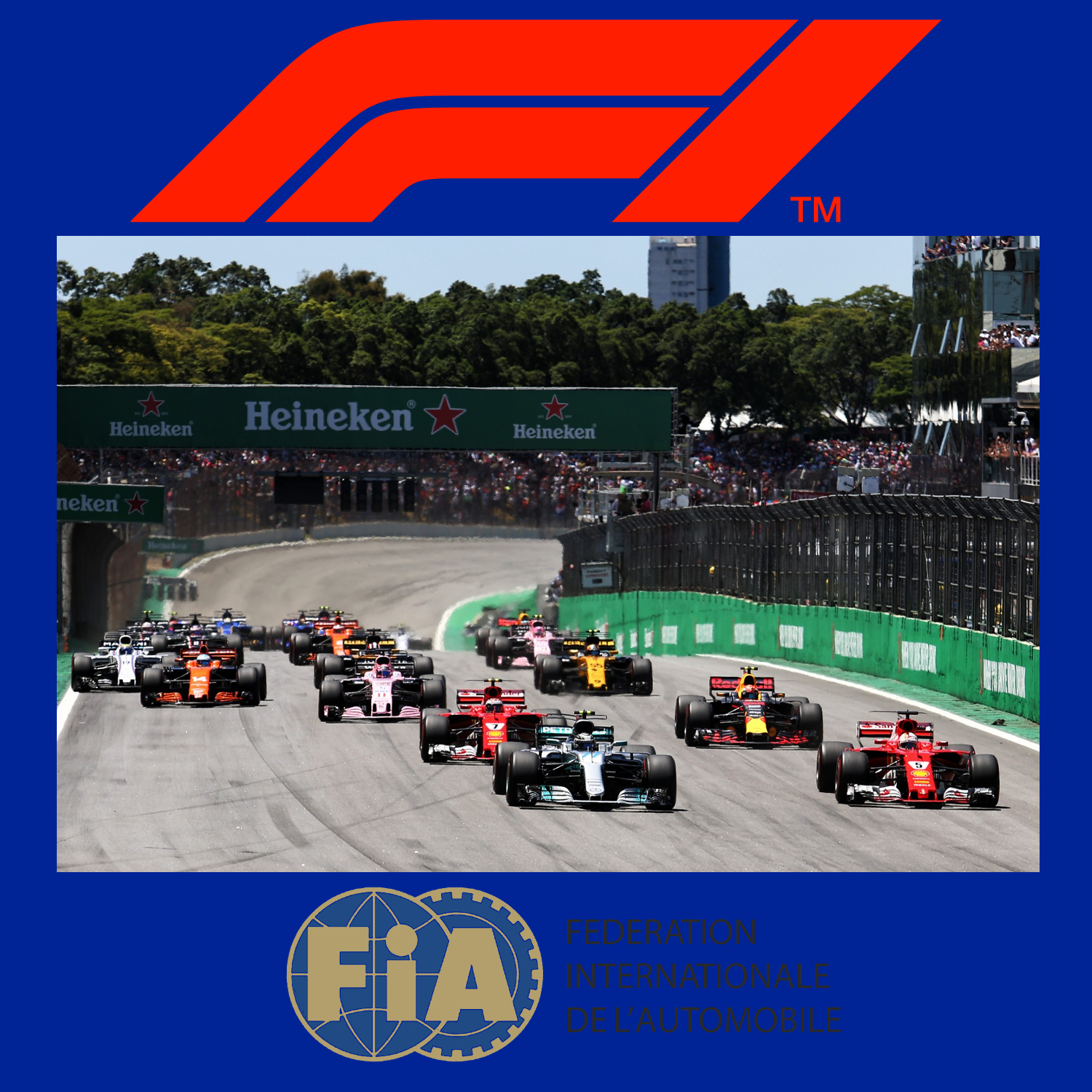
Die Formel 1 ist eine vom Automobil-Dachverband Fédération Internationale de l’Automobile (FIA) festgelegte Formelserie. Hersteller konstruieren Autos, die den Formel-1-Regeln entsprechen. Diese Autos treten im Rahmen der Formel-1-Weltmeisterschaft zu Rennen in ungefähr 20 Orten pro Jahr an. Am Ende der Saison wird der Fahrer mit den meisten Punkten F1 Fahrerweltmeister und der Hersteller mit den meisten Punkten Konstrukteursweltmeister.
Die Formel 1 ist die höchstrangige von der FIA veranstaltete Rennserie des Formelsports. Sie wird als Königsklasse des Automobilsports bezeichnet, da sie den Anspruch erhebt, die höchsten technischen, fahrerischen, aber auch finanziellen Anforderungen aller Rennserien an Fahrer und Konstrukteure zu stellen. Sie wird auch kurz F1 genannt. Die F1 Weltmeisterschaft heißt offiziell FIA Formula One World Championship, bis 1980 hat sie Automobil-Weltmeisterschaft geheissen.
一级方程式赛车(英语:Formula One,也叫Formula 1或者F1)是由国际汽车联盟举办的最高等级的年度系列场地方程式赛车比赛,正式名称为“国际汽车联合会世界一级方程式锦标赛”。名称中“方程式”是指一组所有参赛车辆都必须遵守的规则[1]。F1赛季包括一系列的比赛,而这些所谓的“大奖赛”(Grand Prix,出自法语,本意Great Prizes)的场地是全封闭的专门赛道或者是临时封闭的普通公路。每场比赛的结果算入积分系统并以此确定两个年度世界冠军:一个给车手和另一个给制造商。F1的车手、制造商、组织者以及赛道都必须持有FIA超级驾驶执照,这是国际汽联颁发的最高级别执照。
一级方程式赛车通过产生大量的空气动力学下压力达到非常高的过弯速度,是风靡全球的赛车运动。发动机性能限制在每分钟最多15000转时,其比赛最高速度就可以超过360公里/小时。赛车过弯的横向加速度超过5个标准重力。F1赛车的性能非常依赖电子系统(牵引力控制系统和其他辅助驾驶装置自2008年已被禁止)、空气动力学、悬挂和轮胎。
Formula One (also Formula 1 or F1) is the highest class of single-seater auto racing sanctioned by the Fédération Internationale de l'Automobile (FIA) and owned by the Formula One Group. The FIA Formula One World Championship has been one of the premier forms of racing around the world since its inaugural season in 1950. The "formula" in the name refers to the set of rules to which all participants' cars must conform.[2] A Formula One season consists of a series of races, known as Grands Prix (French for "grand prizes" or "great prizes"), which are held worldwide on purpose-built circuits and public roads.
The results of each race are evaluated using a points system to determine two annual World Championships: one for drivers, the other for constructors. Drivers must hold valid Super Licences, the highest class of racing licence issued by the FIA.[3] The races are required to be held on tracks graded "1" (formerly "A"), the highest grade rating issued by the FIA.[3] Most events are held in rural locations on purpose-built tracks, but there are several events in city centres throughout the world, with the Monaco Grand Prix being the most well-known.
Formula One cars are the fastest regulated road course racing cars in the world, owing to very high cornering speeds achieved through the generation of large amounts of aerodynamic downforce. The cars underwent major changes in 2017,[4] allowing wider front and rear wings, and wider tyres, resulting in cornering forces closing in on 8g and top speeds of up to approximately 375 km/h (230 mph).[5] The hybrid engines are currently limited in performance to a maximum of 15,000 rpm and the cars are very dependent on electronics—although traction control and other driving aids have been banned since 2008—and also on aerodynamics, suspension, and tyres.
While Europe is the sport's traditional base, the championship is truly global, with 11 of the 21 races in the 2018 season taking place outside Europe. With the annual cost of running a mid-tier team—designing, building, and maintaining cars, pay, transport—being US$120 million,[6] Formula One has a significant economic and job-creation effect, and its financial and political battles are widely reported. Its high profile and popularity have created a major merchandising environment, which has resulted in large investments from sponsors and budgets (in the hundreds of millions for the constructors). On 8 September 2016, it was announced that Liberty Media had agreed to buy Delta Topco, the company that controls Formula One, from private equity firm CVC Capital Partners for $4.4 billion in cash, stock, and convertible debt.[7] On 23 January 2017, it was confirmed that the acquisition had been completed, for $8 billion.[8]
La Formule 1, communément abrégée en F1, est une discipline de sport automobile considérée comme la catégorie reine de ce sport. Elle a pris au fil des ans une dimension mondiale et elle est, avec les Jeux olympiques et la Coupe du monde de football, l'un des événements sportifs les plus médiatisés.
Chaque année depuis 1950, un championnat mondial des pilotes est organisé, complété depuis 1958 par un championnat mondial des constructeurs automobiles. La compétition est basée sur des Grands Prix, courses à bord de voitures monoplaces disputées sur circuits routiers fermés permanents mais parfois tracés en ville et temporaires, comme à Monaco, Valence, Singapour, et Bakou.
Cette discipline sportive, régie par la Fédération internationale de l'automobile (FIA), est gérée par la Formula One Administration (FOA) et un ensemble de sociétés satellites contrôlées par Liberty Media. Après l'ère des artisans des années 1960 et 1970, elle a peu à peu attiré les grands constructeurs automobiles mondiaux qui y investissent des sommes élevées, en espérant tirer profit des retombées médiatiques d'éventuels succès. La Formule 1 est considérée comme la vitrine technologique de l'industrie automobile qui y expérimente des nouveautés techniques, parfois issues de la technologie spatiale et susceptibles d'être adaptées ensuite sur les voitures de série.
Outre la compétition, le terme Formule 1 désigne l'ensemble des règles techniques des voitures monoplaces qui sont mises à jour tous les ans par la FIA. Ces règles sont très strictes sur les dimensions des voitures, la cylindrée des moteurs, les technologies mises en œuvre ; elles définissent également les mesures de sécurité des voitures pour assurer la protection du pilote. Les monoplaces de course répondant aux caractéristiques de la réglementation de la Formule 1 sont généralement désignées sous le terme générique de Formules 1.
La Formula 1 o Formula Uno,[1] in sigla F1, è la massima categoria (in termini prestazionali) di vetture monoposto a ruote scoperte da corsa su circuito definita dalla Federazione Internazionale dell'Automobile (FIA).
La categoria è nata nel 1948 (in sostituzione della Formula A, a sua volta sorta solo qualche anno prima, nel 1946), diventando poi a carattere mondiale nella stagione 1950. Inizialmente definita dalla Commissione Sportiva Internazionale (CSI) dell'Associazione Internazionale degli Automobil Club Riconosciuti (AIACR), associazione antesignana della Federazione Internazionale dell'Automobile, oggi la Formula Uno è regolata dal Consiglio Mondiale degli Sport Motoristici (in inglese: World Motor Sport Council, WMSC) della Federazione Internazionale dell'Automobile.
Il termine "formula", presente nel nome, fa riferimento a un insieme di regole alle quali tutti i partecipanti, le macchine e i piloti, devono adeguarsi; esse introducono un numero di restrizioni e specifiche nelle auto, al fine di evitare le eccessive disparità tecniche tra le auto, di porre dei limiti al loro sviluppo e di ridurre i rischi di incidenti. La formula ha avuto molti cambiamenti durante la sua storia. Ad esempio, ci sono stati differenti tipi di motori, con schemi da quattro fino a sedici cilindri e con cilindrate da 1,5 a 4,5 l.
La Fórmula 1, abreviada como F1 y también denominada la «categoría reina del automovilismo»1 o «la máxima categoría del automovilismo»,23 es la competición de automovilismo internacional más popular y prestigiosa, superando a categorías de automovilismo como la NASCAR, el Campeonato Mundial de Rally, el Campeonato Mundial de Turismos o la Fórmula E, entre otras.4 A cada carrera se le denomina Gran Premio y el torneo que las agrupa se denomina Campeonato Mundial de Fórmula 1. La entidad que la dirige es la Federación Internacional del Automóvil (FIA). El Formula One Group es controlado por la empresa estadounidense Liberty Media desde septiembre de 2016.5
Los automóviles utilizados son monoplazas con la última tecnología disponible, siempre limitadas por un reglamento técnico; algunas mejoras que fueron desarrolladas en la Fórmula 1 terminaron siendo utilizadas en automóviles comerciales, como el freno de disco.6 La mayoría de los circuitos de carreras donde se celebran los Grandes Premios son autódromos, aunque también se utilizan circuitos callejeros y anteriormente se utilizaron circuitos ruteros.
El inicio de la Fórmula 1 moderna se remonta al año 1950, en el que participaron escuderías como Ferrari, Alfa Romeo y Maserati. Algunas fueron reemplazadas por otras nuevas como McLaren, Williams, Red Bull y Renault, que se han alzado varias veces con el Campeonato Mundial de Constructores. Las escuderías tienen que planear sus fichajes y renovación de contratos 2 o 3 carreras antes del fin de la temporada. Por su parte, los pilotos deben contar con la superlicencia de la FIA para competir, que se obtiene sobre la base de resultados en otros campeonatos.
 Airbus A320
 A319-100
 Airbus A320
 A320-100 / -200
 Airbus A320
 A320neo
 Airbus A320
 A321-100 / -200
 Airbus A320
 A321neo
 Airbus A330
 A330-200
 Airbus A330
 A330-300
 Airbus A340
 A340-600
 Airbus A350
 A350-900
 Iberia


 Aerospace
 Oneworld
 Spain
Spain

 Companies

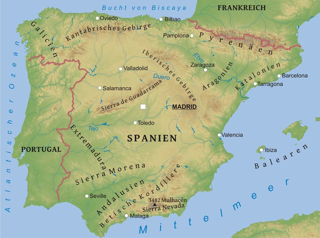
Das Iberische Gebirge (spanisch Sistema Ibérico) ist ein Gebirgssystem in Spanien. Es bildet den hohen Ostrand des zentralen Tafellandes und zugleich die Hauptwasserscheide der Iberischen Halbinsel zwischen dem Atlantischen Ozean und dem Mittelmeer.
伊比利亚山脉(西班牙语:Sistema Ibérico),是西班牙的山脉,长524公里、宽478公里,面积103,927平方公里,最高点海拔高度2,313米的蒙卡约山,山体由石灰岩、砂岩和石英岩组成。
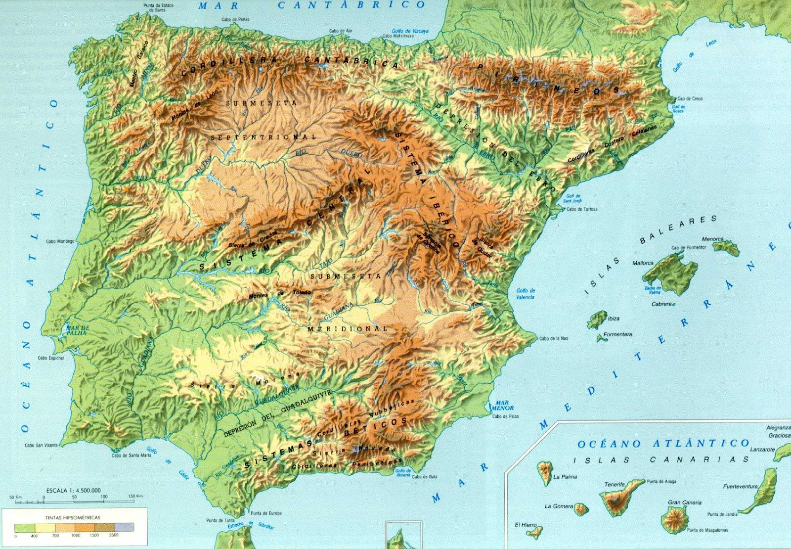
La penisola iberica si trova all'estrema propaggine sud-occidentale dell'Europa; ha una superficie di 583 000 km² ed è amministrativamente divisa tra quattro Paesi, benché i due maggiori, Spagna e Portogallo, ne assommino da soli quasi tutta l'estensione. Andorra è il più piccolo Paese indipendente della penisola, mentre Gibilterra è un territorio d'oltremare britannico. La popolazione ammonta a 56.730.914 abitanti[2].
Separa il Mar Mediterraneo dall'Oceano Atlantico e ha un confine naturale parziale con Francia nella catena dei Pirenei. La sua forma è rozzamente rettangolare e per effetto di ciò gran parte del suo territorio è lontana dal mare, il che causa nette differenze climatiche fra le parti costiere e quelle più interne. Il nome della regione deriva dagli Iberi, denominazione degli antichi abitanti del luogo (originari di tale regione) attribuita da Erodoto.
La península ibérican 1 se encuentra situada en el sudoeste de Europa; está rodeada por el mar Mediterráneo y el océano Atlántico, uniéndose al resto del continente por el noreste. Es una de las tres grandes penínsulas meridionales de Europa, junto a la itálica y la balcánica y mide aproximadamente 596 740 km².[cita requerida] Tradicionalmente se ha establecido la frontera de la península en la cordillera pirenaica, si bien el istmo se encuentra situado en la línea recta que une el punto central de los golfos de Vizcaya y León —entre las respectivas costas de las ciudades de Bayona y Narbona—, quedando por tanto comprendida una franja meridional de territorio francés al sur del istmo. 1
Пирене́йский полуо́стров (также Ибери́йский; исп. , порт. , галис. , астур. península Ibérica, баск. Iberiar penintsula, араг. peninsula Iberica, кат. península Ibèrica, эстр. península Ibérica, фр. péninsule Ibérique, англ. Iberian peninsula, лат. Iberia paeninsula) — полуостров на юго-западе Европы.
Полуостров омывается Средиземным морем, Атлантическим океаном и Бискайским заливом. На юге отделён от Африки Гибралтарским проливом. Самый южный и западный из трёх южных полуостровов Европейского континента (Пиренейский, Апеннинский и Балканский)[1]. На полуострове находятся крайние западная (мыс Рока) и южная (мыс Марроки) точки континентальной Европы. Назван по Пиренейским горам, окаймляющим полуостров на северо-востоке. Альтернативное название «Иберийский» связано с народом иберов, обитавших на востоке полуострова (территория современной Каталонии) в эпоху, предшествующую приходу римлян.

 Automobile
 International cities
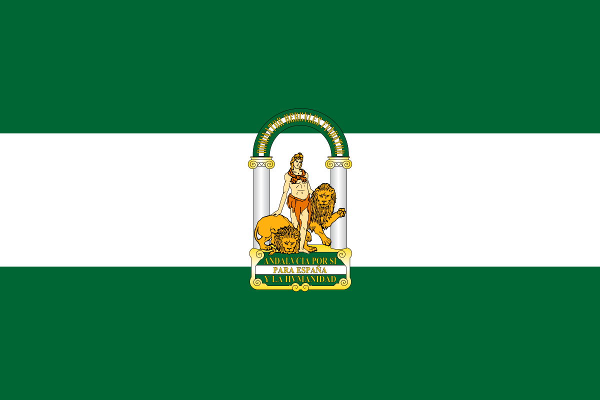 Andalusia
 Important port
 Transport and traffic
 Geography
 Party and government
 European Union
 Madrid
 Eat and Drink
 Motorsport
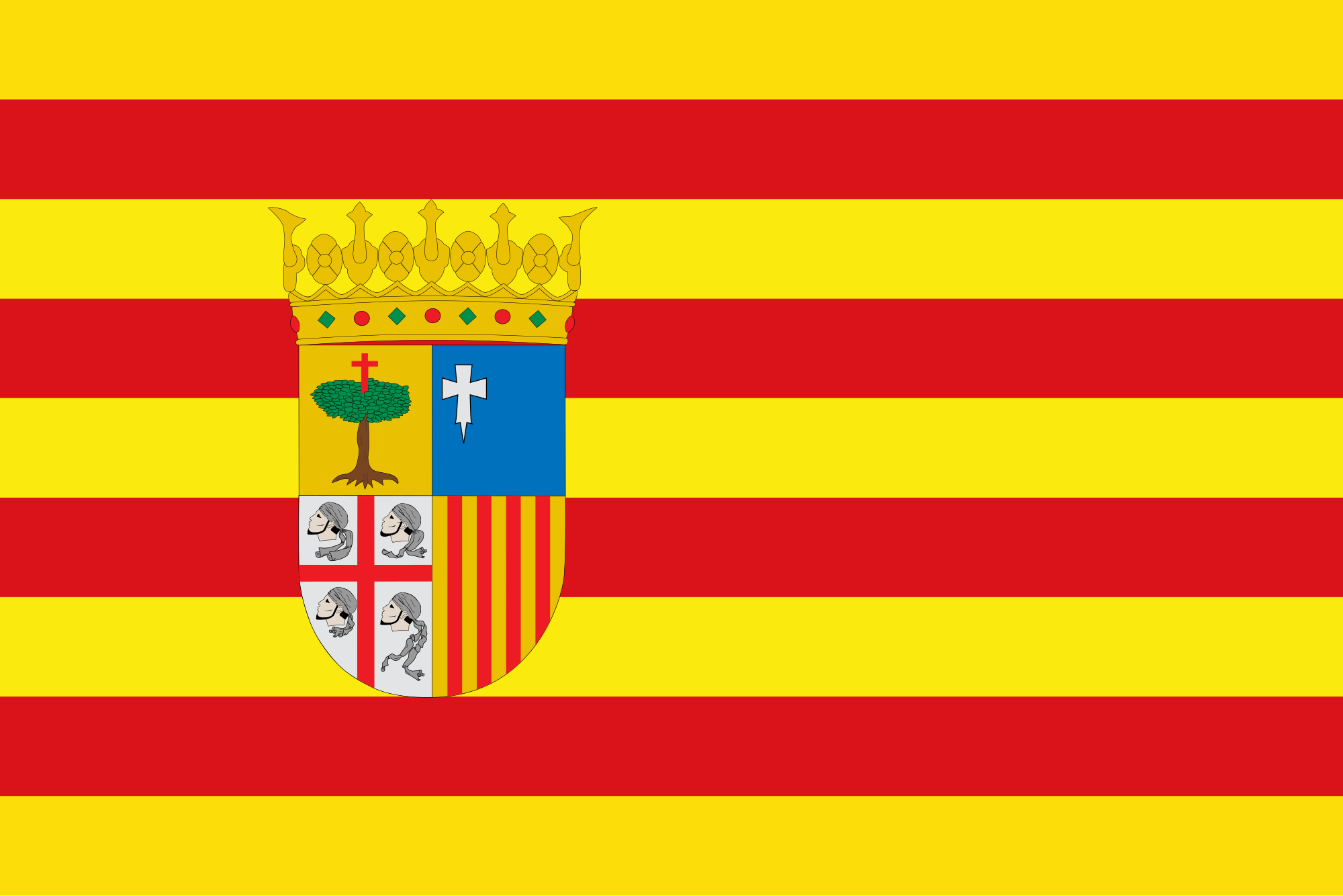 Aragón
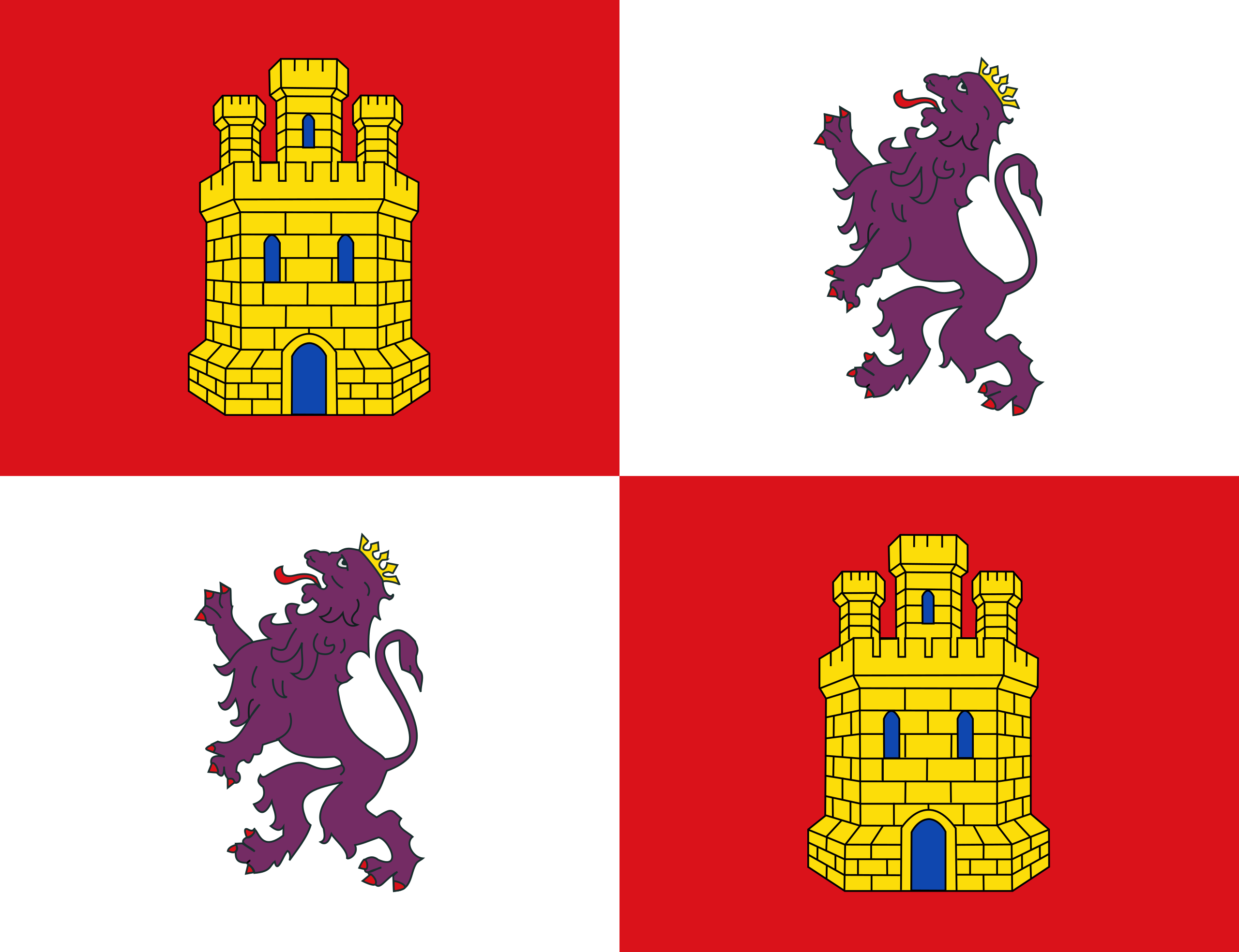 Castilla y León
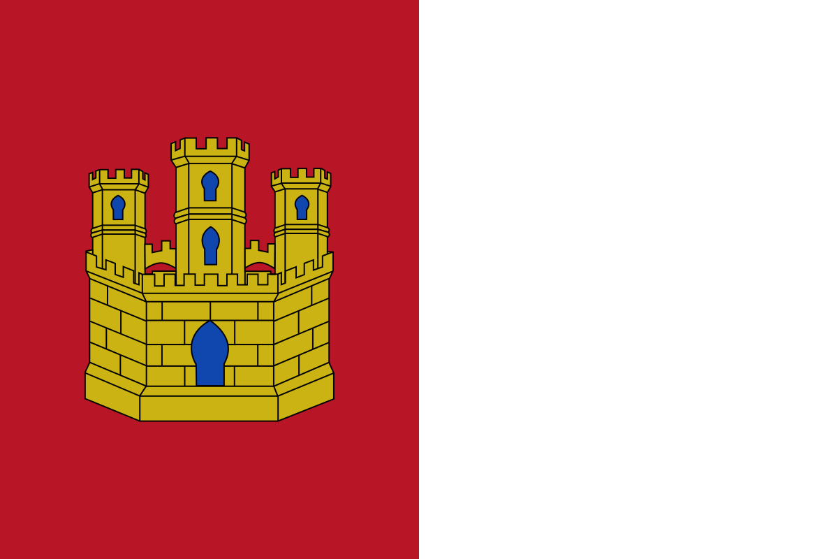 Castilla-La Mancha
 Cataluña
 Valencian Community
 La Rioja