
漢德百科全書 | 汉德百科全书
 Croatia

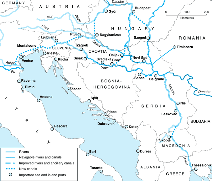


Zagreb [ˈzaːgrɛb] (deutsch Agram, heute selten genutzt; ungarisch Zágráb) ist die Hauptstadt und zugleich größte Stadt Kroatiens. Die Stadt Zagreb selbst hat auch die Funktionen einer Gespanschaft. Die nähere Umgebung der Stadt bildet getrennt von dieser die Gespanschaft Zagreb, deren Verwaltungssitz auch die Stadt Zagreb ist. In Zagreb residieren ein katholischer Erzbischof, die Kroatische Akademie der Wissenschaften und Künste sowie wichtige Verwaltungs- und Militärbehörden. Als Handels- und Finanzzentrum hat die Stadt nationale und regionale Bedeutung.
Die Zagreber Kathedrale ist Sitz der katholischen Erzdiözese Zagreb.
萨格勒布(克罗地亚语:Zagreb;德语旧称:Agram,阿格拉姆;匈牙利语:Zágráb),是克罗地亚的首都和札格雷布县的首府同时也是全国最大城市、一个直辖市。萨格勒布克罗地亚国内足球强队萨格勒布迪纳摩主场位于这里。萨格勒布位于海平面122m(400英尺),它位于克罗地亚的西北部的梅德韦德尼察山南坡,境内有萨瓦河流过。在2011年的正式人口普查中,萨格勒布市人口是792,875人[1]。连同萨格勒布县总人口达到了1,110,517。是克罗地亚唯一一个超过百万人口的大都市区。[2]
萨格勒布是一个有着悠久历史的城市(从古罗马时代到现在)。1094年在东部的卡普托尔主教教区内“萨格勒布”这个名称始见于史籍。在1845年扬科·卡毛夫成为萨格勒布的第一位市长。在1945年,随着人口快速的膨胀和城市的扩张,萨格勒布成为了克罗地亚的首都,从此萨格勒布开始闻名于世界。
萨格勒布在克罗地亚行政区划中有着十分特殊的地位(直辖市)。被管理细分为17个区域,它们大多是都位处低于海平面的萨瓦河山谷。
萨格勒布是克罗地亚全国、西欧和地中海和东南部欧洲的的最重要的交通枢纽。萨格勒布还有通往其他国家的国际列车。市内还有有轨电车。
ザグレブ(クロアチア語: Zagreb)は、クロアチアの首都。同国最大の都市である。クロアチアの北西部サヴァ川河畔に位置しメドヴェドニツァ山の南斜面にあり海抜は122mである。2011年の国勢調査による人口はザグレブ市街が686,568人、ザグレブ市域では792,875人であった。ザグレブ市と周辺の行政的に分かれているザグレブ郡の人口317,642人を合わせたザグレブ都市圏の人口は1,110,517人である。ザグレブはクロアチアでは唯一、100万人を超える都市圏を形成している。[5]
アルプスやディナルアルプス、アドリア海方向へ広がるパンノニア平原南西部の有利な地理的な条件により、中央ヨーロッパとアドリア海を結ぶ良く整備された交通回廊によって周辺地域と結ばれている。ザグレブは交通の要衝である他、産業の集積や科学研究機関、伝統的な産業などでクロアチアで先導する地位にある。また、首都としてクロアチアの中央政府や行政機関、省庁のほとんどがザグレブに拠点を置いている。
Zagreb (/ˈzɑːɡrɛb/ ZAH-greb, Croatian pronunciation: [zǎːɡreb] (![]() listen))[8] is the capital and the largest city of Croatia.[9] It is located in the northwest of the country, along the Sava river, at the southern slopes of the Medvednica mountain. Zagreb lies at an elevation of approximately 122 m (400 ft) above sea level.[10][11] The estimated population of the city in 2018 is 810,003. The population of the Zagreb urban agglomeration is about 1.1 million, approximately a quarter of the total population of Croatia.
listen))[8] is the capital and the largest city of Croatia.[9] It is located in the northwest of the country, along the Sava river, at the southern slopes of the Medvednica mountain. Zagreb lies at an elevation of approximately 122 m (400 ft) above sea level.[10][11] The estimated population of the city in 2018 is 810,003. The population of the Zagreb urban agglomeration is about 1.1 million, approximately a quarter of the total population of Croatia.
Zagreb is a city with a rich history dating from the Roman times to the present day. The oldest settlement located in the vicinity of the city was the Roman Andautonia, in today's Ščitarjevo.[12][13][14][15] The name "Zagreb" is recorded in 1134, in reference to the foundation of the settlement at Kaptol in 1094. Zagreb became a free royal town in 1242.[16][17][18][19][20] In 1851 Zagreb had its first mayor,[21][22][23][24] Janko Kamauf.
Zagreb has a special status in the Croatia's administrative division and is a consolidated city-county (but separated from Zagreb County),[25][26][27][28] and is administratively subdivided into 17 city districts.[29][30][31] Most of them are at a low elevation along the river Sava valley, whereas northern and northeastern city districts, such as Podsljeme[32][33][34] and Sesvete[35][36][37] districts are situated in the foothills of the Medvednica mountain,[38] making the city's geographical image rather diverse. The city extends over 30 kilometres (19 miles) east-west and around 20 kilometres (12 miles) north-south.[39][40]
The transport connections, concentration of industry, scientific, and research institutions and industrial tradition underlie its leading economic position in Croatia.[41][42][43] Zagreb is the seat of the central government, administrative bodies, and almost all government ministries.[44][45][46] Almost all of the largest Croatian companies, media, and scientific institutions have their headquarters in the city. Zagreb is the most important transport hub in Croatia where Central Europe, the Mediterranean and Southeast Europe meet, making the Zagreb area the centre of the road, rail and air networks of Croatia. It is a city known for its diverse economy, high quality of living, museums, sporting, and entertainment events. Its main branches of economy are high-tech industries and the service sector.
Zagreb (prononcé en croate : /ˈzɑːgrɛb/ ; hongrois : Zágráb ; italien : Zagabria ; anciennement nommée en allemand : Agram) est une ville et un comitat (« ville de Zagreb »), capitale de la Croatie. Au recensement de 2011, la ville comptait 688 163 habitants, le comitat 790 017 habitants, dont 93,14 % de Croates5 et la région de Zagreb (le comitat « ville de Zagreb » plus le comitat de Zagreb) comptait 1 107 623 habitants.
Zagreb est située au nord du pays sur les flancs de la Medvednica à côté de la Save à une altitude d'environ 122 m au-dessus du niveau de la mer. Sa situation géographique favorable dans le Sud-Ouest de la plaine de Pannonie qui s'étend des Alpes aux Alpes dinariques et à la mer Adriatique la place sur les axes de communication entre l'Europe centrale et la mer Adriatique.
Les interconnexions de transports, la concentration des industries, de la recherche scientifique et industrielle font de Zagreb le centre économique de la Croatie. Zagreb est également le siège du gouvernement, des corps administratifs et de presque tous les ministères.
Zagabria (in croato Zagreb, pronuncia [ˈzɑːgrɛb]; in tedesco, ai tempi dell'Impero austro-ungarico, Agram; in ungherese Zágráb) è la capitale e la maggiore città della Croazia, con i suoi 809 832 abitanti. Il centro cittadino costituisce una delle regioni della Croazia, mentre l'area geografica intorno alla città fa parte di un'altra unità amministrativa, la Regione di Zagabria.
Zagabria è sede degli organi centrali dello Stato (il Parlamento, il Presidente della Repubblica, il Governo ed il Primo ministro, la Corte Costituzionale, la Corte Suprema) e praticamente di tutti i ministeri. È anche sede universitaria (Università di Zagabria, Università Cattolica Croata, Università Internazionale Libertas, alte scuole, politecnici) e arcivescovile metropolitana (l'arcidiocesi di Zagabria con diocesi suffraganee a Varasdino, Sisak, Bjelovar-Križevci e l'eparchia greco-cattolica a Križevci di rito bizantino).
Zagreb (![]() [ˈzǎːɡreb] (?·i)) es la capital y ciudad más poblada de Croacia. Está localizada al noroeste del país, entre el río Sava y la ladera sur del monte Medvednica, a unos 122 metros sobre el nivel del mar. Dentro de su término municipal residen más de 890 000 habitantes en 2018, lo que la convierte en la cuarta ciudad más grande de Europa Sudoriental y en la segunda por extensión. Si se tienen en cuenta las poblaciones limítrofes, la cifra del área metropolitana asciende a 1 100 000 personas empadronadas.
[ˈzǎːɡreb] (?·i)) es la capital y ciudad más poblada de Croacia. Está localizada al noroeste del país, entre el río Sava y la ladera sur del monte Medvednica, a unos 122 metros sobre el nivel del mar. Dentro de su término municipal residen más de 890 000 habitantes en 2018, lo que la convierte en la cuarta ciudad más grande de Europa Sudoriental y en la segunda por extensión. Si se tienen en cuenta las poblaciones limítrofes, la cifra del área metropolitana asciende a 1 100 000 personas empadronadas.
La zona sobre la que se asienta Zagreb está habitada desde el Imperio romano. El yacimiento más antiguo que se ha localizado es la ciudad romana de Andautonia, situada a 10 km de la actual capital. El término «Zagreb» fue registrado por primera vez en 1134 para referirse a la archidiócesis de Zagreb, fundada en 1094,5 si bien durante siglos hubo dos pueblos distintos: Gradec —con bula de oro desde 1242— y Kaptol, donde se hallaba la catedral. Ambas localidades se fusionaron en 1851 por orden del ban Josip Jelačić para formar la ciudad actual.5
A diferencia de otras localidades del país, Zagreb tiene un estatus especial como «ciudad-condado», independiente del condado de Zagreb. A nivel administrativo está dividida en 17 distritos; la mayoría se encuentran en las zonas bajas cercanas al río Sava, mientras que los barrios del noroeste se sitúan a los pies del monte Medvednica. Su extensión total es de 30 km de este a oeste, y de 20 km de norte a sur.
En calidad de capital de Croacia, Zagreb alberga la sede del gobierno central, de las administraciones públicas y de casi todos los ministerios. La actividad económica concentra la mayoría de la industria, las sedes empresariales y los centros de investigación, con un sistema especializado en tecnologías de la información y en el sector servicios. Es asimismo el principal centro de comunicaciones de Croacia por tierra y aire, siendo un punto clave en la encrucijada entre Europa Central, el Adriático y el resto de la península balcánica. Dispone de una amplia oferta de eventos culturales y deportivos.
За́греб (хорв. Zagreb [ˈzâːɡrɛb]), Аграм (нем. Agram) — столица и крупнейший город Хорватии. Население — 790 017 человек (2011), площадь — 641,29 км². Город расположен на реке Саве, притоке Дуная, на 45,815° северной широты и 15,98306° восточной долготы, на высоте 104 метров над уровнем моря (низшая точка) рядом с горным массивом Медведница. Загреб основан более 900 лет назад.
Город Загреб с пригородами имеет статус отдельной жупании в составе Хорватии, руководство городом осуществляет мэр, избираемый городской ассамблеей. 31 мая 2009 года мэром города на четвёртый срок (третий подряд) был избран Милан Бандич[1].
Загреб находится в зоне континентального климата. Средняя летняя температура составляет +21 градус по Цельсию, средняя зимняя температура +2 градуса по Цельсию. Время — среднеевропейское, GMT+1.
 Andorra
 Belgium
 Bulgaria
 Denmark
 Germany
 Estonia
 Finland
 France
 Gibraltar
 Greece

 Hand in Hand
 Ireland
 Iceland
 Italy
Italy
 Croatia
 Latvia
 Liechtenstein
 Lithuania
 Luxembourg
 Malta
Malta
 Monaco
 Netherlands
 Northern Ireland
 Norwegen
 Austria
 Poland
 Portugal
 Romania
 San Marino
 Sweden
 Switzerland
 Slovakia
 Slovenia
 Spain
Spain
 Czech Republic
 Hungary
 Vatican city
 United Kingdom
 Cyprus

Die Schengener Abkommen sind internationale Übereinkommen, insbesondere zur Abschaffung der stationären Grenzkontrollen an den Binnengrenzen der teilnehmenden Staaten. Dies sind im Kern die Mitglieder der Europäischen Union, jedoch ohne Irland, Rumänien, Bulgarien und Zypern. Durch Zusatzabkommen mit der Europäischen Union wurde der Anwendungsbereich auf Island, Liechtenstein, Norwegen und die Schweiz ausgedehnt. Der Gültigkeitsbereich des Abkommens wird gemeinhin als Schengen-Raum bezeichnet.
Das erste dieser Abkommen vom 14. Juni 1985 sollte vor allem die Schaffung eines europäischen Binnenmarktes vorantreiben und wurde nach dem Unterzeichnungsort benannt, der Gemeinde Schengen im Großherzogtum Luxemburg. Die mehrfach modifizierten Regelungen (Schengen I bis III) konstituieren den Schengen-Besitzstand, einen wesentlichen Pfeiler des „Raumes der Freiheit, der Sicherheit und des Rechts“[1] der Europäischen Union. Bedeutung und Verdienste des Schengener Abkommens werden im Europäischen Museum Schengen dokumentiert.
Das unkontrollierte Passieren der Binnengrenzen als Prinzip der Schengener Abkommen wurde im Zuge der Flüchtlingskrise in Europa ab 2015 zeitweise von mehreren europäischen Ländern außer Kraft gesetzt, nachdem einzelne Mitgliedstaaten die Sicherung der Außengrenzen der Europäischen Union gefährdet sahen.
Von März bis Juni 2020 waren wegen der COVID-19-Pandemie zahlreiche Grenzen zwischen Mitgliedstaaten geschlossen.[2][3] Im Februar 2021 kam es wegen der Pandemie erneut zu Grenzschließungen.
《申根协议》(德语:Schengener Abkommen;法语:Convention de Schengen;荷兰语:Verdrag van Schengen),是一项欧洲大陆国家间的条约协定,其签约目的是取消相互之间的边境检查点,并协调对申根区之外的边境控制。即在成员国相互之间取消边境管制,持有任一成员国有效身份证或申根签证的人可以在所有成员国境内自由流动。根据该协定,旅游者如果持有其中一国的旅游签证即可合法地到所有其他申根国家。
《申根协议》的成员国亦称“申根国家”或者“申根协议国”,成员国的整体又称“申根区”。申根区目前包含26个国家,其中有22个属于欧盟成员。四个非欧盟成员国中,冰岛和挪威以北欧护照联盟成员国的身份加入申根区,官方分类属于与欧盟申根区活动相关的国家。不属于欧洲大陆的爱尔兰没有加入。

 Afghanistan
 Egypt
Egypt
 Albania
 Angola
 Antigua and Barbuda
 Argentina
 Armenia
 Australia
 Bahrain
 Bangladesh
 Barbados
 Belgium
 Belize
 Benin
Benin
 Bolivia
 Botsuana
 Brazil
 Brunei Darussalam
 Bulgaria
 Burkina Faso
 Burundi
 Chile
Chile
 China
China
 Columbia
 Costa Rica
 Côte d´Ivoire
 Cuba
Cuba
 Denmark
 Demokratische Republik Kongo
 Germany
 Dominica
 Dominikanische Republik
 Djibouti
 Ecuador
 Estonia

 European Union
 Fidschi

 Financial
 Finland
 France
 Gabun
Gabun
 Gambia
 Georgia
 Ghana
Ghana
 Grenada
 Greece
 Guatemala
 Guinea
 Guinea-Bissau
 Guyana
 Honduras
 Hongkong Tebiexingzhengqu-HK
 India
India
 Indonesia
 Ireland
 Iceland
 Israel
 Italy
Italy
 Jamaika
 Japan
Japan
 Yemen
Yemen
 Jordan
 Cambodia
 Cameroon
 Canada
 Kap Verde
 Kasachstan
 Katar
Katar
 Kenya
Kenya
 Kyrgyzstan
 Croatia
 Kuwait
 Laos
Laos
 Lesotho
 Latvia
 Liberia
 Liechtenstein
 Lithuania
 Luxembourg
 Macau Tebiexingzhengqu-MO
 Madagaskar
 Malawi
 Malta
Malta
 Morocco
 Mauritania
 Mauritius
 Mexico
 Moldawien

 Mongolei
 Montenegro
 Mosambik
 Myanmar
 Namibia
 Nepal
Nepal
 New Zealand
 Nicaragua
 Netherlands
 Niger
Niger
 Nigeria
 Nordmazedonien
 Norwegen
 Oman
Oman
 Austria
 Pakistan
 Panama
 Papua-Neuguinea
 Paraguay
 Peru
Peru
 Philippines
 Poland
 Portugal
 Republik El Salvador
 Republik Haiti
 Republik Kongo
 Republic of Korea
 Ruanda
 Romania
 Russia
 Salomonen
 Sambia
 Samoa
Samoa
 Saudi Arabia
 Sweden
 Sweden
 Switzerland
 Genf
Genf
 Senegal
 Seychellen
 Sierra Leone
 Simbabwe
 Singapore
 Slovakia
 Slovakia
 Slovenia
 Slovenia
 Spain
Spain
 Sri Lanka
 Saint Kitts and Nevis
 St. Lucia
 St. Vincent and the Grenadines
 South Africa
 Suriname
 Swasiland
 Tajikistan
 Taiwan Sheng-TW
 Tansania
 Thailand
 Togo
Togo
 Tonga
Tonga
 Trinidad und Tobago
 Tschad
 Czech Republic
 Tunisia
 Turkey
 Uganda
 Ukraine
 Hungary
 Uruguay
 Vanuatu
 Venezuela
 United Arab Emirates
 United States
 United Kingdom
 Vietnam

 Important International Organizations
 World Trade Organization
 Roberto Azevêdo
 World Trade Organization
 Mike Moore
 World Trade Organization
 Ngozi Okonjo-Iweala
 World Trade Organization
 Pascal Lamy
 World Trade Organization
 Peter Sutherland
 World Trade Organization
 Renato Ruggiero
 World Trade Organization
 Supachai Panitchpakdi
 Central African Republic
 Cyprus


世界贸易组织(简称世贸组织或世贸;英语:World Trade Organization,缩写为 WTO;法语:Organisation Mondiale du Commerce,缩写为 OMC;西班牙语:Organización Mundial del Comercio,缩写为 OMC)是负责监督成员经济体之间各种贸易协议得到执行的一个国际组织,前身是1948年起实施的关税及贸易总协定的秘书处。
世贸总部位于瑞士日内瓦,现任总干事是罗伯托·阿泽维多。截至2016年7月29日,世界贸易组织共有164个成员。[5]世界贸易组织的职能是调解纷争,加入WTO不算签订一种多边贸易协议,但其设置的入会门槛可以做为愿意降低关税、法政上配合、参与国际贸易的门票,它是贸易体制的组织基础和法律基础,是众多贸易协定的管理者,是各成员贸易立法的监督者,是就贸易提供解决争端和进行谈判的场所。该机构是当代最重要的国际经济组织之一,其成员间的贸易额占世界贸易额的绝大多数,被称为“经济联合国”。
世界貿易機関(せかいぼうえききかん、英: World Trade Organization、略称:WTO)は、自由貿易促進を主たる目的として創設された国際機関である。常設事務局がスイスのジュネーブに置かれている。
GATT(ガット)ウルグアイ・ラウンドにおける合意によって、世界貿易機関を設立するマラケシュ協定(WTO設立協定)に基づいて1995年1月1日にGATTを発展解消させて成立した。
本来GATTは、第二次世界大戦後の安定を見据え、国際通貨基金および国際復興開発銀行とともに設立が予定されていた国際貿易機関(ITO)の設立準備の際に、暫定協定として結ばれたものであった。国際貿易機関の設立が廃案となり、GATTがその代替として発展強化されていくうちに、再びこの分野の常設機関が求められ、WTOが設立されることとなった。発展解消であるため、GATTの事務局及び事務局長もWTOへと引き継がれることとなった[4]。
WTOはGATTを継承したものであるが、GATTが協定(Agreement)に留まったのに対し、WTOは機関(Organization)であるのが根本的な違いである。
を基本原則としている。また、物品貿易だけでなく金融、情報通信、知的財産権やサービス貿易も含めた包括的な国際通商ルールを協議する場である。
対抗処置の発動では、紛争処理機関(パネル)の提訴に対し全加盟国による反対がなければ採択されるというネガティブ・コンセンサス方式(逆コンセンサス方式)を採用した強力な紛争処理能力を持つ。これは国際組織としては稀な例であり、コンセンサス方式を採っていたGATTとの大きな違いで、WTOの特徴の一つといえる。
新多角的貿易交渉(新ラウンド)は、2001年11月にカタールのドーハで行われた第4回WTO閣僚会議で開始を決定し、ドーハ・ラウンドと呼ばれていた。2002年2月1日の貿易交渉委員会で新ラウンドがスタートした。しかし9年に及ぶ交渉は先進国と、急速に台頭してきたBRICsなど新興国との対立によって中断と再開を繰り返した末、ジュネーブで行われた第4回WTO閣僚会議(2011年12月17日)で「交渉を継続していくことを確認するものの、近い将来の妥結を断念する」(議長総括)となり事実上停止状態になった。
その後、2013年のバリ島における閣僚会議で、貿易円滑化協定を含む合意が成立し、2014年7月まで貿易円滑化協定をWTO協定に加える(附属書1Aに追加)するための文書を一般理事会で採択すべきとされた[5]。しかしインドが合意を蒸し返す状態で反対したため期限までに採択できなかった[6]。その後食糧備蓄への補助金の問題で先進国側が譲歩することでようやくインドが合意し、2014年11月27日の一般理事会で貿易円滑化協定が採択された[6]。WTO加盟国の3分の2が改正を受諾した日に発効することになっており、2017年2月22日にこの要件を満たし、協定が発効した。
The World Trade Organization (WTO) is an intergovernmental organization that regulates international trade. The WTO officially commenced on 1 January 1995 under the Marrakesh Agreement, signed by 124 nations on 15 April 1994, replacing the General Agreement on Tariffs and Trade (GATT), which commenced in 1948. It is the largest international economic organization in the world.[5][6]
The WTO deals with regulation of trade in goods, services and intellectual property between participating countries by providing a framework for negotiating trade agreements and a dispute resolution process aimed at enforcing participants' adherence to WTO agreements, which are signed by representatives of member governments[7]:fol.9–10 and ratified by their parliaments.[8] The WTO prohibits discrimination between trading partners, but provides exceptions for environmental protection, national security, and other important goals.[9] Trade-related disputes are resolved by independent judges at the WTO through a dispute resolution process.[9]
The WTO's current Director-General is Roberto Azevêdo,[10][11] who leads a staff of over 600 people in Geneva, Switzerland.[12] A trade facilitation agreement, part of the Bali Package of decisions, was agreed by all members on 7 December 2013, the first comprehensive agreement in the organization's history.[13][14] On 23 January 2017, the amendment to the WTO Trade Related Aspects of Intellectual Property Rights (TRIPS) Agreement marks the first time since the organization opened in 1995 that WTO accords have been amended, and this change should secure for developing countries a legal pathway to access affordable remedies under WTO rules.[15]
Studies show that the WTO boosted trade,[16][17][9] and that barriers to trade would be higher in the absence of the WTO.[18] The WTO has highly influenced the text of trade agreements, as "nearly all recent [preferential trade agreements (PTAs)] reference the WTO explicitly, often dozens of times across multiple chapters... in many of these same PTAs we find that substantial portions of treaty language—sometime the majority of a chapter—is copied verbatim from a WTO agreement."[19]
L'Organisation mondiale du commerce (OMC ; en anglais : World Trade Organization, WTO, en espagnol : Organización Mundial del Comercio, OMC) est une organisation internationale qui s'occupe des règles régissant le commerce international entre les pays. Au cœur de l'organisation se trouvent les accords de l'OMC, négociés et signés en avril 1994 à Marrakech1 par la majeure partie des puissances commerciales du monde2 et ratifiés par leurs assemblées parlementaires. L'OMC a pour but principal de favoriser l'ouverture commerciale. Pour cela, elle tâche de réduire les obstacles au libre-échange, d'aider les gouvernements à régler leurs différends commerciaux et d'assister les exportateurs, les importateurs et les producteurs de marchandises et de services dans leurs activités.
Depuis 2001, le cycle de négociation mené par l'OMC est le Cycle de Doha3. Bien que l'OMC ne soit pas une agence spécialisée de l'ONU, elle entretient des liens avec cette dernière4. Le siège de l'OMC est au Centre William-Rappard, à Genève. Depuis le 1er septembre 2013, l'organisation est présidée par le Brésilien Roberto Azevêdo qui a été élu directeur général.
L'Organizzazione mondiale del commercio, abbreviato in OMC (in inglese: World Trade Organization, WTO), è un'organizzazione internazionale creata allo scopo di supervisionare numerosi accordi commerciali tra gli stati membri. Vi aderiscono[3] 164 Paesi, a cui se ne aggiungono altri 22 con ruolo di osservatori,[4] comprendendo così oltre il 95% del commercio mondiale di beni e servizi.[5]
La sede dell'OMC si trova, dal 1995, presso il Centro William Rappard a Ginevra, Svizzera.[6]
La Organización Mundial del Comercio (OMC) fue establecida en 1995. Tiene su sede en Ginebra, Suiza, y sus idiomas oficiales son el inglés, el francés y el español. La OMC no forma parte del sistema de las Naciones Unidas, y tampoco de los organismos de Bretton Woods como el Banco Mundial o el FMI.Nota 1
Всеми́рная торго́вая организа́ция (ВТО; англ. World Trade Organization (WTO), фр. Organisation mondiale du commerce (OMC), исп. Organización Mundial del Comercio) — международная организация, созданная 1 января 1995 года с целью либерализации международной торговли и регулирования торгово-политических отношений государств-членов. ВТО образована на основе Генерального соглашения по тарифам и торговле (ГАТТ), заключенного в 1947 году и на протяжении почти 50 лет фактически выполнявшего функции международной организации, но не являвшегося тем не менее международной организацией в юридическом смысле.
ВТО отвечает за разработку и внедрение новых торговых соглашений, а также следит за соблюдением членами организации всех соглашений, подписанных большинством стран мира и ратифицированных их парламентами. ВТО строит свою деятельность, исходя из решений, принятых в 1986—1994 годах в рамках Уругвайского раунда и более ранних договоренностей ГАТТ. Обсуждения проблем и принятие решений по глобальным проблемам либерализации и перспективам дальнейшего развития мировой торговли проходят в рамках многосторонних торговых переговоров (раунды). К настоящему времени проведено 8 раундов таких переговоров, включая Уругвайский, а в 2001 году стартовал девятый в Дохе, Катар. Организация пытается завершить переговоры по Дохийскому раунду переговоров, который был начат с явным акцентом на удовлетворение потребностей развивающихся стран. По состоянию на декабрь 2012 года будущее раунда переговоров в Дохе остаётся неопределённым: программа работы состоит из 21 части, а первоначально установленный окончательный срок 1 января 2005 года был давно пропущен[3]. В ходе переговоров возник конфликт между стремлением к свободной торговле и стремлением множества стран к протекционизму, особенно в плане сельскохозяйственных субсидий. До сих пор эти препятствия остаются главными и мешают любому прогрессу для запуска новых переговоров в рамках Дохийского раунда. По состоянию на июль 2012 года, существуют различные группы переговоров в системе ВТО для решения текущих вопросов в плане сельского хозяйства, что приводит к застою в самих переговорах[4].
Штаб-квартира ВТО расположена в Женеве, Швейцария. Глава ВТО (генеральный директор) — Роберту Карвалью ди Азеведу, в штате самой организации около 600 человек[5].
На 26 апреля 2015 года в ВТО состояли 162 страны[6].
Правила ВТО предусматривают ряд льгот для развивающихся стран. В настоящее время развивающиеся страны — члены ВТО имеют (в среднем) более высокий относительный уровень таможенно-тарифной защиты своих рынков по сравнению с развитыми. Тем не менее, в абсолютном выражении общий размер таможенно-тарифных санкций в развитых странах гораздо выше, вследствие чего доступ на рынки высокопередельной продукции из развивающихся стран серьёзно ограничен[7].
Правила ВТО регулируют только торгово-экономические вопросы. Попытки США и ряда европейских стран начать дискуссию об условиях труда (что позволило бы считать недостаточную законодательную защиту работников конкурентным преимуществом) были отвергнуты из-за протестов развивающихся стран, которые утверждали, что такие меры только ухудшат благосостояние работников в связи с сокращением числа рабочих мест, снижением доходов и уровня конкурентоспособности[7].
Mitglieder der WTO
| Staat | Beitrittsdatum |
|---|---|
| 30. Juni 1995 | |
| 29. Juli 2016 | |
| 8. September 2000 | |
| 23. November 1996 | |
| 1. Januar 1995 | |
| 1. Januar 1995 | |
| 5. Februar 2003 | |
| 1. Januar 1995 | |
| 1. Januar 1995 | |
| 1. Januar 1995 | |
| 1. Januar 1995 | |
| 1. Januar 1995 | |
| 1. Januar 1995 | |
| 22. Februar 1996 | |
| 12. September 1995 | |
| 31. Mai 1995 | |
| 1. Januar 1995 | |
| 1. Januar 1995 | |
| 1. Dezember 1996 | |
| 3. Juni 1995 | |
| 23. Juli 1995 | |
| 1. Januar 1995 | |
| 11. Dezember 2001 | |
| 1. Januar 1995 | |
| 1. Januar 1995 | |
| 1. Januar 1995 | |
| 1. Januar 1995 | |
| 9. März 1995 | |
| 31. Mai 1995 | |
| 21. Januar 1996 | |
| 7. Mai 1995 | |
| 1. Januar 1995 | |
| 13. November 1999 | |
| 1. Januar 1995 | |
| 1. Januar 1995 | |
| 14. Januar 1996 | |
| 1. Januar 1995 | |
| 1. Januar 1995 | |
| 1. Januar 1995 | |
| 23. Oktober 1996 | |
| 14. Juni 2000 | |
| 1. Januar 1995 | |
| 22. Februar 1996 | |
| 1. Januar 1995 | |
| 21. Juli 1995 | |
| 25. Oktober 1995 | |
| 31. Mai 1995 | |
| 1. Januar 1995 | |
| 30. Januar 1996 | |
| 1. Januar 1995 | |
| 1. Januar 1995 | |
| 1. Januar 1995 | |
| 1. Januar 1995 | |
| 1. Januar 1995 | |
| 1. Januar 1995 | |
| 21. April 1995 | |
| 1. Januar 1995 | |
| 9. März 1995 | |
| 26. Juni 2014 | |
| 1. Januar 1995 | |
| 11. April 2000 | |
| 13. Oktober 2004 | |
| 13. Dezember 1995 | |
| 1. Januar 1995 | |
| 23. Juli 2008 | |
| 30. November 2015 | |
| 13. Januar 1996 | |
| 1. Januar 1995 | |
| 20. Dezember 1998 | |
| 30. April 1995 | |
| 1. Januar 1997 | |
| 27. März 1997 | |
| 30. November 2000 | |
| 20. April 1995 | |
| 1. Januar 1995 | |
| 2. Februar 2013 | |
| 31. Mai 1995 | |
| 10. Februar 1999 | |
| 14. Juli 2016 | |
| 1. September 1995 | |
| 31. Mai 2001 | |
| 1. Januar 1995 | |
| 1. Januar 1995 | |
| 17. November 1995 | |
| 29. April 2012 | |
| 31. Mai 1995 | |
| 1. Januar 1995 | |
| 31. Mai 1995 | |
| 31. Mai 1995 | |
| 1. Januar 1995 | |
| 1. Januar 1995 | |
| 31. Mai 1995 | |
| 1. Januar 1995 | |
| 4. April 2003 | |
| 1. Januar 1995 | |
| 26. Juli 2001 | |
| 29. Januar 1997 | |
| 26. August 1995 | |
| 1. Januar 1995 | |
| 1. Januar 1995 | |
| 23. April 2004 | |
| 1. Januar 1995 | |
| 3. September 1995 | |
| 1. Januar 1995 | |
| 13. Dezember 1996 | |
| 1. Januar 1995 | |
| 1. Januar 1995 | |
| 9. November 2000 | |
| 1. Januar 1995 | |
| 1. Januar 1995 | |
| 6. September 1997 | |
| 9. Juni 1996 | |
| 1. Januar 1995 | |
| 1. Januar 1995 | |
| 1. Januar 1995 | |
| 1. Juli 1995 | |
| 1. Januar 1995 | |
| 22. Mai 1996 | |
| 1. Januar 1995 | |
| 22. August 2012 | |
| 26. Juli 1996 | |
| 1. Januar 1995 | |
| 11. Dezember 2005 | |
| 10. Mai 2012 | |
| 1. Januar 1995 | |
| 1. Januar 1995 | |
| 1. Januar 1995 | |
| 26. April 2015 | |
| 23. Juli 1995 | |
| 5. März 1995 | |
| 1. Januar 1995 | |
| 1. Januar 1995 | |
| 30. Juli 1995 | |
| 1. Januar 1995 | |
| 1. Januar 1995 | |
| 21. Februar 1996 | |
| 1. Januar 1995 | |
| 1. Januar 1995 | |
| 1. Januar 1995 | |
| 1. Januar 1995 | |
| 1. Januar 1995 | |
| 2. März 2013 | |
| 1. Januar 2002 | |
| 1. Januar 1995 | |
| 1. Januar 1995 | |
| 31. Mai 1995 | |
| 27. Juli 2007 | |
| 1. März 1995 | |
| 19. Oktober 1996 | |
| 1. Januar 1995 | |
| 29. März 1995 | |
| 26. März 1995[2] | |
| 1. Januar 1995 | |
| 16. Mai 2008 | |
| 1. Januar 1995 | |
| 1. Januar 1995 | |
| 1. Januar 1995 | |
| 10. April 1996 | |
| 1. Januar 1995 | |
| 1. Januar 1995 | |
| 24. August 2012 | |
| 11. Januar 2007 | |
| 31. Mai 1995 | |
| 30. Juli 1995 |

Split [ʃplit] (kroatisch Split, italienisch Spalato, entstanden aus griechisch ἀσπάλαθος, aspálathos) ist die zweitgrößte Stadt Kroatiens. Sie ist die größte Stadt Südkroatiens und gilt daher im Volksmund als „Hauptstadt Dalmatiens“, ohne dass ihr dieser Status je offiziell zugesprochen wurde. Die Stadt ist Verwaltungssitz der Gespanschaft Split-Dalmatien (kroatisch Splitsko-dalmatinska županija), die den mittleren Teil Dalmatiens umfasst. Split zählte 2011 etwa 167.000 Einwohner.[2]
Split ist eine bedeutende Hafenstadt und Sitz der katholischen Erzdiözese Split-Makarska. In Split befindet sich zudem eine Universität. Die Ursprünge der Stadt sind auf den Diokletianspalast zurückzuführen. Die Innenstadt von Split mitsamt dem Diokletianspalast wurde 1979 von der UNESCO zum Weltkulturerbe erklärt.
Split (Croatian pronunciation: [splît] (![]() listen); see other names) is the second-largest city of Croatia and the largest city of the region of Dalmatia, with about 200,000 people living in its urban area. It lies on the eastern shore of the Adriatic Sea and is spread over a central peninsula and its surroundings. An intraregional transport hub and popular tourist destination, the city is linked to the Adriatic islands and the Apennine peninsula.
listen); see other names) is the second-largest city of Croatia and the largest city of the region of Dalmatia, with about 200,000 people living in its urban area. It lies on the eastern shore of the Adriatic Sea and is spread over a central peninsula and its surroundings. An intraregional transport hub and popular tourist destination, the city is linked to the Adriatic islands and the Apennine peninsula.
Home to Diocletian's Palace, built for the Roman emperor in 305 CE, the city was founded as the Greek colony of Aspálathos (Aσπάλαθος) in the 3rd or 2nd century BC. It became a prominent settlement around 650 CE when it succeeded the ancient capital of the Roman province of Dalmatia, Salona. After the Sack of Salona by the Avars and Slavs, the fortified Palace of Diocletian was settled by the Roman refugees. Split became a Byzantine city, to later gradually drift into the sphere of the Republic of Venice and the Kingdom of Croatia, with the Byzantines retaining nominal suzerainty. For much of the High and Late Middle Ages, Split enjoyed autonomy as a free city, caught in the middle of a struggle between Venice and the King of Hungary for control over the Dalmatian cities.
Venice eventually prevailed and during the early modern period Split remained a Venetian city, a heavily fortified outpost surrounded by Ottoman territory. Its hinterland was won from the Ottomans in the Morean War of 1699, and in 1797, as Venice fell to Napoleon, the Treaty of Campo Formio rendered the city to the Habsburg Monarchy. In 1805, the Peace of Pressburg added it to the Napoleonic Kingdom of Italy and in 1806 it was included in the French Empire, becoming part of the Illyrian Provinces in 1809. After being occupied in 1813, it was eventually granted to the Austrian Empire following the Congress of Vienna, where the city remained a part of the Austrian Kingdom of Dalmatia until the fall of Austria-Hungary in 1918 and the formation of Yugoslavia. In World War II, the city was annexed by Italy, then liberated by the Partisans after the Italian capitulation in 1943. It was then re-occupied by Germany, which granted it to its puppet Independent State of Croatia. The city was liberated again by the Partisans in 1944, and was included in the post-war Socialist Yugoslavia, as part of its republic of Croatia. In 1991, Croatia seceded from Yugoslavia amid the Croatian War of Independence.
Split (grec ancien : Ασπάλαθος, Aspálathos, latin : Spalatum, italien : Spalato) est la deuxième ville la plus peuplée de Croatie et le siège du Comitat de Split-Dalmatie. Au recensement de 2011, le comitat comptait 454 798 habitants5, la municipalité 178 102 habitants6, dont 96,23 % de Croates7 et la ville seule comptait 167 121 habitants2.
La ville de Split s'est établie à l'intérieur, puis autour de l'immense palais de l'empereur romain Dioclétien, construit entre 294 et 305, qui s'étendait sur une surface de 39 000 m2. L'empereur était originaire de la ville de Salone (située sur les hauteurs de Split). En 1420, Split fut intégrée dans la République de Venise, jusqu'à sa disparition en 1797. La ville est aujourd'hui inscrite sur la liste du patrimoine mondial par l'UNESCO.
C'est un grand port, industriel et touristique de la côte dalmate.
Spalato (Spàlato; in croato Split; in dalmatico Spalatro; in greco antico Ασπάλαθος, Aspálathos) è una città della Croazia, capoluogo della regione spalatino-dalmata, principale centro della Dalmazia e, con i suoi 178.192 abitanti (2011), seconda città del Paese. Spalato è anche sede universitaria e arcivescovile.
Il nome della città deriva dalla ginestra spinosa, arbusto molto comune nella regione, che in greco antico era denominato Aspálathos (Aσπάλαθος). Sotto l'Impero romano la città si chiamò "Spalatum" e nel Medioevo "Spalatro" in lingua dalmatica. In lingua croata viene denominata "Split" mentre in italiano "Spalato". Nei primi anni del XIX secolo il nome divenne "Spljet" per poi tornare di nuovo alla forma "Split".
Split (![]() [splît] (?·i), en griego antiguo, Ασπάλαθος, Aspálathos; en latín, Spalatum) es una ciudad situada al sur de Croacia, puerto marítimo de la costa dálmata, en el mar Adriático. Cuenta con 221 456 habitantes, según el censo de 2007.
[splît] (?·i), en griego antiguo, Ασπάλαθος, Aspálathos; en latín, Spalatum) es una ciudad situada al sur de Croacia, puerto marítimo de la costa dálmata, en el mar Adriático. Cuenta con 221 456 habitantes, según el censo de 2007.
Es la principal ciudad de la región de Dalmacia, la capital del condado de Split-Dalmacia y la segunda ciudad más populosa del país, después de Zagreb, de la que dista 380 km. Es un importante puerto pesquero y base naval del Adriático, así como un centro cultural y turístico importante; la ciudad antigua es una joya arquitectónica, declarada Patrimonio de la Humanidad en 1979. En su entorno existen astilleros, fábricas de cemento y de plástico, industrias madereras, vitivinícolas y de la alimentación.

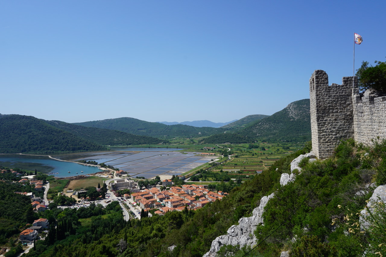
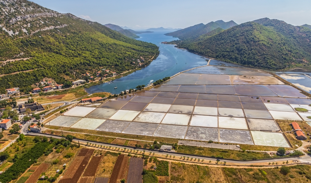
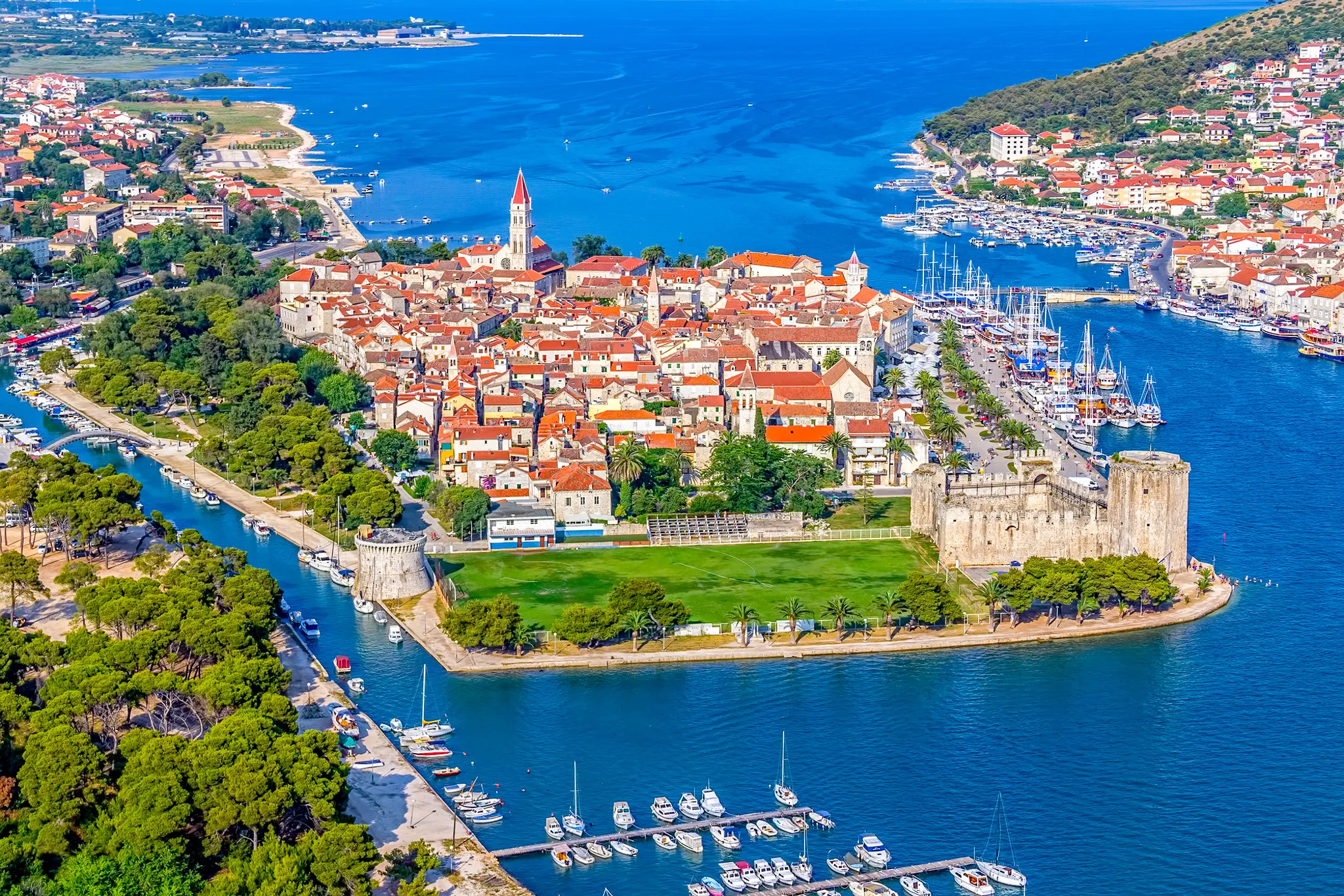
Trogir [ˈtrɔ.ɡiːr] (deutsch und ungarisch Trau, altgriechisch Τραγούριον Tragoúrion, lateinisch Tragurium, italienisch Traù) ist eine Hafenstadt in Kroatien. Sie liegt in Mitteldalmatien, etwa 15 Kilometer westlich von Split. Die gesamte Altstadt zählt seit 1997 zum Weltkulturerbe der UNESCO.
特罗吉尔(克罗地亚语:Trogir,意大利语、达尔马提亚语:Traù,拉丁语:Tragurium,希腊语:Tragurion,匈牙利语:Trau)是克罗地亚的一座古城,亚德里亚海港口,2001年人口 13,322人。特罗吉尔古城座落在克罗地亚大陆和契奥沃岛之间的一个小岛上。位在斯普利特以西27公里。
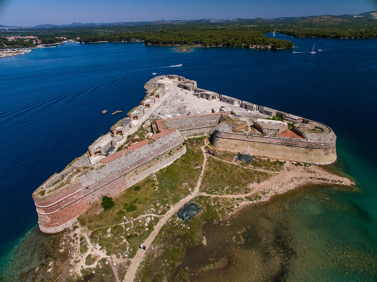
 *Mediterranean Sea

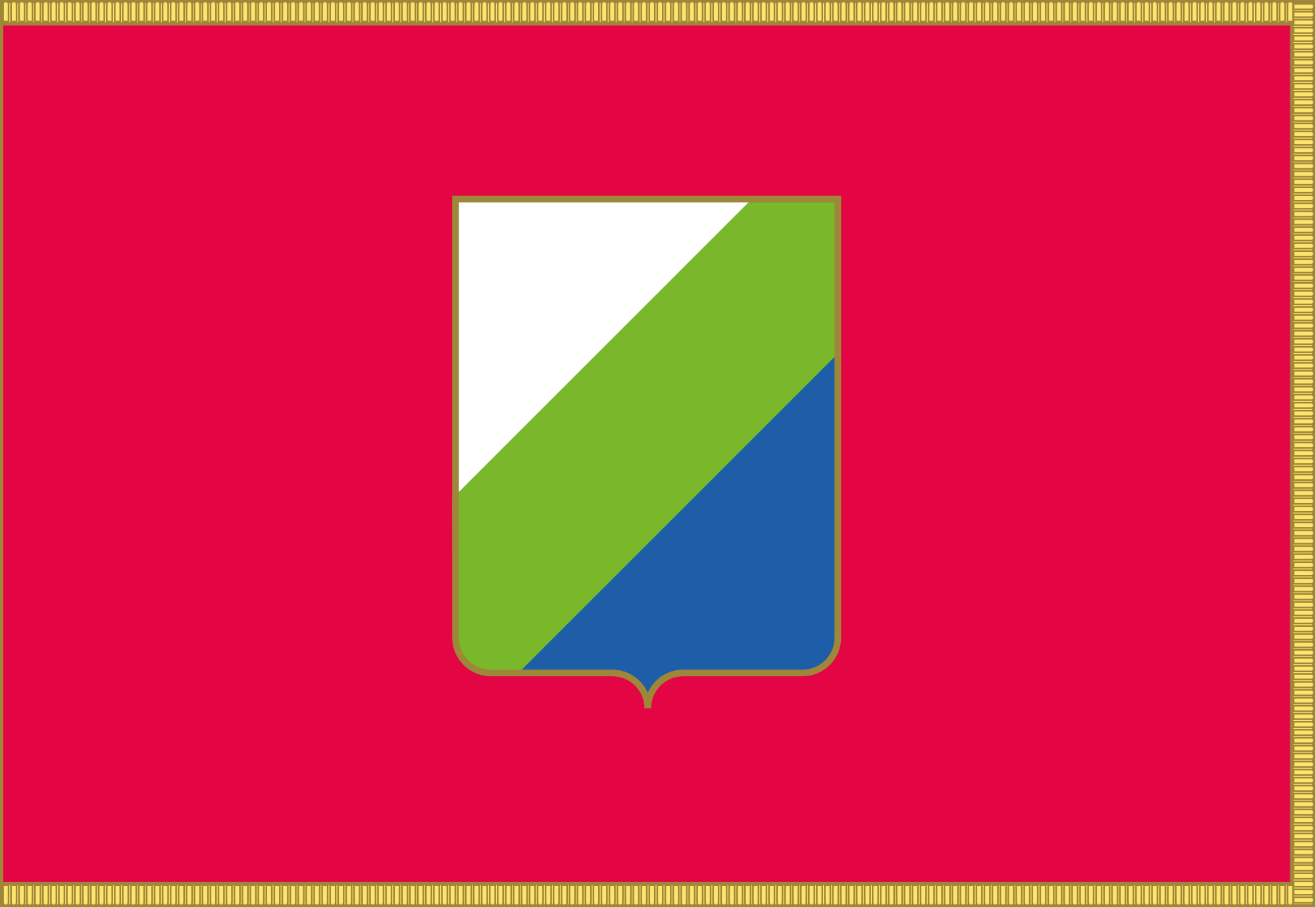 Abruzzo
 Albania
 Amber Road
 Bosnia Herzegovina

 Emilia-Romagna

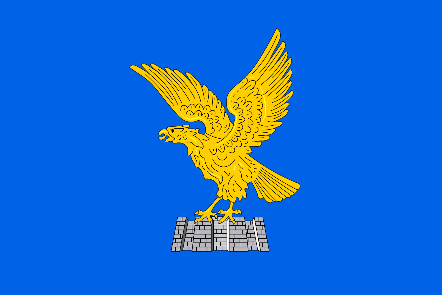 Friuli-Venezia Giulia
 Italy
Italy
 Croatia

 Marche

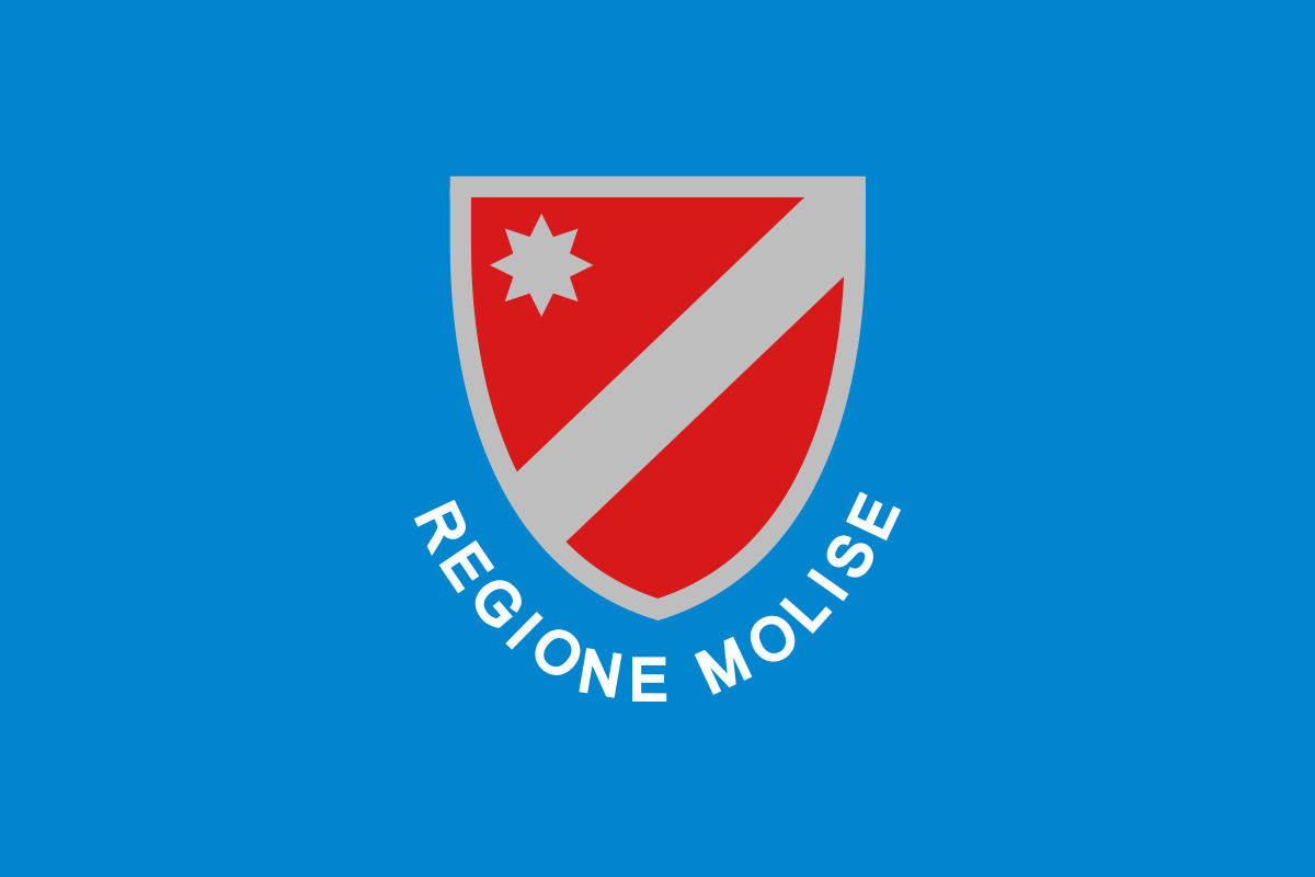 Molise
 Montenegro

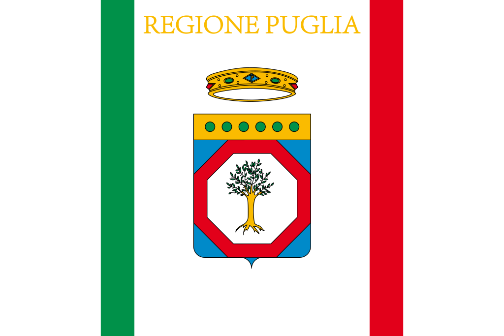 Puglia
 Slovenia

 Veneto
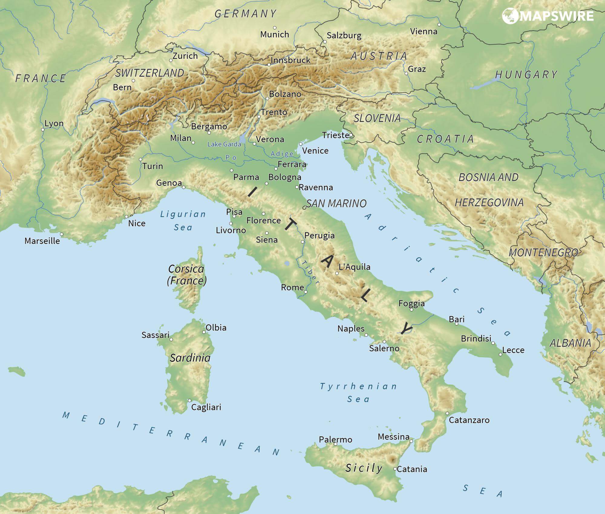
Das Adriatische Meer, kurz auch die Adria (lateinisch Mare Adriaticum; italienisch Mare Adriatico; bosnisch, kroatisch und serbisch Jadransko more oder kurz Jadran; slowenisch Jadransko morje; albanisch Deti Adriatik oder kurz Adriatiku), ist das lang gestreckte nördliche Seitenbecken des Mittelmeeres zwischen der Apenninhalbinsel und Balkanhalbinsel. Es ist nach der Stadt Adria in Italien (Provinz Rovigo) benannt. Zum Adriatischen Meer wird alles gerechnet, was nördlich der Straße von Otranto liegt.
亚得里亚海(意大利语:Mar Adriatico,斯洛文尼亚语:Jadransko morje,克罗地亚语:Jadransko more,阿尔巴尼亚语:Deti Adriatik),是地中海的一部分水域,分隔了意大利半岛(亚平宁半岛)和巴尔干半岛,也分隔了亚平宁山脉与狄那里克阿尔卑斯山脉及其临近地区。亚得里亚海西岸属于意大利,东岸则分别属于斯洛文尼亚、克罗地亚、波斯尼亚和黑塞哥维那、黑山和阿尔巴尼亚。亚得里亚海透过位于其南部的奥特朗托海峡与爱奥尼亚海相连。波河、阿迪杰河、奥凡托河等河流流入亚得里亚海;海中有近1200个岛屿,其中只有69个有人居住。
アドリア海(アドリアかい、英: Adriatic Sea ; イタリア語: Mar Adriatico ; クロアチア語: Jadransko more)は、地中海の海域の一つ。イタリア半島とバルカン半島に挟まれている。
The Adriatic Sea (/ˌeɪdriˈætɪk/) is a body of water separating the Italian Peninsula from the Balkans. The Adriatic is the northernmost arm of the Mediterranean Sea, extending from the Strait of Otranto (where it connects to the Ionian Sea) to the northwest and the Po Valley. The countries with coasts on the Adriatic are Albania, Bosnia and Herzegovina, Croatia, Italy, Montenegro and Slovenia. The Adriatic contains over 1,300 islands, mostly located along the Croatian part of its eastern coast. It is divided into three basins, the northern being the shallowest and the southern being the deepest, with a maximum depth of 1,233 metres (4,045 ft). The Otranto Sill, an underwater ridge, is located at the border between the Adriatic and Ionian Seas. The prevailing currents flow counterclockwise from the Strait of Otranto, along the eastern coast and back to the strait along the western (Italian) coast. Tidal movements in the Adriatic are slight, although larger amplitudes are known to occur occasionally. The Adriatic's salinity is lower than the Mediterranean's because the Adriatic collects a third of the fresh water flowing into the Mediterranean, acting as a dilution basin. The surface water temperatures generally range from 30 °C (86 °F) in summer to 12 °C (54 °F) in winter, significantly moderating the Adriatic Basin's climate.
The Adriatic Sea sits on the Apulian or Adriatic Microplate, which separated from the African Plate in the Mesozoic era. The plate's movement contributed to the formation of the surrounding mountain chains and Apennine tectonic uplift after its collision with the Eurasian plate. In the Late Oligocene, the Apennine Peninsula first formed, separating the Adriatic Basin from the rest of the Mediterranean. All types of sediment are found in the Adriatic, with the bulk of the material transported by the Po and other rivers on the western coast. The western coast is alluvial or terraced, while the eastern coast is highly indented with pronounced karstification. There are dozens of marine protected areas in the Adriatic, designed to protect the sea's karst habitats and biodiversity. The sea is abundant in flora and fauna—more than 7,000 species are identified as native to the Adriatic, many of them endemic, rare and threatened ones.
The Adriatic's shores are populated by more than 3.5 million people; the largest cities are Bari, Venice, Trieste and Split. The earliest settlements on the Adriatic shores were Etruscan, Illyrian, and Greek. By the 2nd century BC, the shores were under Rome's control. In the Middle Ages, the Adriatic shores and the sea itself were controlled, to a varying extent, by a series of states—most notably the Byzantine Empire, the Croatian Kingdom, the Republic of Venice, the Habsburg Monarchy and the Ottoman Empire. The Napoleonic Wars resulted in the First French Empire gaining coastal control and the British effort to counter the French in the area, ultimately securing most of the eastern Adriatic shore and the Po Valley for Austria. Following Italian unification, the Kingdom of Italy started an eastward expansion that lasted until the 20th century. Following World War I and the collapse of Austria-Hungary and the Ottoman Empire, the eastern coast's control passed to Yugoslavia and Albania. The former disintegrated during the 1990s, resulting in four new states on the Adriatic coast. Italy and Yugoslavia agreed on their maritime boundaries by 1975 and this boundary is recognised by Yugoslavia's successor states, but the maritime boundaries between Slovenia, Croatia, Bosnia-Herzegovina, and Montenegro are still disputed. Italy and Albania agreed on their maritime boundary in 1992.
Fisheries and tourism are significant sources of income all along the Adriatic coast. Adriatic Croatia's tourism industry has grown faster economically than the rest of the Adriatic Basin's. Maritime transport is also a significant branch of the area's economy—there are 19 seaports in the Adriatic that each handle more than a million tonnes of cargo per year. The largest Adriatic seaport by annual cargo turnover is the Port of Trieste, while the Port of Split is the largest Adriatic seaport by passengers served per year.
La mer Adriatique (du latin : Mare Hadriaticum ou Mare Adriaticum) est une mer séparant la péninsule italienne de la péninsule balkanique. L'Adriatique est le bras de la Méditerranée situé le plus au nord en s'étendant du canal d'Otrante (où elle rejoint la mer Ionienne) jusqu'aux villes de Venise et de Trieste et à l'embouchure du Pô. Les pays côtiers sont l'Italie, la Slovénie, la Croatie, la Bosnie-Herzégovine, le Monténégro et l'Albanie, ainsi que la Grèce par l'île de Corfou.
Il mare Adriatico è l'articolazione del mar Mediterraneo orientale situata tra la penisola italiana e la penisola balcanica; suddiviso in Alto Adriatico, Medio Adriatico e Basso Adriatico, bagna sei Paesi: Italia, Slovenia, Croazia, Bosnia ed Erzegovina, Montenegro e Albania, confinando a sud-est con il Mar Ionio.
El mar Adriático (del latín, Mare Hadriaticum) es un golfo estrecho y alargado que forma parte del mar Mediterráneo. Se encuentra situado entre la península Itálica, al oeste, y la península de los Balcanes, al este, con una anchura máxima de unos 200 km, y una longitud de unos 800 km. Su extremo meridional limita con el mar Jónico, del que lo separa el canal de Otranto. Su superficie total es de, aproximadamente, 160 000 km².
Las costas occidental, septentrional, y parte de la oriental corresponden a Italia (60% de la longitud de costa del Adriático), mientras que el resto de la costa oriental corresponde a Croacia, Eslovenia, Bosnia y Herzegovina, Montenegro y Albania. Algunos de los ríos que desembocan en el Adriático son el Reno, el Po, el Adigio, el Brenta, el Piave y el Neretva.
La costa del Adriático concentra un gran número de centros turísticos, como Venecia, que recibe el nombre de «Reina del Adriático». Tras la división de Yugoslavia, la costa croata se ha convertido también en un destino turístico muy popular.
Sus aguas sostienen industria pesquera, y se llevan a cabo prospecciones petrolíferas en este mar. Durante los años 1990, varias investigaciones revelaron que sus niveles de contaminación son muy altos.
En las últimas décadas el gobierno de Italia ha intentado hacer de él una barrera contra la inmigración ilegal, en su mayor parte proveniente de Albania.
Адриати́ческое мо́ре (итал. mare Adriatico, эмил.-ром. Mèr Adriâtic, вен. Mar Adriàtico, неап. Mar Adriateco, словен. Jadransko morje, сербохорв. Jadransko more/Јадранско море, алб. Deti Adriatik, лат. mare Hadriaticum), также Адриатика — полузамкнутое море, часть Средиземного моря между Апеннинским и Балканским полуостровами. Омывает берега Италии (более 1000 км), Словении (47 км), Хорватии (1777 км), Боснии и Герцеговины (20 км), Черногории (200 км), Албании (472 км).
 Architecture
 Sport
Sport
 Geography
 International cities
 Cities founded by the Romans
 Economy and trade
 History
 World Heritage
 Important port
 Colleges and Universities in Europe
 Energy resource
 Eat and Drink