
Deutsch-Chinesische Enzyklopädie, 德汉百科
 Cuba
Cuba

 Alabama-AL
 Cuba
Cuba

 Florida-FL

 Louisiana-LA
 Mexico
 Mississippi River

 Mississippi-MS

 Texas-TX
 United States

墨西哥湾是北美洲南部大西洋的一海湾,以佛罗里达半岛-古巴-犹加敦半岛一线与外海分割。北为美国,南、西为墨西哥,东南为古巴,东经佛罗里达海峡与大西洋相连,经尤卡坦海峡与加勒比海相接,是著名的墨西哥湾暖流的起点。墨西哥湾形成于3亿年前的地球板块运动。[1]
Der Golf von Mexiko (englisch Gulf of Mexico, spanisch Golfo de México; veraltet: Meerbusen von Mexiko[1]) ist eine nahezu vollständig von Nordamerika eingeschlossene Meeresbucht. Der Golf ist ein Randmeer des Atlantischen Ozeans und der nordwestliche Teil des Amerikanischen Mittelmeers.
湾の東部、北部、および北西部の海岸線はアメリカ合衆国(フロリダ州、アラバマ州、ミシシッピ州、ルイジアナ州、テキサス州)に接し、南西部と南部の海岸線はメキシコ(タマウリパス州、ベラクルス州、タバスコ州、カンペーチェ州、ユカタン州およびキンタナ・ロー州)に接している。また南東部はキューバとの海岸線をもつ。
アメリカとキューバの間にあるフロリダ海峡を経て大西洋に通じており、メキシコとキューバの間にあるユカタン海峡を経てカリブ海へと通じている。支湾として北東部にアパラチー湾、南西部にカンペチェ湾などがある。
メキシコ湾は東西の幅が約1,500km、総面積は約160万 km²で、南の3分の1は熱帯に入る。最大水深はSigsbee Deepでの4,384m。二大海流として黒潮と共に知られるメキシコ湾流はここを起源とし、巨大ハリケーンが頻繁に訪れることでも有名である。
The Gulf of Mexico (Spanish: Golfo de México) is an ocean basin and a marginal sea of the Atlantic Ocean,[1] largely surrounded by the North American continent.[2] It is bounded on the northeast, north and northwest by the Gulf Coast of the United States, on the southwest and south by the Mexican states of Tamaulipas, Veracruz, Tabasco, Campeche, Yucatan, and Quintana Roo, and on the southeast by Cuba. The US states of Texas, Louisiana, Mississippi, Alabama, and Florida border the Gulf on the north, which are often referred to as the "Third Coast", in comparison with the U.S. Atlantic and Pacific coasts.
The Gulf of Mexico formed approximately 300 million years ago as a result of plate tectonics.[3] The Gulf of Mexico basin is roughly oval and is approximately 810 nautical miles (1,500 km; 930 mi) wide and floored by sedimentary rocks and recent sediments. It is connected to part of the Atlantic Ocean through the Florida Straits between the U.S. and Cuba, and with the Caribbean Sea via the Yucatán Channel between Mexico and Cuba. With the narrow connection to the Atlantic, the Gulf experiences very small tidal ranges. The size of the Gulf basin is approximately 1.6 million km2 (615,000 sq mi). Almost half of the basin is shallow continental shelf waters. The basin contains a volume of roughly 2,500 quadrillion liters (550 quadrillion Imperial gallons, 660 quadrillion US gallons, 2.5 million km3 or 600,000 cu mi).[4] The Gulf of Mexico is one of the most important offshore petroleum production regions in the world, comprising one-sixth of the United States' total production.[5]
Le golfe du Mexique est un golfe de l'océan Atlantique, situé au sud-sud-est de l'Amérique du Nord. Il s'étend sur une superficie de 1 550 000 km2. Il baigne la péninsule de Floride, la Louisiane , le Sud-Est du Texas, la côte orientale du Mexique et une partie du littoral nord de Cuba.
Il golfo del Messico è uno dei golfi più grandi del mondo[1], situato nell'Oceano Atlantico, tra la costa dell'America settentrionale e centrale ad ovest e il mar dei Caraibi ad est.
Situato a Sud degli Stati Uniti e a Nord del Messico, e delimitato da due grandi penisole, lo Yucatán e la Florida, rispettivamente in Messico e negli Stati Uniti, comprende i litorali di undici stati: Florida, Alabama, Mississippi, Louisiana e Texas (per gli Stati Uniti) e Tamaulipas, Veracruz, Tabasco, Campeche, Yucatán e Quintana Roo (per gli Stati del Messico). Sul golfo si affaccia anche lo Stato di Cuba ed è collegato ad est al Mar dei Caraibi.
L'ampia sezione del golfo compresa tra la penisola dello Yucatán e la costa messicana assume la denominazione di baia di Campeche, mentre insieme al Mar dei Caraibi, forma il Mediterraneo Americano, espressione non riportata normalmente nelle carte, ma usata in oceanografia, geologia e biologia marina[2]. In esso viene generata la famosa Corrente del Golfo che rende abitabili la maggior parte delle coste atlantiche dell'Europa ed è inoltre luogo di formazione e transito di cicloni tropicali che qui prendono il nome di uragani a partire da tempeste tropicali che impattano poi sovente sulla costa messicana e statunitense o sulle isole caraibiche.
El golfo de México es una cuenca oceánica contenida entre los litorales de México, Estados Unidos y Cuba. Los estados mexicanos que tienen costa en este golfo son: Tamaulipas, Veracruz, Tabasco, Campeche, Yucatán; los estadounidenses son: Florida, Alabama, Misisipi, Luisiana y Texas. La península de Florida y la isla de Cuba ocupan la parte oriental del golfo, donde se encuentra la salida de este hacia el océano Atlántico, en tanto que la península de Yucatán, también al oriente, separa al golfo del mar Caribe.1
Мексика́нский зали́в (исп. Golfo de México, англ. Gulf of Mexico, фр. Golfe de Mexique) — внутреннее море западной части Атлантического океана. Ограничен с северо-запада, севера и востока побережьем США (штаты Флорида, Алабама, Миссисипи, Луизиана и Техас), на юге и юго-западе — побережьем Мексики (штаты Тамаулипас, Веракрус, Табаско, Кампече, Юкатан), а также островом Кубой[1]. Внешне напоминает овал. Площадь залива — 1543 тыс. км², объём воды — около 2332 тыс. км³[2]. Энергия вод, которые сильно нагреваются в летний период, служит основой для формирования сильных тропических штормов и мощных ураганов, крупнейшие из которых (Катрина, Густав, Иван и др.) практически ежегодно приводят к разрушительным последствиям в прибрежных регионах залива. Имеет важное хозяйственное значение для государств, омываемых им. Является одним из самых тёплых водоёмов в мире[3].
Мексиканский залив образовался примерно 300 миллионов лет назад в результате тектоники литосферных плит[4]. Поверхность залива по форме напоминает овал шириной около 1,5 тысяч километров. Дно залива составлено из осадочных пород и недавних отложений. Сообщается с Атлантическим океаном через Флоридский пролив между США и Кубой, и с Карибским морем через Юкатанский пролив между Кубой и Мексикой. Мексиканский залив и Карибское море иногда объединяют под названием Американское Средиземное море. Из-за слабой связи с Атлантическим океаном, залив испытывает лишь небольшие приливы и отливы. Площадь залива составляет 1,5—1,6 млн км², около половины составляют континентальные шельфовые воды. Объём воды в заливе оценивается в 2.5 миллиона кубических километров[3].


古巴首都、西印度洋最大的城市哈瓦那(Havana),位于古巴岛西北部哈瓦那湾的阿尔门达雷斯河畔,扼佛罗里达海峡西南口,与美国佛罗里达半岛隔海相望,气候温和,四季宜人,风光秀丽,素有“加勒比海明珠”之称。
哈瓦那是一座拥有400多年历史的城市,现有人口200多万,是古巴政治、经济、文化和交通中心。古巴岛于1492年由哥伦布发现,1510年开始殖民化进程。哈瓦那建于1519年,1550年成为古巴主要城市,1898年起成为首都。
哈瓦那市区分为新城旧城两部分。新城濒临加勒比海,街道宽阔整齐,高楼鳞次栉比,拥有豪华的宾馆、饭店、公寓、政府大厦等,花坛草坪点缀其间,充满现代化 气息,是拉丁美洲著名的现代化城市之一。旧城位于哈瓦那湾西侧的一个半岛上,占地面积不大,街道狭窄曲折,迄今保留着许多欧洲式古老建筑。旧城是当年西班 牙殖民统治时期征服新大陆的重要基地,四周工事环绕,具有很高建筑学价值的古老建筑物大多集中在城区的兵器广场、大教堂广场、圣弗朗西斯科广场以及老广场 附近。城区那些传统性民宅具有独特的历史文化氛围。哈瓦那老城区古建筑布局整齐和谐,外观古香古色,迄今保存完好,1982年被联合国教育、科学及文化组 织列入世界文化及自然遗产保护名录。(Quelle: http://trip.byecity.com/article-6052.html)
哈瓦那[3],当地华人旧称湾京 或 夏灣拿 ,(西班牙语:La Habana,旧称:San Cristóbal de La Habana)为古巴的首都,主要城市以及商业中心。城市人口有240万人。是古巴和加勒比海国家里最大的城市。城市分别向西和向南延伸,内有三个港口:Regla、Guanabacoa和Atarés。阿尔门达雷斯河从南到北贯穿整个城市,注入佛罗里达海峡。它位于古巴的西北部海岸,被哈瓦那省包围,距离佛罗里达州的基韦斯特南部仅90多海里(144 km)。地理位置是北纬23度8分、西经82度23分。
需要注意的是,哈瓦那市(Ciudad de La Habana)并不属于前哈瓦那省,而是单独成为古巴15个省份之一,名称就是哈瓦那市(Ciudad de La Habana),哈瓦那市下分为15个(县)区(municipio)。在古巴及大部分拉美国家,municipio是基层地方政府。此外,哈瓦那(La Habana)一词在当地人的口中一般特指该城于西班牙殖民时期所建的部分,即哈瓦那旧城(La Habana Vieja)以及后来建造的中哈瓦那(Centro Habana)。
西班牙腓力二世国王于1592年授予哈瓦那城市的封号,并于1634年由皇家颁布其"通往新世界的钥匙和西印度群岛的堡垒"封号以正式确认该市的重要地位。[4]这个封号铭刻在哈瓦那的盾章上。西班牙人开始修建防御工事,在1553年政府所在地从岛上最东面的圣地亚哥迁到了哈瓦那,从而使哈瓦那成为实际意义上的首都(de facto capital)。修建港口防御工事的重要性最早是由于当时英国、法国以及荷兰的海盗在16世纪袭击该城市。而在1898年,美国缅因号战舰在哈瓦那港口沉船事件是美西战争的导火索。
现在,哈瓦那是古巴国务委员会、古巴全国人大和古巴共产党中央委员会所在地,许多政体机构以及商业总部也都设在那里。
Havanna (spanisch La Habana), vollständige Bezeichnung Villa de San Cristóbal de la Habana, ist die Hauptstadt der Republik Kuba und zugleich eigenständige Provinz. Mit rund 2,10 Millionen Einwohnern und einer Fläche von 728,26 km² ist sie die zweitgrößte Metropole der Karibik nach Santo Domingo. Die Stadt grenzt im Norden an den Atlantischen Ozean bzw. die Straße von Florida und erstreckt sich südlich und westlich der Bucht von Havanna („Bahía de La Habana“). Der Fluss Río Almendares durchquert die Stadt von Süden nach Norden und mündet schließlich westlich der Bucht in die Floridastraße. Die östlich des Zentrums gelegene Bucht beheimatet die drei großen Häfen der Stadt: Marimelena, Guanabacoa und Atarés.
Havanna wurde im Jahr 1519 aufgrund der strategisch günstigen Lage von den Spaniern gegründet. Die Stadt diente als Angelpunkt, von dem aus die weitere Eroberung des Kontinents bis nach Nordamerika durch die Spanier erfolgte. Philipp II. von Spanien erteilte Havanna im Jahr 1592 das Stadtrecht, doch war Havanna bereits seit dem Jahr 1552 die Hauptstadt Kubas.[3] Der Untergang der USS Maine im Hafen von Havanna im Jahr 1898 war der unmittelbare Auslöser des Spanisch-amerikanischen Krieges.
Die Stadt ist das politische Zentrum des Landes und Sitz der Regierung, zahlreicher Ministerien und Unternehmen sowie über 90 Botschaften. Die aktuelle Bürgermeisterin Havannas ist Marta Hernández Romero (PCC). Die Stadt ist des Weiteren ein touristisches Zentrum Kubas, im Jahr 2010 besuchten 1,17 Millionen Touristen die Stadt, 46 % aller Besucher des Landes.[4] Seit dem Jahr 1982 ist die Altstadt, La Habana Vieja, UNESCO-Welterbe.
ハバナ(スペイン語: La Habana[1] [la aˈβana] (![]() 音声ファイル)、英語: Havana /həˈvænə/[2])は、キューバの首都。キューバ島北西沿岸のフロリダ海峡に接する地点に位置し、カリブ海地域における最大の都市である。人口は約200万人。位置は北緯23度8分、西経82度23分。キューバの公用語であるスペイン語での発音は「ラ・アバーナ」に近いが、日本語では英語音に近い「ハバナ」の名称が広く用いられている。
音声ファイル)、英語: Havana /həˈvænə/[2])は、キューバの首都。キューバ島北西沿岸のフロリダ海峡に接する地点に位置し、カリブ海地域における最大の都市である。人口は約200万人。位置は北緯23度8分、西経82度23分。キューバの公用語であるスペイン語での発音は「ラ・アバーナ」に近いが、日本語では英語音に近い「ハバナ」の名称が広く用いられている。
歴史的な名称はサン・クリストーバル・デ・ラ・アバーナ[注 1](スペイン語: San Cristóbal de La Habana)。「クリストーバル」はクリストフォロスのスペイン語読みであり、ハバナの守護聖人である。
Havana (/həˈvænə/; Spanish: La Habana [la aˈβana] ( listen)) is the capital city, largest city, province, major port, and leading commercial center of Cuba.[4] The city has a population of 2.1 million inhabitants,[5][4] and it spans a total of 781.58 km2 (301.77 sq mi) – making it the largest city by area, the most populous city, and the fourth largest metropolitan area in the Caribbean region.[5][6]
The city of Havana was founded by the Spanish in the 16th century and due to its strategic location it served as a springboard for the Spanish conquest of the Americas, becoming a stopping point for treasure-laden Spanish galleons returning to Spain. The King Philip II of Spain granted Havana the title of City in 1592.[7] Walls as well as forts were built to protect the old city.[8] The sinking of the U.S. battleship Maine in Havana's harbor in 1898 was the immediate cause of the Spanish–American War.[9]
The city is the center of the Cuban government, and home to various ministries, headquarters of businesses and over 90 diplomatic offices.[10] The current governor is Reinaldo García Zapata of the Communist Party of Cuba (PCC).[11][12] In 2009, the city/province had the third highest income in the country.[13]
Contemporary Havana can essentially be described as three cities in one: Old Havana, Vedado and the newer suburban districts. The city extends mostly westward and southward from the bay, which is entered through a narrow inlet and which divides into three main harbors: Mari melena, Guanabacoa and Antares. The sluggish Almendares River traverses the city from south to north, entering the Straits of Florida a few miles west of the bay.[14]
The city attracts over a million tourists annually;[15] the Official Census for Havana reports that in 2010 the city was visited by 1,176,627 international tourists,[15] a 20% increase from 2005. Old Havana was declared a UNESCO World Heritage Site in 1982.[16] The city is also noted for its history, culture, architecture and monuments.[17] As typical of Cuba, Havana experiences a tropical climate.
La Havane (en espagnol : La Habana [la aˈβana], Ciudad de La Habana officiellement) est la capitale et le centre économique de Cuba. Cette ville portuaire est aussi l'une des quinze provinces cubaines. La ville/province compte 2,4 millions d'habitants, tandis que l'agglomération en compte plus de 3,7 millions, ce qui fait de La Havane la plus grande ville des Caraïbes1. La ville s'étend sur plus de 720 kilomètres carrés principalement à l'ouest et au sud d'une baie, à laquelle on accède par un passage étroit, et qui est divisé en trois ports : Marimelena, Guanabacoa et Atarés. La rivière Almendares traverse la ville du sud au nord, et se jette dans le détroit de Floride à quelques kilomètres à l'ouest de la baie.
Le roi Philippe II d'Espagne accorde à La Havane le statut de ville en 1592, et un décret royal de 1634 reconnaît son importance en la désignant officiellement comme « Clé du Nouveau Monde et Rempart des Caraïbes2 ». Le blason de La Havane porte par ailleurs cette inscription. Les Espagnols commencent à édifier des fortifications, et en 1553 ils transfèrent la résidence du gouverneur depuis Santiago de Cuba, à l'extrémité est de l'île, jusqu'à La Havane, lui accordant de facto le rang de capitale. En 1607, La Havane est désignée capitale de l’île par un ordre royal qui divisa également le pays en deux gouvernements : un à La Havane et l’autre à Santiago, le second étant subordonné au premier3.
Aujourd'hui, La Havane est le centre du gouvernement cubain, et divers ministères y sont basés. C'est aussi le centre économique et culturel de l'île.
L'Avana (in spagnolo La Habana, ufficialmente San Cristóbal de La Habana) è la capitale di Cuba, di cui è anche il principale porto, il centro economico-culturale e il principale polo turistico. È la città più popolata del paese, con una popolazione di 2 106 146 abitanti secondo dati del 2012, e la più popolata dei Caraibi.[1] Come capitale di Cuba, la città è la sede ufficiale degli organi superiori dello Stato e del Governo cubano, di tutti gli organismi centrali e di quasi la totalità delle imprese e associazioni in ambito nazionale.
Fondata nel 1514 dal conquistador Diego Velázquez de Cuéllar, con il nome di Villa di San Cristóbal de La Habana, fu una delle prime sette cittadine fondate dagli spagnoli nell'isola.[2] Grazie alla sua posizione privilegiata rispetto alle coste del Mar dei Caraibi, e per le caratteristiche della sua baia, l'allora villa si convertì in un importante centro commerciale, e per questo fu attaccata da pirati e corsari con lo scopo di saccheggiarla, durante i primi anni del XVI secolo. Nel 1561, la Corona spagnola dispose che la villa fosse il luogo di attracco delle navi spagnole provenienti dalle colonie americane prima di attraversare l'oceano (Flotta spagnola del tesoro), e quindi furono costruite, per la sua protezione, difese militari all'entrata della baia dell'Avana e in altri luoghi strategici, convertendo la città in una delle più difese del Nuovo Mondo.[3][4]
Nel 1563 il governatore di Cuba trasferì all'Avana la sua residenza ufficiale, da Santiago di Cuba, sede fino ad allora del governo dell'isola, e ventinove anni dopo, il 20 di dicembre del 1592, Filippo II di Spagna conferì alla villa il titolo di "città". Nel 1665 le venne concesso il diritto di mostrare il suo proprio scudo, nel quale erano rappresentate le tre fortezze (La Real Fuerza, El Morro e La Punta) che difendevano la città.
Il suo patrimonio storico, architettonico e culturale, espresso dalla fusione tra europei, africani e aborigeni all'inizio, accanto a altri componenti etnici e culturali più contemporanei, convertono la città in un importante sito turistico. Il suo centro storico, dichiarato Patrimonio dell'umanità dall'Unesco nel 1982, è uno dei meglio conservati dell'America Latina.[5] Tra i suoi monumenti più rappresentativi si trovano la Cattedrale dell'Avana, Plaza de Armas, il Castello del Morro, il Museo della Rivoluzione, il Museo nazionale delle belle arti, il Gran Teatro dell'Avana, il Capitolio, la Piazza della Rivoluzione e il Malecón, forse il simbolo più riconosciuto a livello internazionale della città.
La Habana es la capital de la República de Cuba, su urbe más grande, el principal puerto, su centro económico-cultural y su principal polo turístico. Es la ciudad más poblada del país, con una población de 2 106 146 habitantes según datos de 2012,4 y la tercera más poblada de la región del Caribe. Como capital de Cuba, la ciudad es la sede oficial de los órganos superiores del Estado y el Gobierno cubano, de todos los organismos centrales y de casi la totalidad de empresas y asociaciones de ámbito nacional. Además, reúne la mayor cantidad de sucursales y casas matrices de las entidades extranjeras radicadas en Cuba.
Fundada en 1514 (inicialmente en la costa sur de la isla) por el conquistador Pánfilo de Narváez (bajo las órdenes de Diego Velázquez de Cuéllar), bajo el nombre fundacional de Villa de San Cristóbal de La Habana,5 fue una de las primeras siete villas fundadas por la Corona española en la isla. Debido a su privilegiada ubicación, frente a las costas del Atlántico Norte, y las características de su bahía, la entonces villa se convirtió en un importante centro comercial, razón por la cual fue sometida a ataques y saqueos por parte de piratas y corsarios durante los primeros años del siglo XVI. En 1561, la Corona dispone que la villa sea el lugar de concentración de las naves españolas procedentes de las colonias americanas antes de cruzar juntas el océano (Flota de Indias),6 construyéndose por tanto, para su protección, defensas militares a la entrada de la bahía de La Habana y en sitios estratégicos,7 convirtiendo a la ciudad en una de las mejor defendidas del Nuevo Mundo.
El 20 de diciembre de 1592, Felipe II confiere a la villa el título de "ciudad", veintinueve años después de que el gobernador de Cuba trasladara a ella su residencia oficial desde Santiago de Cuba, sede hasta entonces del gobierno de la isla.
En 1634 por Decreto Real se le declaró "Llave del Nuevo Mundo y Salvaguarda de las Indias Orientales".
En 1665, se le concedió el derecho de ostentar su escudo de armas, en el que estuvieron representadas, mediante tres torreones, las fortalezas (La Real Fuerza, El Morro y La Punta) que defendían la ciudad.
El azúcar y el comercio influyeron notablemente en que durante los siglos XIX y XX la urbe experimentara no solo un profundo proceso de expansión de su territorio sino también de crecimiento demográfico, socio-económico y cultural, factores que convirtieron a La Habana en una de las ciudades más ricas y notorias de la zona de América Central y Caribe. Surgen durante esa etapa nuevos barrios como El Cerro o El Vedado, donde se concentraría la nueva burguesía habanera; mientras, las zonas antiguas de la ciudad se convertirían en áreas de casa de inquilinato y ciudadelas. No es hasta la década de 1950 que comienza a configurarse la actual forma de la capital, producto de la aparición del concepto especulativo de propiedad horizontal así como el establecimiento de centros y subcentros urbanos a lo largo de ese siglo. El triunfo de la Revolución cubana y la aplicación de proyectos de transformación nacional trajeron consigo el aumento de la emigración hacia las urbes, provocando el boom demográfico en La Habana, y con ello su expansión, esta vez hacia las zonas del este y el sur.
Su patrimonio histórico, arquitectónico y sobre todo cultural, expresado en la fusión entre europeos, africanos y aborígenes en un inicio, junto a otros componentes étnicos y culturales más contemporáneos, convierten a la ciudad en una importante receptora de turismo internacional y en el centro de la vida nacional. Su centro histórico, declarado Patrimonio de la Humanidad por la Unesco en 1982,8 es hoy uno de conjuntos arquitectónicos mejor conservados de América Latina. Entre sus monumentos más representativos se encuentran la Catedral de la Habana, la Plaza de Armas, el Castillo del Morro, el Museo de la Revolución, el Palacio Nacional de Bellas Artes, el Gran Teatro de La Habana, el Capitolio, la Plaza de la Revolución y el Malecón, quizás el símbolo más reconocido a nivel internacional de la ciudad.
Гава́на (исп. La Habana [aβana] — Авана, полностью San Cristóbal de La Habana) — столица и крупнейший город Республики Куба, политический, экономический и культурный центр страны, одна из 16 её провинций. Площадь большой Гаваны составляет 728,25 км², город поделён на 15 муниципалитетов[es].


 Antigua and Barbuda
 Bahamas
 Barbados
 Belize
 Columbia
 Costa Rica
 Cuba
Cuba
 Dominica
 Dominikanische Republik
 Grenada
 Guatemala
 Guyana
 Honduras
 Jamaika
 Mexico
 Nicaragua
 Panama
 Republik El Salvador
 Republik Haiti
 Saint Kitts and Nevis
 St. Lucia
 St. Vincent and the Grenadines
 Suriname
 Trinidad und Tobago
 Venezuela

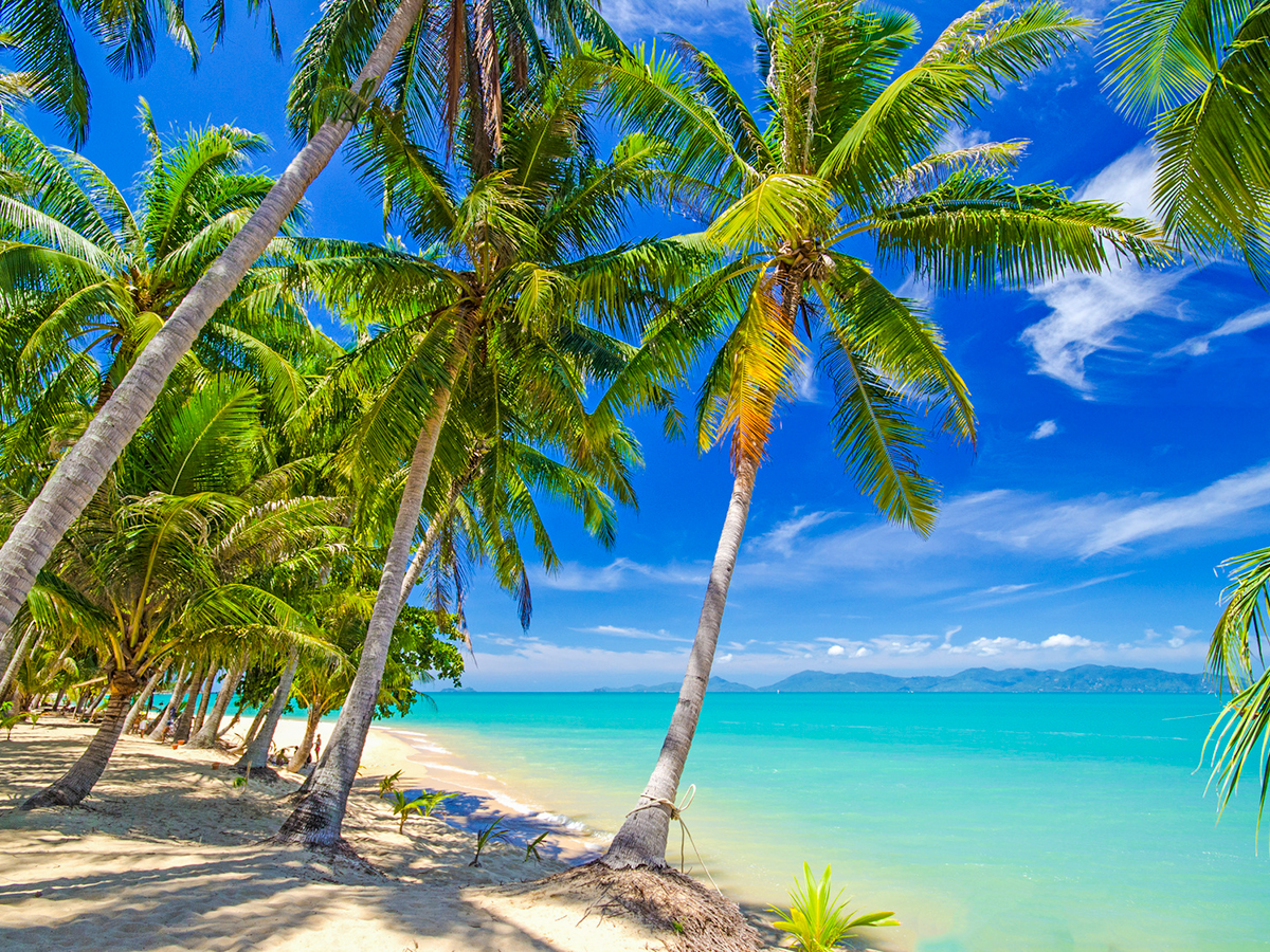


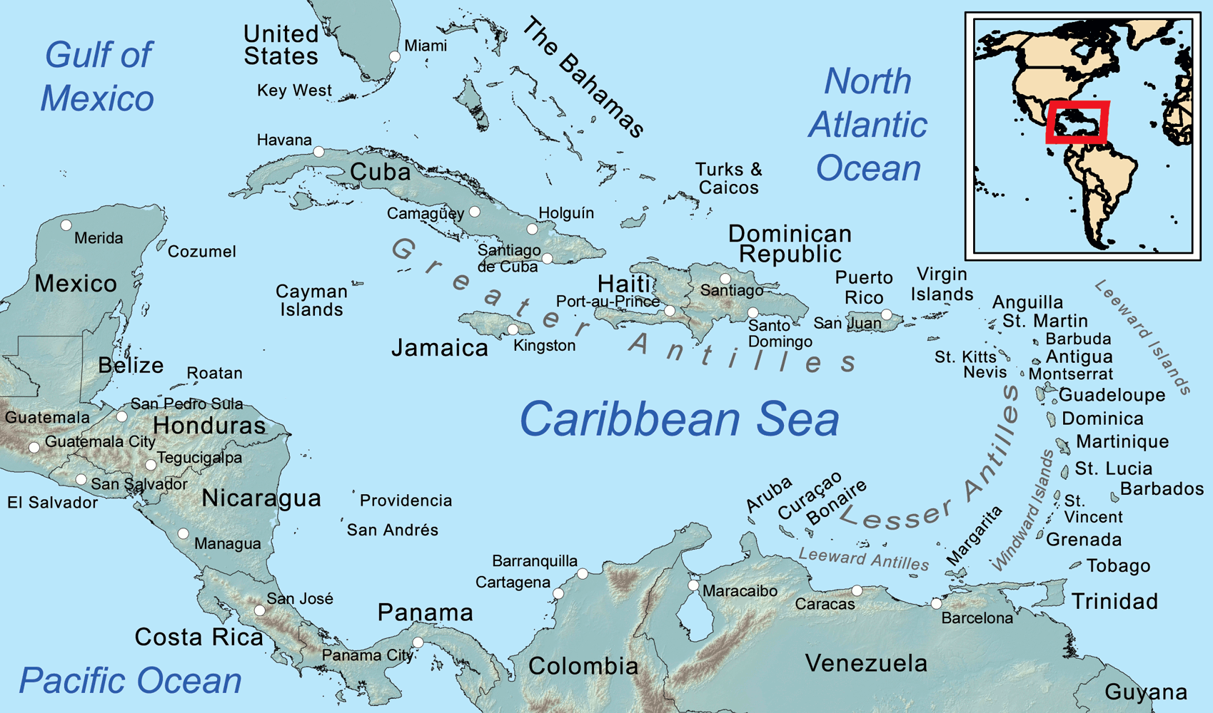
Die Karibik ist eine Region im westlichen, tropischen Teil des Atlantischen Ozeans nördlich des Äquators. Als Teil des mittelamerikanischen Subkontinents besteht sie aus den am und im Karibischen Meer gelegenen Inseln und Inselgruppen und dem Meeresgebiet zwischen ihnen. Am Westende reicht die Karibik in den Golf von Mexiko.
Die Karibik ist nach dem Volk der Kariben benannt, das die spanischen Eroberer auf den Kleinen Antillen (lat. ante ilium, „vorgelagerte Inseln“) vorgefunden haben. Sie wurde bzw. wird auch Westindien genannt, da man sich bei ihrer Entdeckung auf direktem Seeweg nach Indien glaubte.
カリブ海地域(カリブかいちいき、英語: The Caribbean、スペイン語: Caribe、オランダ語: ![]() Caraïben、カリブ・ヒンドゥスターニー語: कैरिबियन (Kairibiyana); フランス語: Caraïbe ないし Antilles)は、カリブ海と、その海域の島々(カリブ海域内の島々や、カリブ海と北大西洋の境界を成す島々)、周辺海域から構成されている。カリブ海地域はメキシコ湾と北アメリカ大陸の南東、中央アメリカの東、南アメリカ大陸の北に位置している。日本語ではカリブ地域、あるいはこの地域にある国を総称してカリブ諸国とも呼ばれる。
Caraïben、カリブ・ヒンドゥスターニー語: कैरिबियन (Kairibiyana); フランス語: Caraïbe ないし Antilles)は、カリブ海と、その海域の島々(カリブ海域内の島々や、カリブ海と北大西洋の境界を成す島々)、周辺海域から構成されている。カリブ海地域はメキシコ湾と北アメリカ大陸の南東、中央アメリカの東、南アメリカ大陸の北に位置している。日本語ではカリブ地域、あるいはこの地域にある国を総称してカリブ諸国とも呼ばれる。
この地方の大部分はカリブプレート上にあり、域内には700以上の島嶼、岩礁、キー(サンゴ礁上の低い島)などがある(カリブ海地域の島の一覧)。島々の多くは島弧を形成して、カリブ海のと東渕と北縁となっている[3]。カリブ海地域の島々は、北側の大アンティル諸島と、南および東側の小アンティル諸島(リーワード・アンティル諸島を含む) から成り、大アンティル諸島やカリブ海より北に位置するバハマ諸島(バハマからタークス・カイコス諸島に至る範囲)をも含んだ、より広い範囲を指す表現としての西インド諸島の一部となっている。広い意味では、大陸の一部であるベリーズ、ベネズエラ、ガイアナ、スリナム、フランス領ギアナもカリブ海地域に含める場合がある。
地政学的には、カリブ海地域の島々は北アメリカの下位区分 (subregion) と見なされることが多く[4][5][6][7][8]、合わせて30の主権国家、海外県、属領から成っている。1954年12月15日から2010年10月10日まで、5つの統治体から成るオランダ領アンティルと称されたオランダ属領があった[9]。また、1958年1月3日から1962年5月31日まで、イギリス属領であった英語圏の領域が構成した、西インド連邦と称された短命な自治国が存在していた。クリケット西インド諸島代表は、その後も、これら諸国の多くを代表して編成され続けている。
The Caribbean (/ˌkærɪˈbiːən, kəˈrɪbiən/, locally /ˈkærɪbiæn/;[4] Spanish: El Caribe; French: les Caraïbes; Haitian Creole: Karayib; Dutch: De Caraïben; Papiamento: Karibe) is a region of the Americas that consists of the Caribbean Sea, its islands (some surrounded by the Caribbean Sea[5] and some bordering both the Caribbean Sea and the North Atlantic Ocean)[6] and the surrounding coasts. The region is southeast of the Gulf of Mexico and the North American mainland, east of Central America, and north of South America.
Situated largely on the Caribbean Plate, the region has more than 700 islands, islets, reefs and cays (see the list of Caribbean islands). Island arcs delineate the eastern and northern edges of the Caribbean Sea:[7] the Greater Antilles on the north and the Lesser Antilles on the south and east (which includes the Leeward Antilles). They form the West Indies with the nearby Lucayan Archipelago (The Bahamas and the Turks and Caicos Islands), which are sometimes considered to be a part of the Caribbean despite not bordering the Caribbean Sea. On the mainland, Belize, Nicaragua, the Caribbean region of Colombia, Cozumel, the Yucatán Peninsula, Margarita Island, and The Guianas (Guyana, Suriname, French Guiana, Guayana Region in Venezuela, and Amapá in Brazil) are often included due to their political and cultural ties with the region.[8]
A mostly tropical geography, the climates are greatly shaped by sea temperatures and precipitation, with the hurricane season regularly leading to natural disasters. Because of its tropical climate and low-lying island geography, the Caribbean is vulnerable to a number of climate change effects, including increased storm intensity, saltwater intrusion, sea-level rise and coastal erosion, and precipitation variability.[9] These weather changes will greatly change the economies of the islands, and especially the major industries of agricultural and tourism.[9]
The Caribbean was occupied by indigenous people since at least 3600 BC. When European colonization followed the arrival of Columbus, the population was quickly decimated by brutal labor practices, enslavement and disease and on many islands, Europeans supplanted the native populations with enslaved Africans. Following the independence of Haiti from France in the early 19th century and the decline of slavery in the 19th century, island nations in the Caribbean gradually gained independence, with a wave of new states during the 1950s and 60s. Because of the proximity to the United States, there is also a long history of United States intervention in the region.
The islands of the Caribbean (the West Indies) are often regarded as a subregion of North America, though sometimes they are included in Middle America or then left as a subregion of their own[10][11] and are organized into 30 territories including sovereign states, overseas departments, and dependencies. From December 15, 1954, to October 10, 2010, there was a country known as the Netherlands Antilles composed of five states, all of which were Dutch dependencies.[12] From January 3, 1958, to May 31, 1962, there was also a short-lived political union called the West Indies Federation composed of ten English-speaking Caribbean territories, all of which were then British dependencies.
Les Caraïbes, (également nommées la Caraïbe, l'espace caraïbe, ou encore l'espace des Caraïbes) sont une région des Amériques qui comprend la mer des Caraïbes, ses îles (certaines entourées par la mer des Caraïbes et d'autres bordant à la fois la mer des Caraïbes et l'océan Atlantique Nord) et les côtes environnantes. La région est située au sud-est du golfe du Mexique et du continent nord-américain, à l'est de l'Amérique centrale et au nord de l'Amérique du Sud.
Située en grande partie sur la plaque des Caraïbes, la région compte plus de 700 îles, îlots, récifs et cayes. Les arcs insulaires délimitent les bords est et nord de la mer des Caraïbes : les Grandes Antilles au nord et les Petites Antilles au sud et à l'est (qui comprennent les îles sous le vent). Elles forment les Antilles avec l'archipel voisin de Lucayan (les Bahamas et les Îles Turques-et-Caïques), qui sont parfois considérées comme faisant partie des Caraïbes bien qu'elles ne bordent pas la mer des Caraïbes. Sur le continent, le Belize, le Nicaragua, la région caribéenne de Colombie, Cozumel, la péninsule du Yucatán, l'île de Margarita et les Guyanes (Guyane, Suriname, Guyane française, région de Guayana au Venezuela et Amapá au Brésil) sont souvent inclus en raison de leurs liens politiques et culturels avec la région.
La géographie est essentiellement tropicale et le climat est fortement influencé par la température de la mer et les précipitations, la saison des ouragans entraînant régulièrement des catastrophes naturelles. En raison de leur climat tropical et de leur géographie insulaire de basse altitude, les Caraïbes sont vulnérables à un certain nombre d'effets du changement climatique, notamment l'augmentation de l'intensité des tempêtes, l'intrusion d'eau salée, l'élévation du niveau de la mer et l'érosion côtière, ainsi que la variabilité des précipitations.
Les Caraïbes ont été occupées par des peuples indigènes depuis au moins 3600 avant J.-C. Lorsque la colonisation européenne a suivi l'arrivée de Christophe Colomb, la population a été rapidement décimée par des pratiques de travail brutales, l'esclavage et la maladie et sur de nombreuses îles, les Européens ont supplanté les populations indigènes par des Africains réduits en esclavage. Après l'indépendance d'Haïti par rapport à la France au début du XIXe siècle et le déclin de l'esclavage, les nations insulaires ont progressivement acquis leur indépendance, avec une vague de nouveaux États au cours des années 1950 et 1960. En raison de la proximité des États-Unis, il existe également une longue histoire d'intervention américaine dans la région.
Les Antilles sont souvent considérées comme une sous-région de l'Amérique du Nord, bien qu'elles soient parfois incluses dans l'Amérique centrale ou alors laissées comme une sous-région à part entière et sont organisées en 30 territoires comprenant des États souverains, des Département et région d'outre-mer et des dépendances. Du 15 décembre 1954 au 10 octobre 2010, il y avait un pays appelé Antilles néerlandaises composé de cinq États, tous dépendants des Pays-Bas. Du 3 janvier 1958 au 31 mai 1962, il y a également eu une union politique de courte durée, la Fédération des Indes occidentales, composée de dix territoires caribéens anglophones, tous dépendants des Britanniques à l'époque.
I Caraibi sono una vasta regione geografica delle Americhe che comprende tutti i paesi bagnati dal Mare Caraibico, cioè tutte le isole delle Antille e i litorali di alcuni paesi continentali del centro e sud America che si affacciano su di questo mare. L'area caraibica è costituita dalle numerose isole che separano il Golfo del Messico dal mar dei Caraibi e quest'ultimo dall'Oceano Atlantico.
El Caribe es una región conformada por el mar Caribe, sus islas y las costas que rodean a este mar. La región se localiza al sureste de América del Norte, al este de América Central, al oeste de América Insular y al norte de América del Sur.
Анти́льские острова́ (также Карибы или Карибские острова) — острова в Карибском море и Мексиканском заливе, расположенные между Северной Америкой и Южной Америкой. Вместе взятые, образуют площадь в 228 662 км² с населением примерно 42 млн чел. (на начало XXI века).
Впервые название «Антильские» встречается в 1493 году у Петра Мартира д’Ангиера, современника Христофора Колумба, придворного Фердинанда Арагонского и Изабеллы Кастильской. Предположительно, были названы по полумифическому острову или архипелагу Антилия, изображавшемуся на средневековых картах.
Подразделяются на две главные группы: Большие Антильские и Малые Антильские острова:
К первым относятся 4 острова: Куба, Гаити, Ямайка и Пуэрто-Рико; из них первые два и последний (самый малый) образуют почти прямую линию, направленную западным углом Кубы к полуострову Юкатан.[1]
Острова материкового и вулканического происхождения. Большая часть их поверхности гориста; равнинные участки главным образом на Кубе и на Юго-Восточном Гаити, а также на Виргинских и Подветренных островах. Горные сооружения Больших Антильских островов высотой до 3098 м (на острове Гаити) являются продолжением структур Центральной Америки. Климат тропический, пассатный, жаркий, преимущественно летне-влажный. Осадков 1200—2000 мм в год. Характерны сильные ураганы в конце лета. Естественная растительность — саванны, летне-зеленые и листопадно-вечнозелёные тропические леса и кустарники — сохранилась мало. На наветренных склонах гор уцелели вечнозелёные леса.[2]
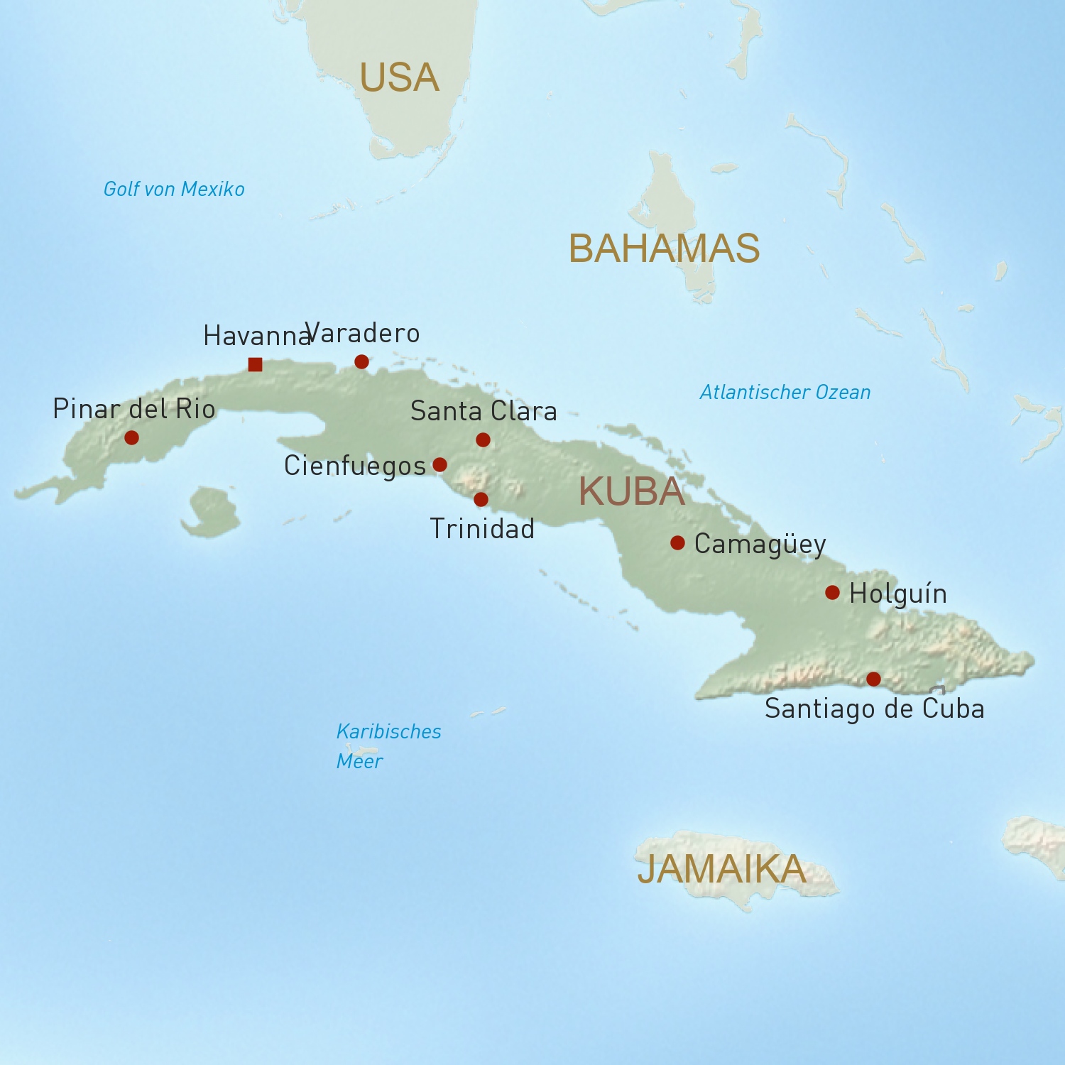

 Geography
 Music
Music

 Architecture
 Religion
 International cities
 World Heritage
 Party and government
 Sport
Sport