


 *Mediterranean Sea
Egypt
*Mediterranean Sea
Egypt
 Ancient Egypt
Ethiopia
Burundi
Demokratische Republik Kongo
Kenya
Republic of the Sudan
Republik Südsudan
Ruanda
Tansania
Uganda
Ancient Egypt
Ethiopia
Burundi
Demokratische Republik Kongo
Kenya
Republic of the Sudan
Republik Südsudan
Ruanda
Tansania
Uganda
尼羅河 尼罗河
Der Nil (arabisch النيل an-Nīl) ist ein Strom in Afrika, der mit einer Gesamtlänge von ungefähr 6650 km als längster Fluss der Erde gilt. Die Diskussion darüber, ob er nicht nach dem Amazonas als zweitlängster Fluss einzuordnen ist (s. u.), hält an. Er entspringt in den Bergen von Ruanda und Burundi, durchfließt dann Tansania, Uganda, den Südsudan und den Sudan, bevor er in Ägypten in das Mittelmeer mündet.
尼罗河是一条流经非洲东部与北部的河流,与中非地区的刚果河以及西非地区的尼日尔河并列非洲最大的三个河流系统。尼罗河长6670km,是世界上最长的河流。2007年虽有来自巴西的学者宣称亚马逊河长度更胜一筹,但尚未获得全球地理学界的普遍认同。尼罗河有两条主要的支流,白尼罗河和青尼罗河。发源于埃塞俄比亚高原的青尼罗河是尼罗河下游大多数水和营养的来源,但是白尼罗河则是两条支流中最长的。
尼罗河(英语:Nile,阿拉伯语:النيل,埃及语:Ḥ'pī / iteru,科普特语:ⲫⲓⲁⲣⲟ / phiaro)是一条流经非洲东部与北部的河流,与中非地区的刚果河以及西非地区的尼日尔河并列非洲最大的四个河流系统。尼罗河长6650千米,是世界上第一长的河流[2]。2007年虽有来自巴西的学者宣称亚马逊河长度更胜一筹,但尚未获全球地理学界的普遍认同[3]。尼罗河有两条主要的支流,白尼罗河和蓝尼罗河。发源于埃塞俄比亚高原的青尼罗河是尼罗河下游大多数水和营养来源,但白尼罗河则是两条支流中最长的。它源于非洲中部的大湖地区,其最远的源头位于卢旺达( 2°16′55.92″S 29°19′52.32″E / 2.2822000°S 29.3312000°E),向北它流经坦桑尼亚并注入维多利亚湖,再从此湖中溢出注入艾伯特湖,往北流入乌干达和苏丹共和国南部,并于后者处形成大面积沼泽湿地。蓝尼罗河源于埃塞俄比亚的塔纳湖(12°2′8.8″N 37°15′53.11″E / 12.035778°N 37.2647528°E),从东南流入苏丹。在苏丹首都喀土穆附近,白尼罗河蓝尼罗河相汇,形成尼罗河。
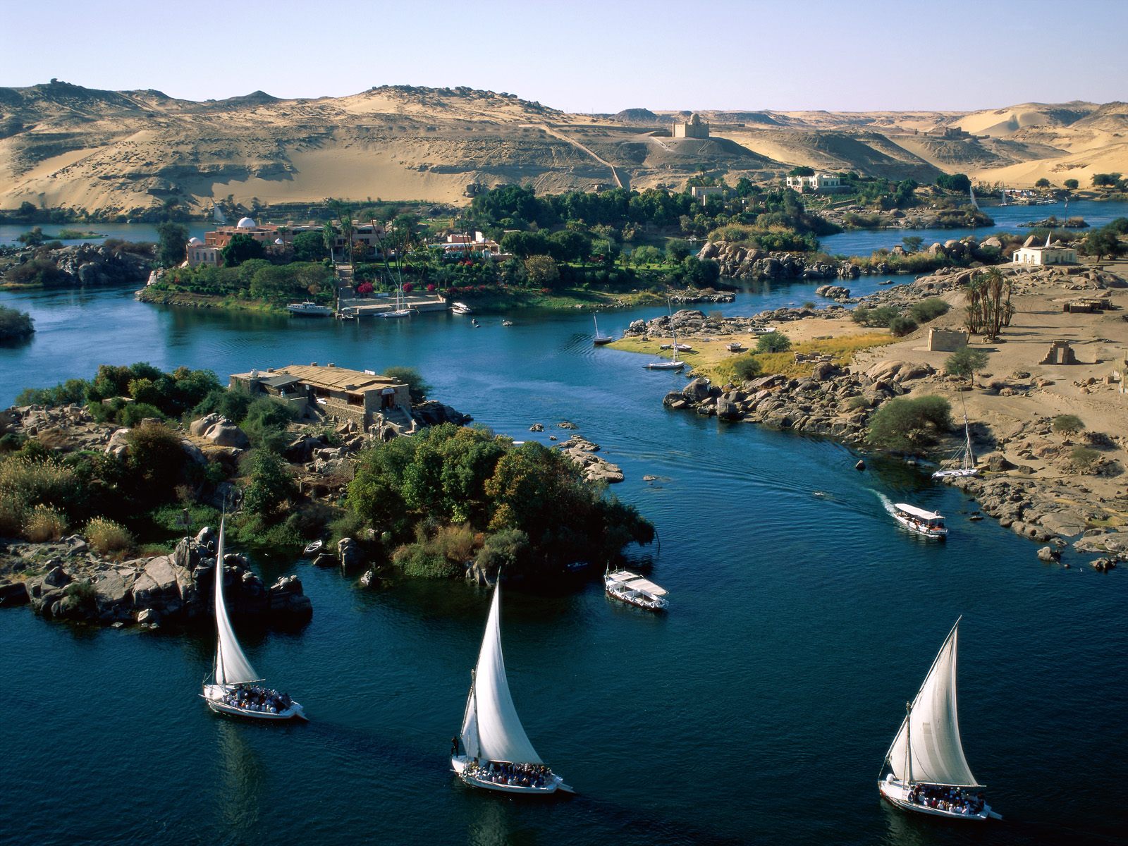
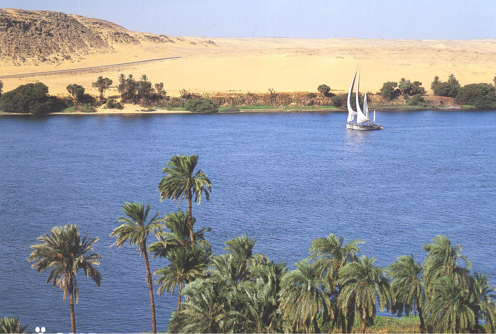
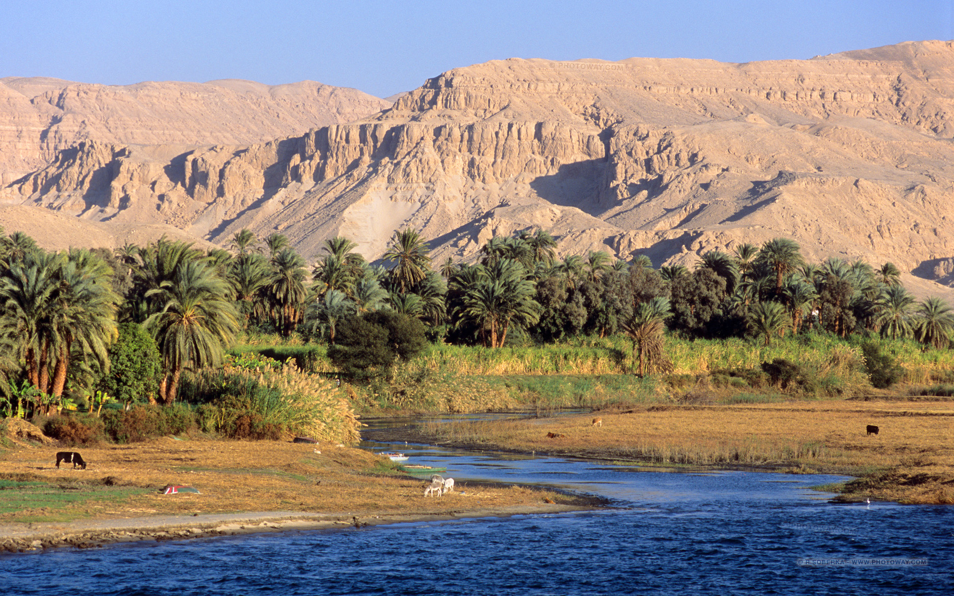
尼罗河从苏丹首都向北穿过苏丹和埃及,所经过的地方均是沙漠。从古代开始埃及的文明就依靠尼罗河而形成和兴旺。除海港和海岸附近的城市外埃及所有的城市和大多数居民住在阿斯旺以北的尼罗河畔,几乎所有的古埃及遗址均位于尼罗河畔。 在其入海口尼罗河形成一个巨大的三角洲,在这里它注入地中海。
Der Nil (arabisch النيل an-Nīl; von altgriechisch Νεῖλος Neilos, später Nīlos, davor lateinisch Nilus, altägyptisch ı͗tr.w bzw. *ı͗ắtraw „Fluss“,[6] koptisch ⲫⲓⲁⲣⲱ piaro bzw. phiaro) ist ein Strom in Afrika, der mit einer Gesamtlänge von ungefähr 6650 km[1] als längster Fluss der Erde[7] gilt. Die Diskussion darüber, ob er nicht nach dem Amazonas als zweitlängster Fluss einzuordnen ist (s. u.), hält an.[8] Er entspringt in den Bergen von Ruanda und Burundi, durchfließt dann Tansania, Uganda, den Südsudan und den Sudan, bevor er in Ägypten in das Mittelmeer mündet. Das meiste Wasser erhält der Nil aus den wechselfeuchten Tropen Ostafrikas und zu einem geringeren Teil aus den immerfeuchten Tropen Zentralafrikas. Als einziger Fluss der Erde durchquert er dann vollständig einen der beiden subtropischen Trockengürtel, der hier zudem die größte Trockenwüste der Erde, die Sahara, hervorgebracht hat. Die besonderen Eigenheiten des Flusses ließen an seinen Ufern eine der frühesten Hochkulturen entstehen, das altägyptische Pharaonenreich. Auch heute noch ist der Nil für Ägypten von entscheidender wirtschaftlicher Bedeutung.
ナイル川(ナイルがわ、アラビア語: النيل (an-nīl)、英語: the Nile、フランス語: le Nil)は、アフリカ大陸東北部を流れ地中海に注ぐアフリカ最長級の河川である。長さは6,650km、流域面積は2,870,000km2にのぼる。
一般にはヴィクトリア湖を源流だとする約5,760kmの大河だと思われているが、ヴィクトリア湖には多数の流入河川が存在し、一方でヴィクトリア湖からの流出河川はナイル川しか存在しないため、ヴィクトリア湖をナイル川水系に含み、そこに流れ込む河川の長さもナイル川の長さに加算するのが普通である。ヴィクトリア湖に流れ込む河川のうちで最大最長のものは、ルワンダに源を持ち、ルワンダとブルンジやタンザニアの国境をなし、さらにタンザニアとウガンダの国境をなした後タンザニアのブコバ市北方でヴィクトリア湖に流れ込むカゲラ川である。そのカゲラ川の支流のうちでもっとも長いものは、ブルンジ南部のブルリ県を水源とするルヴィロンザ川(Ruvyironza)であり、これがナイル川の最上流であるとされる。
ヴィクトリア湖(標高1134m)は赤道直下のサバナ気候であり、降水量も多い。ヴィクトリア湖から下流はヴィクトリアナイルとも呼ばれその長さは約5,760kmである。ヴィクトリア湖からのナイル川の流出口は湖北部のジンジャであり、流出口には記念碑が建てられているほか、オーエン・フォールズ・ダムが建設され、発電をおこなっている。ヴィクトリア湖から約500km下流に行くとキオガ湖を経て、120mの高さのあるマーチソン・フォールズをとおり、アルバート湖(標高619m)に着く[1]。アルバート湖には、ほかにもウガンダ南西部のジョージ湖からカジンガ水路、エドワード湖を通って流れてきたセムリキ川が注いでいる。アルバート湖からはアルバートナイルとも呼ばれる。南スーダンに入り、急流を一つ越えると首都ジュバである。ジュバからは勾配が非常に緩やかとなり、少し北のモンガラ市周辺からはスッドの影響を受けるようになる。支流のバハル・エル=ガザル川(Bahr el Ghazal)とノ湖で合流し、そこからは白ナイル川とよばれる。このあたりはスッドと呼ばれる大湿原となっており、ここで蒸発して流量が激減する。帆船時代はここは複雑な流路と生い茂る水草によって南北の交通を阻む障壁となってきたが、蒸気船の登場以後は航路が設定されるようになった。さらに、スッドの出口であるマラカル市の南でソバト川を合わせる。マラカルからハルツームまでの800kmの標高差は12mにすぎず、非常に緩やかな流れとなる[2]。
白ナイル川はスーダンのハルツームで、エチオピアのタナ湖から流れてくる青ナイル川と合流する。ハルツームを過ぎて80kmほどで、ナイル川には再び急流が出現する。これは北から数えて6番目の急流のため、第6急流と呼ばれる。ここからエジプトのアスワンまでの間にある6つの急流は、エジプトとスーダンの間の舟運を拒み、交通の障害となってきた。しかし、この急流の区間は古くからエジプトの影響を受け、ヌビアと呼ばれて独自の古代王国を築いていた。第6急流の北、200kmほどのところには古代のクシュ王国の都であったメロエ(Meroë)がある。さらにその北、ハルツームから約300km下流のアトバラで支流のアトバラ川と合流する。これ以北は完全な砂漠気候であり、ナイル河谷を除いてほとんど人は住まなくなる。また、これ以北ではナイルに注ぎ込む常時水流のある支流は存在せず、わずかに降水時に水の流れるワジが点在するのみとなる。第4急流付近には、メロエ以前にクシュの首都であったナパタ(ゲベル・バルカル)がある。この付近に2009年メロウェダム(Merowe Dam)が完成し、大規模な発電を開始した。エジプトに入ると、アスワン・ハイ・ダムとそれによって出来たナセル湖がある。ナセル湖の長さは550kmに及び、その南端はスーダン最北の町ワジハルファを越えさらに南まで延びている。アスワン以北は古くからの「エジプト」であり、幅5kmほどのナイル河谷に人が集住するようになる。アスワンからカイロまでは上エジプトと呼ばれる。この区間ではナイル川はほぼ一本の河川であるが、北西へと流れる支流があり、カイロ南西にファイユーム・オアシスを作ってカルーン湖に注ぎ込む。それからさらに北へ流れ、カイロから北は三角州が発達している。ナイル川三角州は下エジプトとも呼ばれる。三角州はアレクサンドリアからポートサイドまで約240kmの幅を持ち、東のロゼッタ支流と西のダミエッタ支流という二つの主流と多くの分流に別れ、地中海に注いでいる。
The Nile (Arabic: النيل, romanized: an-Nīl, Arabic pronunciation: [an'niːl], Bohairic Coptic: ⲫⲓⲁⲣⲟ Pronounced [pʰjaˈro][4], Nobiin: Áman Dawū[5]) is a major north-flowing river in northeastern Africa, and is the longest river in Africa and the disputed longest river in the world,[6][7] as the Brazilian government says that the Amazon River is longer than the Nile.[8][9] The Nile is about 6,650 km (4,130 mi)[n 1] long and its drainage basin covers eleven countries: Tanzania, Uganda, Rwanda, Burundi, the Democratic Republic of the Congo, Kenya, Ethiopia, Eritrea, South Sudan, Republic of the Sudan, and Egypt.[11] In particular, the Nile is the primary water source of Egypt and Sudan.[12]
The Nile has two major tributaries – the White Nile and the Blue Nile. The White Nile is considered to be the headwaters and primary stream of the Nile itself. The Blue Nile, however, is the source of most of the water, containing 80% of the water and silt. The White Nile is longer and rises in the Great Lakes region of central Africa, with the most distant source still undetermined but located in either Rwanda or Burundi. It flows north through Tanzania, Lake Victoria, Uganda and South Sudan. The Blue Nile begins at Lake Tana in Ethiopia[13] and flows into Sudan from the southeast. The two rivers meet just north of the Sudanese capital of Khartoum.[14]
The northern section of the river flows north almost entirely through the Sudanese desert to Egypt, then ends in a large delta and flows into the Mediterranean Sea. Egyptian civilization and Sudanese kingdoms have depended on the river since ancient times. Most of the population and cities of Egypt lie along those parts of the Nile valley north of Aswan, and nearly all the cultural and historical sites of Ancient Egypt are found along river banks.
Le Nil (prononcé [nil]) est un fleuve d'Afrique. Avec une longueur d'environ 6 700 km, c'est avec le fleuve Amazone, le plus long fleuve du mondenotes 1. Il est issu de la rencontre du Nil Blanc et du Nil Bleu. Le Nil blanc (Nahr-el-Abiad) prend sa source au lac Victoria (Ouganda, Kenya, Tanzanie) ; le Nil bleu (Nahr-el-Azrak) est issu du lac Tana (Éthiopie). Ses deux branches s'unissant à Khartoum, capitale du Soudan actuel, le Nil se jette dans la Méditerranée en formant un delta au nord de l'Égypte. En comptant ses deux branches, le Nil traverse le Rwanda, le Burundi, la Tanzanie, l'Ouganda, l'Éthiopie, le Soudan du Sud, le Soudan et l'Égypte. Il longe également le Kenya et la République démocratique du Congo (respectivement avec les lacs Victoria et Albert), et son bassin versant concerne aussi l'Érythrée grâce à son affluent du Tekezé.
Le Nil est la voie qu'empruntaient les Égyptiens pour se déplacer. Il apporte la vie en fertilisant la terre et garantit l'abondance. Il joua un rôle très important dans l'Égypte antique, du point de vue économique, social (c'était autour de lui que se trouvaient les plus grandes villes), agricole (grâce au précieux limon des crues) et religieux. Fleuve nourricier de cette civilisation, il fut divinisé sous le nom d'Hâpynotes 2, personnifiant la crue du Nil dans la mythologie égyptienne.
La crue du Nil, qui avait lieu chaque été et qui apportait le limon noir permettant la culture de ses rives, est restée longtemps un phénomène inexpliqué. C'est de ce limon noir que vient le nom antique de l'Égypte, Kemet, qui veut dire « la terre noire ».
De nos jours, les eaux limoneuses du Nil sont captées et redistribuées sur les terres agricoles grâce aux barrages de Ziftah, d'Assiout, d'Hammadi, d'Esna et surtout aux deux barrages géants d'Assouan, l'ancien et le grand barrage, dont la construction dans les années 1970 a nécessité le déplacement de plusieurs temples dont ceux d'Abou Simbel, qui auraient été noyés dans la retenue du lac Nasser.
Il Nilo (in arabo: نهر النيل, Nahr al-Nīl) è un fiume africano lungo 6 852 Km. Tradizionalmente considerato il fiume più lungo del mondo, contende il primato della lunghezza al Rio delle Amazzoni.[1]
Possiede due grandi affluenti, il Nilo Bianco e il Nilo Azzurro; quest'ultimo contribuisce con un maggior apporto di acqua e di limo fertile, ma il primo è il più lungo. Il Nilo Bianco nasce convenzionalmente dal Lago Vittoria a Jinja in Uganda, ma le sue fonti si spingono fino al Ruanda ed al Burundi; scorre poi verso nord in Uganda e in Sudan meridionale. Il Nilo Azzurro invece nasce convenzionalmente dal Lago Tana in Etiopia, e scorre attraverso il Sudan sud-orientale. I due fiumi s'incontrano e si fondono presso la capitale sudanese Khartum.
La sezione settentrionale del fiume scorre quasi interamente attraverso il Sahara, dal Sudan all'Egitto, un paese la cui civiltà è dipesa dal fiume fin dai tempi antichi e più remoti. La maggior parte della popolazione egiziana e tutte le sue città (con l'eccezione di quelle situate lungo la costa) si trovano lungo la valle del Nilo a nord di Assuan, e quasi tutti i siti storici e culturali dell'Antico Egitto si trovano lungo le sponde del fiume.
Alla fine il Nilo si dirama in un grande delta e sfocia nel Mar Mediterraneo.
Dalle sorgenti al delta il Nilo attraversa sette paesi africani: Burundi, Ruanda, Tanzania, Uganda, Sudan del Sud, Sudan ed Egitto, ma il suo bacino idrografico include porzioni della Repubblica Democratica del Congo, Kenya, Etiopia ed Eritrea.
El río Nilo (en árabe: النيل, alnayl) es el mayor río de África, que fluye en dirección norte a través de diez países —Burundi, Ruanda, Tanzania, Uganda, Kenia, República Democrática del Congo, Sudán del Sur, Sudán, Egipto y Etiopía— hasta desaguar en el extremo sureste del mar Mediterráneo, formando el gran delta del Nilo, sobre el que están situadas las ciudades de El Cairo y Alejandría. Tiene una longitud de 6853 km, el segundo río más largo del mundo, tras el Amazonas.
Durante siglos fue considerado el río más largo del mundo;2 sin embargo, mediciones de los años 2007 y 2008 han redefinido el nacimiento del Amazonas en la cuenca del río Apurimac al sur del Perú, designándolo como el río más largo del mundo.34
La fuente más lejana del lago Victoria es el río Kagera, localizado al oeste de Tanzania. Si se considera este como fuente del Nilo, su nacimiento sería el curso de agua más largo de los que desembocan en el Mediterráneo, siendo el Nilo-Kagera el segundo río más largo del mundo, con una longitud de 6853 kilómetros.5
El Nilo tomó su actual configuración al final de la Era Terciaria. Está ubicado al nordeste del continente. Nace en Burundi y tiene dos ramales o fuentes principales: el Nilo Blanco y el Nilo Azul. El primero atraviesa los Grandes Lagos de África, teniendo su fuente más distante en Ruanda, y fluye hacia el norte por Tanzania, el lago Victoria, Uganda, Sudán del Sur y Sudán, mientras que el Nilo Azul nace en el lago Tana, en Etiopía, y cruza el sudeste de Sudán. Ambos se encuentran cerca de la capital sudanesa, Jartum.
La parte del norte del río fluye casi completamente por el desierto, entre Sudán y Egipto, una zona cuya civilización ha dependido del río desde hace milenios. La mayor parte de la población de Egipto y todas sus ciudades —a excepción de las del delta del Nilo y los oasis— se encuentran a lo largo del valle del Nilo (al norte de Asuán), y la mayoría de los lugares de interés cultural e histórico se hallan en las riberas del río. La desembocadura del río conforma el delta del Nilo, a orillas del mar Mediterráneo.
Нил (араб. النيل, Эн-Ниль[1]; англ. Nile, егип. jtrw Ятрау или ḥꜥpj Хапи, копт. Ⲫⲓⲁⲣⲟ (p(h)iaro)) — река в Африке, одна из величайших по протяжённости речных систем в мире. Слово «Нил» происходит от греческого названия реки «Нейлос» (Νεῖλος).
Река берёт начало на Восточно-Африканском плоскогорье и впадает в Средиземное море, образуя дельту площадью 24 тыс. км²[2]. Среднегодовой расход воды в устье Нила 2900 м³/сек[3]. В верхнем течении принимает крупные притоки — Эль-Газаль (левый) и Асуа, Собат, Голубой Нил и Атбара (правые). Ниже устья правого притока Атбары Нил течёт по полупустыне, не имея притоков на протяжении последних 3000 км[4].
Водная система Нила считается самой длинной на Земле[5]. Однако, по мнению бразильских исследователей, самая длинная речная система у Амазонки — по этим данным, её длина составляет 6992 километра, в то время как длина системы Нила — 6852 километра[6]. Площадь бассейна реки Нил составляет 3349 тыс. км²[5]. Исток находится в Руанде, это река Рукарара, впадающая в реку Кагера. Сток воды сильно и резко изменяется в течение года. Суммарная длина судоходных участков составляет 3,2 тыс. км. Воды реки используются для орошения и производства электроэнергии. В дельте и долине Нила проживает почти все население и базируется почти вся экономика Египта. Крупнейшими городами являются Каир, Хартум, Асуан, Александрия[2].
5 years ago
2 years ago
5 years ago
2 years ago
5 years ago
2 years ago
5 years ago
2 years ago
