


Inseln von Kuwait/Islands of Kuwait
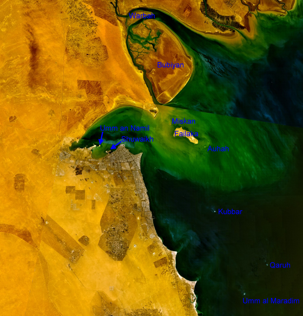
| NASA Visible Color Satellite Image with islands of Kuwait | ||||||||
| Island | Arabic | Area km² | Coordinates | |||||
|---|---|---|---|---|---|---|---|---|
| northern mudflat islands (Al Jahra Governorate) | ||||||||
| Warbah Island | جَزِيرَة وَرْبَة | 37 |  29°59′38″N 48°04′00″E 29°59′38″N 48°04′00″E | |||||
| Bubiyan Island | جَزِيرَة بُوبِيَان | 863 | 29°44′41″N 48°21′03″E | |||||
| Failaka with satellite islands (Al Asimah Governorate) | ||||||||
| Miskan Island | جَزِيرَة مِسْكَان | 0.75 | 29°29′05″N 48°15′05″E | |||||
| Failaka Island | جَزِيرَة فَيْلَكَا | 20 | 29°26′26″N 48°20′05″E | |||||
| Auhah Island | جَزِيرَة عَوْهَة | 0.35 | 29°22′40″N 48°26′21″E | |||||
| islands of Kuwait Bay (Al Asimah Governorate) | ||||||||
| Umm an Namil Island | جَزِيرَة أُمّ اَلنَّمْل | 0.569 | 29°22′54″N 47°52′01″E | |||||
| Shuwaikh Island1) | جَزِيرَة قُرَيْن | 0.012 | 29°21′16″N 47°54′35″E | |||||
| southern islands (Al Ahmadi Governorate) | ||||||||
| Kubbar Island | جَزِيرَة كُبَّر | 0.11 | 29°04′20″N 48°29′36″E | |||||
| Qaruh Island | جَزِيرَة قَارُوه | 0.035 | 28°49′03″N 48°46′35″E | |||||
| Umm al Maradim Island | جَزِيرَة أُمّ اَلْمَرَادِم | 0.165 | 28°40′42″N 48°39′10″E | |||||
| Islands of Kuwait | 922 | |||||||
| 1) former island | ||||||||