German — Chinese


苏伊士运河(阿拉伯语:قناة السويس,罗马化:Qanā al-Suways[1])处于埃及西奈半岛西侧,横跨在亚洲、非洲交界处的苏伊士地峡,头尾则在地中海侧的塞德港和红海苏伊士湾侧的苏伊士两座城市之间,全长约163公里,是全球少数具备大型商船通行能力的无船闸运河。
这条运河连结了欧洲与亚洲之间的南北双向水运,船只不必绕过非洲南端的好望角,大大节省航程。以从英国伦敦港或法国马赛港到印度孟买港的航行为例,穿过苏伊士运河比绕道好望角可缩短至少43%的航程距离(约7000公里)。在苏伊士运河开通之前,有时人们从船上卸下货物,透过陆运在地中海和红海之间运输。
运河当前由埃及的苏伊士运河管理局拥有和管理。[2]由于位置极具战略价值,根据君士坦丁堡公约,“运河在战时也可像和平时期一样,任何商用及军用船只均可使用,而无需悬挂区别旗帜。”
Der Sueskanal (auch Suezkanal nach der englischen und französischen Schreibweise für die Hafenstadt Suez; arabisch قناة السويس Qanāt as-Suwais) ist ein Schifffahrtskanal in Ägypten zwischen den Hafenstädten Port Said und Port Taufiq bei Sues, der das Mittelmeer über die Landenge von Sues (Isthmus von Sues) mit dem Roten Meer verbindet und der Seeschifffahrt zwischen Nordatlantik und Indischem Ozean den Weg um Afrika erspart. Der Kanal, der damit Teil der maritimen Seidenstraße ist, bildet die Grenze zwischen Afrika und Asien.[1] Er wurde am 17. November 1869 eröffnet. Seine Länge betrug damals 164 km. Seit der 2009 fertiggestellten Vertiefung ist er einschließlich der nördlichen und südlichen Zufahrtskanäle 193,3 km lang.[2] 2015 wurde ein neuer, parallel zum existierenden Kanal verlaufender, rund 37 km langer Kanalabschnitt eröffnet, der die bisherige Strecke begradigt und dadurch (für die eine Fahrtrichtung) etwas verkürzt.[3] Im Jahr 2015 passierten 17.483 Schiffe den Kanal.[4] Im Jahr 2019, dem letzten Jahr vor der COVID-19-Pandemie, waren es 18.800 Schiffe. Der ägyptische Staatsbetrieb Suez Canal Authority nahm über 5 Milliarden US-Dollar ein, durchschnittlich mehr als 300.000 US-Dollar pro Durchfahrt.[5]
Der Sueskanal ist ein Meerwasserkanal. Er ist schleusenlos und braucht deshalb (anders als Kanäle wie der Panamakanal, die einen Höhenunterschied überwinden) keinen ständigen Wassernachschub.
Der Kanal kann von allen Schiffen (Handels- und Kriegsschiffen) aller Staaten in Friedenszeiten und in Kriegszeiten zu gleichen Bedingungen benutzt werden. Für Kriegsschiffe kriegführender Staaten gelten bestimmte Einschränkungen, zum Beispiel Durchfahrt ohne Halt und keine Versorgung. Dies wurde in der nach wie vor geltenden Konvention von Konstantinopel[6] vom 29. Oktober 1888 vereinbart. Kriegsschiffe sollen ihre Durchfahrt beim ägyptischen Außenministerium, dem Verteidigungsministerium und der Behörde für maritime Sicherheit anmelden.[7]
Von Juni 1967 bis Juni 1975 war der Kanal als Folge des Sechstagekrieges gesperrt. 2003 wurde er von der American Society of Civil Engineers in die Liste der geschichtlichen Meilensteine der Ingenieurbaukunst aufgenommen.
スエズ運河(スエズうんが、قناة السويس qanāt as-suwēs)は、エジプトのスエズ地峡(スエズちきょう)に位置し、地中海と紅海(スエズ湾)を結ぶ、海面と水平な人工運河である。船だけではなく、大東電信会社の電信ケーブルも運河を通った。
1869年11月17日開通。本運河によりアフリカ大陸を回らずにヨーロッパとアジアを海運で連結することができる。運河は北端のポートサイドと南端のスエズ市タウフィーク港を結び、中間点より北に3キロメートルの運河西岸にはイスマイリアがある[2]。
建設当初のスエズ運河は全長164キロメートル (102 mi)、深さ8メートル (26 ft)だったが、その後何度かの拡張工事を受け、2010年段階では全長193.30キロメートル (120.11 mi)、深さ24メートル (79 ft)、幅205メートル (673 ft)となった[3]。
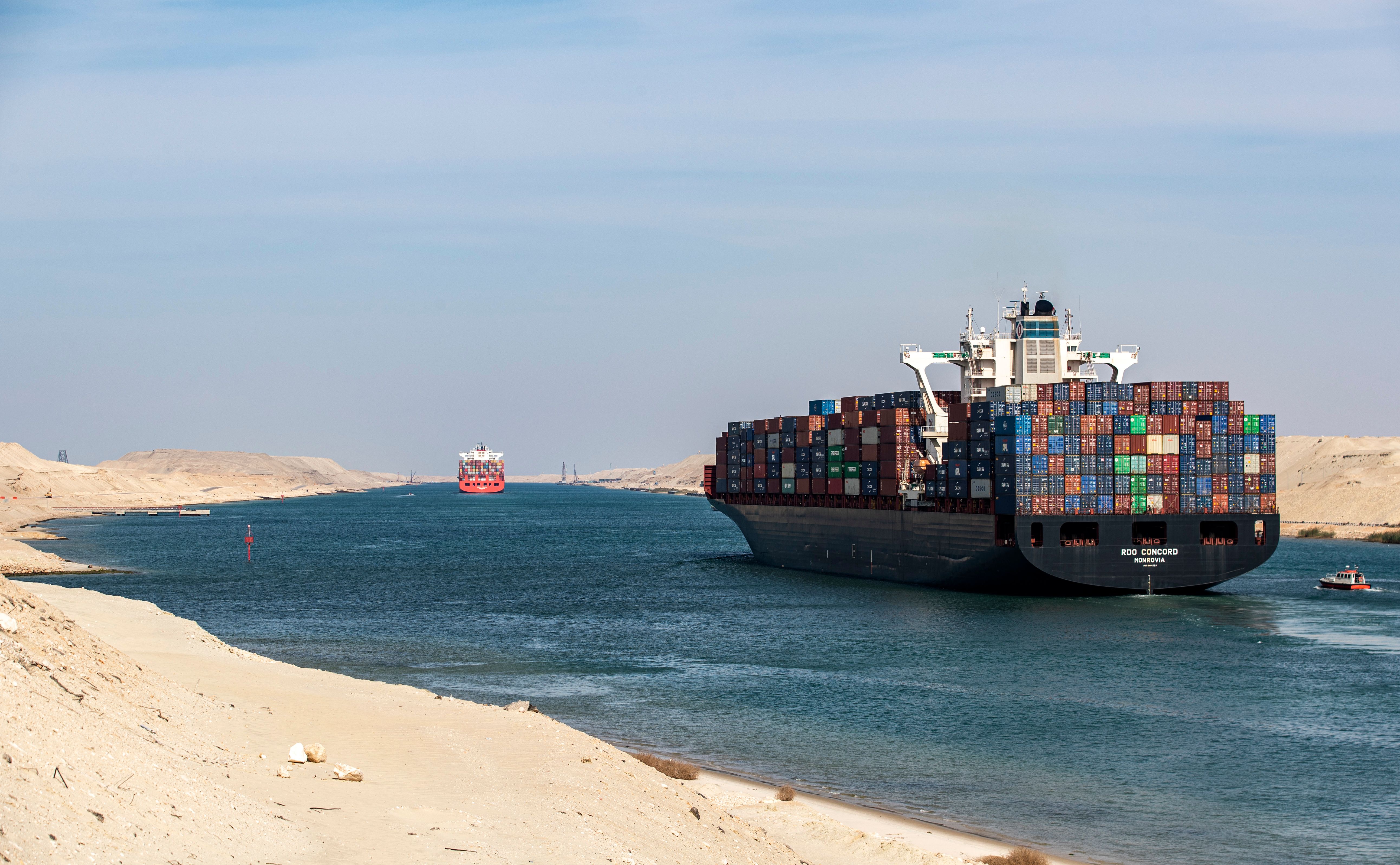
スエズ運河は南北どちらかの一方通行で運営され、船のすれ違いはバッラ・バイパス(Ballah By-Pass)やグレートビター湖など4か所で可能である[4]。運河には閘門が無いため海水は自由に流れ、主に夏にはグレートビター湖から北へ、冬は南へ水流が生じる。潮目の変化は湖の南で起こる[5]。
運河はエジプト政府が直轄するスエズ運河庁(SCA)が所有・運営しており[6]、エジプトに莫大な外貨収入をもたらしている。しかし、国際協定における規定も存在し、1888年のコンスタンチノープル協定では紛争時を除き航行の自由が保障されたが、「有事の際も平時同様、軍事目的の船舶であっても、所属国の如何を問わず」航行が認められるという解釈もなされている[7]。
The Suez Canal (Arabic: قناة السويس qanāt as-suwēs) is an artificial sea-level waterway in Egypt, connecting the Mediterranean Sea to the Red Sea through the Isthmus of Suez and dividing Africa and Asia. Constructed between 1859 and 1869 by the Suez Canal Company formed by Ferdinand de Lesseps in 1858, it officially opened on 17 November 1869. The canal offers watercraft a more direct route between the North Atlantic and northern Indian oceans via the Mediterranean and Red seas, thus avoiding the South Atlantic and southern Indian oceans and reducing the journey distance from the Arabian Sea to Asia by approximately 8,900 kilometres (5,500 mi), or 8-10 days.[1] It extends from the northern terminus of Port Said to the southern terminus of Port Tewfik at the city of Suez. Its length is 193.30 km (120.11 mi) including its northern and southern access-channels. In 2020, over 18,500 vessels traversed the canal (an average of 51.5 per day).[2]
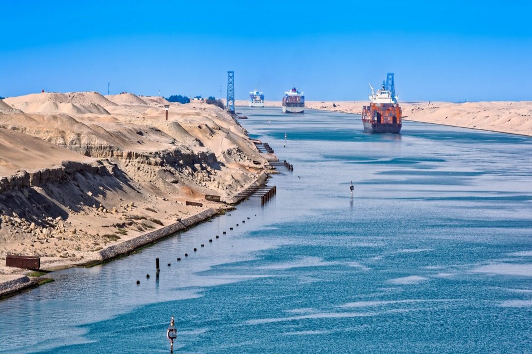
The original canal featured a single-lane waterway with passing locations in the Ballah Bypass and the Great Bitter Lake.[3] It contained, according to Alois Negrelli's plans, no lock systems, with seawater flowing freely through it. In general, the water in the canal north of the Bitter Lakes flows north in winter and south in summer. South of the lakes, the current changes with the tide at Suez.[4]
While the canal as such was the property of the Egyptian government, European shareholders, mostly French and British, owned the concessionary company which operated it until July 1956, when President Gamal Abdel Nasser nationalized it—an event which led to the Suez Crisis of October–November 1956.[5] The canal is operated and maintained by the state-owned Suez Canal Authority[6] (SCA) of Egypt. Under the Convention of Constantinople, it may be used "in time of war as in time of peace, by every vessel of commerce or of war, without distinction of flag."[7] Nevertheless, the canal has played an important military strategic role as a naval short-cut and choke-point. Navies with coastlines and bases on both the Mediterranean and Red Seas (Egypt and Israel) have a particular interest in the Suez Canal. After Egypt closed the Suez canal at the beginning of the Six Day War on June 5, 1967, the canal remained closed for precisely eight years, reopening on June 5, 1975.[8]
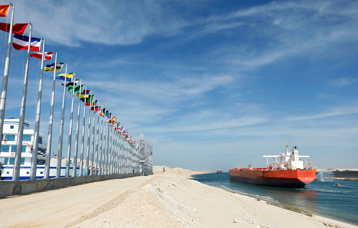
In August 2014, the Egyptian government launched construction to expand and widen the Ballah Bypass for 35 km (22 mi) to speed up the canal's transit-time. The expansion intended to nearly double the capacity of the Suez Canal, from 49 to 97 ships per day.[9] At a cost of 59.4 billion Egyptian pounds (US$9bn), this project was funded with interest-bearing investment certificates issued exclusively to Egyptian entities and individuals. The "New Suez Canal", as the expansion was dubbed, was opened in a ceremony on 6 August 2015.[10]
On 24 February 2016, the Suez Canal Authority officially opened the new side channel. This side channel, located at the northern side of the east extension of the Suez Canal, serves the East Terminal for berthing and unberthing vessels from the terminal. As the East Container Terminal is located on the Canal itself, before the construction of the new side channel it was not possible to berth or unberth vessels at the terminal while a convoy was running.[11]
Le canal de Suez (en arabe : قناة السويس, qanāt as-suwēs) est un canal navigable situé en Égypte. Long de 193,3 km, large de 280 à 345 m et profond de 22,5 m, il relie, via trois lacs naturels, la ville portuaire de Port-Saïd en mer Méditerranée à la ville de Suez dans le golfe de Suez (partie septentrionale de la mer Rouge)2.
Percé entre 1859 et 1869, grâce à une levée de fonds géante à la Bourse de Paris, sous la direction du diplomate retraité français Ferdinand de Lesseps3, il permet aux navires d'aller d'Europe en Asie sans devoir contourner l'Afrique par le cap de Bonne-Espérance et sans rupture de charge par voie terrestre entre la Méditerranée et la mer Rouge.
Le canal de Suez ainsi établi reprend la vieille idée de relation par voie d'eau entre les deux mers, déjà mise en œuvre dans l'Antiquité par les pharaons égyptiens. Le canal antique relie le Nil à la mer Rouge. Pendant la Renaissance, la république de Venise avait sans succès cherché à rétablir cette liaison.
À la suite de la Première Guerre mondiale, le canal est placé sous la protection militaire de la Grande-Bretagne. En 1956, Nasser, le président égyptien, met un terme à cette situation en nationalisant le canal.
Avec l'augmentation du trafic, le canal est devenu la troisième source de devises de l'Égypte4. Un blocage du canal entraînerait des pertes d'environ 7 millions de dollars par jour5. En 2015, 17 483 navires transportant 999 millions de tonnes de marchandises l'ont emprunté, soit 8 % du commerce maritime international6.
Le 6 août 2015, le président égyptien Al-Sissi inaugure le « Nouveau canal de Suez » permettant, après un an de travaux, de doubler la capacité de passage. Les travaux ont consisté à élargir le canal existant ainsi qu'à en augmenter la profondeur sur 35 km, et à doubler le canal sur 37 km dans sa partie orientale.
En 2020, près de 19 000 navires ont transité par le canal, ce qui représente une moyenne de 51,5 navires par jour7.
Le canal est la propriété de la Suez Canal Authority, qui est aussi responsable de son administration et de sa gestion.
Il canale di Suez (in arabo: قناة السويس, Qanāt al-Suways) è un alveo artificiale navigabile situato in Egitto, a ovest della penisola del Sinai, tra Porto Said (Bûr Sa'îd) sul mar Mediterraneo e Suez (al-Suways) sul Mar Rosso, che taglia l'omonimo istmo di Suez, permettendo la navigazione diretta dal Mediterraneo all'Oceano Indiano, senza la necessità di circumnavigare l'Africa sull'Oceano Atlantico lungo la rotta del capo di Buona Speranza.
Completato nel 1867 ma inaugurato il 17 novembre 1869, il canale venne realizzato dal francese Ferdinand de Lesseps su progetto dell'ingegnere trentino Luigi Negrelli e consiste di due tratte, a nord e a sud del Grande Lago Amaro: la costruzione durò 10 anni, lavoro svolto grazie a una cooperazione tra molte nazioni europee tra cui la Francia che diede il contributo maggiore. Nel 2015 è stato completato il raddoppio di alcuni tratti del canale.
Alla fine della sua costruzione il canale misurava 164 km di lunghezza, 8 m di profondità, 53 m di larghezza e consentiva il transito di navi con pescaggio massimo di 6,7 m.
Nel 2010[1] il percorso del canale è stato modificato a 193,30 km di lunghezza (compresi un canale di accesso Nord di 22 km e un canale di accesso Sud di 9 km), 24 m di profondità e una larghezza che varia tra i 205 e i 225 m e consente il transito di navi con pescaggio massimo di 20,12 m.
El canal de Suez (en árabe, قناة السويس qanat al-Suways) es un canal navegable situado en Egipto que une el mar Mediterráneo con el mar Rojo (golfo de Suez). El canal convirtió a la región del Sinaí en una nueva península, constituyendo la frontera entre los continentes de África y Asia. Su longitud es de 163 km entre Puerto Saíd (en la ribera mediterránea) y Suez (en la costa del mar Rojo). Permite acortar la ruta del comercio marítimo entre Europa y el sur de Asia, pues evita tener que rodear el continente africano.
Суэ́цкий кана́л (араб. قناة السويس, Канат эс-Сувайс[1]) — бесшлюзовый судоходный канал в Египте, соединяющий Средиземное и Красное моря. Зона канала считается условной границей между двумя материками, Африкой и Евразией. Кратчайший водный путь между Индийским океаном и акваторией Средиземного моря Атлантического океана: благодаря каналу больше не нужно огибать Африку и путь сократился на 8 тыс. км. Суэцкий канал был открыт для судоходства 17 ноября 1869 года. Главные порты: Порт-Саид и Суэц[2].
Находится к западу от Синайского полуострова, имеет длину в 160 км, ширину по зеркалу воды до 350 м, по дну — 45—60 м, глубину 20 м[3]. Канал расположен в Египте между Порт-Саидом на Средиземном море и Суэцем на Красном море. На восточной стороне канала напротив Порт-Саида находится Порт-Фуад, где размещена Администрация Суэцкого канала. На восточной стороне канала напротив Суэца находится Порт-Тауфик. На канале в районе озера Тимсах расположен крупный промышленный центр — город Исмаилия.
Канал, соединяющий Средиземное море с Суэцким заливом на Красном море, состоит из двух частей — к северу и к югу от Большого Горького озера. Течение в канале в зимние месяцы происходит из горьких озёр на север, а летом обратно из Средиземного моря. К югу от озёр течение меняется в зависимости от приливов и отливов.
Канал позволяет водному транспорту проходить в обе стороны между Европой и Азией, не огибая Африку. До открытия канала суда разгружали, и грузы перевозили от моря к морю по суше.


 Important port


