
漢德百科全書 | 汉德百科全书

 Ski vacation

 Auvergne-Rhône-Alpes
 International cities

Albertville ist eine französische Gemeinde mit 19.812 Einwohnern (Stand 1. Januar 2021) im Département Savoie in der Region Auvergne-Rhône-Alpes in den Alpen. Sie ist der Hauptort des gleichnamigen Arrondissements Albertville und damit Standort einer Unterpräfektur. Sie gehört zum Gemeindeverband Communauté d’agglomération Arlysère und beherbergt dessen Verwaltungssitz.
Albertville erlangte weltweite Bekanntheit als Hauptschauplatz der 1992 in der Region Savoyen ausgetragenen XVI. Olympischen Winterspiele.
阿尔贝维尔(法语:Albertville,法语发音:[albɛʁvil] (ⓘ);法兰克-普罗旺斯语:Arbèrtvela),法国东部城市,奥弗涅-罗讷-阿尔卑斯大区萨瓦省的一个市镇,同时也是该省的一个副省会,下辖阿尔贝维尔区[1]。阿尔贝维尔是1992年冬季奥林匹克运动会的主办城市,是法国重要的冬季旅游目的地,同时也是前往阿尔卑斯山多个滑雪场的必经之路。


Grenoble [gʀəˈnɔbl] (arpitanisch Grenoblo, deutsch veraltet Graswalde)[1] ist die Hauptstadt des französischen Départements Isère und der Dauphiné in der Region Auvergne-Rhône-Alpes im Südosten Frankreichs.
Grenoble ist mit 158.198 Einwohnern (Stand 1. Januar 2019)[2] die größte am Hochgebirge liegende Stadt der Alpen, noch vor Innsbruck, mit dem es touristisch vieles gemeinsam hat. Der gesamte Großraum zählt rund 665.000 Menschen.
Die Stadt Grenoble liegt an der Mündung des Drac in die Isère.
Das Stadtzentrum befindet sich auf etwa 212 m an der Isère, geographische Breite 45° 10′ Nord, geografischer Länge 5° 43′ Ost. Es liegt damit etwa 150 Kilometer südlich von Genf, 100 Kilometer östlich von Lyon und 350 Kilometer nördlich der Côte d’Azur.
Im nahen Umfeld der Stadt befinden sich im Abstand weniger Kilometer alpine Berggipfel mit teils über 3000 m Höhe; es handelt sich dabei im Einzelnen um das Bergmassiv des Vercors, die Gebirgszüge der Chartreuse sowie die Chaîne de Belledonne, den westlichen Ausläufer der französischen Alpen.
Die Stadt liegt nordöstlich des Regionalen Naturparks Vercors, mit dem sie als Zugangsort assoziiert ist. Der Stadtteil Île Verte ist es eines der am dichtest besiedelten Gebiete der Stadt.
格勒诺布尔(法语:Grenoble,法语发音:[gʁə.nɔbl] ( 聆听)),法国东南部城市,奥弗涅-罗讷-阿尔卑斯大区伊泽尔省的一个市镇,也是该省的省会和人口最多的市镇,其市镇面积为18.13平方公里,2019年1月1日年人口数量为158198人,在法国城市中排名第15位,在奥弗涅-罗讷-阿尔卑斯大区当中排名第三,仅次于首府里昂和工业城市圣艾蒂安[1][2]。“格勒诺布尔”一名来源于格拉提安城,由古罗马皇帝格拉提安命名[3]。
格勒诺布尔历史悠久,法国大革命前为多菲内的首府,二战后建设成为法国重要的科教城市和经济中心。1968年冬季奥林匹克运动会和1974年世界击剑锦标赛在此举办。格勒诺布尔位于法国东南部,奥弗涅-罗讷-阿尔卑斯大区中东部偏南和伊泽尔省中北部,距离大区首府里昂大约100公里[2]。与格勒诺布尔接壤的市镇包括:圣马丹代尔、圣马丹勒维努、萨瑟纳日、塞西内-帕里塞、塞桑、拉特龙什、埃希罗勒、埃邦、方丹、圣埃格雷沃[2]。

 Sport
Sport


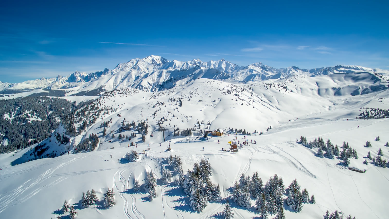
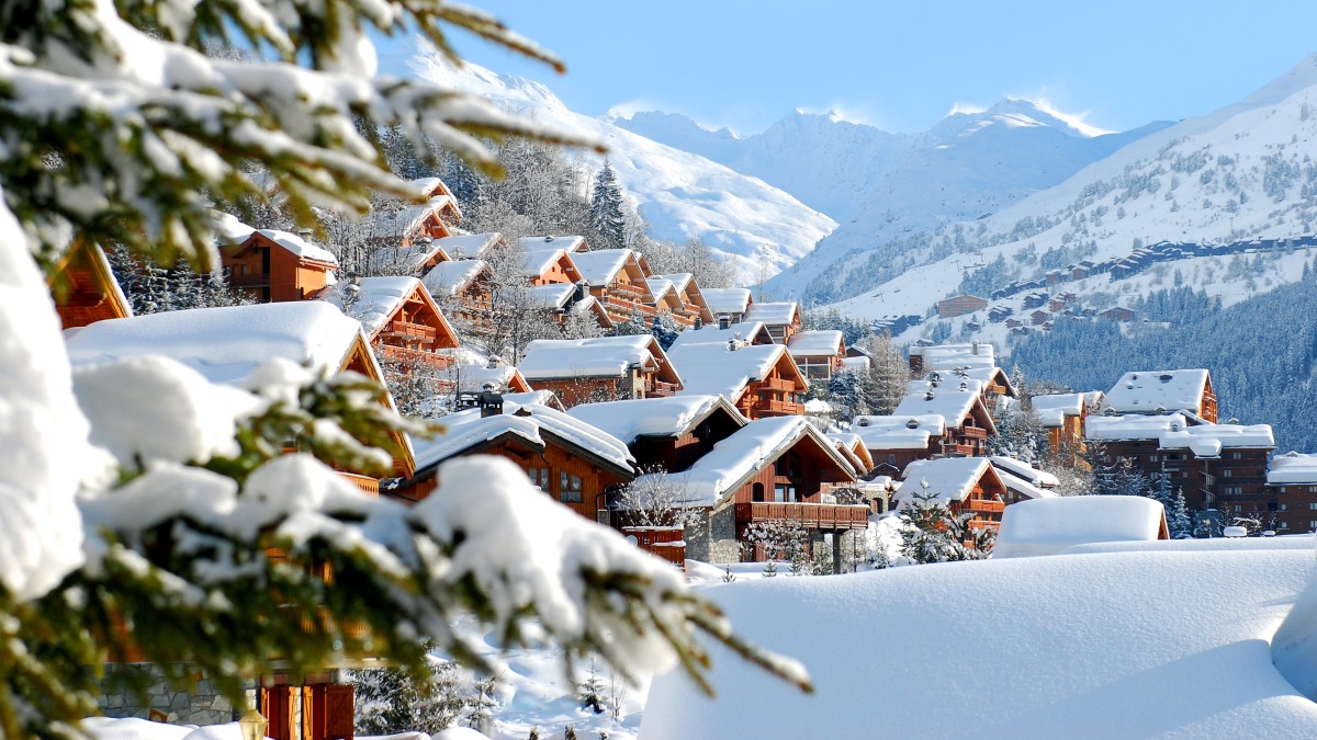
Chamonix-Mont-Blanc (seit 1921 der offizielle Name), meistens kurz Chamonix genannt, ist ein Skiort und Zentrum des Alpinismus in Frankreich. Die Gemeinde liegt im Département Haute-Savoie in der Region Auvergne-Rhône-Alpes. Sie erlangte weltweite Bekanntheit als Austragungsort der I. Olympischen Winterspiele.
Chamonix-Mont-Blanc wurde im Rahmen der Alpenkonvention zur Alpenstadt des Jahres 2015 gekürt.[1]
霞慕尼勃朗峰(法语:Chamonix-Mont-Blanc)是法国东南方接近瑞士与意大利国界的一个山中小镇,处于罗纳-阿尔卑斯大区上萨瓦省的勃朗峰山脚下,常住居民约9830人,是法国人口第865名的城镇[1],由16个村庄组成。
1091年日内瓦的伯爵把周边的谷地赠送给位于皮埃蒙特的一座本笃会修道院,这是首次提到阿尔沃河右岸的一些小建筑,即霞慕尼的前身。它后来属于萨伏依,后来随之被合并入萨丁王国。法国大革命和拿破仑帝国后它被并入法国。1860年3月24日按照都灵条约[2]萨伏依公国正式合并入法国,由此霞慕尼也于1860年4月4日正式成为法国一镇,1921年11月21日它更名为今天的名字。
霞慕尼是法国高度最高的镇之一,欧洲最高的高峰勃朗峰(海拔4810米)位于其境内,因此它是欧洲知名滑雪胜地,一般游客和体育登山攀登勃朗峰起点,因此是一座旅游业很兴旺的镇[3],这使得这座镇显得非常世界主义。霞慕尼的面积为245.46平方公里,是法国面积第四大的镇。
在1924年,第一届冬季奥林匹克运动会曾在这个城市举行。
シャモニー=モン=ブラン(Chamonix-Mont-Blanc)はフランス東部、オート=サヴォワ県のコミューン。モンブランの麓にある標高1036mの登山とスキーのリゾート地である。日本では単にシャモニーと表記する場合が多い。
シャモニーはモンブランから続くモンブラン山群のふもとの渓谷の町であり、世界でも有数のスキーリゾートとして観光客を集めている。
1786年8月8日にモンブランが初登頂されてから、現在の登山というスポーツが始まったとされているため、登山発祥の地として登山家の聖地とも呼ばれている。
1924年に開催された冬季オリンピックの記念すべき第1回大会、シャモニーオリンピックがここで開催された。これにより冬季五輪・発祥の地と呼ばれる。
モンブランが西ヨーロッパ最高峰であるため、多くの登山家がここから山頂を目指した。各種クライミング、エクストリームスキー、パラグライダー、ラフティング、キャニオニング、マウンテンバイク、ウルトラトレイル(UTMB)など、その他の厳しい山岳スポーツの中心地でもある。
Chamonix-Mont-Blanc,[note 1] more commonly known as Chamonix[note 2] (formerly spelled Chamounix), is a commune in the Haute-Savoie département in the Auvergne-Rhône-Alpes region in south-eastern France. It was the site of the first Winter Olympics in 1924. The commune's population of around 8,900 ranks 1,089th within the country of France.[1]
Situated near the massive peaks of the Aiguilles Rouges and most notably the Aiguille du Midi, Chamonix is one of the oldest ski resorts in France. The north side of the summit of Mont Blanc, and therefore a summit half is part of the village of Chamonix. To the south side, the situation is different depending on the country. Italy considers that the border passes through the top. France considers that the boundary runs along the rocky Tournette under the summit cap, placing it entirely in French territory. The south side was in France, assigned to the commune of Saint-Gervais-les-Bains sharing the summit with its neighbor Chamonix. It is this situation "for France," which is found on the French IGN maps. The Chamonix commune is popular with skiers and mountain enthusiasts, and via the cable car lift to the Aiguille du Midi it is possible to access the off-piste (backcountry) ski run of the Vallée Blanche. With an area of 245 km2 (95 sq mi), Chamonix is the fourth largest commune, in area, in mainland France.
Chamonix-Mont-Blanc (prononcé [ ʃa.mɔ.ˈni mɔ̃ blɑ̃]1,Note 1) ou plus communément Chamonix, est une commune française située dans le département de la Haute-Savoie, en région Auvergne-Rhône-Alpes. La commune de Chamonix-Mont-Blanc recouvre du nord au sud seize villages ou hameaux : le Tour, Montroc, le Planet, Argentière, les Chosalets, le Lavancher, les Tines, les Bois, les Praz de Chamonix, Chamonix-Mont-Blanc, les Pècles, les Mouilles, les Barrats, les Pélerins, les Gaillands, les Bossons.
Chamonix entre dans l'histoire en 1091, lorsque le comte Aymon Ier de Genève fait dotation de la vallée à l'abbaye bénédictine de Saint-Michel de la Cluse, en Piémont. Des moines s'installent sur la rive droite de l'Arve. C'est la naissance du prieuré de Chamonix. La commune est un territoire du duché de Savoie qui fait partie des États de Savoie, eux-mêmes intégrés par la suite au royaume de Sardaigne. Puis sous la Révolution française et le Premier Empire, elle devient un territoire français. Le 24 mars 1860, par le traité de Turin, le duché de Savoie est cédé à la France. Le 4 avril 1860, la commune de Chamonix devient alors définitivement française. Elle prend le nom de Chamonix-Mont-Blanc le 21 novembre 1921 : l'extension Mont-Blanc résulte d'un accord avec la commune de Saint-Gervais-les-Bains.
Enserrée entre les massifs montagneux des Aiguilles rouges et du mont Blanc, Chamonix partage avec Saint-Gervais-les-Bains le record de la commune ayant l'altitude la plus haute de France et d'Europe occidentale (ce point fait l'objet d'une discussion transfrontalière avec l'Italie. Il n'est pas réglé à ce jour du point de vue du droit international). Elle le doit à la présence sur son territoire du sommet le plus haut des Alpes : le mont Blanc qui culmine à 4 810 mètres. La commune est très prisée des amateurs d'alpinisme et des sportifs de montagne en général. Le site du mont Blanc étant le troisième site naturel le plus visité au monde5, cet atout touristique confère un visage très cosmopolite à la ville.
Chamonix-Mont-Blanc (pronuncia: ʃa.mɔ.ni mɔ̃ blɑ̃], in arpitano savoiardo Chamônix e in grafia Conflans Shamoni, pronuncia: θamuni) è un comune francese di 9.378 abitanti situato nel dipartimento dell'Alta Savoia della regione dell'Alvernia-Rodano-Alpi. È una grande stazione sciistica conosciuta in tutto il mondo. La città ha ottenuto nel 2015 il titolo Città alpina dell'anno.
Attraverso il Traforo del Monte Bianco la città francese è collegata al comune di Courmayeur (AO), in Italia, quindi all'autostrada A5 per Torino.
Chamonix es una población y comuna francesa, en la región de Auvernia-Ródano-Alpes, departamento de Alta Saboya, en el distrito de Bonneville. Es el chef-lieu del cantón de su nombre. Se encuentra a los pies del Mont Blanc.
Шамони́-Мон-Блан[2][3][4], или просто Шамони (фр. Chamonix-Mont-Blanc [ ʃa.mɔ.ni mɔ̃ blɑ̃ ], франкопров. Chamônix) — город и коммуна на востоке Франции, в департаменте Верхняя Савойя (историческая область Савойя).
Население — 9830 жителей (1999 год).
Расположен в Альпах, в узкой долине реки Арв (приток Роны), у подножия горы Монблан, в которой у Шамони прорыт тоннель, соединяющий Францию с Италией.
Шамони — центр популярного горнолыжного региона Шамони-Монблан.