
漢德百科全書 | 汉德百科全书

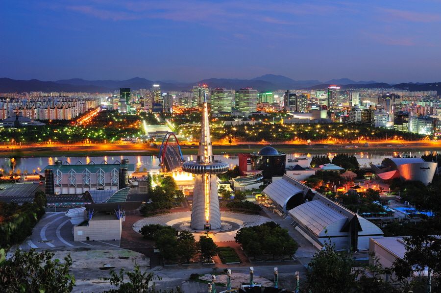
Daegu (koreanisch 대구, [tɛɡu]), früher Taegu, offiziell Daegu Metropolitan City, ist eine Stadt in der Provinz Gyeongsangbuk-do in Südkorea.
Daegu liegt rund 240 Kilometer von Seoul im Südosten des Landes und ist mit fast 2,5 Millionen Einwohnern die viertgrößte Stadt Südkoreas nach Seoul, Incheon und Busan. Politisch bildet sie eine unabhängige Einheit. Die Fläche der Stadt beträgt heute 883,7 km², die Höhenlage erstreckt sich von 50 Metern in Flussnähe bis zu 600 Metern auf den Bergketten. Die Stadt liegt am Nakdong-Fluss, dem längsten Fluss Südkoreas.
Daegu ist ein nationales Zentrum für Elektro- und Textilindustrie in Südkorea. Zahlreiche bekannte koreanische Unternehmen wie der Samsung-Konzern, TaeguTec und Kolon Industries wurden in Daegu gegründet. Aufgrund des subtropischen Klimas ist die Region um Daegu zudem eines der wichtigsten Obstanbaugebiete des Landes.
Die Stadt ist Sitz des römisch-katholischen Erzbistums Daegu, das aus dem 1911 errichteten Apostolischen Vikariat Taiku hervorging und 1962 zum Erzbistum erhoben wurde. Hauptkirche ist die Kyesan-Kathedrale „Unsere Liebe Frau von Lourdes“.
大邱广域市(朝鲜语:대구광역시/大邱廣域市 Daegu gwangyeoksi */?),简称大邱,是位于大韩民国东南部的广域市,与首尔、釜山并列韩国三大城市,至2018年估计人口约2,501,673人。面积883.63平方千米。
大邱是个工业城市,主要工业包括纺织、冶金和机械。由于地理位置优越,历史上大邱曾是朝鲜半岛的南部商业中心(首尔是中部中心;平壤是北部中心)。大邱盛产高质量的苹果和甜瓜,因此得名“苹果城”,除此之外,还有“纺织城”、“时装城”的美称。
大邱举办了2002年韩日世界杯足球赛、2003年夏季世界大学生运动会、2011年世界田径锦标赛、2013年世界能源大会、2015年世界水论坛大会及2017世界室内田径锦标赛等多项大型国际活动,使大邱跃升为扬名世界的国际城市。
大邱広域市(テグこういきし、たいきゅうこういきし、朝: 대구광역시、英: Daegu)は、大韓民国東南部の内陸にある広域市である。ソウル・釜山に次ぐ、韓国第3の都市である。大邱は八公山や琵瑟山などの高い山に囲まれた盆地であるため、大韓民国で最も気温の高い都市に属し、大邱は特殊型気候の地域に分類される。都市は繊維産業を中心に成長し、1981年7月1日、大邱市は直轄市に昇格、1995年1月1日、地方自治体が施行され大邱広域市に改称された。東城路や中央路を中心として都心部を形成している。市庁所在地は中区 東仁洞 1街で、行政区域は7区1郡である。
Daegu (Korean: [tɛɡu]; 대구, 大邱, literally 'large hill'), formerly spelled Taegu[a] and officially known as the Daegu Metropolitan City, is a city in South Korea, the fourth-largest after Seoul, Busan, and Incheon, and the third-largest metropolitan area in the nation[b] with over 2.5 million residents. Daegu and surrounding North Gyeongsang Province are often referred to as Daegu-Gyeongbuk, with a total population over 5 million. Daegu is located in south-eastern Korea about 80 km (50 mi) from the seacoast, near the Geumho River and its mainstream, Nakdong River in Gyeongsang-do. The Daegu basin, where the city lies, is the central plain of the Yeongnam region. In ancient times, there was a proto-country named Jinhan, to which the current Daegu area belonged. Later, Daegu was part of the Silla Kingdom which unified the Korean Peninsula. During the Joseon Dynasty period, the city was the capital of Gyeongsang-do, which was one of the traditional eight provinces of the country.
Daegu was an economic motor of Korea during the 1960s–1980s period and was especially known for its electronics industry. The humid subtropical climate of Daegu is ideal for producing high-quality apples, thus the nickname, "Apple City".[4] Daegu is also known as "Textile City".[5] Textiles used to be the pillar industry of the city. With the establishment of the Daegu-Gyeongbuk Free Economic Zone, Daegu is currently focusing on fostering fashion and high-tech industries.
Daegu was the host city of the 22nd World Energy Congress of 2013, the 2011 World Championships in Athletics, and the 2003 Summer Universiade.[6] It also hosted four matches in the 2002 FIFA World Cup. Daegu hosted the World Masters Indoor Championships on March 19–25, 2017. More than 4600 athletes worldwide competed.[7]
Daegu (en hangeul 대구, tɛɡu, en caractères chinois : 大邱: "large colline", en français vieilli Taïkou) est une ville de Corée du Sud et le nom d'une division administrative de haut niveau Daegu Gwangyeoksi (대구광역시). Elle est la capitale du Gyeongsang du Nord.
Taegu[1][2][3][4] (대구 광역시?, 大邱廣域市?, Daegu gwang-yeoksiLR), il cui nome ufficiale è Città metropolitana di Taegu, è una città metropolitana della Corea del Sud. È la quarta città più grande del paese dopo Seul, Pusan e Incheon, con una popolazione di quasi due milioni e mezzo di persone alla fine del 2005.[5] Dal punto di vista amministrativo è una città metropolitana autoamministrata con rango di provincia.
Daegu (hangul: 대구, RR: Daegu, MR: Taegu)? pronunciado: [tɛ̝.ɡu], oficialmente Ciudad Metropolitana de Daegu (hangul: 대구광역시, RR: Daegu-gwangyeoksi, MR: Taegu-gwangyŏkshi)?, es una de las seis ciudades metropolitanas que, junto a las nueve provincias, la ciudad especial y la ciudad autónoma especial, forman Corea del Sur.
Está ubicada al sureste del país, entre las provincias de Gyeongsang del Norte y Gyeongsang del Sur. Es la cuarta ciudad más poblada de Corea del Sur, después de Seúl, Busán e Incheon. Fue la capital de la provincia de Gyeongsang del Norte, aunque legalmente no es parte de esta provincia. La capital se trasladó a Andong, Gyeongsang del Norte en Febrero del año 2016. Se encuentra en el norte de la región de [[Yeongnam]. Daegu, también es conocida por ser la ciudad natal de el rapero, productor y compositor Suga, miembro de la boyband de Kpop más famosa, BTS.
Daejeon ist mit 1.539.154 Einwohnern die fünftgrößte Stadt Südkoreas. Es liegt zwischen den Provinzen Chungcheongbuk-do und Chungcheongnam-do und ist die Hauptstadt von Chungcheongnam-do (abgek.: Chungnam), obwohl es politisch eine eigenständige Einheit bildet.
Die Stadt ist vollständig von bewaldeten Hügeln umschlossen; auf gut ausgebauten Wegen kann Daejeon umwandert werden. Der Stadtbezirk Yuseong liegt im Nordwesten von Daejeon und ist bekannt für seine heißen Quellen. Hier befindet sich auch der Hauptcampus der Chungnam-Nationaluniversität.
大田广域市(朝鲜语:대전광역시/大田廣域市 Daejeon gwangyeoksi */?)位于韩国中部,是韩国第五大城市,于2012年及之前曾为忠清南道的首府。2010年人口为150万。大田是韩国京釜线、湖南线、京釜高速公路、湖南高速公路的交汇处,是韩国铁道公社总部所在地。世宗特别自治市位于大田广域旁边。目前韩国关税厅、统计厅、特许厅、调达厅、兵务厅、山林厅、文化财厅、中小企业厅等12个政府机关位于大田市。
大田是韩国科技中心,许多韩国研究机构像韩国科学技术院(KAIST),韩国电子和电信研究院(ETRI),韩国航空宇宙研究院(KARI)都位于大田市。位于大田儒城区的大田科技园内驻有79个研究机构和28个韩国政府主管的研究所,拥有5万人以上研究人员。大田于1998年主办成立了世界科学城市联盟(WTA)。 目前,WTA已经发展成为拥有32个国家67个机构的国际组织,作为UNESCO的正式咨询机构,与众多国际组织展开了积极的合作。1993年,大田市还曾举办1993年世界博览会。
大田広域市(テジョンこういきし、朝鮮語: 대전광역시)は、大韓民国の都市。韓国で5番目の大都市である。5区と79行政洞よりなる。現在は広域市に位置づけられ、道には属さないが、1988年までは忠清南道に属していた。
西には名山・聖山として知られた鶏龍山がそびえる。古来より近郊の儒城温泉が知られていたが大きな町はなく、公州所属の農村地帯に過ぎなかった。ゆえにこの地域を「大きな田畑」を意味する固有語でハンバッ(한밭、Hanbat)と曖昧に指し示していた。日本統治下の自治体統廃合の際に「大田」と漢字が当てられ、さらに京釜線・湖南線などが開通して交通の要衝となり急速に発展、大きな都市となった。
大田国際博覧会が1993年に開催されたほか、市内の儒城区にハイテク団地「大徳研究団地」を有するなど科学技術都市として知られる。1973年に研究学園団地として指定された大徳研究団地は、韓国科学技術院(KAIST)や韓国電子通信研究院(ETRI)など政府・民間の研究所100以上が集中しており、原子力や宇宙開発、生命工学などの研究を行っている。また特許庁や統計庁など首都機能の一部が大田に分散されており、韓国鉄道公社(KORAIL)の本社も置かれている。
Daejeon (Korean: [tɛ̝.dʑʌn] (![]() listen)) is South Korea's fifth-largest metropolis. Daejeon had a population of over 1.5 million in 2010.[2] Located in the central region of South Korea, Daejeon serves as a hub of transportation and is at the crossroads of major transport routes. The capital Seoul is about 50 minutes away by KTX high-speed train.
listen)) is South Korea's fifth-largest metropolis. Daejeon had a population of over 1.5 million in 2010.[2] Located in the central region of South Korea, Daejeon serves as a hub of transportation and is at the crossroads of major transport routes. The capital Seoul is about 50 minutes away by KTX high-speed train.
Daejeon is one of South Korea's administration hubs with the Daejeon Government Complex (Other administrative hubs: Seoul, Gwacheon and Sejong). The Korean administration in the 1980s decided to relocate some of its functions from Seoul, the national capital, to other cities. Currently, 12 national government offices, including Korea Customs Service, Small and Medium Business Administration, Public Procurement Service, National Statistical Office, Military Manpower Administration, Korea Forest Service, Cultural Heritage Administration, and Korean Intellectual Property Office, as well as Patent Court of Korea, are located in Daejeon. Korail, Korea Water Resources Corporation, and Korea Minting and Security Printing Corporation are also headquartered in the city.
Daejeon has 18 universities, including KAIST and Chungnam National University. Daejeon has earned its name as "Asia's Silicon Valley" and "high technology city".[3] The city hosted the Taejon Expo '93 and the International Mathematical Olympiads in 2000. Several important research institutes are based in the city.[3]
Daedeok Innopolis (Daedeok Research and Development Special Zone) is composed of 28 government-funded research institutions, as well as 79 private research institutes with as many as 20,000 researchers. In addition, Daejeon established the World Technopolis Association (WTA) in 1998 with the view of realizing regional development through international cooperation with world science cities. The WTA has grown to have 67 members from 32 countries, and it actively cooperates with many international organizations including UNESCO as its official consultative body.
Daejeon (en hangeul : 대전 en hanja : 大田: grand champ) est une ville située au centre de la Corée du Sud, légèrement à l'ouest. Elle se trouve à 150 km au sud de Séoul.
Malgré l'adoption du nouveau système de romanisation du hangeul, les anciennes écritures Taejŏn et Daejon restent très utilisées. Daejeon signifie grand champ en coréen, ce que l'on retrouve dans l'appellation vernaculaire hanbat (한밭) du même sens : 한밭 大學校 Université Hanbat, par exemple.
C'est la cinquième ville de Corée, elle compte 1 530 650 d'habitants pour 539,84 km2 (en 2011) et se dénote par son profil scientifique. Elle a été la capitale du Chungcheong du Sud de 1932 à 2012.
Daejeon (대전광역시?, 大田廣域市?, Daejeon gwang-yeoksiLR) è una città nel centro della Corea del sud. È la quinta città più grande della Corea con una popolazione di 1.537.324 nel giugno 2012.
Dal punto di vista amministrativo è contemporaneamente capoluogo della provincia del Sud Chungcheong e città metropolitana autoamministrata con rango di provincia.
A partire dal 1997 è stata avviata la costruzione del "Daejeon Government Complex" nel quadro dello sforzo di decentrare alcuni uffici governativi della capitale Seul; tra gli altri Daejeon è sede di Statistics Korea, l'ufficio statistico coreano.
Daejeon (hangul: 대전, RR: Daejeon, MR: Taejŏn)? pronunciado: [tɛ̝.dʑʌn], oficialmente Ciudad Metropolitana de Daejeon (hangul: 대전광역시, RR: Daejeon-gwangyeoksi, MR: Taejŏn-gwangyŏkshi)?, es una de las seis ciudades metropolitanas que, junto a las nueve provincias, la ciudad especial y la ciudad autónoma especial, forman Corea del Sur.
Se ubica en el centro del país, a 167 kilómetros al sur de Seúl, y es la capital de la provincia de Chungcheong del Sur. Es la quinta ciudad más poblada, con aproximadamente 1.5 millones de habitantes.
Тэджо́н (кор. 대전 [tɛ̝.dʑʌn]) — город прямого подчинения в центре Южной Кореи, административный центр провинции Чхунчхон-Намдо. Официальное название города — Город-метрополия Тэджон (кор. 대전광역시 Тэджон-гванъёкси). Пятый по величине город Кореи c населением 1 564 тыс. жит[1]. Считается научно-технической столицей Южной Кореи.
 Vacation and Travel

大同市,简称同、大,古称平城、云中,是中华人民共和国山西省下辖的地级市,经国务院批准的较大的市,中国九大古都之一,是山西省第二大城市,位于山西省北部,晋冀蒙三省区交界。市境西接朔州市,南毗忻州市,东南界河北省保定市,东达河北省张家口市,北邻内蒙古自治区乌兰察布市。地处黄土高原东北部,大同盆地北缘,西北为阴山山脉、西南为吕梁山脉,东南为太行山脉,东北遥望燕山山脉。桑干河横贯市境中部,御河自北向南流经城区并汇入桑干河。全市总面积14,056平方公里,人口340.64万,市人民政府驻平城区。大同是国家历史文化名城,曾是北魏首都,辽、金陪都“西京”,明、清九边军事重镇,素有“魏都”、“煤都”和“凤凰城”之称。京包、同蒲、大秦等铁路在此交会。
大同市是山西省政府确立的"一主三副"省域副中心城市之一 。国务院批复的中部地区重点城市, 山西省第二大城市 ,古称云中、平城,山西省辖地级市 ,山西北部地区中心城市 ,国务院批复确定的中国晋冀蒙交界地区中心城市之一、重要的综合能源基地。 截至2018年,全市下辖4个区、6个县,总面积14176平方千米 ,建成区面积180平方千米。 截至2020年11月1日零时,根据第七次全国人口普查数据,大同市常住人口为3105591人。 2021年大同市城镇化率为73.38%。
大同地处中国华北地区、晋北大同盆地中心、晋冀蒙三省区交界处、黄土高原东北边缘,是全晋之屏障、北方之门户,且扼晋、冀、内蒙之咽喉要道,北隔长城与内蒙古乌兰察布接壤 ,是历代兵家必争之地,有“北方锁钥”之称。 大同是首批国家历史文化名城之一、曾是代国南都、北魏首都,辽、金、元初陪都,境内古迹众多,包括云冈石窟、华严寺、善化寺、恒山悬空寺、九龙壁等 ,是中国首批13个较大的市之一、中国九大古都之一、国家新能源示范城市、中国优秀旅游城市、国家园林城市 、全国双拥模范城市、全国性综合交通枢纽 、中国雕塑之都、中国十佳运动休闲城市。
大同是中国最大的煤炭能源基地之一,国家重化工能源基地,神府、准格尔新兴能源区与京津唐工业区的中点。素有“凤凰城”和“中国煤都”之称。 2019年8月13日,入选全国城市医疗联合体建设试点城市。
2021年,大同全市实现地区生产总值1686亿元,同比增长7.5%。
Datong (chinesisch 大同, Pinyin Dàtóng, W.-G. Ta-t'ung, Abk.: 大, Dà / 同, Tóng) ist eine chinesische bezirksfreie Stadt in der Provinz Shanxi mit etwa 1,85 Millionen Einwohnern (Stand: 2020) im urbanen Stadtzentrum und weiteren 1,25 Millionen Einwohnern in den umliegenden Kreisen.[2] Datong liegt etwa 300 Kilometer westlich von Peking auf rund 1200 m ü. NN. und hat eine Fläche von 14.068 Quadratkilometern.
Die Stadt wurde als Píngchéng (平城 – „Friedensstadt“) während der Han-Dynastie gegründet und war während der Nördlichen Wei-Dynastie fast hundert Jahre lang (398 bis 494) Hauptstadt. 1048 wurde die Stadt in Datong fu (大同府 – „Große Einheit“), nach einem lokalen Strom (大同川), umbenannt, ein Namen, den sie bis heute behalten hat. Die Stadt hat im Chinesischen den poetischen Beinamen Fènghuáng Chéng (鳳凰城 / 凤凰城 – „Phönixstadt“).
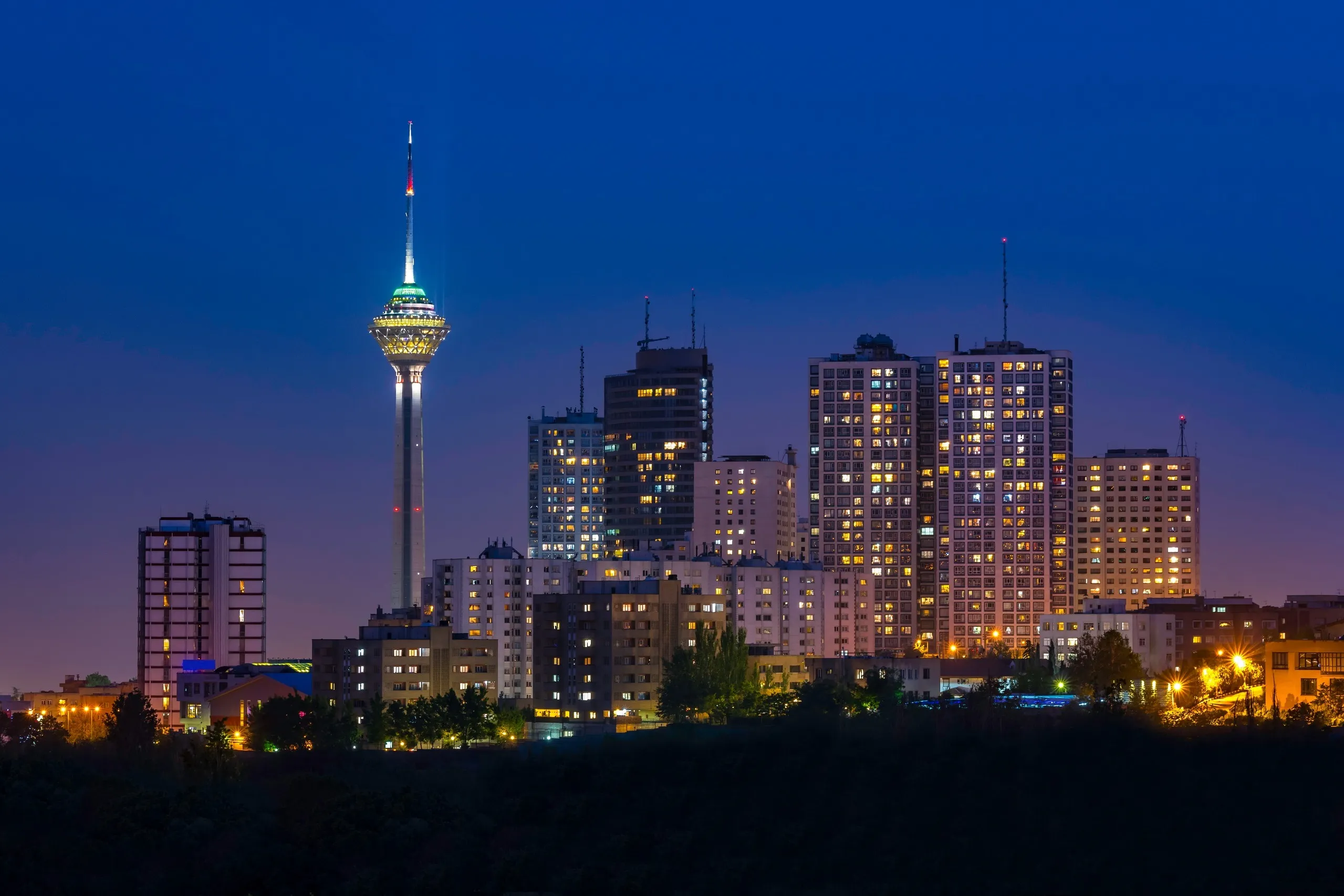
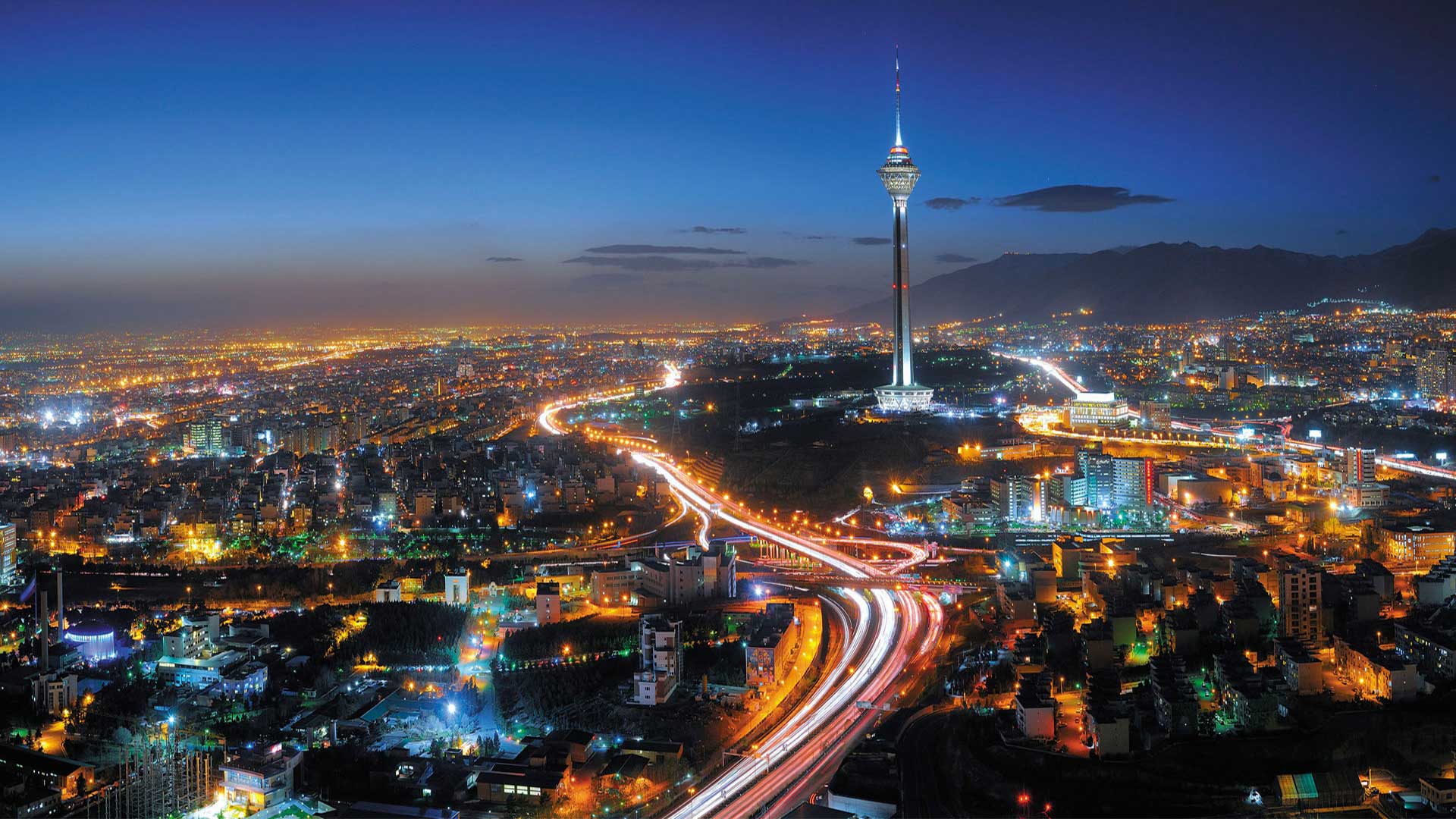
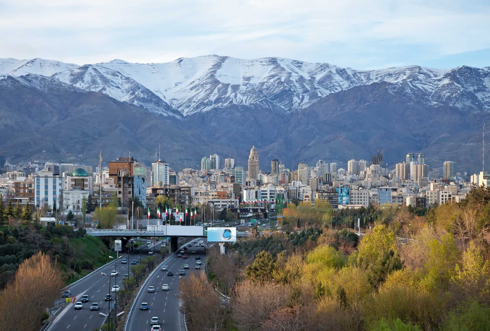

Teheran (persisch تهران, DMG Tehrān, traditionell auch طهران, DMG Ṭehrān /teɦˈrɔːn/) ist die Hauptstadt Irans und der gleichnamigen Provinz. Im administrativen Stadtgebiet leben knapp 8,7 Millionen Menschen (laut Volkszählung von 2016). Die Bevölkerungszahl der Metropolregion wird auf rund 20 Millionen Einwohner geschätzt; die offizielle Statistik von 2011 belegt jedoch nur 15,2 Millionen Menschen.[2] Als Industrie- und Handelsstadt mit Universitäten, Hochschulen, Bibliotheken und Museen ist Teheran ein bedeutendes Wirtschafts-, Wissenschafts- und Kulturzentrum sowie ein wichtiger Verkehrsknotenpunkt des Landes.
德黑兰(波斯语:تهران / Ťehrân,读音ⓘ发音:[tehˈɾɒːn])是伊朗的首都和最大城市,同时是德黑兰省省会,总人口达8,429,807人[2],是西亚地区人口最稠密的城市之一,也是世界第19大城市[3]。
在20世纪,伊朗各地有大批民众涌入德黑兰定居[4],有意见认为德黑兰的市区人口应要减少至少5,000,000人[5]。德黑兰有许多历史上著名的清真寺、基督教堂、犹太会堂及琐罗亚斯德教的火庙。当代的德黑兰是现代化的城市,高楼大厦林立,当中的阿扎迪塔及默德塔是德黑兰的标志性建筑。德黑兰在2008年是全球生活成本最低的城市[6][7][8][9][10]。以城市人口计算,德黑兰是全球第19大的都市,国内生产总值排行第56位,城市群人口排行第29位[11]。伊朗的历史悠久,首都也随着时代的推进而变迁,德黑兰是第32个伊朗首都。德黑兰的母语是带有德黑兰口音的波斯语,98%的德黑兰人都使用母语[注 1],德黑兰的大部分居民都是波斯人[注 2]。在前伊斯兰及伊斯兰时代早期,德黑兰在祆教里称为“拉伊”(Ray),亦即波斯古经里的剌伽[注 3]。
 Dubai
Dubai
 Financial
 ***Global Financial Center
 History
N 2000 - 2100 AD
Silk road
United Arab Emirates
History
N 2000 - 2100 AD
Silk road
United Arab Emirates
 Important port

Geschichte
Die Anfänge der Besiedlung auf der arabischen Halbinsel reichen bis in die Steinzeit zurück. Das belegen Funde, die auf ein Alter von bis zu 7000 Jahren datiert wurden. Anfang des 20. Jahrhunderts war Dubai eine Hochburg des Perlenhandels und wurde 1904 zum Freihafen erklärt. Die Stadt avancierte zum wichtigsten Hafen der Golfküste. Die Schiffslinien und der Seehandel öffneten Dubai das Tor zur Welt, denn Bombay war ebenso gut zu erreichen wie Kairo, das damalige kulturelle und religiöse Zentrum der Golfregion. Der große Reichtum kam mit den ersten Ölfunden in den 30er Jahren über das Scheichtum. 1958 eröffnete dann auch der erste moderne Flughafen in Dubai. Im Jahre 1971 erklärten die sieben Emirate der heutigen V.A.E ihre Unabhängigkeit von der damaligen Schutzmacht Großbritannien. Heute präsentiert sich das Emirat Dubai als glitzernde Metropole, als Handels- und Tourismuszentrum, das trotz aller Zugeständnisse an die westliche Welt seine Traditionen bewahrt hat.(Quelle:http://www.dubai.de/4-Land-Leute.html)

Didim ist eine Stadt im gleichnamigen Ilçe (Landkreis) der türkischen Provinz Aydın und gleichzeitig ein Stadtbezirk der 2012 geschaffenen Büyükşehir belediyesi Aydın (Großstadtgemeinde/Metropolprovinz). Sie liegt an der türkischen Ägäisküste, etwa 200 km südlich von İzmir.
In der Antike befand sich hier die Stadt Didyma mit einem bedeutenden Orakelheiligtum des Gottes Apollon. Der Apollontempel zählt heute zu den am besten erhaltenen Großbauten des Altertums.
Die heutige Stadt Didim wurde nach dem Erdbeben von 1955 gegründet. Dabei wurde der Name des antiken Didyma übernommen.
Seit 1995 besteht eine Gemeindepartnerschaft mit dem hessischen Laubach.

迪亚巴克尔(奥斯曼土耳其语:دیاربکر,Diyâr-ı Bekr;库尔德语:Amed[2];古希腊语:Amida, Άμιδα;叙利亚语:ܐܡܝܕ, Amid;亚美尼亚语:Տիգրանակերտ),为土耳其东南部最大的城市,为迪亚巴克尔省省会。总人口约600,000。当地居民以库尔德人为主。该城市被誉为“土耳其库尔德斯坦的非官方首都”。
在亚述帝国时,“Amid”一词的意思是鞘中的剑,同样的名字也用于当时的叙利亚和阿拉伯人中。[3] 古罗马和拜占庭帝国称之为“亚米大”(Amida)。[3] 阿尔图格王朝和白羊王朝时因其城墙颜色而称之为“黑色阿米德”(Kara Amid),同时也称为“黑堡”(Kara Kale)。[3] 在Book of Dede Korkut和一些其他土耳其文献中,也称Kara Hamid。[3]
在7世纪阿拉伯人入侵后,阿拉伯贝克尔族占领该城,[3] 并将之改名为Diyar Bakr (意为:巴克尔族的地产,波斯语:Diyar-ı Bekir)。[4][5] 1937年,凯末尔参观该城,并将之改为现名Diyarbakır。
Diyarbakır (türkisch; osmanisch دیاربکر Diyâr-i Bekr, deutsch ‚Land von Bekr‘, kurdisch Amed, armenisch Ամիդ Amid, zazaisch Diyarbekir, aramäisch ܐܡܝܕ Amedu) ist nach Gaziantep die zweitgrößte Stadt Südostanatoliens in der Türkei. Diyarbakır liegt auf einem Basaltplateau am rechten Tigrisufer in Südostanatolien. Seit einer Gebietsreform ist die Stadt eine Büyükşehir Belediyesi, damit ist sie flächen- und einwohnermäßig identisch mit der Provinz. Bereits im Altertum war sie unter dem Namen Amida bedeutend. In der Stadt leben überwiegend Kurden.
Der antike Name der Stadt erscheint erstmals in assyrischen Geschichtsquellen aus dem 13. Jahrhundert v. Chr. als Amida oder Amed. In griechischen und lateinischen Quellen erscheint sie als Amido und Amida. Nach der Eroberung durch die arabischen Armeen tauchen auch die Namen Amid und Schwarzes Amid auf. Der Zusatz Schwarz soll sich auf die Farbe des Basalts beziehen, aus dem viele Gebäude der Stadt erbaut sind.
Der arabische Name Diyarbekir mit der Bedeutung Land der Bekr wurde dem Gebiet um Amida nach der Niederlassung der arabischen Stammesgruppe der Bakr im späten 7. Jahrhundert verliehen.[2] Hauptort dieses Gebietes war die Stadt Amida, und mit der Zeit ging der Name der Gegend auf die Stadt selbst über. Christlich-syrische Traditionen leiten den Namen Diyarbekir hingegen vom aramäischen Dayr Bekir (= „erste Kirche“, oder „Kirche der Jungfrau [Maria]“) in Anlehnung an die Mutter-Gottes-Kirche (Meryem Ana Kilisesi) in der Stadt ab. Die Kirche ist laut lokaler Tradition eine der ältesten Kirchen überhaupt und soll aus dem 2. Jahrhundert stammen; die ältesten erhaltenen Teile stammen allerdings aus der Spätantike.
Die moderne Türkei hat den Namen Diyarbekir 1937 in Diyarbakır (Gebiet des Kupfers) umgewandelt. Kurden verwenden die aramäische Bezeichnung Amed in Anspielung auf das antike Volk der Meder, als dessen Nachfolger sie sich sehen. Etymologisch besteht allerdings keine Verbindung des aramäischen Amed bzw. Amid mit den Medern.
 Financial
***Global Financial Center
Financial
***Global Financial Center
 Geography
*World's Most Livable Cities
History
N 2000 - 2100 AD
History
M 1500 - 2000 AD
Geography
Geography
*World's Most Livable Cities
History
N 2000 - 2100 AD
History
M 1500 - 2000 AD
 International cities
***Global Urban Economic Competitiveness
Japan
Kantō
Olympic Summer Games
1964 Summer Olympics
2020 Summer Olympics
Silk road
Important port
International cities
***Global Urban Economic Competitiveness
Japan
Kantō
Olympic Summer Games
1964 Summer Olympics
2020 Summer Olympics
Silk road
Important port

Tokio (auch Tokyo, japanisch 東京 Tōkyō  [to̞ːkjo̞ː]) ist eine Weltstadt[3] in der Kantō-Region im Osten der japanischen Hauptinsel Honshū. Mit 9.508.776 Einwohnern ist sie nicht nur die bevölkerungsreichste Metropole des Landes, sondern als Sitz der japanischen Regierung und des Tennō auch die Hauptstadt Japans. Sie umfasst die 23 Bezirke auf dem Gebiet der 1943 als Verwaltungseinheit abgeschafften Stadt Tokio und ist damit keine eigene Gebietskörperschaft mehr; stattdessen bilden die Bezirke zusammen mit den Städten und Gemeinden der westlich gelegenen Tama-Region und den südlichen Izu- und Ogasawara-Inseln die Präfektur Tokio. Diese bildet wiederum das Zentrum der Metropolregion Tokio-Yokohama, in der mehr als 37 Millionen Menschen leben (Stand 2014), was die Region zum größten Ballungsraum der Welt macht.
Die Stadtgeschichte beginnt im Jahr 1446, als Ōta Dōkan in einem Sumpfgebiet am Nordufer der heutigen Bucht von Tokio mit dem Bau der Burg Edo begann, umgeben von einigen Fischerdörfern. 1590 ging diese Burg an Tokugawa Ieyasu, der hier nach seinem Sieg in der Schlacht von Sekigahara sein neues Shōgunat und damit die Edo-Zeit begründete. Edo wurde neben Kyōto zum politischen und kulturellen Zentrum des Landes. Mit der Meiji-Restauration 1868 wurde das Shōgunat abgeschafft und der Sitz des Tennō nach Edo verlegt, die Burg wurde zum Kaiserpalast und Edo bekam seinen neuen Namen Tokio, der „Östliche Hauptstadt“ bedeutet. Von da an wuchs auch die Bevölkerung der Stadt, die bereits um 1910 mit rund zwei Millionen Einwohnern zu den größten der Welt zählte. Im Zweiten Weltkrieg war Tokio zahlreichen Luftangriffen durch die USA ausgesetzt, bei denen rund die Hälfte der Stadtfläche zerstört wurde. Nach dem Ende der amerikanischen Besatzungszeit folgte ein rasanter wirtschaftlicher Aufschwung, einhergehend mit einem erneuten Bevölkerungszuwachs.
Tokio ist heute das Industrie-, Handels-, Bildungs- und Kulturzentrum Japans mit zahlreichen Universitäten, Hochschulen, Forschungsinstituten, Theatern und Museen. Mit den Flughäfen Narita und Haneda und als Ausgangspunkt der meisten Shinkansen-Linien ist es auch das Verkehrszentrum des Landes. Der Finanzplatz Tokio ist nicht nur der größte Japans, sondern zählt neben London, New York und Hongkong auch zu den fünf größten der Welt. Zudem weist die Stadt ein hohes Preisniveau auf und lag in einer Studie 2014 auf Platz 9 der teuersten Städte weltweit.[4][5] Neben modernen Sehenswürdigkeiten wie dem Tokyo Tower oder Tokyo Skytree bietet sie auch historische Anlagen wie die Kaiserlichen Gärten in Chiyoda, den Ueno-Park oder den Asakusa-Kannon-Tempel. In den vergangenen Jahren wurde Tokio zu einem zunehmend beliebten Tourismusziel und befindet sich mit jährlich bis zu acht Millionen Besuchern aus dem Ausland unter den 20 meistbesuchten Städten.[6] In einer Rangliste der Städte nach ihrer Lebensqualität belegte Tokio im Jahre 2018 den 50. Platz unter 231 untersuchten Städten weltweit.[7]
东京(日语:東京/とうきょう Tōkyō)是位于日本关东地方的都市,狭义上指东京都、或东京都区部(即东京市区),亦可泛指东京都及周边卫星都市群相连而成的“首都圈”(东京都会区)。目前(2017年8月)东京都区部人口数达946万,首都圈的人口数则达3千6百万,是目前全球规模最大的都会区[1],亦为亚洲最重要的世界级城市。东京是传统上的全球四大世界级城市[2]之一,在2016年GDP达9472.7亿美元,超越纽约(9006.8亿)成为全球第一,同时全球城市指数排名中排名第三。
东京古称江户,自德川幕府时代以来开始成为日本主要都市之一,明治维新时期改为现名后,更发展为日本政治、经济、文化、交通等众多领域的枢纽中心。经过二战后的继续发展,东京不仅成为世界商业金融、流行文化与时尚重镇,亦为世界经济发展度与富裕程度最高的都市之一。此外,东京还有目前全球最复杂、最密集的城市轨道交通系统,其中单就计算东京的地铁系统管辖区段每日平均运量达880万人次,繁忙程度居全球地铁第三位(如含地铁直通运转路线、私铁通勤路线及JR东日本通勤路线,则每日平均运量位居世界城市轨道交通运输系统第一位)。
在正式的行政区划定义上,东京仅限于东京都,与道、府、县同为日本的一级行政区,辖区包含东京都区部、多摩地方与伊豆群岛、小笠原群岛等离岛;其中,东京都区部为日本中央政府所在地。东京都同时也囊括了日本最南端(冲之鸟礁)和最东端(南鸟岛)等地理极点,拥有日本各都道府县中最多的人口数,同时也是日本人口密度最高的都道府县。
東京(とうきょう、英: Tokyo)は、日本の関東平野中央部に位置し、東京湾に面する都市。日本の首都である[1][注 1]。現在、その域内には23特別区・26市・5町・8村の基礎自治体がある[2]。
日本における政治・経済・文化の中心である。政治面では、日本政府が本拠地としている。立法府である国会の議事堂、司法府の頂点である最高裁判所、行政府の長である内閣総理大臣の官邸、中央省庁街(「霞が関」)などは、いずれも東京の中心部である東京23区にある。経済面では、日本の株式上場企業の本社のほとんどが東京に集中し、(東京圏では)購買力平価(PPP)を基にしても東京都市圏のGDPは1兆5369億ドル(2014年)であり[3]、世界的な経済都市であり、大消費地でもある。文化面では、たとえば現在では(東京都内に)千数百におよぶ劇場・ホール・ライブハウス類があり[4]多数のアーティストたちが活動する場であり、ポップカルチャーなどの新しい文化の発信地でもあり、ミシュランガイドの星つきの飲食店の数は世界最多で[5]食文化が華開いている場所でもある。
東京には、日本国内からだけでなく近隣の様々な国や世界各国から外国人が観光に訪れるようになった他、東京に移住した外国人が移民街を形成している。関東大震災や東京大空襲で焼け野原となったが、戦後の発展により現在は世界最大級のメトロポリス・世界都市となっている。東京は明治期にも課題が山積みの都市であったが(#明治維新後の課題と都市政策を参照)、現在もさまざまな課題を抱えている都市である(#近年の東京が都市としてかかえる課題を参照)。 東京都(とうきょうと、英: Tokyo Metropolis)は、日本の首都[注 1]。関東地方に位置する広域地方公共団体(都道府県)のひとつ。都庁所在地は新宿区[注 2]。最大の都市は世田谷区[注 3]。 管轄する領域は東京都区部(東京23区)、多摩地域(26市[注 4]と西多摩郡3町1村)および東京都島嶼部(大島、三宅、八丈、小笠原)の4支庁(2町7村)からなっている。東京都区部(東京23区)は、一つの都市として「東京」とも呼ばれる。沖ノ鳥島、南鳥島を含む小笠原諸島を含むため、日本最南端および最東端に位置する都道府県でもある。都公認の「東京都」の英語表記はTokyo Metropolis(Tokyo Met.)。他には Tokyo Prefecture と Tokyo Metropolitan Prefecture がある。
Tokyo (東京 Tōkyō, /ˈtoʊkioʊ/;[7] Japanese: [toːkʲoː] ( listen)), officially Tokyo Metropolis (東京都 Tōkyō-to), is one of the 47 prefectures of Japan and has been the capital since 1869.[8][9] The Greater Tokyo Area is the most populous metropolitan area in the world.[10] It is the seat of the Emperor of Japan, the Japanese government and the National Diet. Tokyo is in the Kantō region on the southeastern side of the main island Honshu and includes the Izu Islands and Ogasawara Islands.[11] Tokyo was formerly named Edo when Shōgun Tokugawa Ieyasu made the city as his headquarters in 1603. It became the capital after Emperor Meiji moved his seat to the city from Kyoto in 1868; at that time Edo was renamed Tokyo. Tokyo Metropolis was formed in 1943 from the merger of the former Tokyo Prefecture (東京府 Tōkyō-fu) and the city of Tokyo (東京市 Tōkyō-shi).
Tokyo has 39 million residents, 50% more people than any other urban area, with a $2.5 trillion economy larger than that of any other city; if it were a country, Tokyo would be the 8th largest economy in the world. Tokyo is often referred to as a city, but is officially known and governed as a "metropolitan prefecture", which differs from and combines elements of a city and a prefecture, a characteristic unique to Tokyo. The Tokyo Metropolitan Government administers the 23 Special Wards of Tokyo (each governed as an individual city), which cover the area that was the city of Tokyo before it merged and became the metropolitan prefecture in 1943, the 30 municipalities in the western part of the prefecture, and the two outlying island chains. The population of the special wards is over 9 million people, with the total population of the prefecture exceeding 13 million. The prefecture is part of the world's most populous metropolitan area with upwards of 37.8 million people and the world's largest urban agglomeration economy. In 2011, the city hosted 51 of the Fortune Global 500 companies, the highest number of any city in the world at that time.[12] Tokyo ranked third (twice) in the International Financial Centres Development Index. The city is also home to various television networks such as Fuji TV, Tokyo MX, TV Tokyo, TV Asahi, Nippon Television, NHK and the Tokyo Broadcasting System.
Tokyo is ranked first in the Global Economic Power Index and third in the Global Cities Index. The city is considered an alpha+ world city – as listed by the GaWC's 2008 inventory[13] – and in 2014, Tokyo was ranked first in the "Best overall experience" category of TripAdvisor's World City Survey (the city also ranked first in the following categories: "helpfulness of locals", "nightlife", "shopping", "local public transportation" and "cleanliness of streets").[14] In 2015, Tokyo was ranked as the 11th most expensive city for expatriates, according to the Mercer consulting firm,[15] and also the world's 11th most expensive city, according to the Economist Intelligence Unit's cost-of-living survey.[16] In 2015, Tokyo was named the Most Liveable City in the world by the magazine Monocle.[17] The Michelin Guide has awarded Tokyo by far the most Michelin stars of any city in the world.[18][19] Tokyo was ranked first out of all sixty cities in the 2017 Safe Cities Index.[20] The QS Best Student Cities ranked Tokyo as the 3rd-best city in the world to be a university student in 2016[21] and 2nd in 2018.[22] Tokyo hosted the 1964 Summer Olympics, the 1979 G-7 summit, the 1986 G-7 summit, and the 1993 G-7 summit, and will host the 2019 Rugby World Cup, the 2020 Summer Olympics and the 2020 Summer Paralympics.
Tokyo (東京(とうきょう), Tōkyō?, littéralement « Capitale de l'est »), anciennement Edo (江戸(えど)?), officiellement la préfecture métropolitaine de Tokyo (東京都(とうきょうと), Tōkyō-to?), est la capitale actuelle du Japon. Elle est la plus peuplée des préfectures du Japon, avec plus de 13 831 421 habitants intra-muros en 2018 et 42 794 714 dans l'agglomération2, et forme l'aire urbaine la plus peuplée au monde. Située sur la côte est de l'île principale de l'archipel japonais, Honshū, Tokyo est l'une des quarante-sept préfectures du Japon. Principal centre politique de l'archipel depuis le XVIIe siècle, la ville accueille la plupart des institutions du pays : la résidence de l'empereur du Japon, du Premier ministre, le siège de la Diète (le parlement japonais), du Cabinet, les ministères qui le constituent ainsi que toutes les ambassades étrangères.
À l'origine, Tokyo était un petit village de pêcheurs nommé Edo (« l'estuaire »). Fortifié au XVe siècle, Edo devient la base militaire du shogun Tokugawa Ieyasu à la fin du XVIe siècle, puis la capitale de son gouvernement. Durant l’époque d'Edo (1603-1868), la ville se développe et devient l'une des plus peuplées au monde à la fin du XVIIIe siècle, avec une population de près d'un million d'habitants. Avec la restauration de l'Empire en 1868, elle est confortée dans son rôle de cœur politique du Japon : le château d'Edo devient la résidence de l'empereur Meiji (Kōkyo), et la ville acquiert son nom actuel par opposition à Kyoto, l'ancienne capitale. Elle est ravagée en 1923 par un séisme de magnitude 7,9 qui fait plus de 100 000 morts. Durant la Seconde Guerre mondiale, elle est détruite pour moitié par des bombardements aériens américains, mais est rapidement reconstruite. Dans la seconde moitié du XXe siècle, Tokyo devient une métropole de rang mondial grâce à un fort développement industriel — notamment dans l'électronique —, et voit sa population multipliée par dix en cinquante ans.
Principal centre économique et financier du Japon, Tokyo est l'une des principales places financières asiatiques et mondiales. Elle est la première ville mondiale en termes de produits urbains bruts. Le dynamique arrondissement de Shinjuku comporte de nombreux gratte-ciels, dont la mairie de la ville, et plusieurs grands magasins du Japon. Minato-ku accueille les sièges sociaux de nombreuses entreprises japonaises et étrangères, ainsi qu'une cinquantaine d'ambassades. Chiyoda concentre quant à lui les institutions politiques japonaises. Enfin, Shibuya est réputé être l'un des quartiers les plus animés de la ville, grâce à la présence de grands centres commerciaux comme le 109. Malgré la modernité de son architecture, dont témoigne la tour Tokyo Skytree, de nombreux sanctuaires shinto et temples bouddhistes ont été préservés ou reconstruits après les bombardements, comme le Sensō-ji, le sanctuaire Yasukuni, le Zōjō-ji ou les portes Hōzōmon.
Située au fond de la baie de Tokyo, la commune de Tokyo dispose d'un statut administratif particulier parmi les préfectures du Japon, la ville de Tokyo ayant été supprimée en tant qu'entité politique ou administrative en 1943. L'agglomération de Tokyo, qui s'étend bien au-delà des limites de la préfecture, s'étend sur une large frange de la baie de Tokyo ainsi que sur la région du Kantō. Elle constitue en outre un des pôles de la mégalopole japonaise, avec notamment Ōsaka et Nagoya. La préfecture a organisé les Jeux olympiques d'été de 1964, et les accueillera à nouveau en 2020.
Tokio (東京都 Tōkyō-to?, lit. ‘capital del este’; pronunciación japonesa: [toːkʲoː] (?·i)) es la capital de facto6 de Japón, localizada en el centro-este de la isla de Honshu, concretamente en la región de Kanto. En conjunto forma una de las 47 prefecturas de Japón, aunque su denominación oficial es metrópolis o capital (都 -to). La ciudad es el centro de la política, economía, educación, comunicación y cultura popular del país. Cuenta también con la mayor concentración de sedes corporativas, instituciones financieras, universidades y colegios, museos, teatros, y establecimientos comerciales y de entretenimiento de todo Japón.
Con una población que supera los 13 millones de habitantes, se subdivide en 23 barrios (区 -ku); 26 ciudades (市 -shi); un distrito (郡 -gun) subdividido en tres pueblos (町 -chō o -machi) y una villa (村 -son o -mura); y cuatro subprefecturas (支庁 -shichō) subdivididas en dos pueblos y siete villas, que representan a varias pequeñas islas al sur de Honshu que se extienden más allá de 1800 km de Shinjuku, capital de la metrópoli y sede de la gobernación. El centro de Tokio, con sus 23 barrios, ocupa un tercio de la metrópoli, con una población cercana a los 13,23 millones de habitantes; esta área es lo que se conoce internacionalmente como la ciudad de Tokio. En su área metropolitana viven más de 37 millones de habitantes, lo que la convierte en la mayor aglomeración urbana del mundo.
A pesar de que Tokyo es la romanización más común del nombre en japonés, el nombre de la ciudad es Tokio en español y otros idiomas —entre ellos el alemán y el neerlandés—. En inglés y otros idiomas se escribe Tokyo, aunque antiguamente también se escribía Tokio. En el pasado, la ciudad se denominaba como Tokei, Edo o Yedo. El gentilicio de Tokio es tokiota.
Tokio fue sede de los Juegos Olímpicos de 1964 y será sede de los Juegos Olímpicos de 2020.7
То́кио (яп. 東京 То:кё: (инф.), «Восточная столица»[4][5]) — столица Японии, её административный, финансовый, промышленный и политический центр. Крупнейшая городская экономика мира[6]. Расположен в юго-восточной части острова Хонсю, на равнине Канто в бухте Токийского залива Тихого океана.
Помимо столицы, Токио также является одной из сорока семи префектур страны. Площадь префектуры составляет 2188,67 км²[7], население — 13 742 906 человек (1 октября 2017)[8], плотность населения — 6279,11 чел./км². По состоянию на 1 мая 2020 года население Токио составляло 14 002 973 человека, что делает Токио префектурой с самым большим населением в Японии.[9] Большой Токио является городской территорией с самым большим населением в мире, с населением по состоянию на 2016 год в 38 140 000 человек.[2]
Токийский столичный округ — административная единица Японии, включающая в себя специальные районы Токио, область Тама и островные территории Токийского столичного округа (острова Идзу и Огасавара).


Doha (arabisch الدوحة ad-Dauha, DMG ad-Dauḥa, im Dialekt ad-Dōha für „Die Bucht“) ist die Hauptstadt von Katar und liegt am Persischen Golf. Die Einwohnerzahl lag im April 2015 bei 587.055.[1] In der Agglomeration Dohas leben (Stand April 2015) 956.457 Menschen.[2] Doha wächst mit der nur neun Kilometer entfernten Stadt Ar-Rayyan schnell zusammen. Die Stadt beherbergt den Hamad International Airport, wichtige Teile der Öl- und Fischereiindustrie sowie mit der „Education City“ ein Gebiet für Forschung und Bildung.
多哈(阿拉伯语:الدوحة ad-Dūḥa)位于波斯湾畔的著名港口,是卡塔尔的首都,卡塔尔8个区之一。多哈是卡塔尔的第一大城市以及全国经济、交通和文化中心,2009年时,人口为998,651人,约占全国人口的60%。
第十五届亚洲运动会于2006年12月1日至15日在卡塔尔首都多哈进行,这可能是亚运会有史以来规模最大的一届。2011年12月,多哈举办第20届世界石油理事会,同年的12月,2011年泛阿拉伯运动会也于多哈举行。在2012年,多哈举办了第十八次联合国气候变化大会。在2022年,多哈将会举办2022年世界杯足球赛。
ドーハ(英語:Doha、アラビア語:الدوحة al-Dawha)は、カタールの首都。カタール半島東海岸のペルシア湾に面した港町で、同国最大の都市。また、同国を構成する基礎自治体のひとつである。中東有数の世界都市でもある。人口は1,312,947人(2013年)で、カタールの人口の60%がドーハ都市圏に住んでいる。
Doha (Arabic: الدوحة, ad-Dawḥa or ad-Dōḥa, pronounced [adˈdawħa]) is the capital and most populous city of the State of Qatar. Doha has a population of 1,351,000 in the city proper with the population close to 1.5 million.[1] The city is located on the coast of the Persian Gulf in the east of the country. It is Qatar's fastest growing city, with over 50% of the nation's population living in Doha or its surrounding suburbs, and it is also the economic centre of the country.
Doha was founded in the 1820s as an offshoot of Al Bidda. It was officially declared as the country's capital in 1971, when Qatar gained independence from being a British Protectorate.[2] As the commercial capital of Qatar and one of the emergent financial centres in the Middle East, Doha is considered a world city by the Globalization and World Cities Research Network. Doha accommodates Education City, an area devoted to research and education.
The city was host to the first ministerial-level meeting of the Doha Development Round of World Trade Organization negotiations. It was also selected as host city of a number of sporting events, including the 2006 Asian Games, the 2011 Pan Arab Games and most of the games at the 2011 AFC Asian Cup. In December 2011, the World Petroleum Council held the 20th World Petroleum Conference in Doha.[3] Additionally, the city hosted the 2012 UNFCCC Climate Negotiations and is set to host a large number of the venues for the 2022 FIFA World Cup.[4]
In May 2015, Doha was officially recognized as one of the New7Wonders Cities together with Vigan, La Paz, Durban, Havana, Beirut and Kuala Lumpur.[5]
Doha (en arabe : الدوحة, ad-Dawha ou ad-Doha, littéralement « le grand arbre » ou « l'arbre collant ») est la capitale du Qatar. Située sur le golfe Persique, avec une corniche de 7 km, elle a en avril 2010 une population de 796 947 habitants1. Doha est la plus grande ville du Qatar, abritant avec sa proche banlieue plus de 80 % de la population du pays. Elle est en croissance rapide et est maintenant juxtaposée à la ville d'Al Rayyan (455 623 hab. en avril 2010)1 située à 9 km à l'intérieur des terres. C'est également le centre économique du pays.
Doha est aussi le siège du gouvernement du Qatar, dirigé par le cheikh Hamad bin Khalifa Al Thani. Doha est le siège de l'Education City, espace consacré à la recherche et l'éducation.
Doha a été le site de la première réunion au niveau ministériel du cycle de Doha pour le développement des négociations de l'Organisation mondiale du commerce.
La ville de Doha a également accueilli les Jeux asiatiques de 2006, le sommet sur le changement climatique du 4 au 8 décembre 2012, la 38e session du Comité du patrimoine mondial de l'UNESCO du 15 au 25 juin 2014.
Doha abritera enfin plusieurs matches de la coupe du monde de football de 2022 organisée par le Qatar.
Doha (الدوحة in arabo, ad-Dawḥa oppure ad-Dōḥa, letteralmente il grande albero) è la capitale e la città più popolata dello stato del Qatar. Si trova sul Golfo Persico e aveva nel 2015 una popolazione di 956.460 abitanti. Doha è la più grande città del Qatar, il 60% della popolazione dello Stato risiede infatti nella città o nell'area suburbana.
A Doha vi è la sede del governo del Qatar, il cui capo è l'emiro Tamim bin Hamad Al Thani. Vicino a Doha sorge Education City, una zona in cui si sono insediati diversi campus universitari e istituti dedicati alla ricerca e all'innovazione.
La città presenta un carattere cosmopolita.[senza fonte] In Qatar è stanziato il principale quartier generale del Comando Centrale Militare USA, il più grande dell'intero medio-oriente.
Doha (en árabe, 'دوحة', Ad-Dawhah; trascripción: Doha, correspondiente a la pronunciación árabe dialectal) es la capital de Catar, país situado en una pequeña península en el golfo Pérsico. Su población estimada es de 1 903 447 habitantes (2012)1 y las principales actividades económicas son la industria del gas y el petróleo. Cerca de Doha se encuentra la Ciudad de la Educación, zona dedicada a la investigación y la educación.
Doha fue en 2001 la sede de la primera reunión a nivel ministerial de la Ronda de Doha, esto es, las negociaciones de la Organización Mundial de Comercio con el propósito de liberalizar el comercio mundial.
La ciudad cuenta con un aeropuerto, el Nuevo Aeropuerto Internacional de Doha.
En la ciudad se encuentra la sede de la cadena de televisión Al-Jazeera, uno de los principales medios de comunicación internacionales en lengua inglesa y árabe. En 2022, será sede de la Copa del Mundo de Fútbol en Catar. El Estadio Nacional de Lusail, el más grande de todos, será la sede de entre otros encuentros, del partido inaugural y la final.
La ciudad fue la sede de los Campeonatos Mundiales de Ciclismo en Ruta de 2016.2
До́ха (араб. الدوحة, Эд-Доха) — столица и крупнейший город арабского государства Катар, расположенный у побережья Персидского залива. Административный центр муниципалитета Эд-Доха.
В мае 2015 года Доха была официально избрана в качестве одного из «Семи новых чудо-городов», наряду с городами Бейрут, Виган, Дурбан, Гавана, Куала-Лумпур и Ла-Пас.