
Deutsch-Chinesische Enzyklopädie, 德汉百科


 Architecture
 Roman architecture

 Architecture
 Greek architecture
 Italy
Italy

 Sicilia

 World Heritage

 Civilization

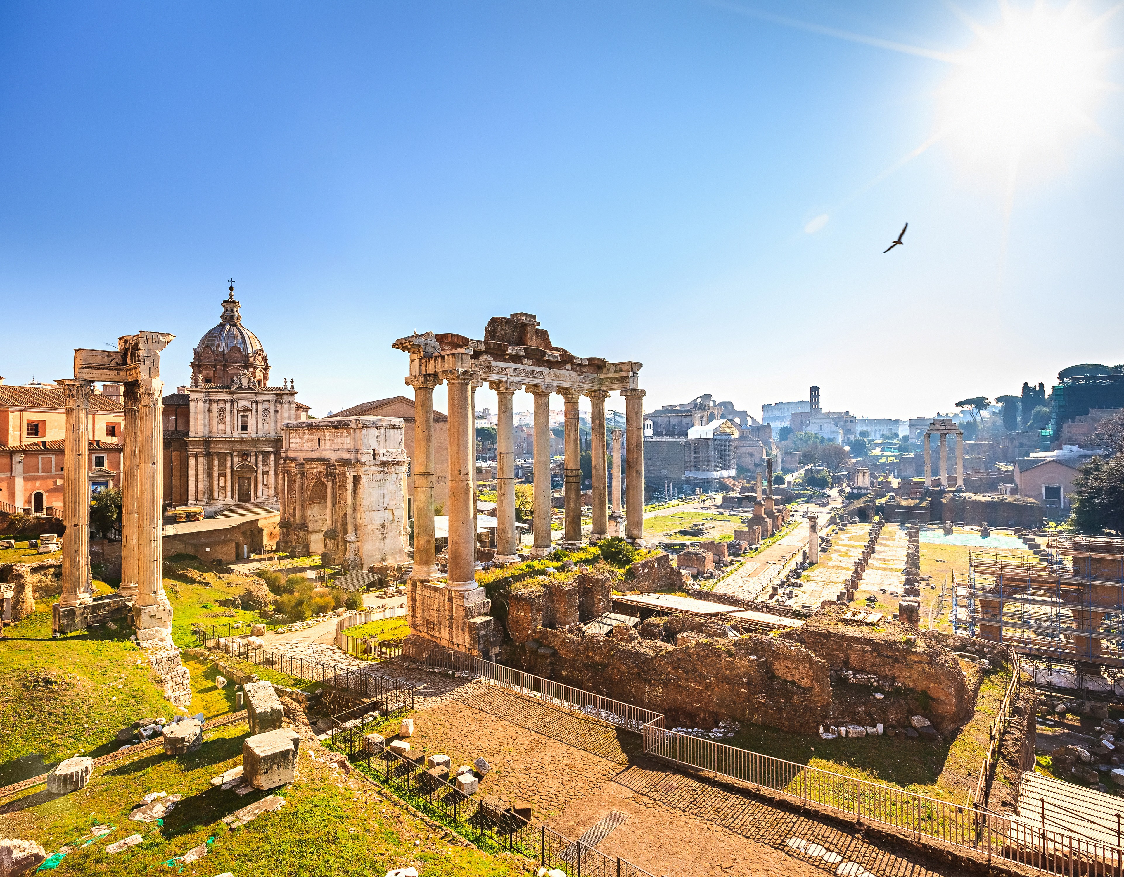

古罗马广场(Roman Forum)是古罗马时代的城市中心,其中还残留了些许的古罗马时期的重要建筑的废墟。屹立在此地的建筑物有提图斯凯旋门、奥古斯都凯旋门、塞维鲁凯旋门、凯撒神庙、灶神庙,维纳斯和罗马神庙。古罗马政治、宗教、商业、娱乐等建筑的聚集地又可以被称为“古罗马废墟”。
罗马市政府刻意保留了这块残垣断壁,为全人类留下了珍贵的文化遗产,这片古罗马废墟犹如大露天博物馆不仅吸引着全世界慕名而来的游客一探究竟,还吸引着众多考古工作者和历史学家前来探寻古罗马当时的生活百态,很具有考古价值。这片废墟其实最早是被破砖乱瓦覆盖,到十九世纪才被重见天日,古代劳动人民为我们留下了一片难得的建筑遗迹,让人联想到昔日的繁荣富裕的生活。公元前6世纪时开始建设,至西罗马帝国灭亡为止。广场上集中了大量宗教性和纪念性建筑物。广场的主要部分约长134米,宽63米。南北两侧各有一座巴西利卡(长方形会堂),供审判和集会用。广场东端是凯撒庙和奥古斯都凯旋门,西端是检阅台和另一座凯旋门。广场西北角的元老院和门前的集议场形成政治中心;凯撒庙和奥古斯都凯旋门以东的灶神庙和祭司长府是宗教中心。公元 4世纪建造君士坦丁巴西利卡之后,广场向东扩展,建造了第度凯旋门。西端在检阅台外还有两座公元初期的神庙。中世纪时,有几座古罗马时代建筑物被改成教堂。以后又不断拆取古建筑物的大理石,用于建筑或烧石灰,以致除少数建筑物外,广场建筑群仅存废墟。18世纪末开始发掘,并加以保护。罗马城旧广场的北面,从公元前1世纪到公元 2世纪初陆续建造了凯撒广场、奥古斯都广场、韦帕香广场、乃尔维广场和图拉真广场。它们各自按设计一次建成,平面为长方形,四周柱廊的一端建造神庙。凯撒广场有钱庄和演讲台,奥古斯都广场有演讲堂。这些广场都是为纪念个人功绩而建造的。
Das Forum Romanum in Rom ist das älteste römische Forum und war Mittelpunkt des politischen, wirtschaftlichen, kulturellen und religiösen Lebens. Es liegt in einer Senke zwischen den drei Stadthügeln Kapitol, Palatin und Esquilin und war der Ort vieler öffentlicher Gebäude und Denkmäler.
Ursprünglich ein von einem Bach durchzogenes, sumpfiges Tal, wurde es erst unter dem legendären etruskischen König Lucius Tarquinius Priscus zu Beginn des 7. Jahrhunderts v. Chr. in die Stadt einbezogen. Den Höhepunkt seines prachtvollen Ausbaus erlebte es in der Römischen Kaiserzeit.[1] Es ist heute eine der wichtigsten Ausgrabungsstätten des antiken Roms.
The Roman Forum, also known by its Latin name Forum Romanum (Italian: Foro Romano), is a rectangular forum (plaza) surrounded by the ruins of several important ancient government buildings at the center of the city of Rome. Citizens of the ancient city referred to this space, originally a marketplace, as the Forum Magnum, or simply the Forum.
For centuries the Forum was the center of day-to-day life in Rome: the site of triumphal processions and elections; the venue for public speeches, criminal trials, and gladiatorial matches; and the nucleus of commercial affairs. Here statues and monuments commemorated the city's great men. The teeming heart of ancient Rome, it has been called the most celebrated meeting place in the world, and in all history.[1] Located in the small valley between the Palatine and Capitoline Hills, the Forum today is a sprawling ruin of architectural fragments and intermittent archaeological excavations attracting 4.5 million or more sightseers yearly.[2]
Many of the oldest and most important structures of the ancient city were located on or near the Forum. The Roman Kingdom's earliest shrines and temples were located on the southeastern edge. These included the ancient former royal residence, the Regia (8th century BC), and the Temple of Vesta (7th century BC), as well as the surrounding complex of the Vestal Virgins, all of which were rebuilt after the rise of imperial Rome.
Other archaic shrines to the northwest, such as the Umbilicus Urbis and the Vulcanal (Shrine of Vulcan), developed into the Republic's formal Comitium (assembly area). This is where the Senate—as well as Republican government itself—began. The Senate House, government offices, tribunals, temples, memorials and statues gradually cluttered the area.
Over time the archaic Comitium was replaced by the larger adjacent Forum and the focus of judicial activity moved to the new Basilica Aemilia (179 BC). Some 130 years later, Julius Caesar built the Basilica Julia, along with the new Curia Julia, refocusing both the judicial offices and the Senate itself. This new Forum, in what proved to be its final form, then served as a revitalized city square where the people of Rome could gather for commercial, political, judicial and religious pursuits in ever greater numbers.
Eventually much economic and judicial business would transfer away from the Forum Romanum to the larger and more extravagant structures (Trajan's Forum and the Basilica Ulpia) to the north. The reign of Constantine the Great saw the construction of the last major expansion of the Forum complex—the Basilica of Maxentius (312 AD). This returned the political center to the Forum until the fall of the Western Roman Empire almost two centuries later.
Le Forum Romain ou Forum de Rome (Foro Romano en italien, Forum Romanum en latin), appelé aussi Forum Magnum (« Grand Forum ») ou Forum Vetus (« Vieux Forum »), est situé dans le site archéologique le plus important de Rome, entre les collines du Capitole et du Mont Palatin.
Le forum est la place principale de la Rome antique. Son importance historique, religieuse et politique en fait l'endroit autour duquel toute la vie de la ville s'articule : célébration de mariages, organisation de jeux, de combats de gladiateurs, de cérémonies et de fêtes religieuses, de défilés militaires (sur la Via Sacra), de proclamations politiques (par exemple lors de l'incinération de Jules César, en ce même lieu)..., il est le centre vivant de la ville, à l'image de l'agora, lieu de rassemblement politique et mercantile des cités grecques.
Il Foro Romano (in latino Forum Romanum, sebbene i Romani si riferissero ad esso più spesso come Forum Magnum o semplicemente Forum) è un'area archeologica di Roma racchiusa tra il Palatino, il Campidoglio, Via dei Fori Imperiali e il Colosseo, costituita dalla stratificazione dei resti di quegli edifici e monumenti di epoche eterogenee che per gran parte della storia antica di Roma rappresentarono il centro politico, giuridico, religioso ed economico della città di Roma, oltre che il centro nevralgico dell'intera civiltà romana.
Dall'età regia fino all'avvento dell'età medievale, la valle del Foro è stata teatro di eventi e sede di istituzioni di importanza tale da aver determinato a più riprese il corso storico della civiltà occidentale[1][2][3][4][5][6][7][8], e da aver influenzato in modo preponderante le basi politiche, giuridiche, culturali e filosofiche del pensiero occidentale.
Dopo una fase di declino iniziata nell'età tardoantica il Foro Romano è stato soggetto a frequenti spoliazioni e cambi di destinazione d'uso, fino a ritrovarsi, nel XVI secolo, quasi completamente interrato e stabilmente utilizzato come pascolo per i bovini, da cui il nomignolo di Campo Vaccino[9][10].
Grazie alle imponenti ristrutturazioni urbanistiche dell'Italia post-unitaria e del periodo fascista, l'area del Foro è stata gradualmente riportata alla luce, studiata, e musealizzata, diventando con il Colosseo e il Palatino uno dei siti archeologici più illustri e visitati al mondo[11].
El Foro Romano (en latín, Forum Romanum, aunque los romanos se referían a él comúnmente como Forum Magnum o simplemente Forum) era el foro de la ciudad de Roma, es decir, la zona central, semejante a las plazas centrales en las ciudades actuales, donde se encuentran las instituciones de gobierno, mercado y religión. Al igual que hoy en día era donde tenían lugar el comercio, los negocios, la prostitución, la religión y la administración de justicia. En él se situaba el hogar comunal. Series de restos de pavimento muestran que sedimentos erosionados desde las colinas circundantes ya estaban elevando el nivel del foro en la primera época de la República. Originalmente había sido un terreno pantanoso, que fue drenado por los Tarquinios mediante la Cloaca Máxima. Su pavimento de travertino definitivo, que aún puede verse, data del reinado de César Augusto.
Actualmente es famoso por sus restos, que muestran elocuentemente el uso de los espacios urbanos durante el Imperio Romano. El Foro Romano incluye los siguientes monumentos, edificios y demás ruinas antiguas importantes:
- Templo de Cástor y Pólux
- Templo de Rómulo
- Templo de Saturno
- Templo de Vesta
- Templo de Venus y Roma
- Basílica Emilia
- Basílica Julia
- Arco de Septimio Severo
- Arco de Tito
- Rostra (plural de rostrum), la tribuna desde donde los políticos daban sus discursos a los ciudadanos romanos.
- Curia Julia, sede del Senado.
- Basílica de Majencio y Constantino
- Tabulario
- Templo de Antonino y Faustina
- Regia
- Templo de Vespasiano y Tito
- Templo de la Concordia
- Templo de Jano
Un camino procesional, la Vía Sacra, cruza el Foro Romano conectándolo con el Coliseo. Al final del Imperio perdió su uso cotidiano quedando como lugar sagrado.
El último monumento construido en el Foro fue la Columna de Focas. Durante la Edad Media, aunque la memoria del Foro Romano persistió, los edificios fueron en su mayor parte enterrados bajo escombros y su localización, la zona entre el monte Capitolino y el Coliseo, fue designada Campo Vaccinio o ‘campo bovino’. El regreso del papa Urbano V desde Aviñón en 1367 despertó un creciente interés por los monumentos antiguos, en parte por su lección moral y en parte como cantera para construir nuevos edificios. Se extrajo gran cantidad de mármol para construcciones papales (en el Vaticano principalmente) y para cocer en hornos creados en el mismo foro para hacer cal. Miguel Ángel expresó en muchas ocasiones su oposición a la destrucción de los restos. Artistas de finales del siglo XV dibujaron las ruinas del Foro, los anticuarios copiaron inscripciones desde el siglo XVI y una excavación profesional fue comenzada a finales del siglo XVIII. Un cardenal tomó medidas para drenarlo de nuevo y construyó el barrio Alessadrine sobre él. No obstante, la excavación de Carlo Fea, quien empezó a retirar los escombros del Arco de Septimio Severo en 1803, y los arqueólogos del régimen napoleónico marcaron el comienzo de la limpieza del Foro, que no fue totalmente excavado hasta principios del siglo XX.
En su estado actual, se muestran juntos restos de varios siglos, debido a la práctica romana de construir sobre ruinas más antiguas.
Existieron foros en otras zonas de la ciudad, conservándose restos en ocasiones considerables de la mayoría de ellos. Los foros en la antigua ciudad de Roma eran los siguientes:
- Los más importantes son los grandes foros imperiales (o Fori Imperiali), que formaban un complejo con el Foro Romano. Estos eran el Foro de César (o Forum Iulium), el Foro de Augusto (o Forum Augustum), el Foro de Nerva (o Forum Transitorium) y el Foro de Trajano. Los planificadores del régimen de Mussolini retiraron la mayor parte de los estratos medievales y barrocos y construyeron una carretera entre los foros imperiales y el Foro.
- El Foro Boario (o Forum Boarium), entre el monte Palatino y el río Tíber, que estaba dedicado al comercio de ganado.
- El Foro Holitorio (o Forum Holitorium), entre el monte Capitolino y las murallas servianas, que estaba dedicado al comercio de hierbas y verduras.
- El Forum Piscarium, entre el monte Capitolino y el Tíber, en la zona del actual gueto de Roma, que estaba dedicado al comercio de pescado.
- El Forum Suarium, cerca de los barracones de las cohortes urbanae, en la parte norte del campo de Marte, que estaba dedicado al comercio del cerdo.
- El Forum Vinarium, en la zona del actual rione Testaccio, entre el monte Aventino y el Tíber, que estaba dedicado al comercio del vino.
- Existían otros mercados, pero no son correctamente identificables debido a la falta de información precisa o la pluralidad de ubicaciones. Entre éstos está el Forum cuppedinis, dedicado al comercio genérico de varias clases de bienes.
Ubicación geográfica:  41°53′33.12″N 12°29′8.5″E


哈德良长城(英语:Hadrian's Wall,拉丁语:可能为Vallum Aelium),是一条由石头和泥土构成的横断大不列颠岛的防御工事,由罗马帝国君主哈德良所兴建。公元122年,哈德良为防御北部皮克特人反攻,保护已控制的不列颠岛的人民安全,开始在今英格兰北面的边界修筑一系列防御工事,后人称为哈德良长城。哈德良长城的建立,标志着罗马帝国扩张的最北界。1987年,哈德良长城被列为世界文化遗产。
Der Hadrianswall (antiker lateinischer Name möglicherweise vallum Aelium) war ein römisches Grenzbefestigungssystem des britannischen Limes, das zwischen Newcastle und Solway Firth, nahe der heutigen Grenze zwischen Schottland und England in Großbritannien, angelegt war. Er wurde zwischen 122 und 128 n. Chr. auf Anordnung Kaiser Hadrians (76–138) erbaut, nachdem dieser die nördlichen Grenzen im Rahmen seiner Inspektionsreise durch alle Provinzen des Reichs besucht hatte. Der Wall erstreckte sich auf einer Länge von rund 117,5 Kilometern. Nach heute vorherrschender Sicht diente er nicht der Abwehr von Invasionen (für diesen Zweck waren die römischen limites generell nicht geeignet), sondern sollte in erster Linie den Handels- und Personenverkehr überwachen und an den dafür vorgesehenen Grenzübergängen kanalisieren, um dort u. a. die Erhebung von Zöllen zu ermöglichen. Weiters sollte er kleinere Überfälle sowie die unkontrollierte Migration schottischer und irischer Stämme in das Gebiet der Provinz Britannia inferior verhindern.
In ihrem östlichen Teil bestand die Anlage aus einer bis zu 4,5 Meter hohen Steinmauer, im westlichen zunächst nur aus einem Erdwall. Zu ihrer Absicherung wurden ein Grabensystem sowie 320 Türme, 16 Hilfstruppenkastelle und 80 Meilenkastelle errichtet. Ein fast identisches – wenn auch einfacher aufgebautes – Sicherungssystem, vermutlich bestehend aus bis zu 26 Kleinkastellen samt daran angeschlossenen Wach- und Signaltürmen, wurde an der Westküste der heutigen Grafschaft Cumbria als Flankenschutz der Wallzone angelegt.
Die Überreste des Walls lassen noch heute erahnen, wie Roms Grenzbefestigungen einst die Landschaft prägten. Er war das Ergebnis einer neuen Außenpolitik und Limesorganisation, die unter Hadrian ihre endgültige Gestalt annahm. Der Wall war bis zur Regierungszeit des Antoninus Pius, auf dessen Veranlassung an der Schwelle zum schottischen Hochland ein neues Holz-Erde-Wallsystem („Antoninuswall“) gebaut wurde, die nördlichste Grenzzone des römischen Reiches. Diese Erweiterung konnte jedoch nicht lange aufrechterhalten werden (etwa von 141 n. Chr. bis 180 n. Chr.). Der Hadrianswall und dessen Kastelle wurden nach Aufgabe des Antoninuswalles erneut zur Überwachung der Grenze genutzt, bis die römischen Truppen Britannien im 5. Jahrhundert verließen.
Große Teile der Wallanlage existieren noch heute, vor allem im landschaftlich eindrucksvollsten mittleren Abschnitt. Größtenteils auf Hochflächen verlaufend, hat man von ihm aus einen guten Ausblick über das Umland. Das Bodendenkmal ist heute eine der bekanntesten Touristenattraktionen Nordenglands und wurde 1987 von der UNESCO zum Weltkulturerbe erklärt. Man kann es auch bequem auf dem sogenannten Hadrianswall-Path/National-Trail erwandern und dabei alle relevanten archäologischen Stätten besuchen.
ハドリアヌスの長城(ハドリアヌスのちょうじょう、英語: Hadrian's Wall,ラテン語: Vallum Aelium)は、イギリスの北部にあるローマ帝国時代の城壁(囲壁)跡。広義にはローマ帝国の国境線を防御する防御壁『リメス』の一部であり、ローマ帝国最北端の国境線でもある。2世紀に第14代ローマ皇帝ハドリアヌスにより建設された。
ハドリアヌスの長城は1987年に、ユネスコの世界遺産(文化遺産)に登録された。
ハドリアヌスの長城はイングランド北部、スコットランドとの境界線近くにある。ローマ帝国は1世紀半ばにブリタニアまで領土を拡大させたが、ケルト人の侵入に悩まされていた。そこで皇帝ハドリアヌスが長城の建設を命じ[1]、122年に工事が開始される。完成には10年の歳月がかかった。作業者は、ローマ帝国の支配地から動員された。領土拡張を続けていたローマ帝国が、拡張政策を続けることを断念した政策転換点としても象徴的な建造物の一つである。
完成当時は、ニューカッスル・アポン・タインからカーライルまでの118kmにも及んだ。壁の高さは4から5m、厚さ約3m。後の方で建設された部分は約2.5mに狭くなっている。完成当初は土塁で、その後に石垣で補強されたと考えられている。約1.5kmの間隔で監視所も設置されていた。また、6km間隔で要塞も建築され、要塞には500人から1000人のローマ兵が配備されたと推定されている。
この長城は文化的境界ではなく、あくまで軍事上の防衛線として建設されたが、スコットランドに対する防御壁として、ローマ帝国の支配が及ばなくなった4世紀後半以後も、17世紀まで使用されていた。このため、イングランドとスコットランドの国境として半ば固定化し、現在のイングランドとスコットランドの境界線にも大きな影響を与えている。
Hadrian's Wall (Latin: Vallum Aelium), also called the Roman Wall, Picts' Wall, or Vallum Hadriani in Latin, was a defensive fortification in the Roman province of Britannia, begun in AD 122 in the reign of the emperor Hadrian. It ran from the banks of the River Tyne near the North Sea to the Solway Firth on the Irish Sea, and was the northern limit of the Roman Empire, immediately north of which were the lands of the northern Ancient Britons, including the Picts.
It had a stone base and a stone wall. There were milecastles with two turrets in between. There was a fort about every five Roman miles. From north to south, the wall comprised a ditch, wall, military way and vallum, another ditch with adjoining mounds. It is thought the milecastles were staffed with static garrisons, whereas the forts had fighting garrisons of infantry and cavalry. In addition to the wall's defensive military role, its gates may have been customs posts.[1]
A significant portion of the wall still stands and can be followed on foot along the adjoining Hadrian's Wall Path. The largest Roman artifact anywhere, it runs a total of 73 miles (117.5 kilometres) in northern England.[2] Regarded as a British cultural icon, Hadrian's Wall is one of Britain's major ancient tourist attractions.[3] It was designated as a UNESCO World Heritage Site in 1987.[4] In comparison, the Antonine wall, thought by some to be based on Hadrian's wall (the Gillam hypothesis),[5] was not declared a World Heritage site until 2008.[6][7]
It is a common misconception that Hadrian's Wall marks the boundary between England and Scotland. In fact Hadrian's Wall lies entirely within England and has never formed the Anglo-Scottish border.[8] While it is less than 0.6 mi (1.0 km) south of the border with Scotland in the west at Bowness-on-Solway, in the east it is as much as 68 miles (109 km) away.
Le mur d'Hadrien (en anglais : Hadrian's Wall ; en scots : Hadrian's waw ; en latin : Vallum Aeliumnote 1) est une fortification faite de pierre et de terre construite entre 122 apr. J.-C. et 127 apr. J.-C.1,2. L'empereur Hadrien fit édifier ce mur de défense sur toute la largeur du nord de l'actuelle Angleterre, et correspond à peu près à la frontière Angleterre-Écosse actuelle. Ce mur de 80 milles romains (environ 117,5 km) traverse le nord de l’île d’ouest en est, de la mer d’Irlande à l'embouchure du fleuve Tyne, sur la mer du Nord. Ce mur avait pour objectif de protéger la frontière nord de la province romaine de Bretagne des attaques des « barbares ».
Le mur est flanqué de 300 tours, dont 80 tours de défense principales (tous les milles romains) et protégé par dix-sept camps retranchés. Le nom est également parfois employé pour désigner la frontière entre l'Écosse et l'Angleterre, même si la frontière actuelle ne suit pas son tracé.
Le mur a marqué le nord de l'Empire romain jusqu'à la construction du mur d'Antonin, en 142 apr. J.-C., plus au nord de l’Écosse (preuve de la progression des troupes romaines et du symbole impérial que représentaient de tels murs). Cependant, vers 160 apr. J.-C., le mur d'Antonin est dépassé et abandonné par les troupes romaines sous la pression d'invasions pictes et le mur d'Hadrien redevient la frontière nord de l'Empire.
En plus de son utilisation comme fortification militaire et comme marque de puissance politique, on pense que les portes du mur auraient également servi de postes de contrôle pour la perception de taxes sur les produits importés. Ce limes breton fortifié est en effet plus symbolique qu'efficace3.
Une importante partie du mur existe toujours, en particulier dans la partie centrale, et le mur est encore praticable à pied sans danger. C'est aujourd'hui l'attraction touristique la plus populaire du nord de l'Angleterre. En 1987, l'UNESCO l'a inscrit sur la liste du patrimoine mondial. Le musée Hancock d'histoire naturelle, à Newcastle, lui consacre une salle entière.
Il Vallo di Adriano (in latino: Vallum Hadriani, in inglese: Hadrian's Wall o Roman Wall) era una imponente fortificazione in pietra, fatta costruire dall'imperatore romano Adriano nella prima metà del II secolo, che segnava il confine tra la provincia romana occupata della Britannia e la Caledonia. Questa fortificazione divideva l'isola in due parti.
Il vallo di Adriano faceva parte del limes romano e venne costruito per prevenire le incursioni delle tribù dei Pitti che calavano da nord. Il nome viene ancor oggi talvolta usato per indicare il confine tra Scozia e Inghilterra, anche se il muro non segue il confine attuale. Il muro rappresentò il confine più settentrionale dell'Impero Romano in Britannia per gran parte del periodo di dominio romano su queste terre; era inoltre il confine più pesantemente fortificato dell'intero impero. Oltre al suo impiego come fortificazione militare, si ritiene che le porte di accesso attraverso il vallo siano servite come dogane per permettere la tassazione delle merci.
Una significativa porzione del vallo è ancora esistente, in particolare la parte centrale, e per gran parte della sua lunghezza il percorso del muro può essere seguito a piedi, e costituisce un'importante attrazione turistica dell'Inghilterra settentrionale. Il Vallo di Adriano è diventato patrimonio dell'umanità dell'UNESCO nel 1987.
El Muro o Muralla de Adriano es una antigua construcción defensiva de la isla de Britania, levantada entre los años 122-132 por orden del emperador romano Adriano para defender el territorio britano sometido, al sur de la muralla, de las belicosas tribus de los pictos que se extendían más al norte del muro, en lo que llegaría a ser más tarde Escocia tras la invasión de los escotos provenientes de Irlanda. La muralla tenía como función también mantener la estabilidad económica y crear condiciones de paz en la provincia romana de Britannia al sur del muro, así como marcar físicamente la frontera del Imperio romano. Hoy día todavía subsisten importantes tramos de la muralla, mientras que otras secciones han desaparecido al haber sido reutilizadas sus piedras en construcciones vecinas durante siglos.
Este limes fortificado se extendía durante 117 km desde el golfo de Solway, en el oeste, hasta el estuario del río Tyne en el este, entre las poblaciones de Pons Aelius (actual Newcastle upon Tyne) y Maglona (Wigton).1 La muralla en sí estaba construida en su totalidad con sillares de piedra, tenía un grosor de 2,4 a 3 m y una altura de entre 3,6 y 4,8 m. Contaba con 14 fuertes principales y 80 fortines que albergaban guarniciones en puntos clave de vigilancia, así como un foso en su parte septentrional de 10 m y un camino militar que la recorría por su lado meridional. Más al sur del camino militar construyeron otro foso con dos terraplenes de tierra para proteger la muralla de ataques desde el sur. Su nombre se usa en ocasiones como sinónimo de la frontera entre Escocia e Inglaterra, aunque el muro sigue una línea más al sur que la frontera moderna.
Su función defensiva fue asumida posteriormente por la muralla de Antonino Pío, levantada más al norte y abandonada tras un breve período ante la hostilidad de las tribus caledonias, volviendo la muralla de Adriano a ser el límite septentrional del territorio romano de Britania. Los pictos atravesaron la muralla en tres ocasiones, en 197, 296 y 367. Fue reparada y ampliada en 209, durante el reinado de Septimio Severo, y definitivamente abandonada en el año 383. Después de su abandono los habitantes de la región reutilizaron muchas piedras de la muralla para construir granjas, iglesias y otros edificios.
La Unesco la declaró Patrimonio de la Humanidad en 1987, a la que se sumaría el Limes de la Alta Germania-Retia (2005) en Alemania y el Muro Antonino (2008) en el Reino Unido, con el que forman la denominación conjunta "Fronteras del Imperio Romano".2 "English Heritage", una organización gubernamental a cargo del patrimonio histórico de Inglaterra, lo describe como "el monumento más importante construido por los romanos en Gran Bretaña".
Вал Адриана («Стена Адриана»; англ. Hadrian's Wall, лат. Vallum Hadriani) — оборонительное укрепление длиной 117 км, построенное римлянами при императоре Адриане в 122—128 годах для предотвращения набегов пиктов и бригантов с севера.
Пересекает северную Англию от Ирландского (залив Солуэй-Ферт) до Северного (крепость Сигидунум (Segedunum) у реки Тайн) морей у границы с Шотландией. Наиболее выдающийся памятник античности в Великобритании.

 Architecture
 Roman architecture

 Architecture
 Greek architecture

 Campania
 Italy
Italy

 World Heritage

 Civilization


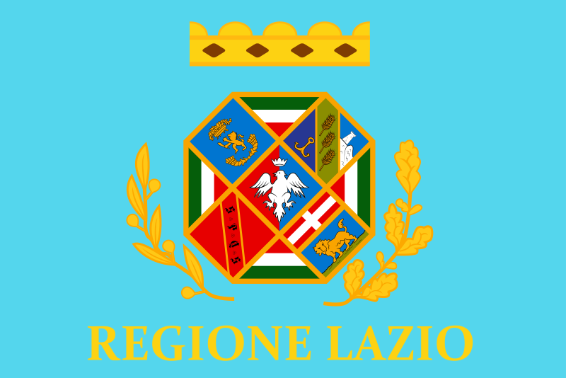 Lazio
Lazio
 History
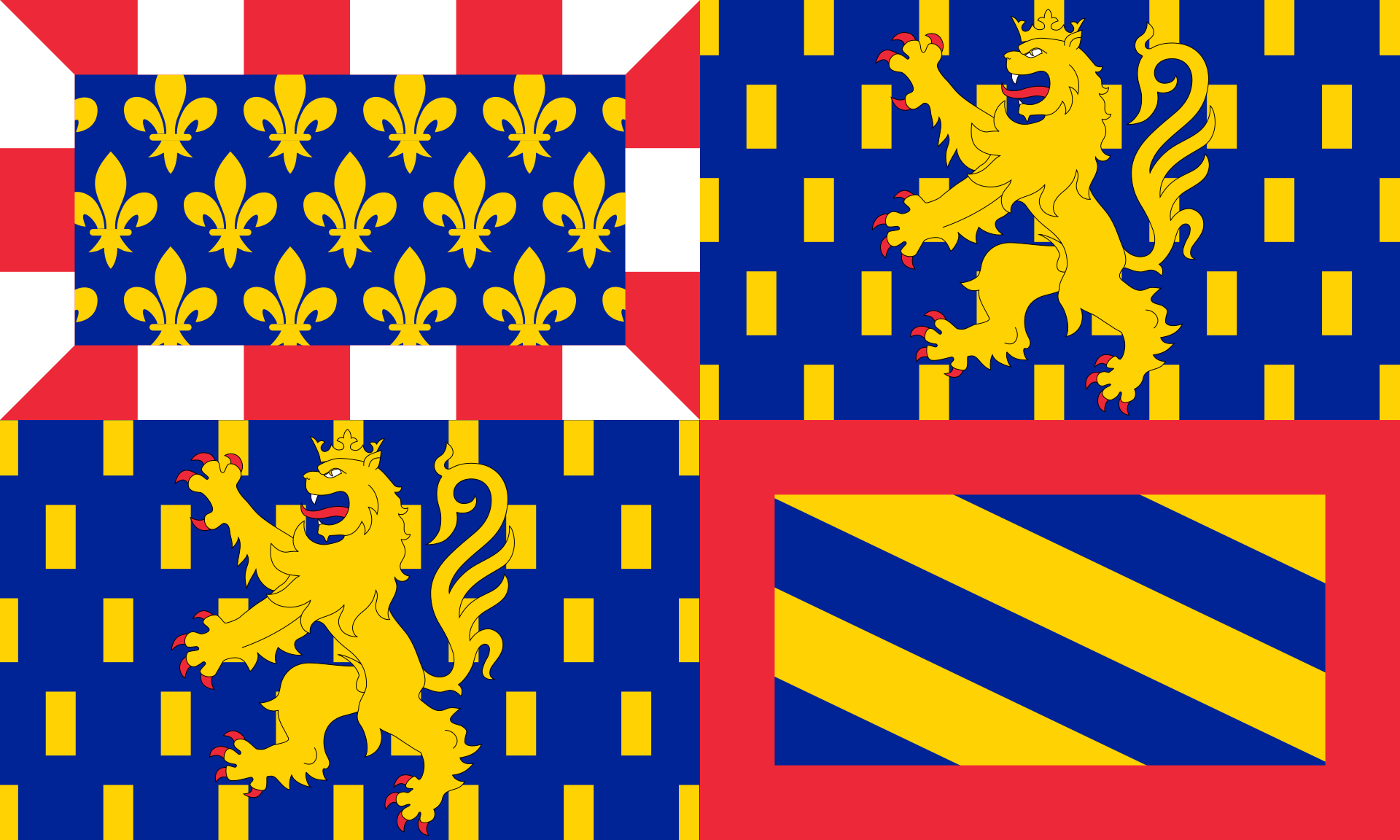 Bourgogne-Franche-Comté
 Rhineland-Palatinate
 Vacation and Travel