
Deutsch-Chinesische Enzyklopädie, 德汉百科


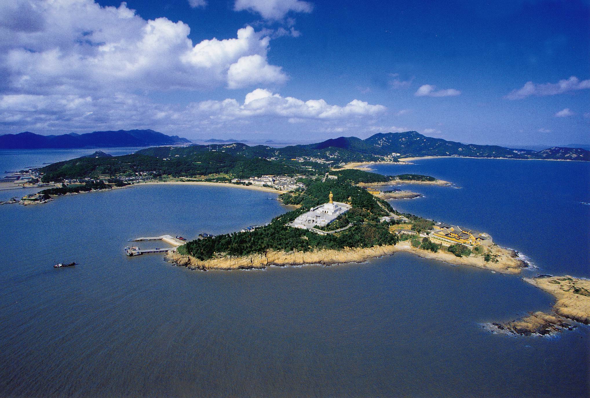
Shōdoshima (jap. 小豆島, dt. „Adzukibohneninsel“) ist die zweitgrößte Insel in der Seto-Inlandsee in Japan.
Auf der Insel gibt es zwei Gemeinden, Tonoshō und Shōdoshima (früher Ikeda und Uchinomi), die den Landkreis Shōzu bilden. Als die japanische Regierung Ende des 19. Jahrhunderts versuchte, die einheimische Landwirtschaft durch Übernahme westlicher Methoden und Kulturpflanzen zu stärken, war die Insel das erste Gebiet, auf dem in Japan erfolgreich Oliven angebaut wurden. Sie heißt daher manchmal auch „Oliven-Insel“.
Zwischen Shōdoshima und der westlich liegenden Nachbarinsel Maeshima liegt die Dobuchi-Straße (土渕海峡, Dobuchi-kaikyō), die schmalste Meerenge der Welt mit 9,93 m Breite an der schmalsten Stelle.
Shōdoshima gehört zur Präfektur Kagawa und liegt nördlich der Präfekturhauptstadt Takamatsu. Sie hat eine Fläche von 153,25 km²[1] und eine Küstenlinie von 126 km. Sie liegt von der Größe her auf dem 23. Platz der Inseln Japans und ist die zweitgrößte der Inlandsee.
小豆岛(日语:小豆島/しょうどしま Shōdoshima */?)是位于日本濑户内海播磨滩的岛,面积153.30平方公里,海岸线长126公里,为日本第19大、濑户内海内第2大岛。岛上有小豆岛町、土庄町2町,行政区划皆属于香川县小豆郡。
小豆岛的寒霞溪是濑户内海国立公园著名的风景名胜之一,称为“日本三大溪谷美景”。从岛屿的最高峰星城山(海拔816米)穿过美原高原(海拔777米),在约8公里的南侧山坡上,长年侵蚀而成的集块岩形成一带奇景。 境内拥有世界最窄的土渕海峡。

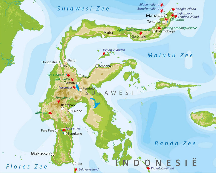
苏拉威西岛(印尼语:Sulawesi)旧名西里伯或西里伯斯,《职方外纪》称则勒伯(荷兰语:Celebes),是印度尼西亚东部的一个大岛屿。
苏拉威西岛按面积是世界第十一大岛,总面积为174,600平方公里[来源请求],位于印度尼西亚东部,菲律宾南方,形状非常特别,类似一个大K字母,有四个半岛,岛中部是险峻的山区,因此四个半岛之间很少来往,从海路连接比从陆路方便。
苏拉威西岛的行政区域分为6个省:西苏拉威西省、北苏拉威西省、中苏拉威西省、南苏拉威西省、东南苏拉威西省和哥伦打洛省。最大的城市是西南部的望加锡,还有北部的万鸦老也是较大的城市。
Sulawesi (früher Celebes) ist eine indonesische Insel zwischen Borneo und Neuguinea mit einer Fläche von 189.216 km².
Die Bevölkerung konzentriert sich im Südwesten um Makassar und im Norden um Manado, Kota Gorontalo, Poso, Palu und Luwuk.
Die Insel ist vulkanischen Ursprungs und daher stark gegliedert und von sehr unregelmäßiger Gestalt; ihre Form erinnert an einen Elefanten oder Kraken. Von der Celebessee im Norden führt die Makassarstraße im Westen von Sulawesi in die Javasee. Im Westen liegt Borneo, im Osten die Inselgruppe der Molukken, im Süden Flores, im Nordosten liegen die Sangihe- und die Talaud-Inseln.
Sulawesi wird im nördlichen Teil vom Äquator durchschnitten, was für das zentrale Bergland starke Niederschläge das ganze Jahr über bedeutet. Die Folge ist eine üppige Vegetation mit dichtem Regen- und Hochnebelwald, in dem vereinzelt indigene Gruppen leben. Zu den Seen der Insel gehören der Poso-See in Zentralsulawesi sowie die Malili-Seen, bestehend aus den größeren Seen Matano und Towuti und den kleineren Seen Lontoa, Mahalona und Masapi im Südosten der Insel.


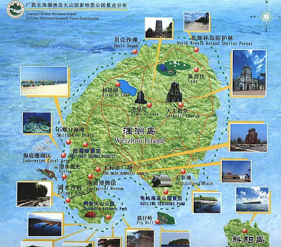
Weizhou Dao (chinesisch 涠洲岛, Pinyin Wéizhōu Dǎo, englisch Weizhou Island ‚Weizhou-Insel‘) ist eine im Golf von Tonkin (Beibu Wan) gelegene chinesische Insel. Sie liegt 56 km westlich der Leizhou-Halbinsel, 35 km südlich der Stadt Beihai des Autonomen Gebiets Guangxi der Zhuang-Nationalität östlich von Vietnam. Es ist mit einer Fläche von rund 25 km² die größte Insel Guangxis.

 Geography

 Animal world