Deutsch-Chinesische Enzyklopädie, 德汉百科

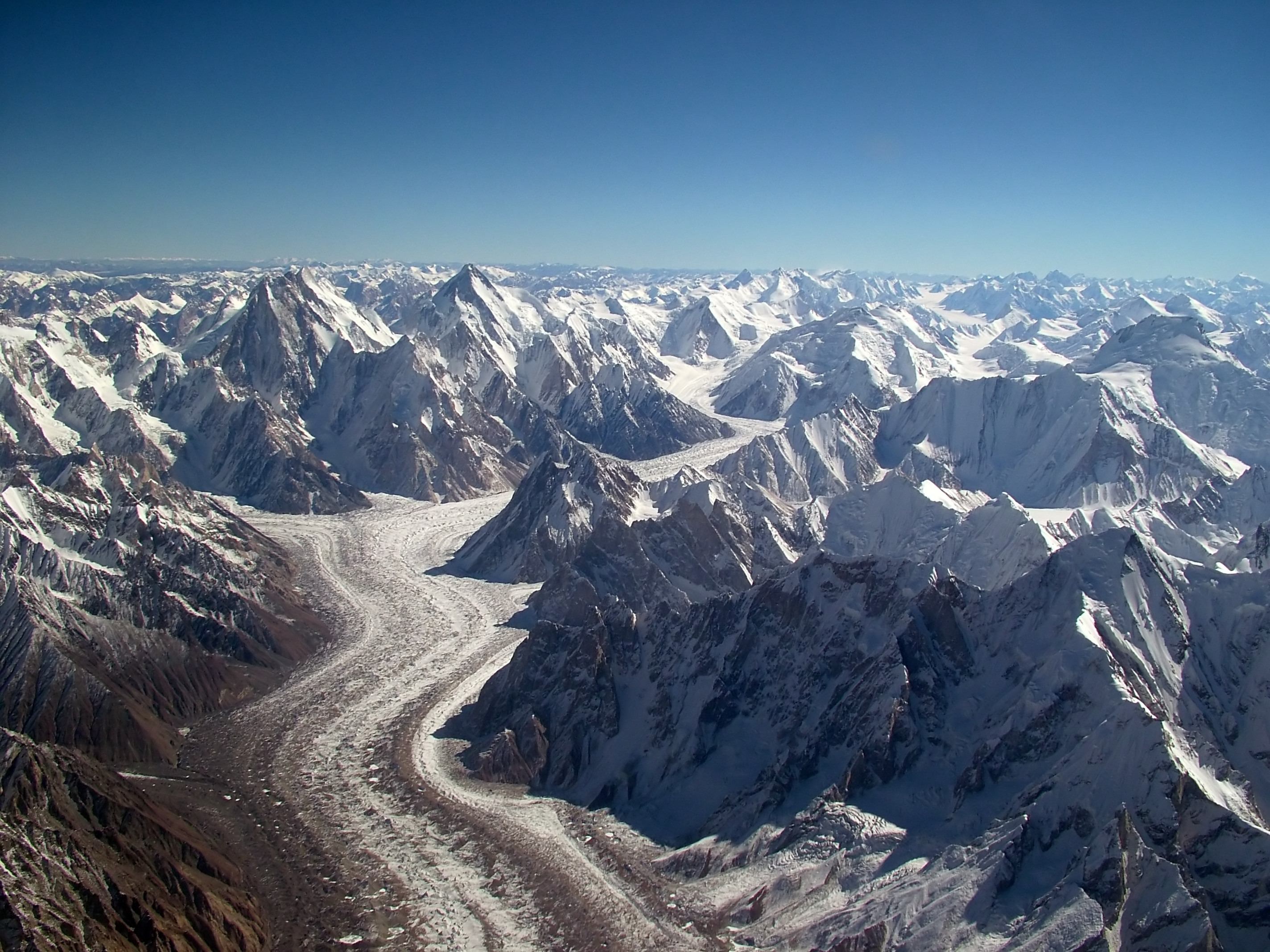
 Geography

 Vacation and Travel
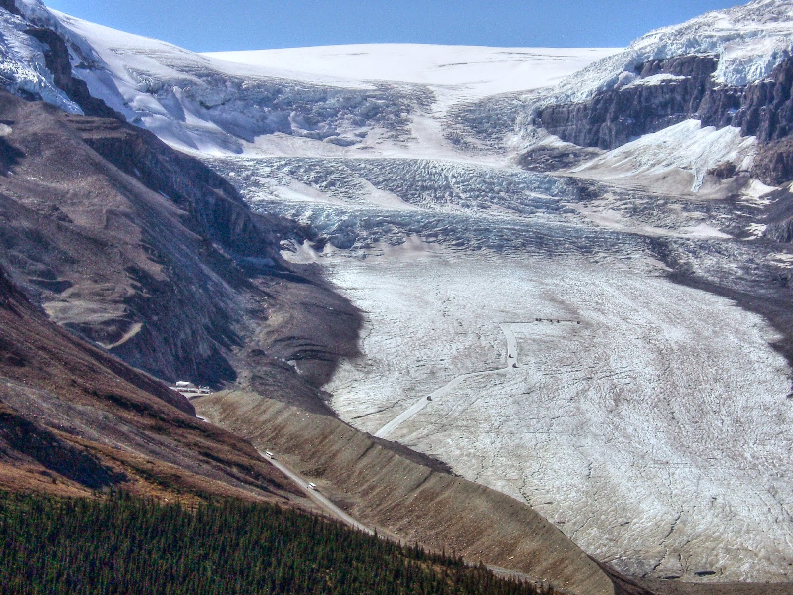
 Alberta-AB
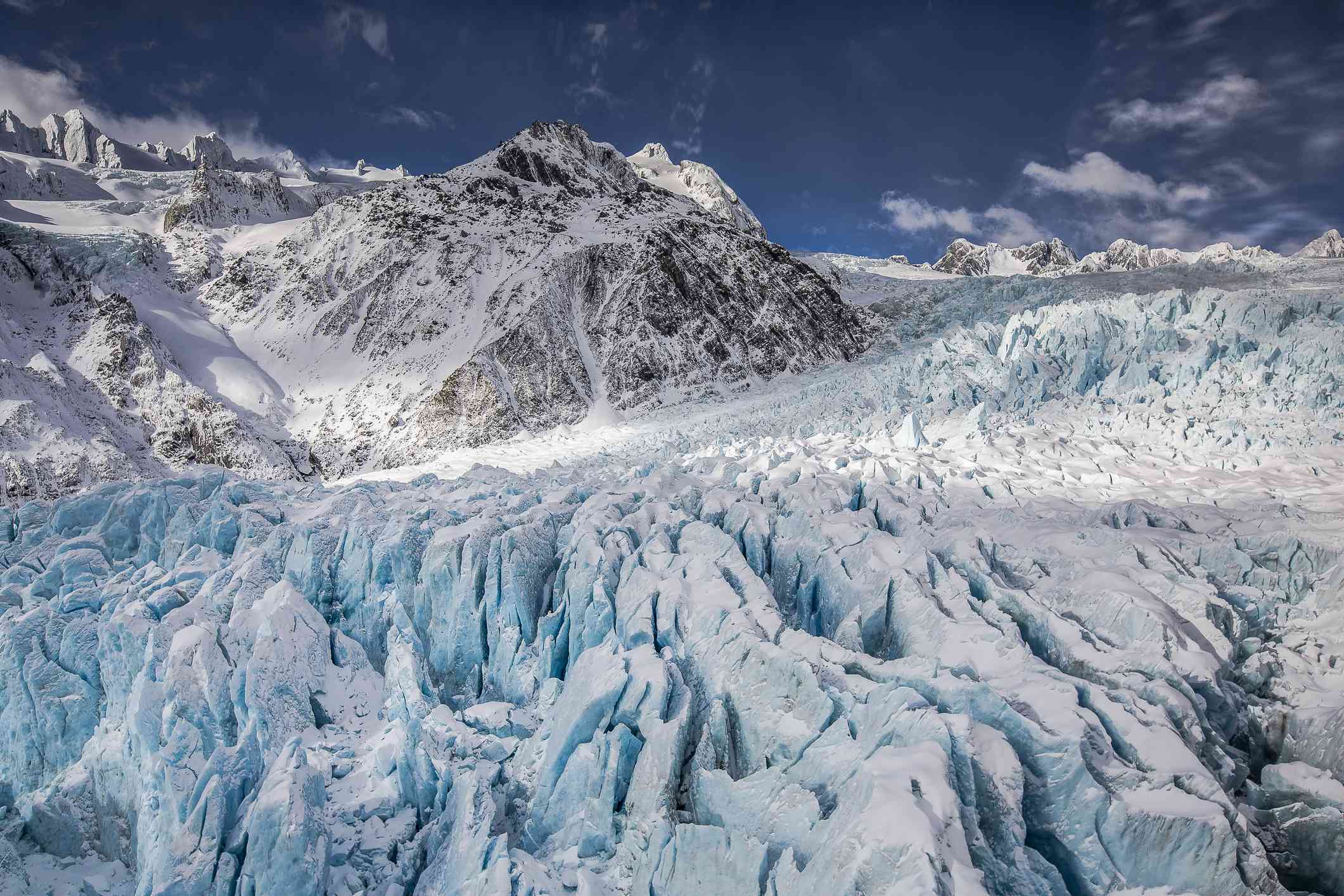
 Animal world
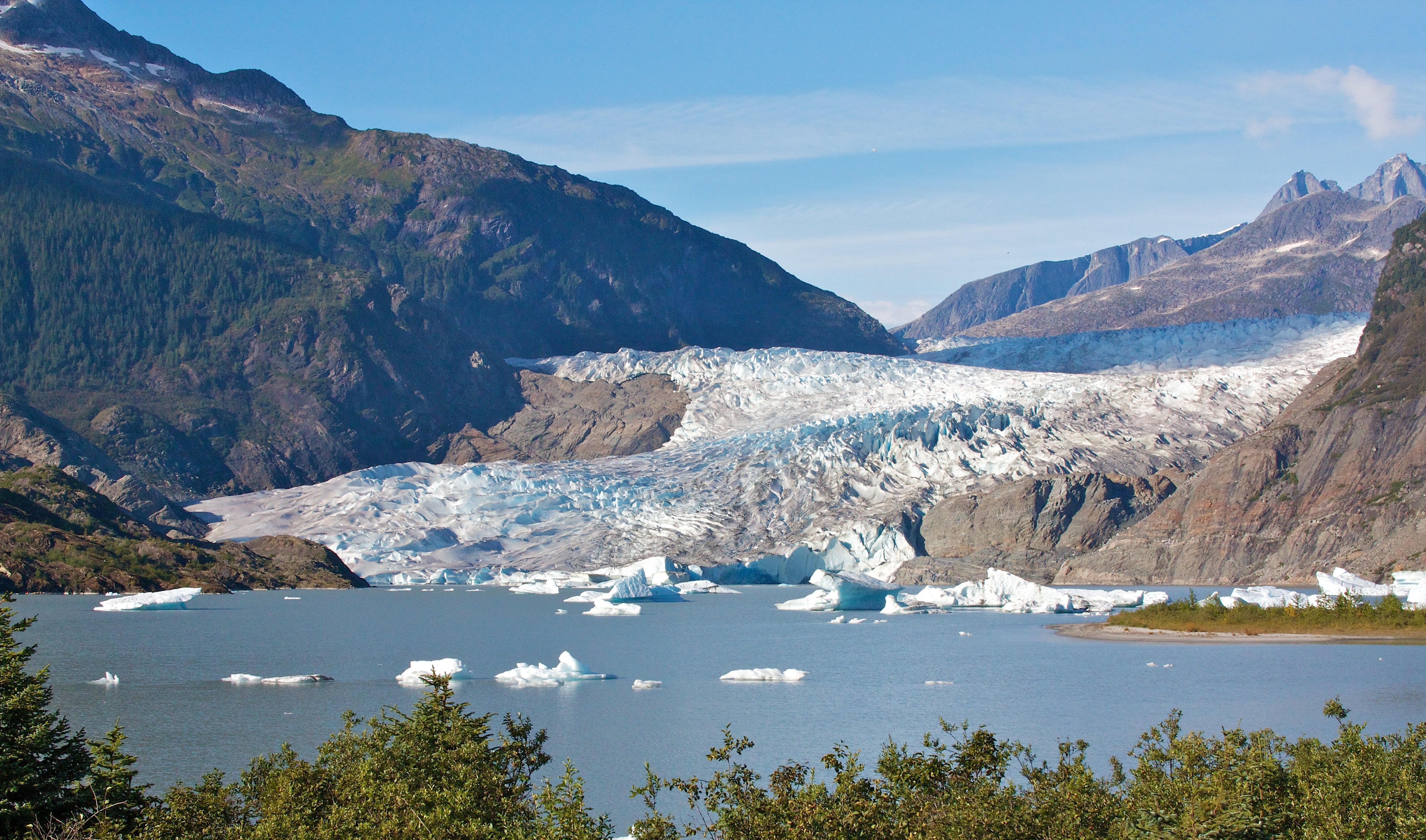
 Alaska-AK

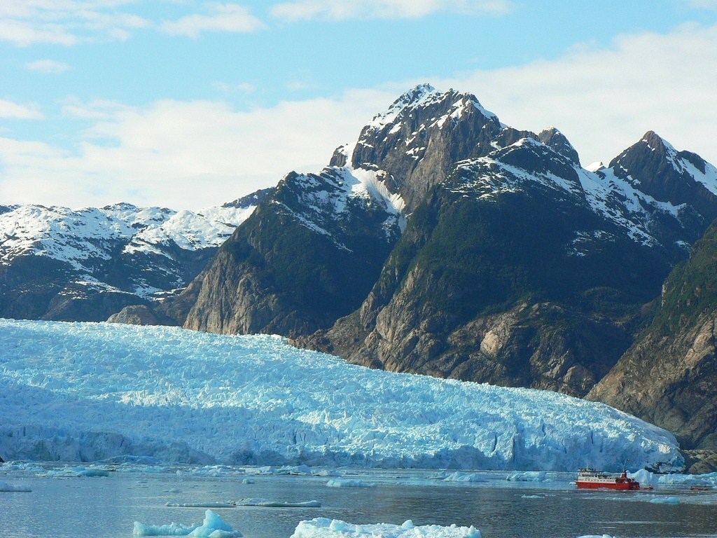
Der Glacier-Bay-Nationalpark (englisch Glacier Bay National Park and Preserve) ist ein Nationalpark der USA im Süden von Alaska, in der Nähe von Juneau, im sogenannten Alaska Panhandle. Im Park gibt es über 50 benannte Gletscher, 7 davon reichen bis in das von den Gezeiten beeinflusste Wasser der von Fjorden wie dem Tarr Inlet durchzogenen, Glacier Bay genannten Bucht („Gletscher-Bucht“). Dort brechen häufig über 50 Meter hohe Eisbrocken ab und fallen explosionsartig in das Wasser (Kalben).
冰川湾国家公园(英语:Glacier Bay National Park and Preserve)是位于美国阿拉斯加州南部的一个国家公园。冰川湾国家公园最初于1925年2月25日设为国家纪念区。于1979年被UNESCO登录为世界自然遗产。1980年12月2日,升格为冰川湾国家公园。1986年,冰川湾国家公园被划入生物圈保护区。公园面积达13,287平方公里。冰川湾国家公园是熊、驯鹿、雪羊、鲸鱼、水鸟等动物的栖息地。冰川湾国家公园内没有道路,因此主要的游览方式是通过游船或飞机在空中游览。

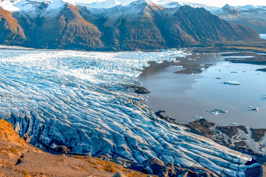
阿根廷冰川国家公园(Los Glaciares National Park)是世上罕见存在大型活冰川的国家公园,目前全球有3个冰川国家公园,北美洲2个,分别位于美国和加拿大。由于全球气候变暖,美国那个公园内的大 冰川近年逐步变成小冰川,小冰川干脆消失了,留下许多形态各异的山川、湖泊和瀑布。
阿根廷冰川国家公园位于阿根廷南部Santa Cruz省,安第斯山脉南端巴塔哥尼亚(Patagonia)高原,紧邻智利边界,面积4459平方公里。1937年,阿根廷政府在这里建立了国家公 园,1945年,冰川国家公园正式破土动工,1981年联合国教科文组织(UNESCO)依据自然遗产遴选标准N(II)(III)将其批准为世界自然遗 产。这个冰川区有47座大型冰川,13座流向大西洋,其中10座位于公园内,通常游客前往Perito Moreno冰川游览。Moreno冰川是世界上唯一一个旅游者可以轻松接近的冰川,面积约250平方公里,发源于南巴塔哥尼亚冰原,这个冰原是世界第三 大淡水储存库,仅次于南极和格陵兰冰原。Moreno冰川长约35公里,其最前端是一条宽约4000米,高60米的冰坝,溶化的冰水注入阿根廷湖 (Lago Argentino),经Santa Cruze河最终流入大西洋。(Quelle:http://www.ccthere.com)
冰川国家公园 (西班牙語:Parque Nacional Los Glaciares)是巴塔哥尼亞地区的一座国家公园,位于阿根廷圣克鲁斯省,总面积4459 km²。[1]1981年被联合国教科文组织列入世界遗产。
冰川国家公园建立于1937年,是阿根廷第二大的国家公园。公园名称里的“冰川”指的是在安第斯山脉附近的47个巨大的冰盖,其中有13个流向大西洋。国家公园里的冰盖是世界上除了南极和格陵兰以外最大的。在世界的其他地方,冰川至少要在平均海拔高于2500米的高度处才开始形成,但由于这里冰川的规模较大,1500米时即形成了冰川。
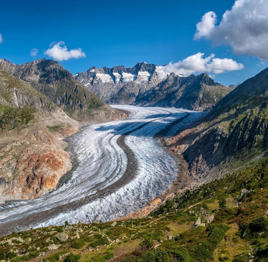
Der Nationalpark Los Glaciares (spanisch Parque Nacional Los Glaciares = „die Gletscher“) liegt im argentinischen Teil Patagoniens (Provinz Santa Cruz). Er bedeckt eine Fläche von 4459 km² und wurde von der UNESCO 1981 in die Welterbeliste aufgenommen.
Der Nationalpark besteht neben einigen kleineren Gletschern im Wesentlichen aus den drei großen Gletschern Perito-Moreno-Gletscher, Upsala-Gletscher und Viedma-Gletscher. Diese münden in zwei Seen, den Lago Argentino und den Lago Viedma, die jedoch nur teilweise innerhalb des Nationalparks liegen. Am Upsala-Arm des Lago Argentino liegt die Bahía Onelli.
Im Nordteil des Parks befinden sich die Granitberge Cerro Fitz Roy und Cerro Torre, welche für Bergsteiger und Trekking-Touristen von Interesse sind.
Im Süden des Nationalparks grenzt der chilenische Nationalpark Torres del Paine an.
Los Glaciares wird von Touristen aus aller Welt besucht. Ausgangspunkt ist die am Lago Argentino gelegene Kleinstadt El Calafate sowie das 1985 gegründete Dorf El Chaltén.
 Carinthia