Deutsch-Chinesische Enzyklopädie, 德汉百科

       
German — Chinese
Geography Caribbean

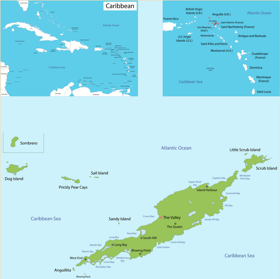
安圭拉
This image, video or audio may be copyrighted. It is used for educational purposes only. If you find it, please notify us byand we will remove it immediately.
安提瓜和巴布达
/assets/contentimages/normal_Flag_of_Antigua_and_Barbuda.png /assets/contentimages/normal_Coat_of_arms_of_Antigua_and_Barbuda.png
This image, video or audio may be copyrighted. It is used for educational purposes only. If you find it, please notify us byand we will remove it immediately.
阿鲁巴
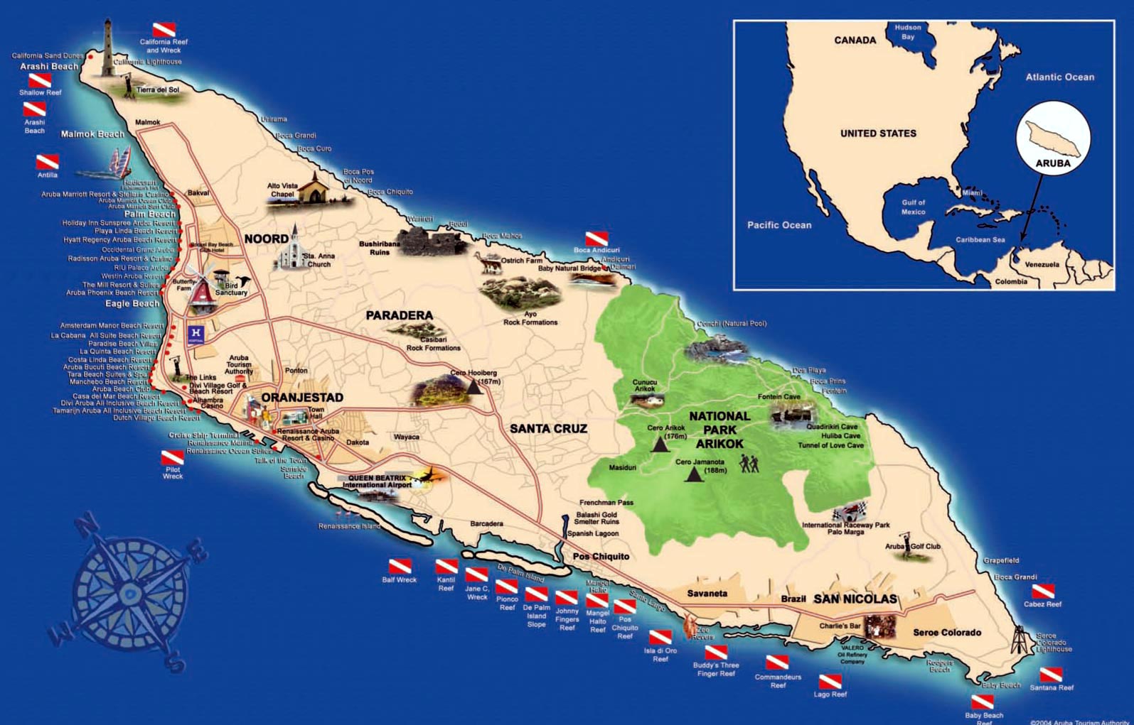
Aruba [aˈruːba] ist die erste der drei ABC-Inseln (Aruba, Bonaire, Curaçao), die geologisch zu Südamerika gehören und Teil der Kleinen Antillen in der südlichen Karibik sind. Die Insel liegt 25 Kilometer nördlich von Venezuela. Sie ist neben Curaçao und Sint Maarten sowie den Niederlanden (bestehend aus den Niederlanden in Europa sowie Bonaire, Sint Eustatius und Saba in der Karibik) eines der vier gleichberechtigten Länder des Königreiches der Niederlande.
http://www.net4info.de/photos/cpg/albums/userpics/10001/Aruba.jpg

阿鲁巴(Aruba)是一个位于加勒比地区岛屿,位于南美国家委内瑞拉北方的委内瑞拉湾外海,仅距离巴拉瓜纳半岛约25公里,従自哥伦比亚东北方约89公里。阿鲁巴目前是荷兰王国四个构成国之一。由于气候干燥,常见热带植物数量不多,岛上的景象与一般人对加勒比海所抱持的既有印象大异其趣。

Aruba [aˈruːba] ist die erste der drei ABC-Inseln (Aruba, BonaireCuraçao), die geologisch zu Südamerika gehören und Teil der Kleinen Antillen in der südlichen Karibik sind. Die Insel liegt 25 Kilometer nördlich von Venezuela. Sie ist neben Curaçao und Sint Maarten sowie den Niederlanden (bestehend aus den Niederlanden in Europa sowie BonaireSint Eustatius und Saba in der Karibik) eines der vier gleichberechtigten Länder des Königreiches der Niederlande. Wie die anderen Länder hat auch Aruba eine eigene Verfassung, Währung und Regierung. Die Insel genießt vollkommene innere Autonomie, ist aber kein souveräner Staat, besitzt also keine äußere Souveränität. Aruba gehört nicht zum Schengen-Raum.
This image, video or audio may be copyrighted. It is used for educational purposes only. If you find it, please notify us byand we will remove it immediately.
巴巴多斯
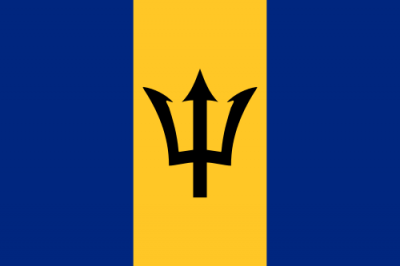
/assets/contentimages/normal_Flag_of_Barbados.png /assets/contentimages/normal_Coat_of_arms_of_Barbados.png
This image, video or audio may be copyrighted. It is used for educational purposes only. If you find it, please notify us byand we will remove it immediately.
巴斯特尔岛
This image, video or audio may be copyrighted. It is used for educational purposes only. If you find it, please notify us byand we will remove it immediately.
伯利兹
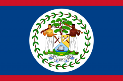
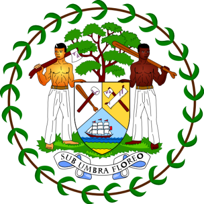
/assets/contentimages/normal_Flag_of_Belize.png /assets/contentimages/normal_Coat_of_arms_of_Belize.png
This image, video or audio may be copyrighted. It is used for educational purposes only. If you find it, please notify us byand we will remove it immediately.
委内瑞拉玻利瓦尔共和国
Amtssprache Spanisch daneben Wayuu, Warao, Pemón, Mapoyo, Panare, Puinave, Pémono, Sapé, Sikiana, Yabarana und Yaruro Hauptstadt Caracas Fläche 912.050 km² Einwohnerzahl 31,7 Millionen (2023) Währung Bolívar digital (VED) Unabhängigkeit 5. Juli 1811 (von Spanien) 1821 anerkannt National­hymne Gloria al bravo pueblo Nationalfeiertag 5. Juli (Freiheitserklärung) Kfz-Kennzeichen YV ISO 3166 VE, VEN, 862 Internet-TLD .ve Telefonvorwahl +58

/assets/contentimages/normal_Flag_of_Venezuela.png /assets/contentimages/normal_Coat_of_arms_of_Venezuela.png

This image, video or audio may be copyrighted. It is used for educational purposes only. If you find it, please notify us byand we will remove it immediately.
博奈爾 博奈尔
Die Insel Bonaire [boˈnɛːr[ə]] ist geographisch Teil der Kleinen Antillen. Politisch ist sie zusammen mit ihrer unbewohnten Nebeninsel Klein Bonaire eine Besondere Gemeinde der Niederlande. Sie ist die zweitgrößte der ABC-Inseln (Aruba, Bonaire, Curaçao). Die „Besonderen Gemeinden“ Bonaire, Sint Eustatius und Saba werden wiederum als „BES(-Inseln)“ zusammengefasst.[7] Bonaire gehört nicht zum Schengen-Raum.

博奈尔荷兰语:Bonaire)是加勒比海中一岛屿,现为荷兰公共实体,与附近的荷兰王国构成国阿鲁巴库拉索并称为“ABC群岛”,与同为荷兰公共实体的圣尤斯特歇斯萨巴合称为“BES岛屿”。首府是克拉伦代克

Die Insel Bonaire [boˈnɛːr[ə]] ist geographisch Teil der Kleinen Antillen. Politisch ist sie zusammen mit ihrer unbewohnten Nebeninsel Klein Bonaire eine Besondere Gemeinde der Niederlande. Sie ist die zweitgrößte der ABC-Inseln (ArubaBonaire, Curaçao). Die „Besonderen Gemeinden“ Bonaire, Sint Eustatius und Saba werden wiederum als „BES(-Inseln)“ zusammengefasst.[7] Bonaire gehört nicht zum Schengen-Raum.

Die Gesamtfläche beträgt 288 Quadratkilometer, die Bevölkerungszahl etwa 18.000. Inselhauptstadt ist Kralendijk (von Koralendijk ‚Korallendeich‘). Die älteste Siedlung ist Rincon. Touristisch attraktiv ist die Insel vor allem durch die Unterwasserwelt.

This image, video or audio may be copyrighted. It is used for educational purposes only. If you find it, please notify us byand we will remove it immediately.
英属维尔京群岛/British Virgin Islands,BVI
/assets/contentimages/British_Virgin_Islands.jpg
This image, video or audio may be copyrighted. It is used for educational purposes only. If you find it, please notify us byand we will remove it immediately.
巴哈马联邦
Amtssprache Englisch Hauptstadt Nassau Fläche 13.939 km² Einwohnerzahl 393.000 (2020) Währung Bahama-Dollar (BSD) Unabhängigkeit 10. Juli 1973 (vom Vereinigten Königreich) National­hymne March On, Bahamaland Nationalfeiertag 10. Juli Kfz-Kennzeichen BS ISO 3166 BS, BHS, 044 Internet-TLD .bs Telefonvorwahl +1 (242)

/assets/contentimages/normal_Flag_of_the_Bahamas.png /assets/contentimages/normal_Coat_of_arms_of_Bahamas.png

This image, video or audio may be copyrighted. It is used for educational purposes only. If you find it, please notify us byand we will remove it immediately.
多米尼克联邦


/assets/contentimages/Commonwealth_von_Dominica.png /assets/contentimages/Coat_of_arms_of_Dominica.png

This image, video or audio may be copyrighted. It is used for educational purposes only. If you find it, please notify us byand we will remove it immediately.
库拉索
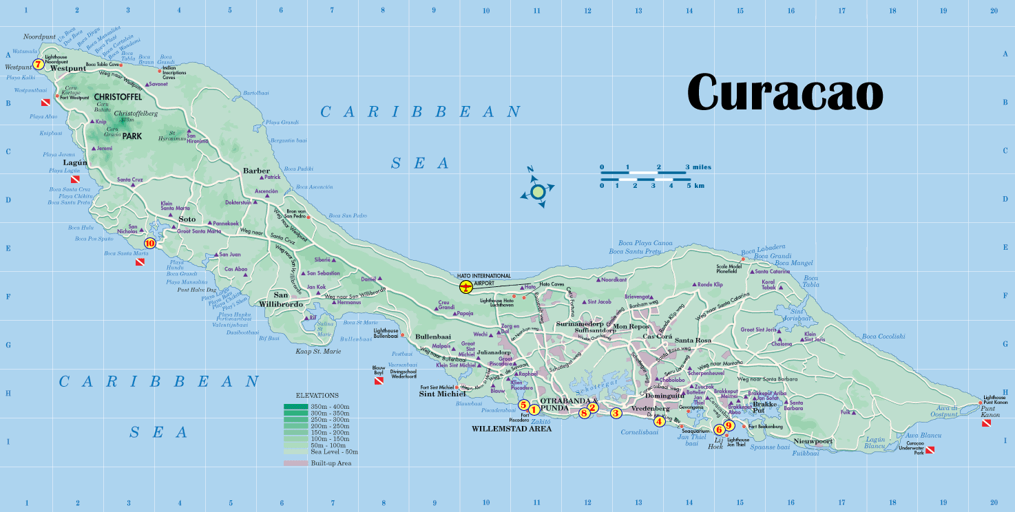
Curaçao [kyʀaˈsaːo] (niederländisch) (papiamentu Kòrsou) ist eine rund 444 Quadratkilometer große Insel und zusammen mit der Nebeninsel Klein Curaçao ein Land des Königreichs der Niederlande in der Karibik.
http://www.net4info.de/photos/cpg/albums/userpics/10001/Curacao.gif

库拉索荷兰语:Curaçao,荷兰语发音:[ky.ra.ˈsʌʊ̯]帕皮阿门托语:Kòrsou)是位于加勒比海南部,靠近委内瑞拉海岸的岛屿。该岛原为荷属安的列斯群岛的一部分,2010年10月10日后改制为荷兰王国构成国。库拉索首府是港口城市威廉斯塔德,过去也是荷属安的列斯的首府。库拉索与邻近的阿鲁巴博奈尔经常被合称为“ABC群岛”。

库拉索岛面积444平方千米,是荷属安的列斯中的最大岛屿。

Curaçao [kyʀaˈsaːo] (niederländisch) (papiamentu Kòrsou) ist eine rund 444 Quadratkilometer große Insel und zusammen mit der Nebeninsel Klein Curaçao ein Land des Königreichs der Niederlande in der Karibik.

Curaçao ist eine der drei ABC-Inseln und als solche Teil der karibischen Inseln unter dem Winde (südliche Kleine Antillen), die geologisch zur Südamerikanischen Kontinentalplatte gehören. Obwohl Curaçao Teil des Königreichs der Niederlande ist, gehört es weder zur Europäischen Union noch zum Schengen-Raum. Curaçao ist aber mit der Europäischen Union assoziiert.

This image, video or audio may be copyrighted. It is used for educational purposes only. If you find it, please notify us byand we will remove it immediately.