漢德百科全書 | 汉德百科全书
 Geography

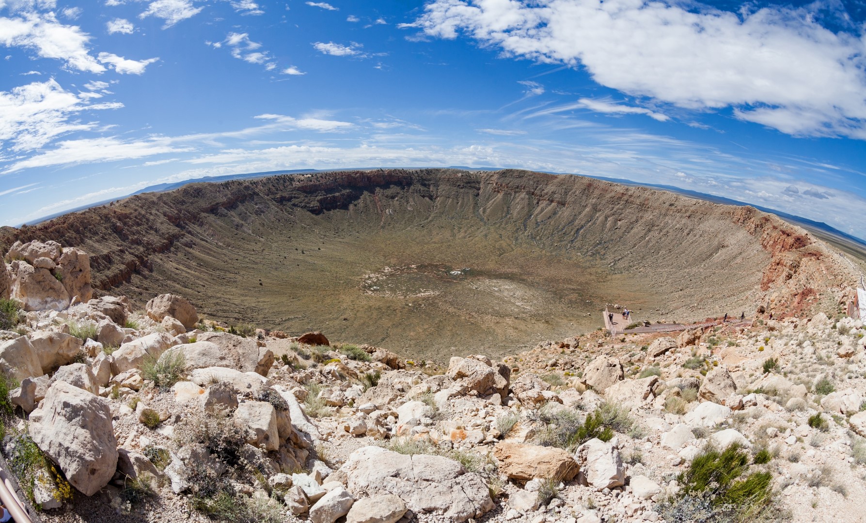
 Arizona-AZ
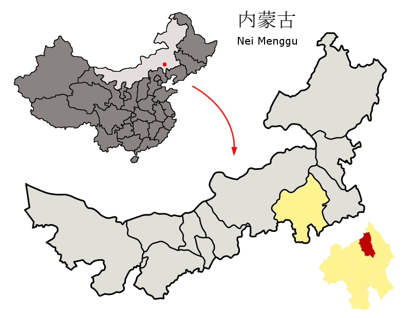
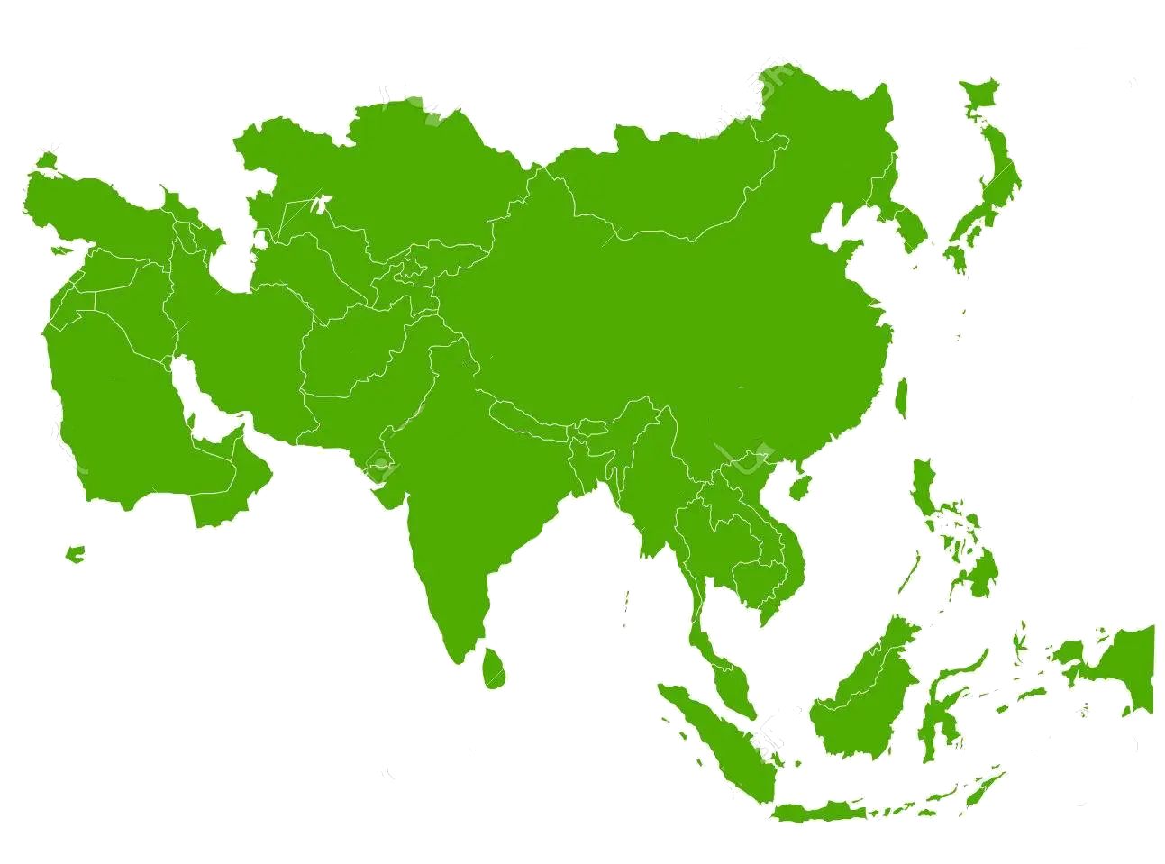 States of Asia


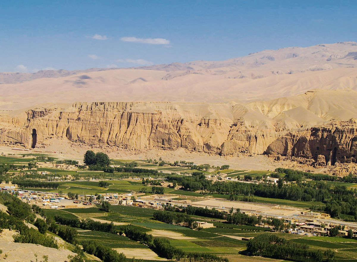
 Afghanistan


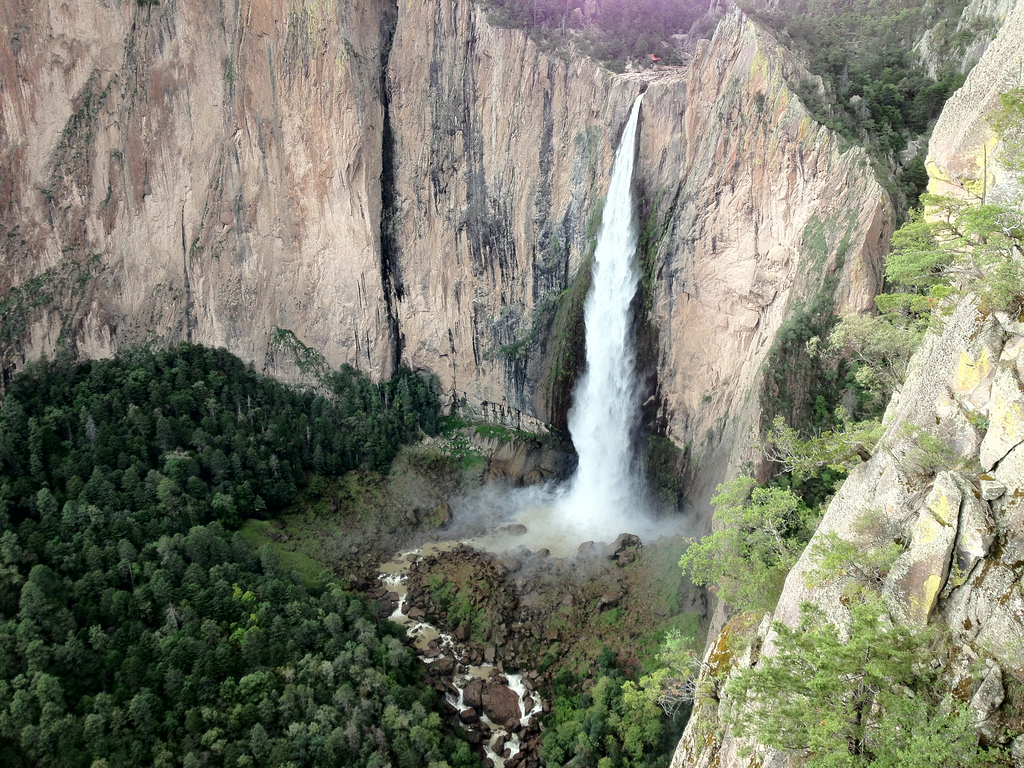
 Science and technology

Der Panamakanal ist eine künstliche, etwa 82 km lange Wasserstraße mit Schleusen und einer Scheitelhaltung von 26 m Höhe, die die Landenge von Panama in Mittelamerika durchschneidet, den Atlantik mit dem Pazifik für die Schifffahrt verbindet und ihr damit die sehr viel längere und gefährlichere Fahrt um das Kap Hoorn oder durch die Magellanstraße an der Südspitze Südamerikas erspart. Arbeiten verschiedener Aktiengesellschaften und schließlich der Vereinigten Staaten begannen 1881 bzw. 1894. Der am 15. August 1914 eröffnete und 2016 für größere Schiffe erweiterte Kanal ist eine der wichtigsten Wasserstraßen der Welt. Bei täglich 30–40 Passagen durchfahren ihn über 14.000 Schiffe pro Jahr (2021 waren es krisenbedingt 13.321[1]; 2022 bereits wieder 14.239[2]).
Die Abmessungen der Schleusen und Fahrrinnen des ursprünglichen Kanals genügten bis Mitte 2016 nur für Schiffe bis zur Panamax-Größe, also beispielsweise Containerschiffe mit 4.600 Standardcontainern (TEU), die nach den Maßstäben dieser Zeit lediglich mittelgroße Schiffe darstellten. Seit die 2007 begonnene Erweiterung am 26. Juni 2016 eröffnet wurde, können ihn Schiffe mit 14.000 TEU passieren (Neopanamax-Klasse).[3][4]
Die durch den Panamakanal transportierte Warenmenge entspricht etwa fünf Prozent des weltweiten Seefrachtverkehrs. Der Kanal erwirtschaftete 2013 fast acht Prozent des panamaischen Bruttoinlandsprodukts.[5]
Ab November 2023 war die Kapazität des Kanals wegen eines beispiellosen Wassermangels reduziert. Für den Februar 2024 wurden nur 18 Durchfahrten pro Tag angeboten.[6]
巴拿马运河(西班牙语:Canal de Panamá)位于中美洲的巴拿马,横穿巴拿马地峡,连接太平洋与大西洋,全长82公里,大致呈西北-东南走向。运河最宽处达304米,最窄处也有152米,是世界的航运要道之一。
运河在太平洋一侧有两座船闸,在大西洋一侧有一座船闸。在大西洋一侧的船闸有三层,高达21米,每扇有745吨重,但平衡相当好,只要30千瓦功率的电机即可驱动开合。船室长305米,宽33.5米,船只在船闸中被提升26米,进入人工筑坝拦截查格里河形成的嘎顿湖,通过运河再经过一座单层船闸降到海拔16.5米,进入米拉弗洛湖,最后经过一座双层船闸降到海平面高度进入太平洋。每座船闸都是成对的,所以可以双行,船只在船闸中由轨道牵引机牵引行动。太平洋海面比大西洋海面高24厘米,并且潮汐较高。嘎顿湖中有几个小岛,是野生动物保护区。
1881年,法国人开始建造巴拿马运河,但很快由于工程技术问题和劳工的高死亡率而停工。美国于1904年接手这一工程,并于1914年8月15日建成。作为人类有史以来最大的工程项目之一,巴拿马运河极大地缩短了船只来往于大西洋和太平洋之间的时间,使船只能够避开遥远而危险的合恩角附近的麦哲伦海峡和德雷克海峡。
在运河的建造过程中,哥伦比亚、法国和美国先后控制了运河周边的区域。美国之后一直控制着运河和其周边的巴拿马运河区,并维持多个军事基地,直到1977年签署《巴拿马运河条约》后,美国才着手将控制权移交给巴拿马。美国和巴拿马共同管理运河一段时期后,最终在1999年美军撤出,将运河完全移交给巴拿马政府,并由其所属的巴拿马运河管理局管理至今。
每年通过巴拿马运河的船只数量从1914年的约1,000艘,增长到了2008年的14,702艘,总装载重量约为3.337亿吨。直到2012年,至少815,000艘船只曾通过巴拿马运河。[1]船只通过运河需要花费11小时。

巴塞尔城市州(德语:Kanton Basel-Stadt,法语:Bâle-Ville,意大利语:Basilea Città,罗曼语:Basilea-Citad)是瑞士面积最小的州,同时也是人口密度最大的州。传统上所称的“半州”,它位于瑞士的西北部,由巴塞尔市、里恩镇(Riehen)和贝廷根镇(Bettingen)组成。Basel-Stadt (Kürzel BS; französisch Bâle-Ville, italienisch Basilea Città, rätoromanisch Basilea-Citadⓘ/?) ist ein Kanton in der Schweiz. Der Hauptort und zugleich einwohnergrösste Ort ist die Stadt Basel. Der Kanton zählt zum Wirtschaftsraum Nordwestschweiz und zur Metropolregion Basel.

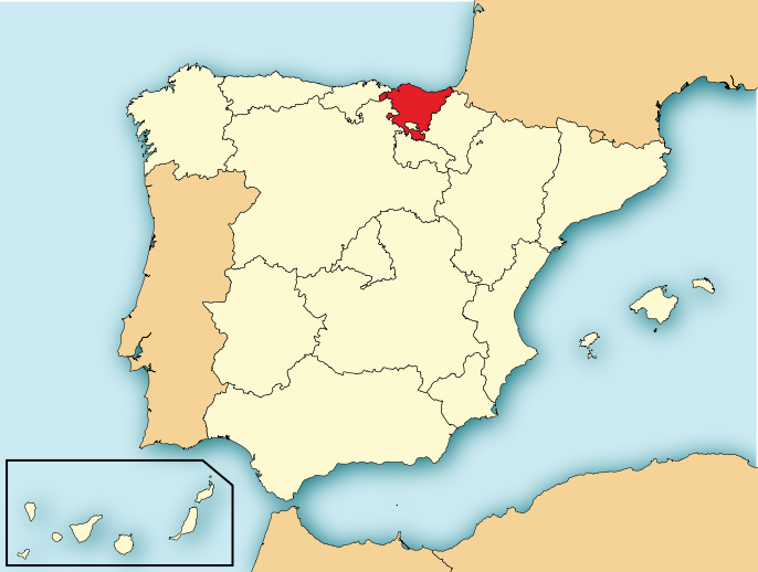
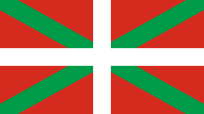
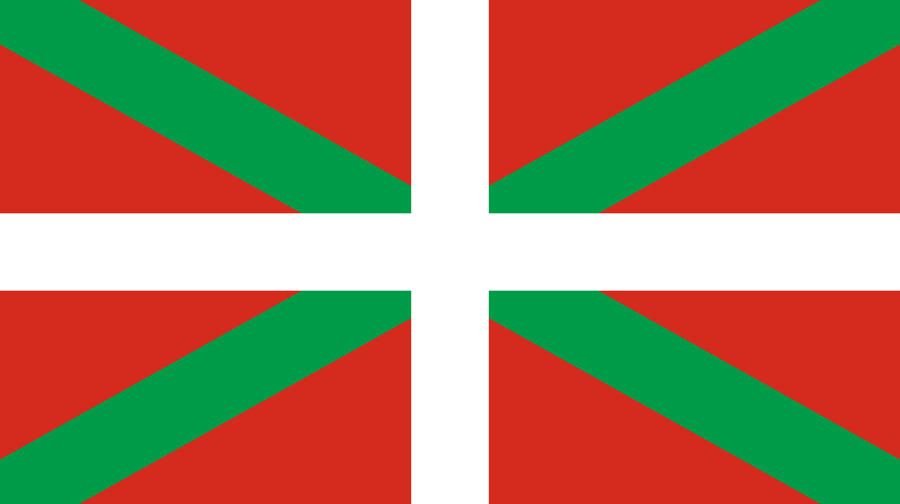 Comunidad Autónoma del País Vasco