
Deutsch-Chinesische Enzyklopädie, 德汉百科
 Geography


英吉利海峡,又名拉芒什海峡(英语:English Channel;法语:la Manche;布列塔尼语:Mor Breizh;威尔士语:Môr Udd、康瓦尔语:Mor Bretannek),是分隔英国与欧洲大陆的法国、并连接大西洋与北海的海峡。海峡长560公里(350英里),宽240公里(150英里),最狭窄处又称多佛尔海峡,仅宽34公里(21英里)。英国的多佛尔与法国的加莱在此处隔海相望。
Der Ärmelkanal (englisch English Channel, wörtlich ‚Englischer Kanal‘; französisch La Manche, wörtlich‚ Der Ärmel‘) ist ein Meeresarm des Atlantiks und verbindet diesen über die Straße von Dover mit der Nordsee.
Der Ärmelkanal liegt zwischen Großbritannien im Norden und Frankreich im Süden. Nach der Definition der International Hydrographic Organization wird die Ostgrenze zur Nordsee durch eine Linie gebildet, die etwa zehn Kilometer östlich der Line Dover-Calais zwei historische Landmarken[1] verbindet. Die Westgrenze wird durch die Linie von Land’s End zum Leuchtturm der Île Vierge gebildet.
Im Kanal liegen die britischen Kanalinseln und die Isle of Wight, die von einem Seitenarm, dem Solent, umschlossen wird. Der größte Fluss, der in den Kanal mündet, ist die Seine. Bekannte Städte am Kanal sind Southampton und Plymouth (beide Großbritannien) und Le Havre (Frankreich).
Der Ärmelkanal ist maximal 248 km breit. Die schmalste Stelle ist die Straße von Dover (frz. Pas de Calais) im Osten – die Strecke von Dover nach Cap Gris-Nez misst nur 34 km. Der Kanal hat in der Nähe des offenen Atlantiks eine durchschnittliche Tiefe von 120 m; an der östlichen Einmündung in die Nordsee sind es seichtere 45 m.
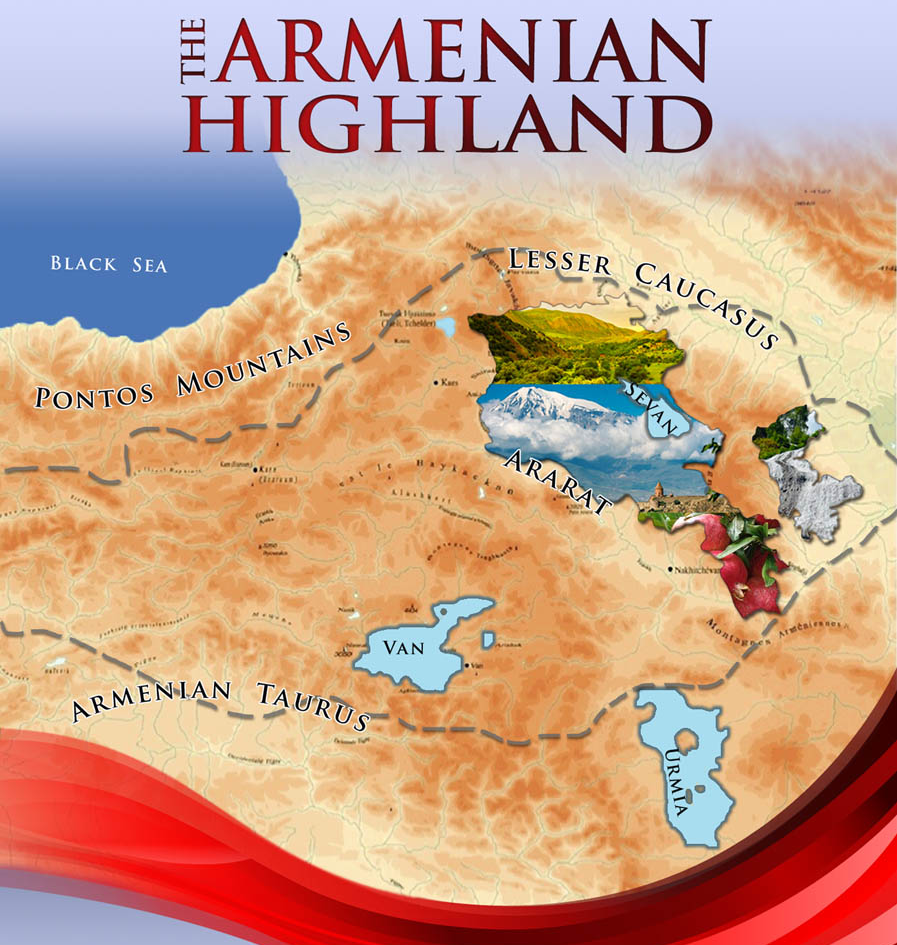
Das Armenische Hochland (armenisch Հայկական լեռնաշխարհ oder Բարձր Հայք / Bardsr Hajk[1]), im Deutschen auch Armenisches Gebirge[2] oder Ararathochland genannt, bildet den zentralen Teil des nordanatolisch-nordiranischen Kettengebirges und umfasst im breiten Sinne auch den Kleinkaukasus.[3]
Je nach Definition ist das Armenische Hochland 300.000 bis 400.000 Quadratkilometer groß[4] und umfasst Gebiete der Türkei (vor allem die ehemaligen armenischen Provinzen des Osmanischen Reiches), des Iran, Georgiens, Aserbaidschans und fast vollständig die heutige Republik Armenien.
Viele Gebirge im Armenischen Hochland stellen eine Aneinanderreihung von Vulkanen dar. Zu diesen zählen das Dschawacheti-Gebirge, das Arsiani-Gebirge (Yalnızçam Dağları), das Geghamgebirge und der Haykakan Par (Ağri Dağları).[3] Die höchste Erhebung ist der 5137 m hohe Ararat, ein erloschener Vulkan. Große Seen sind der Vansee (Salzsee) und der Sewansee (Süßwassersee).
亚美尼亚高原(Armenian Highlands,亚美尼亚语:Հայկական լեռնաշխարհ,罗马化:Haykakan leṙnašxarh,英文名称另有Armenian Upland, Armenian plateau,或是Armenian tableland,[1])是组成西亚北部的三个高原中,位居中央,高度最高的一座。[1]亚美尼亚高原从西方,顺着时钟方向,受安纳托利亚高原、高加索、库拉-阿拉斯低地、伊朗高原、美索不达米亚所包围。亚美尼亚高原受到亚拉拉特平原(其中有亚拉拉特山)所分隔,而分成东西两个区域。所谓西亚美尼亚就是今日所称的东部安那托利亚地区,而所谓的东亚美尼亚即为今日的小高加索山脉,也称Caucasus Minor,或是古代所称的Anti-Caucasus,[2][3]即“在高加索对面”的意思。

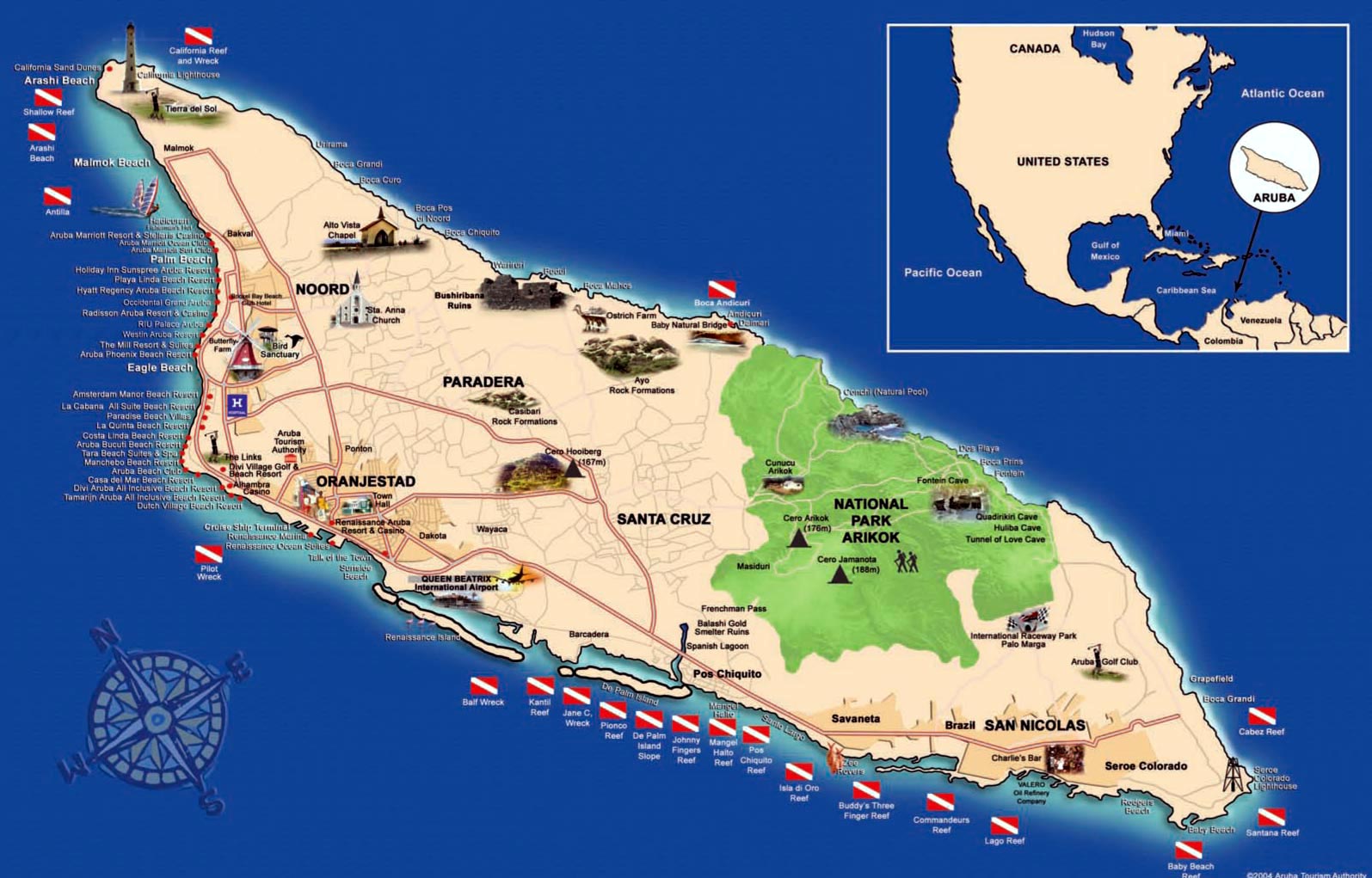
阿鲁巴(Aruba)是一个位于加勒比地区的岛屿,位于南美国家委内瑞拉北方的委内瑞拉湾外海,仅距离巴拉瓜纳半岛约25公里,従自哥伦比亚东北方约89公里。阿鲁巴目前是荷兰王国四个构成国之一。由于气候干燥,常见热带植物数量不多,岛上的景象与一般人对加勒比海所抱持的既有印象大异其趣。
Aruba [aˈruːba] ist die erste der drei ABC-Inseln (Aruba, Bonaire, Curaçao), die geologisch zu Südamerika gehören und Teil der Kleinen Antillen in der südlichen Karibik sind. Die Insel liegt 25 Kilometer nördlich von Venezuela. Sie ist neben Curaçao und Sint Maarten sowie den Niederlanden (bestehend aus den Niederlanden in Europa sowie Bonaire, Sint Eustatius und Saba in der Karibik) eines der vier gleichberechtigten Länder des Königreiches der Niederlande. Wie die anderen Länder hat auch Aruba eine eigene Verfassung, Währung und Regierung. Die Insel genießt vollkommene innere Autonomie, ist aber kein souveräner Staat, besitzt also keine äußere Souveränität. Aruba gehört nicht zum Schengen-Raum.
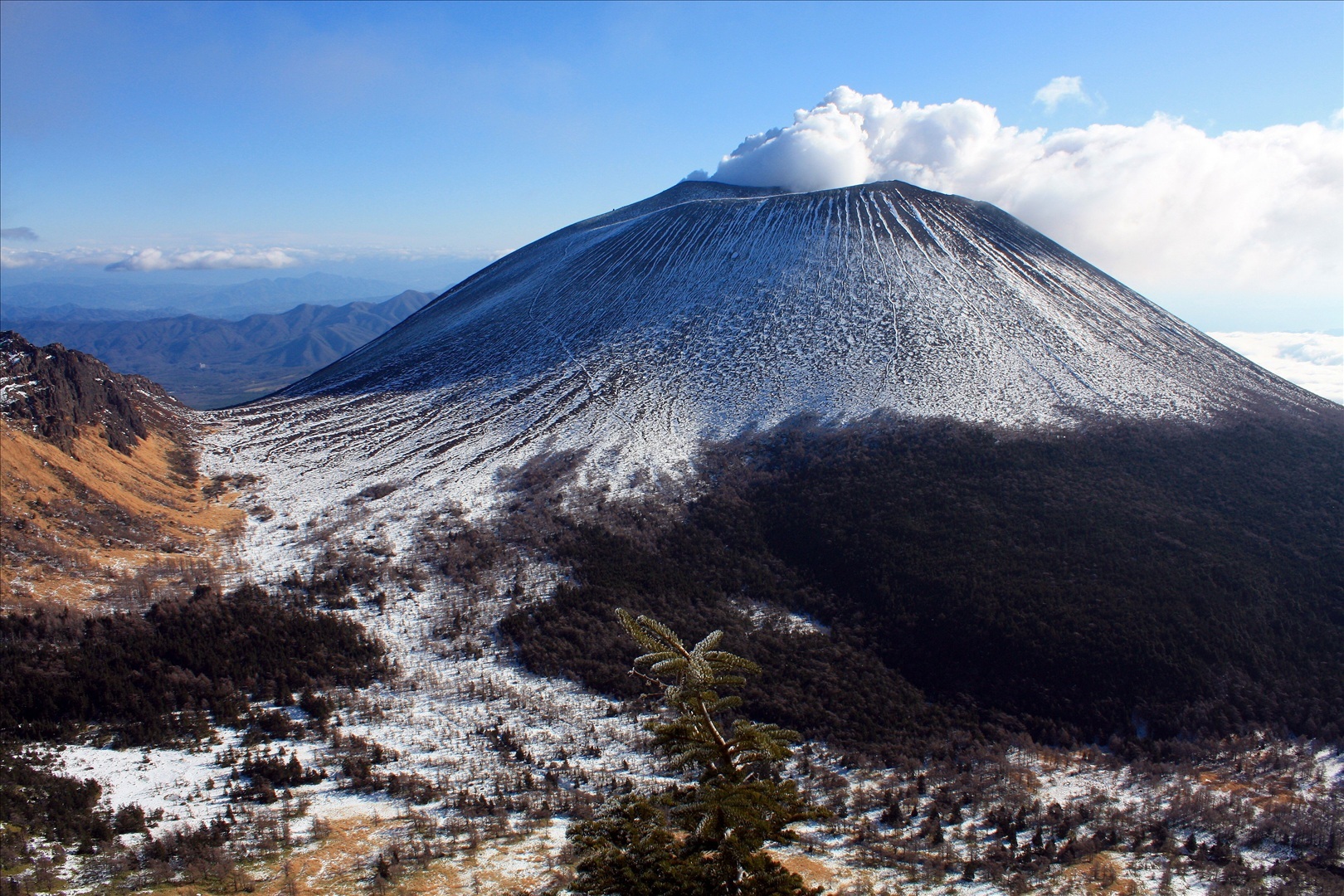

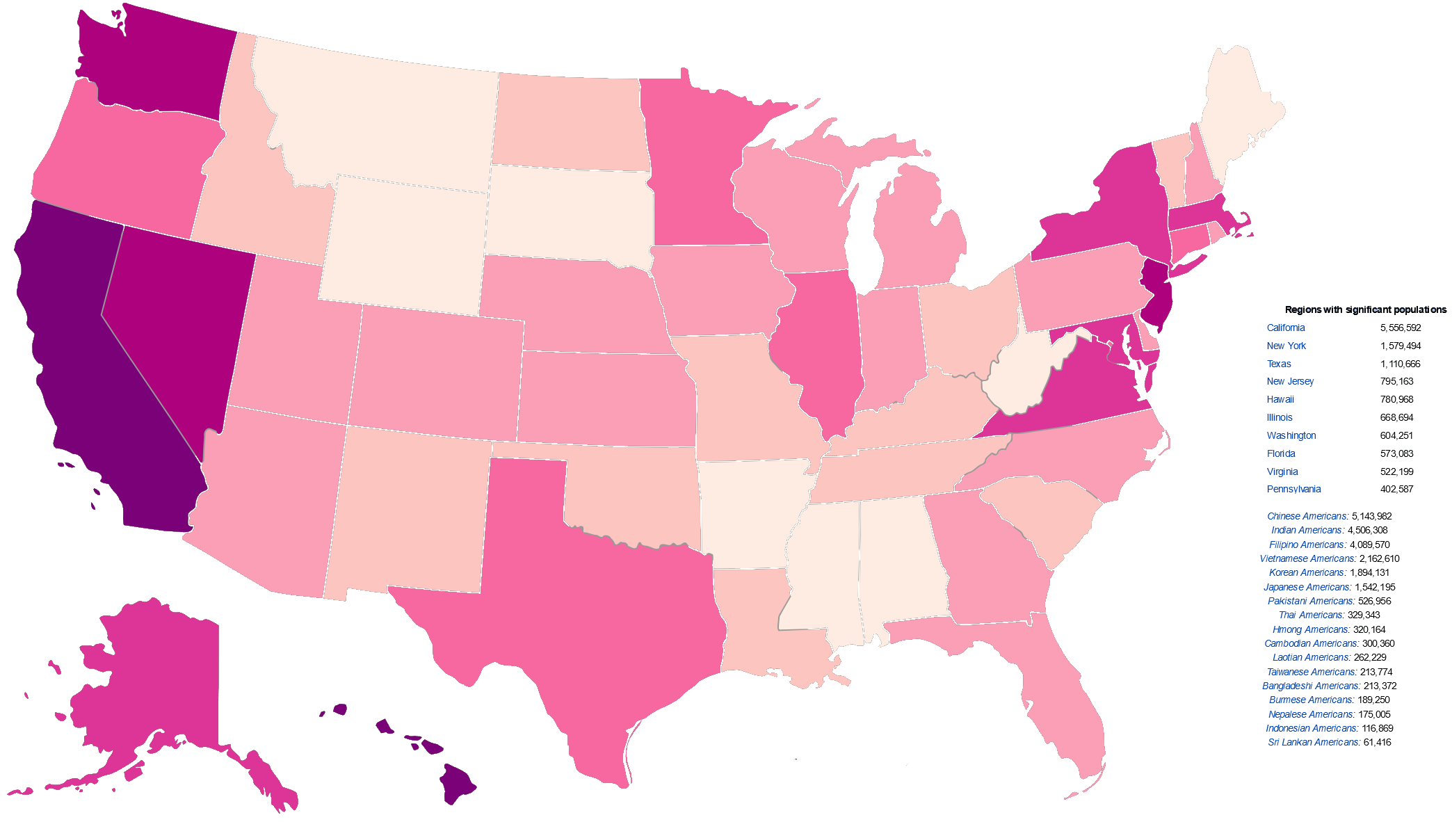

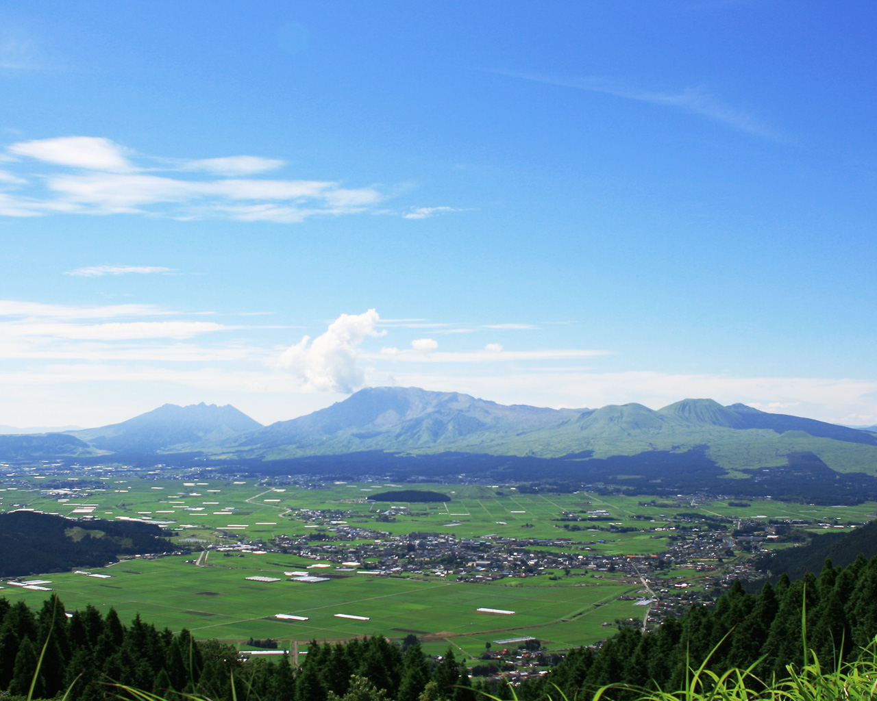
亚细亚洲(古希腊语:Ασία;拉丁语:Asia),简称亚洲,面积4457.9万平方公里,约占地球总面积的8.6%(总陆地面积的29.4%);亚洲人口约47亿人,是世界总人口约61%(2019年)[2];是七大洲中面积最大,人口最多的一个洲。
亚洲位于亚欧大陆东部,大部分土地位于东半球和北半球,东面是太平洋、北面是北冰洋,南面则濒临印度洋。亚洲与非洲以苏伊士运河为界限,隔亚丁湾、曼德海峡、红海与非洲相邻。亚洲与欧洲分界线为乌拉尔山脉、乌拉尔河、里海、大高加索山脉、黑海和黑海海峡。亚洲东北部与北美洲大致以白令海峡为界限。亚洲东南部以帝汶海同大洋洲相望。
亚洲大陆(不含离岛)的四至是,最东端为至白令海峡杰日尼奥夫角(西经169度40分,北纬60度5分),最南端为马来西亚丹绒比亚(东经103度31分,北纬1度16分)[3],最西端为土耳其巴巴角(东经26度3分,北纬39度27分),北至最北端为俄罗斯切柳斯金角(东经104度18分,北纬77度43分)。跨越经纬度十分广,东西时差11小时。除大陆外,亚洲岛屿面积约270万平方公里,仅次于北美洲。
亚洲最高峰为世界第一高峰珠穆朗玛峰,最低点为世界陆地最低点死海,最高高原是世界最高高原青藏高原,最长河流是世界第三长度河流长江,最大湖泊是里海,最深湖泊是贝加尔湖,最大沙漠是阿拉伯沙漠。
亚洲是人类文明摇篮之一,是世界三大宗教佛教、伊斯兰教和基督教的发源地,四大文明古国中有三个(古巴比伦、古代印度、古代中国)位于亚洲。
Asien, Teil von Eurasien, ist mit rund 44,615 Millionen Quadratkilometern, etwa einem Drittel der gesamten Landmasse, der flächenmäßig größte Erdteil. Mit über vier Milliarden Menschen, mehr als der Hälfte der Weltbevölkerung, ist dieser Erdteil auch der einwohnerstärkste. Es gibt 47 international anerkannte Staaten Asiens.
Menschheitsgeschichtlich spielte Asien früh eine wichtige Rolle. Hier entstanden bereits um 900 v. Chr. mit dem Neuassyrischen Reich oder 500 v. Chr. mit dem noch größeren Achämenidenreich die ersten Großreiche.
アジア(ラテン語: Asia[注釈 1])は、世界の大州のひとつ。現在では一般的にヨーロッパを除くユーラシア大陸全般を指すが、政治的・経済的な立場の違いにより、様々な定義がなされる場合がある。亜州(あしゅう)。アッシリア語で東を意味する「アス」に語源をもつ。古代では現在の小アジアを指した。
現在ではユーラシア大陸のヨーロッパ以外の地域、つまり、アジア大陸(島嶼・海域を含む)であり、六大州の一つ。ユーラシア大陸の面積の約80%をアジアが占め、人口は世界最多であり世界人口の約60%強がアジアに住んでいるといわれている。世界の都市のうち都市圏人口上位8位まではアジアに属する都市が占めている(世界の都市圏人口の順位を参照)。
アジアとヨーロッパの境界は、地理上の境界とヨーロッパ中心主義的な観点から見た人為的な境界が入り交じっている。地理上の境界は、ウラル山脈-ウラル川-カスピ海-コーカサス山脈-黒海-ボスポラス海峡-マルマラ海-ダーダネルス海峡とすることが多い。なお、アフリカとはスエズ地峡を、オセアニアとはニューギニア島西方の海峡を挟んでいるため、この両地域とは地理的境界と人為的境界が一致している。
アジアは六大州で最も大きな州であり、地理的にも多様で変化に富む。アジアの大半はアジア大陸に属するが、大陸内でも気候や地形に様々な差がある。また、特に大陸東側には環太平洋造山帯の活動によってできた無数の島々が点在しており、日本やフィリピン、インドネシアといった島国に多数の人口を抱える国家が存在する。アジアの東部から南部にかけては降雨が多く肥沃な土壌に恵まれることから人口が古代より非常に多く、現代においても世界最大の人口密集地域となっている。
人種に関して多くはモンゴロイドであるが一部地域ではヨーロッパと隣接しているためその地域ではコーカソイドの特徴がある場合がある。
Asia (/ˈeɪʒə, ˈeɪʃə/ (![]() listen)) is Earth's largest and most populous continent, located primarily in the Eastern and Northern Hemispheres. It shares the continental landmass of Eurasia with the continent of Europe and the continental landmass of Afro-Eurasia with both Europe and Africa. Asia covers an area of 44,579,000 square kilometres (17,212,000 sq mi), about 30% of Earth's total land area and 8.7% of the Earth's total surface area. The continent, which has long been home to the majority of the human population,[5] was the site of many of the first civilizations. Asia is notable for not only its overall large size and population, but also dense and large settlements, as well as vast barely populated regions. Its 4.5 billion people (as of June 2019) constitute roughly 60% of the world's population.[6]
listen)) is Earth's largest and most populous continent, located primarily in the Eastern and Northern Hemispheres. It shares the continental landmass of Eurasia with the continent of Europe and the continental landmass of Afro-Eurasia with both Europe and Africa. Asia covers an area of 44,579,000 square kilometres (17,212,000 sq mi), about 30% of Earth's total land area and 8.7% of the Earth's total surface area. The continent, which has long been home to the majority of the human population,[5] was the site of many of the first civilizations. Asia is notable for not only its overall large size and population, but also dense and large settlements, as well as vast barely populated regions. Its 4.5 billion people (as of June 2019) constitute roughly 60% of the world's population.[6]
In general terms, Asia is bounded on the east by the Pacific Ocean, on the south by the Indian Ocean, and on the north by the Arctic Ocean. The border of Asia with Europe is a historical and cultural construct, as there is no clear physical and geographical separation between them. It is somewhat arbitrary and has moved since its first conception in classical antiquity. The division of Eurasia into two continents reflects East–West cultural, linguistic, and ethnic differences, some of which vary on a spectrum rather than with a sharp dividing line. The most commonly accepted boundaries place Asia to the east of the Suez Canal separating it from Africa; and to the east of the Turkish Straits, the Ural Mountains and Ural River, and to the south of the Caucasus Mountains and the Caspian and Black Seas, separating it from Europe.[7]
China and India alternated in being the largest economies in the world from 1 to 1800 CE. China was a major economic power and attracted many to the east,[8][9][10] and for many the legendary wealth and prosperity of the ancient culture of India personified Asia,[11] attracting European commerce, exploration and colonialism. The accidental discovery of a trans-Atlantic route from Europe to America by Columbus while in search for a route to India demonstrates this deep fascination. The Silk Road became the main east–west trading route in the Asian hinterlands while the Straits of Malacca stood as a major sea route. Asia has exhibited economic dynamism (particularly East Asia) as well as robust population growth during the 20th century, but overall population growth has since fallen.[12] Asia was the birthplace of most of the world's mainstream religions including Hinduism, Zoroastrianism, Judaism, Jainism, Buddhism, Confucianism, Taoism, Christianity, Islam, Sikhism, as well as many other religions.
Given its size and diversity, the concept of Asia—a name dating back to classical antiquity—may actually have more to do with human geography than physical geography.[citation needed] Asia varies greatly across and within its regions with regard to ethnic groups, cultures, environments, economics, historical ties and government systems. It also has a mix of many different climates ranging from the equatorial south via the hot desert in the Middle East, temperate areas in the east and the continental centre to vast subarctic and polar areas in Siberia.
L'Asie est un des sept continents ou une partie des supercontinents Eurasie ou Afro-Eurasie de la Terre. Avec 43 810 582 km2 de terres et 4,3 milliards d'habitants2, l'Asie est le plus grand continent (8,6 % de la surface totale terrestre ou 29,4 % des terres émergées) et le plus peuplé (environ 60 % de la population mondiale). L'Asie est davantage un concept culturel qu'une entité physique homogène.
Ce continent abrite le plus haut sommet du monde, l'Everest, qui culmine à 8 848 mètres, et la plus haute tour du monde, Burj Khalifa, à Dubaï, d'une hauteur de 828 mètres, ainsi que la terre émergée la plus éloignée de tout océan, située à 2 648 km de la côte la plus proche, au nord-ouest de la Chine (46° 17′ N, 86° 40′ E).
L'Asia è una regione geografica del mondo, comunemente considerata un continente, parte del supercontinente euroasiatico, insieme all'Europa, ed una delle tre parti del supercontinente composto da: Africa, Europa ed Asia. È il più vasto dei continenti del mondo, con una superficie di oltre 4,4 volte più grande di quella dell'Europa e pari a circa un terzo di tutte le terre emerse e, con circa 4,4 miliardi di abitanti, è di gran lunga il più popolato.
Asia es el continente más grande y poblado de la Tierra. Con cerca de 45 millones de km², supone el 8,74 % del total de la superficie terrestre y el 29,45 % de las tierras emergidas y, con alrededor de 4.463 millones de habitantes, el 69 % de la población mundial. Se extiende sobre la mitad oriental del hemisferio Norte, desde el océano Glacial Ártico, al norte, hasta el océano Índico, al sur. Limita, al oeste, con los montes Urales, y al este, con el océano Pacífico.
En la división convencional de continentes, de origen europeo, Asia y Europa aparecen como dos entidades diferentes por razones culturales e históricas. En términos geográficos, forman en realidad un único continente, llamado Eurasia. Además, África está unida a Eurasia por el istmo de Suez por lo que también se puede considerar toda la extensión conjunta de Europa, Asia y África como un único supercontinente, ocasionalmente denominado Eurafrasia, o Afro-eurasia.
А́зия — крупнейшая часть света, как по территории, так и по численности населения. Образует вместе с Европой материк Евразию. Площадь (вместе с островами) — около 43,4 млн км²[2]. Население — 4,2 млрд чел. (2012) (60,5 % населения Земли). Азия является ныне крупнейшим развивающимся регионом в мире[3].


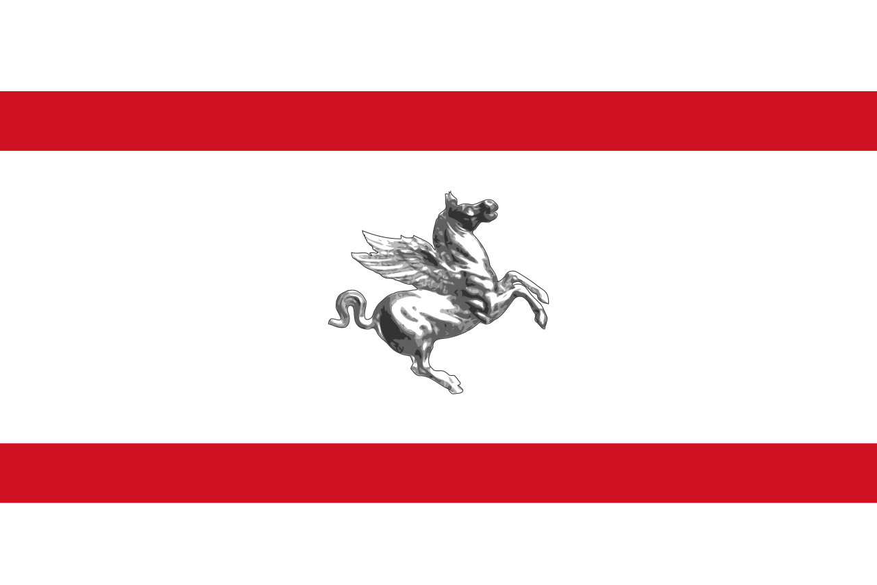 Toscana
 Aerospace