Deutsch-Chinesische Enzyklopädie, 德汉百科

       
German — Chinese
Catalog Geography

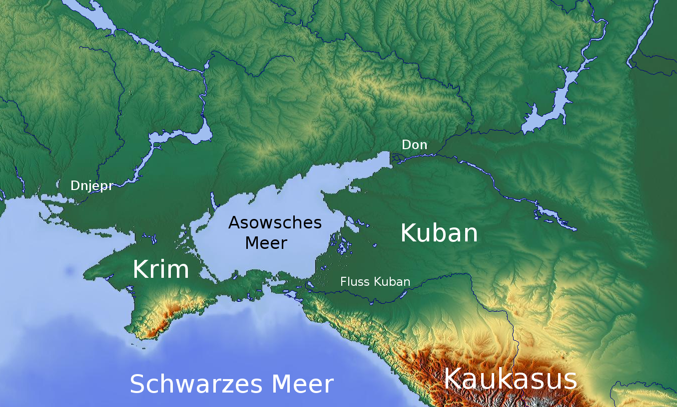
亚速海/Sea of Azov/Азовське море/Азовское море/Azaq deñizi
http://www.net4info.de/photos/cpg/albums/userpics/10001/Asowsches_Meer.png
This image, video or audio may be copyrighted. It is used for educational purposes only. If you find it, please notify us byand we will remove it immediately.
阿斯圖裡亞斯 阿斯图里亚斯/Asturias
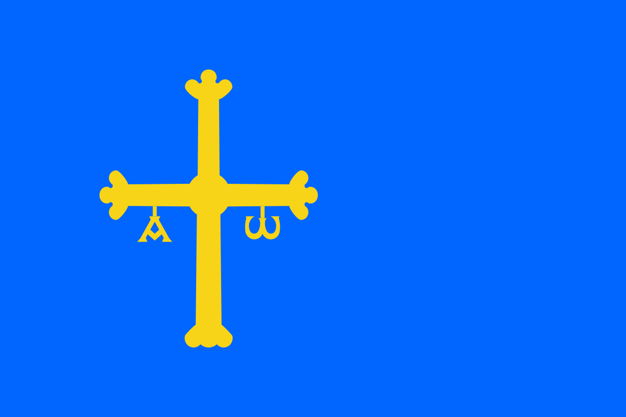
Asturien (spanisch Asturias; offiziell spanisch Principado de Asturias, asturisch Asturies, offiziell asturisch Principáu d’Asturies; deutsch Fürstentum Asturien) ist eine Autonome Gemeinschaft im Nordwesten Spaniens. Das Territorium der Autonomen Gemeinschaft ist identisch mit dem der Provinz Asturien (früher Provinz Oviedo).
/assets/contentimages/normal_Asturias.png /assets/contentimages/normal_Asturias~0.png

阿斯图里亚斯西班牙语:[asˈtuɾjas]阿斯图里亚斯语:Asturies,阿斯图里亚斯语发音:/asˈtuɾjes/;英语:Asturias,/æˈstʊəriəs, ə-/[1][2]) 正式名称是阿斯图里亚斯亲王国(西班牙语:Principado de Asturias;阿斯图里亚斯语:Principáu d'Asturies),是西班牙的一个单省自治区,有过3500年历史。它北向坎塔布连海、南接卡斯蒂利亚-莱昂、西邻加利西亚、东连坎塔布里亚,总面积达10,604平方公里[3]。首府奥维耶多,最大城市为港城希洪

Asturien (spanisch Asturias; offiziell spanisch Principado de Asturiasasturisch Asturies, offiziell asturisch Principáu d’Asturiesdeutsch Fürstentum Asturien) ist eine Autonome Gemeinschaft im Nordwesten Spaniens. Das Territorium der Autonomen Gemeinschaft ist identisch mit dem der Provinz Asturien (früher Provinz Oviedo). 
This image, video or audio may be copyrighted. It is used for educational purposes only. If you find it, please notify us byand we will remove it immediately.
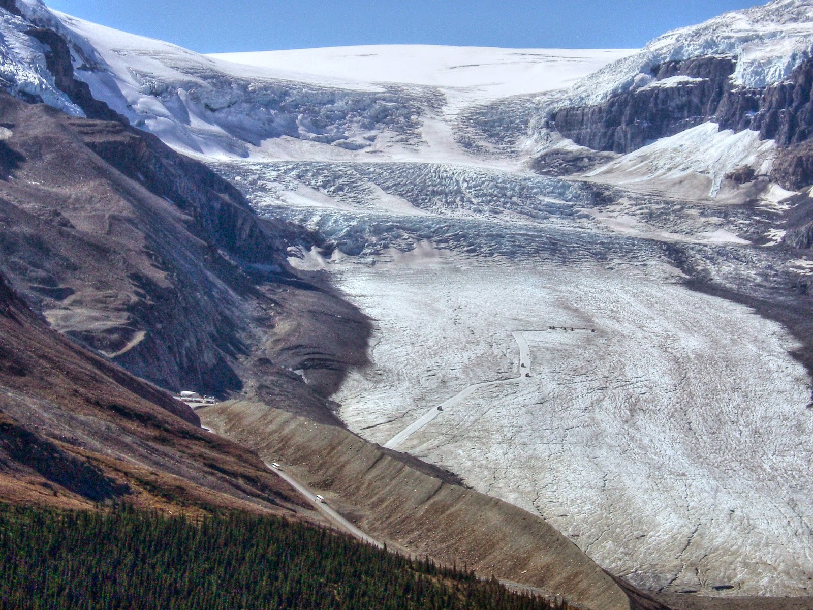
阿萨巴斯卡冰川

This image, video or audio may be copyrighted. It is used for educational purposes only. If you find it, please notify us byand we will remove it immediately.
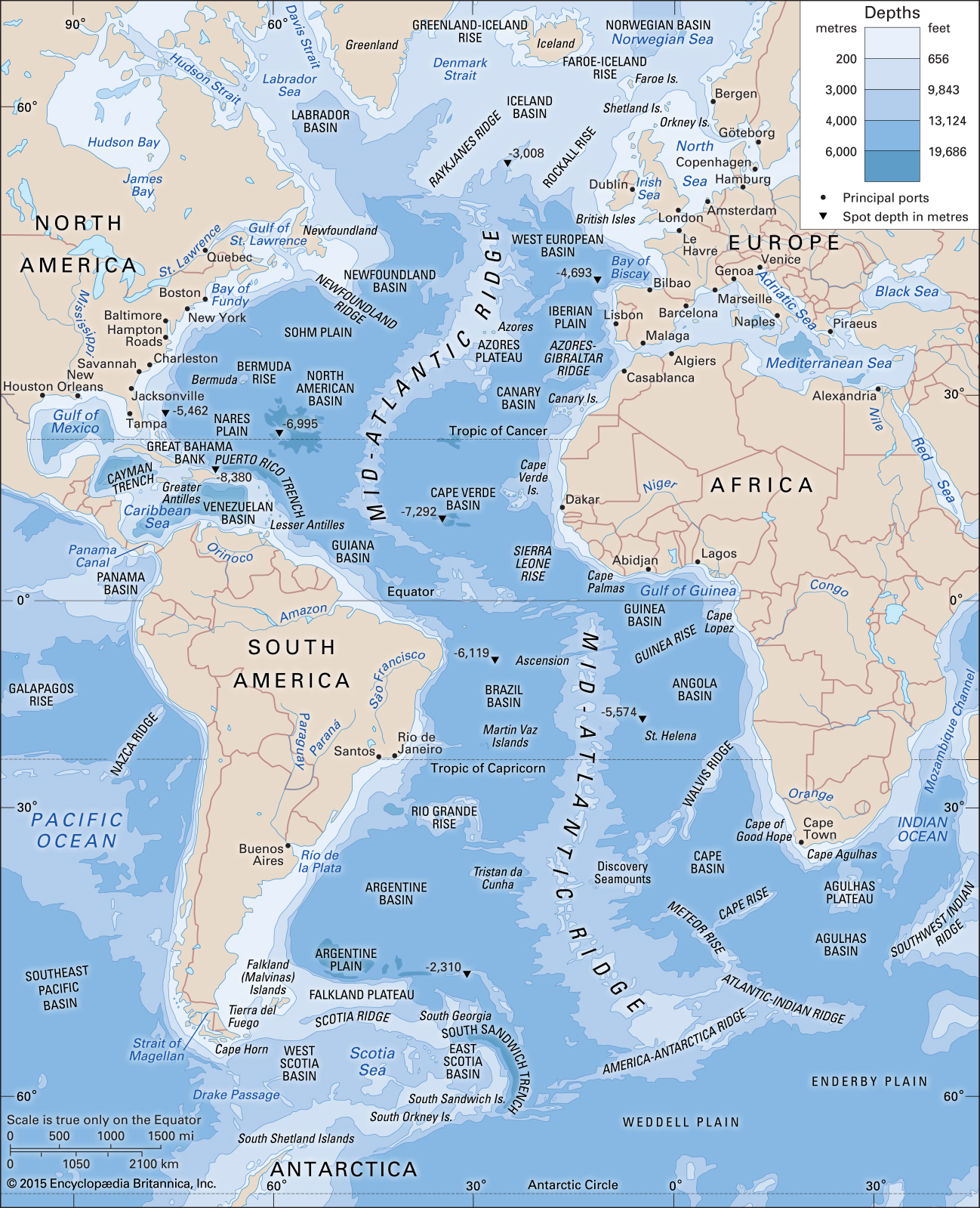
大西洋
This image, video or audio may be copyrighted. It is used for educational purposes only. If you find it, please notify us byand we will remove it immediately.
大西洋/Atlantik/Atlantic Ocean
This image, video or audio may be copyrighted. It is used for educational purposes only. If you find it, please notify us byand we will remove it immediately.
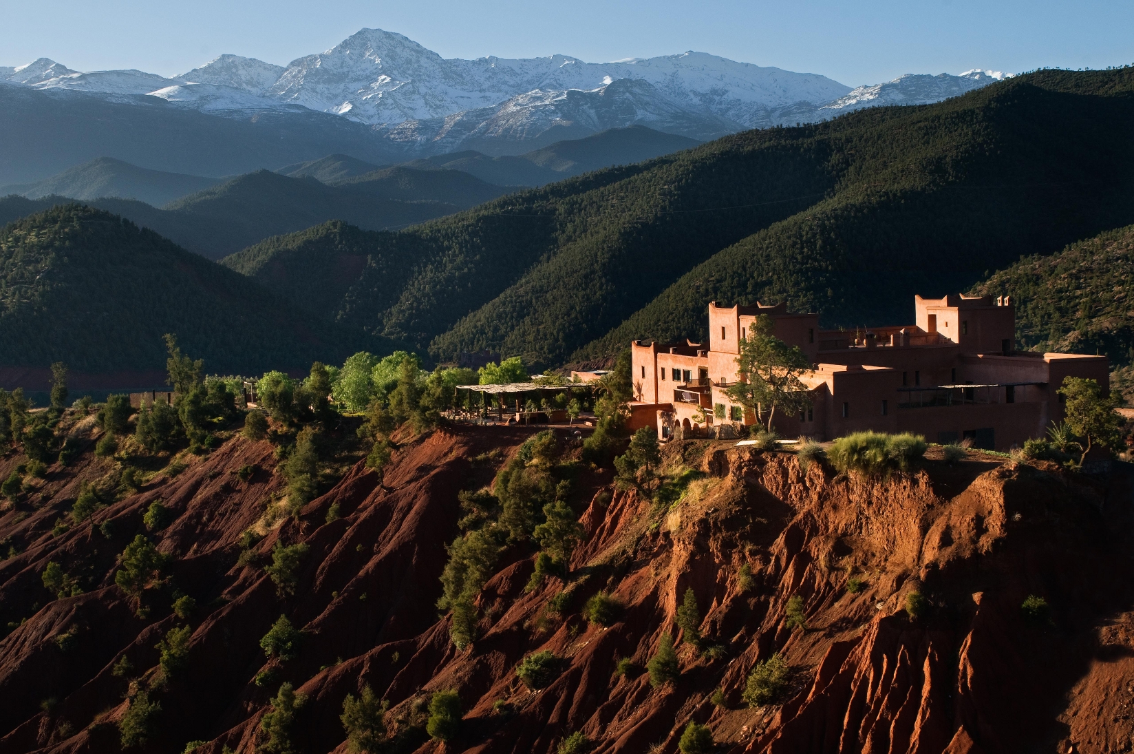
阿特拉斯山脈
 http://www.net4info.de/photos/cpg/albums/userpics/10002/Atlas_Mountains~0.jpg

阿特拉斯山(Atlas Mountains),非洲西北部山脉,是非洲最广大的褶皱断裂山地区,阿尔卑斯山系的一部分。横跨摩洛哥、阿尔及利亚、突尼斯三国(包括直布罗陀半 岛),把地中海西南岸与撒哈拉沙漠分开。阿特拉斯山西南起于摩洛哥的大西洋海岸,东北经阿尔及利亚到突尼斯的舍里克半岛,呈东北东—西南西走向。长 1800千米,南北最宽约450千米。最高峰为图卜卡勒峰(Jbel Toubkal,海拔4167米),位于摩洛哥西南部 (31°03′43″N, 7°54′58″W)。

This image, video or audio may be copyrighted. It is used for educational purposes only. If you find it, please notify us byand we will remove it immediately.
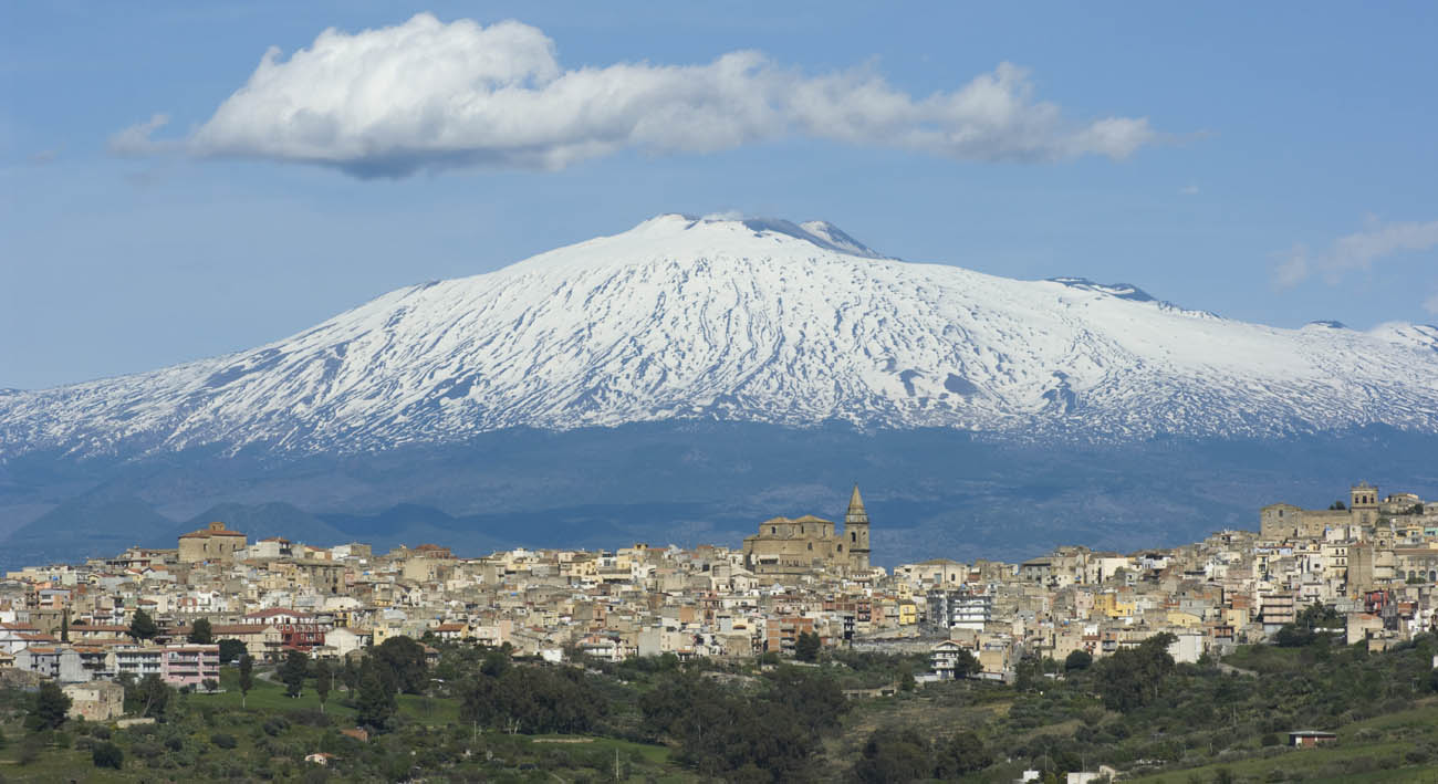
埃特納火山 埃特纳火山
Der Ätna (italienisch Etna oder auch Mongibello) ist mit etwa 3323 Meter über dem Meeresspiegel der höchste und aktivste Vulkan Europas. Er liegt auf der italienischen Insel Sizilien in der Nähe von Catania und Messina.

http://www.net4info.de/photos/cpg/albums/userpics/10002/etna_italy.jpg
Der Ätna (italienisch Etna oder auch Mongibello) ist mit etwa 3323 Meter über dem Meeresspiegel der höchste und aktivste Vulkan Europas. Er liegt auf der italienischen Insel Sizilien in der Nähe von Catania und Messina. Am 21. Juni 2013 hat die UNESCO den Ätna in die Liste des Weltnaturerbes aufgenommen.
埃特纳火山意大利语:Etna),是欧洲著名的活火山,属层状火山。它位于意大利西西里岛东海岸的墨西拿卡塔尼亚之间,是欧洲最高的活火山海拔3326米,其高度随喷发活动而变化。埃特纳火山下部为一个巨大的盾形火山,上部为高约300米的火山渣锥,面积约1190平方公里,底部周长约140公里。由于埃特纳火山处于亚欧板块非洲板块交汇处,一直活动频繁,其喷发史可以追溯到公元前1500年,迄今为止已喷发过200多次。2002年10月28日曾大规模喷发。
This image, video or audio may be copyrighted. It is used for educational purposes only. If you find it, please notify us byand we will remove it immediately.
世界范围的核反应堆


/assets/contentimages/Nuclear_power_stations.png


This image, video or audio may be copyrighted. It is used for educational purposes only. If you find it, please notify us byand we will remove it immediately.
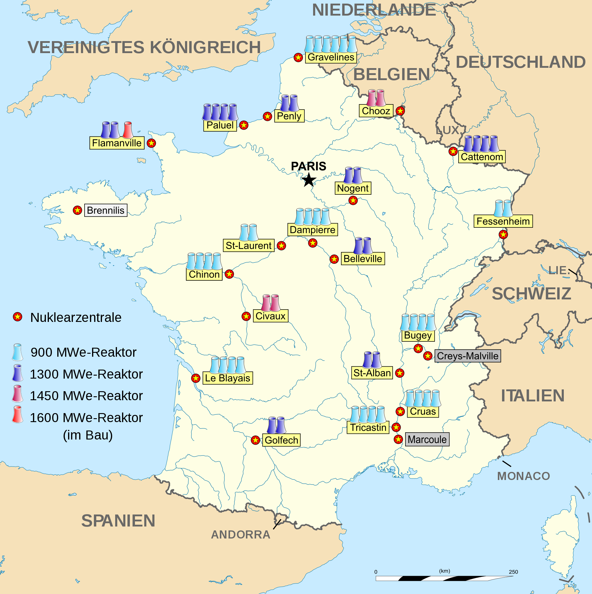
法国原子能发电站
This image, video or audio may be copyrighted. It is used for educational purposes only. If you find it, please notify us byand we will remove it immediately.
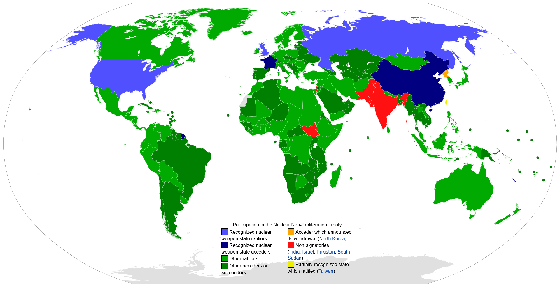
武器不扩散条约/Treaty on the Non-Proliferation of Nuclear Weapons
This image, video or audio may be copyrighted. It is used for educational purposes only. If you find it, please notify us byand we will remove it immediately.
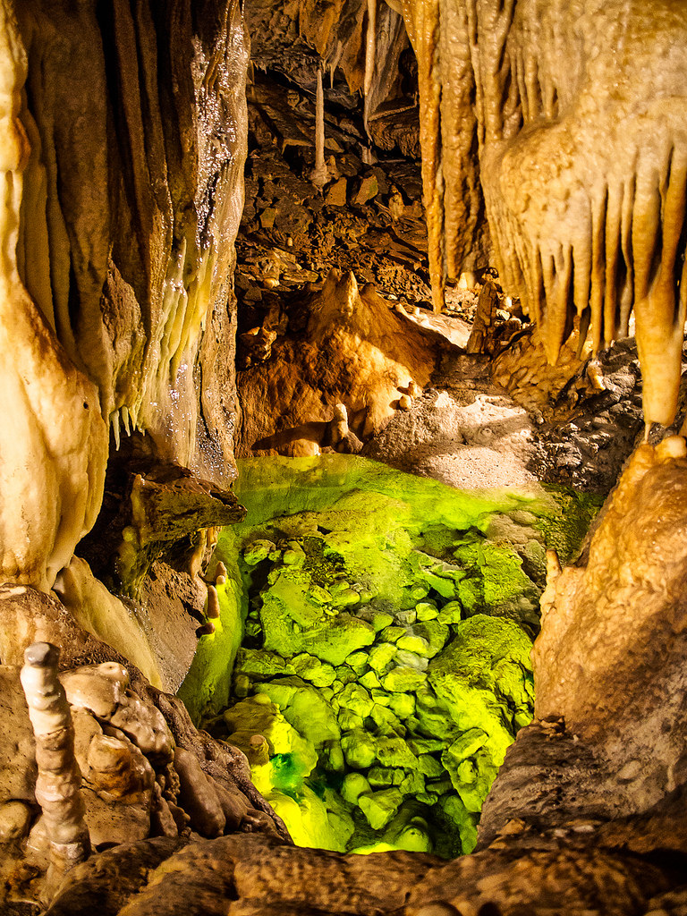
阿塔溶洞
https://www.net4info.de/photos/cpg/albums/userpics/10001/atta_hohle.jpg
This image, video or audio may be copyrighted. It is used for educational purposes only. If you find it, please notify us byand we will remove it immediately.
阿圖什 阿图什
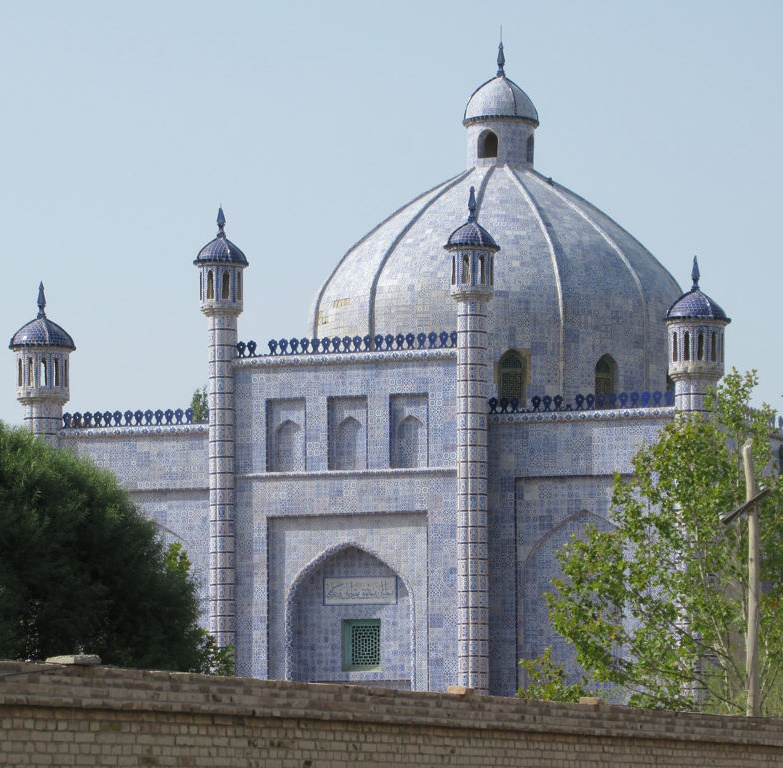
阿图什市(维吾尔语:ئاتۇش‎),新疆克孜勒苏柯尔克孜自治州辖县级市、首府,位于新疆维吾尔自治区西南部,天山南麓,塔里木盆地西缘,东连柯坪县,东北与阿合奇县相接,东南接巴楚县,南与伽师县和疏附县相连,西邻乌恰县,西北与吉尔吉斯斯坦为界,边境线长88.3千米,属暖温带大陆气候,总面积1.55万平方千米。阿图什市是克孜勒苏柯尔克孜自治州政治、经济、文化中心;阿图什市下辖2个街道办事处、1个镇、6个乡:幸福路街道、​光明路街道、​新城街道、​上阿图什镇、​松他克乡、​阿扎克乡、​阿湖乡、​格达良乡、​哈拉峻乡和吐古买提乡。
This image, video or audio may be copyrighted. It is used for educational purposes only. If you find it, please notify us byand we will remove it immediately.