
Deutsch-Chinesische Enzyklopädie, 德汉百科
Energy resource
*Renewable energy
*****Electronic electricity meters*****Energy storage*****Largest electricity producers in Europe*****Electricity prices for private households***Winter heating equipment and simple methods***Summer cooling equipment and simple methods***Transmission system operator***Power & Energy Events***Hydrogen Energy*Nuclear power*Electrical power*Renewable energy*Low carbon economy roadmap *High-energy-consuming industries*International Thermonuclear Experimental Reactor*Nuclear fusion*Oil and natural gas*Highly polluting industries*HydrogenBauxiteBiomass power plantsIron and steel companiesIron orePetroleum refineryRefuse Derived Fuel power plantsFossil thermal power plantsGeothermal power plantsGold Mine|Gold RefineriesGold reserve Manufacturers of wind turbinesNuclear power plantsCoal mining companyCoal mineCopper mineMethane hydrateMinerals Resources Waste incineratorsOil and gas pipelinesOnshore and offshore wind farmsPetrochemical companySalt mines and salt pansShale gasSilver mineSmart GridsSolar power plantsStorage power plantsCharging stationGas stationsHydroelectric power plants

 Architecture
 Brazil

 Energy resource

 Energy resource
 *Electrical power

 Energy resource
 Hydroelectric power plants
 Erneuerbare Energie
 Hydropower
 Paraguay
 Paraná

 Economy and trade
伊泰普大壩 伊泰普大坝
Bauzeit: 1975–1982 Höhe des Absperrbauwerks: 196 m Bauwerksvolumen: 12,57 Mio. m³ Kronenlänge: 7760 m Kraftwerksleistung: 20 × 700 = 14.000 MW Wasseroberfläche 1350 km² Stauseelänge 170 km Stauseebreite 7–12 km Speicherraum 29.000 Mio. m³ Bemessungshochwasser: 62.200 m³/s

施工期:1975-1982 年 屏障结构高度:196 米 结构体积:1257 万立方米 冠幅长度:7760 米 电站输出功率:20 × 700 = 14,000 兆瓦 水面面积:1350 平方公里 水库长度:170 公里 水库宽度:7-12 公里 蓄水量:29,000 万立方米 设计洪水位:62,200 立方米/秒


 Energy resource

 Energy resource
 *Electrical power

 Energy resource
 Hydroelectric power plants
 Erneuerbare Energie
 Hydropower
 Sichuan Sheng-SC
锦屏一级
位置 中国四川省凉山彝族自治州 始建 2005年 启用 2012年 横跨 雅砻江 高度 305米(1,001英尺) 长度 568米(1,864英尺) 形成 锦屏一级水库 总容量 7,700,000,000立方米(6,200,000英亩·英尺) 集水面积 102,560平方千米(39,600平方英里) 表面积 82平方千米(32平方英里)涡轮机 6 × 600MW 装机容量 3,600 MW 年均发电量 16-18 TWh


 Energy resource

 Energy resource
 *Electrical power

 Energy resource
 Solar power plants
 Erneuerbare Energie
 Solar energy
 India
India
 Tamil Nadu
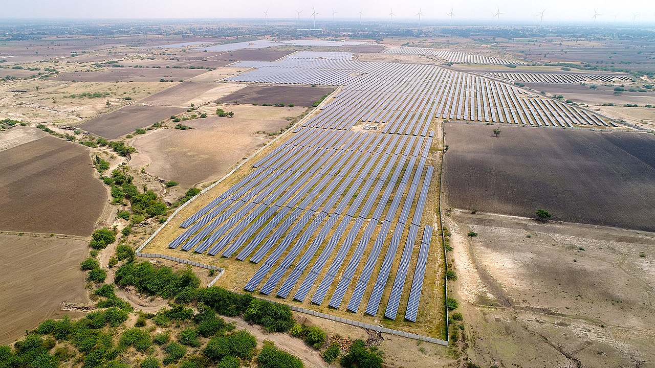
卡姆提光伏项目
Typ Photovoltaikkraftwerk Primärenergie Solarenergie Leistung 648 MW (elektrisch) Eigentümer Adani Group Betriebsaufnahme September 2016 Der Solarpark Kamuthi, zum Teil auch als Solarpark Tamil Nadu bezeichnet, ist eine Photovoltaik-Freiflächenanlage nahe der indischen Stadt Kamuthi im Bundesstaat Tamil Nadu.

 Energy resource
 *Renewable energy

 Energy resource
 *Electrical power

 Energy resource
 Onshore and offshore wind farms
 Erneuerbare Energie
 Windenergie

 Economy and trade
全球风能容量和年增长/Wind power global capacity and annual addition

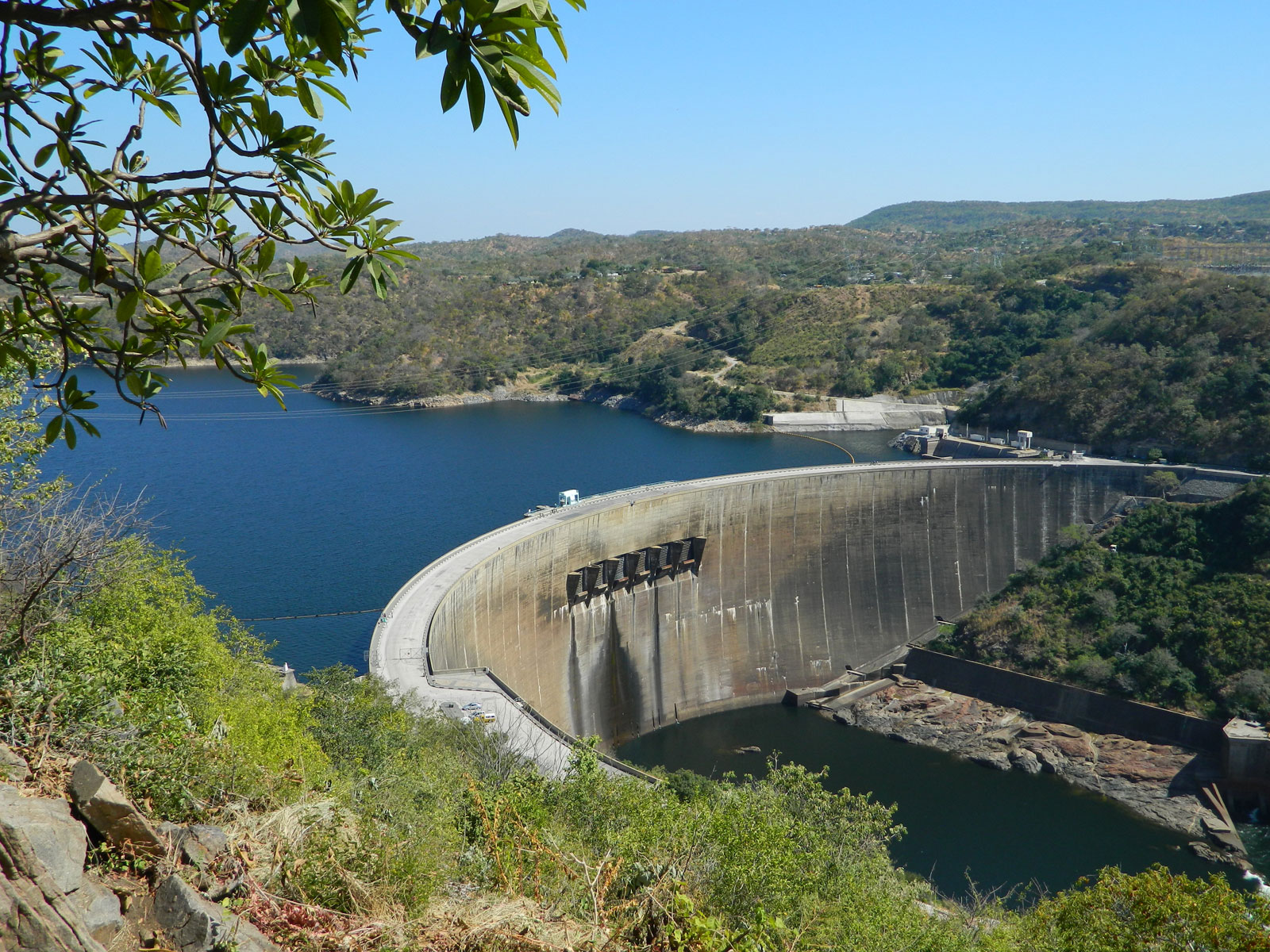
卡里巴水库
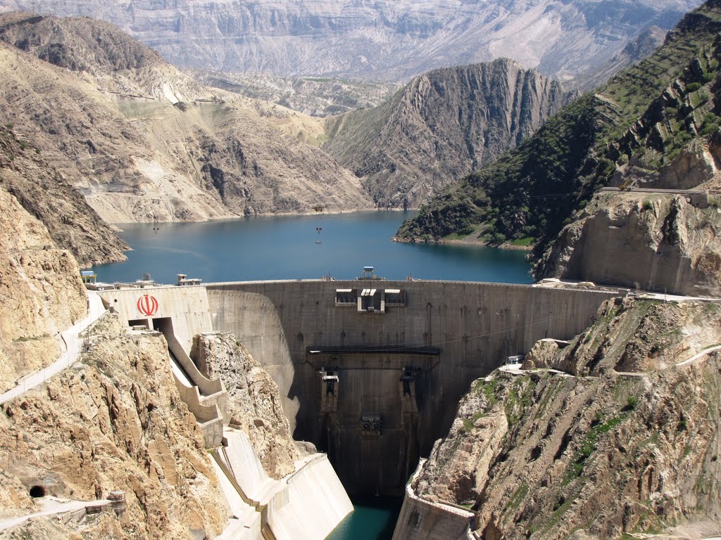
卡伦河三号水库/卡伦河三号大坝/Karun-3 Dam
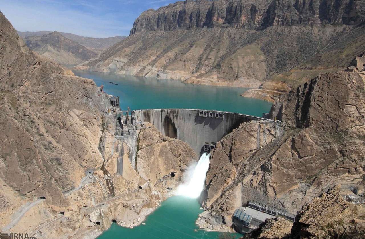
卡伦河四号水库/卡伦河四号大坝/Karun-4 Dam
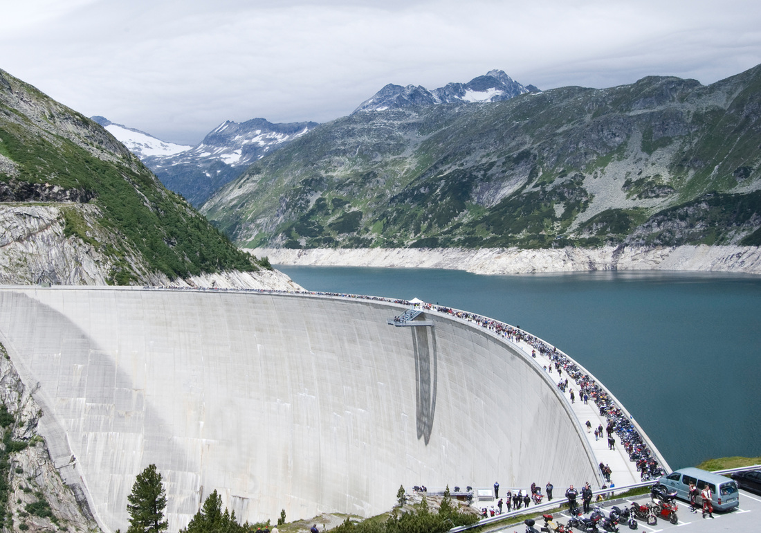
科恩布莱茵水库/科恩布莱茵大坝
瓦尔扎扎特太阳能电站/Ouarzazate Solar Power Station

 Brazil

 Energy resource

 Energy resource
 *Electrical power

 Energy resource
 Hydroelectric power plants
 Erneuerbare Energie
 Hydropower
 Goiás
Goiás
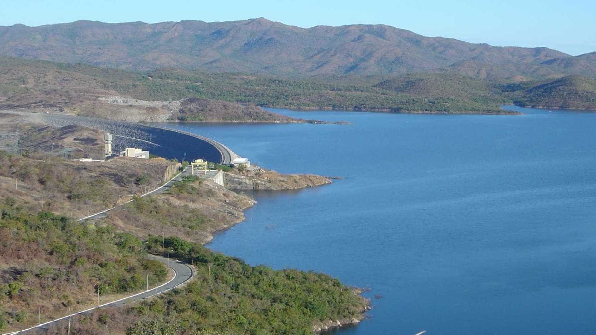
塞拉达梅萨水电站
Das Kraftwerk Serra da Mesa (portugiesisch Usina Hidrelétrica (de) Serra da Mesa) ist ein Wasserkraftwerk im brasilianischen Bundesstaat Goiás, das das Wasser des Rio Tocantins zum Stausee Serra da Mesa (port. Lago de Serra da Mesa) aufstaut. Ungefähr 20 Kilometer nordöstlich des Kraftwerks befindet sich die Gemeinde Minaçu. Engpassleistung 1.275 Megawatt Regelarbeitsvermögen 4.000 Millionen kWh/Jahr Turbinen Francis-Turbinen: 3 × 425 MW Eigentümer Furnas Centrais Elétricas

 Energy resource

 Energy resource
 *Electrical power

 Energy resource
 Hydroelectric power plants
 Erneuerbare Energie
 Erneuerbare Energie
 Hydropower
 Russia
克拉斯诺雅尔斯克水库/Красноярское водохранилище
Sperrentyp: Gewichtsstaumauer Bauzeit: 1961–1968 Höhe über Gründungssohle: 124 m / 119 m Kronenlänge: 1.065 oder 1.072 m Kronenbreite: 24 m Basisbreite: 140 m Kraftwerksleistung: 6 000 MW Höhenlage (bei Stauziel) 243 m Wasseroberfläche 2.130 km² Stauseelänge ca. 400 km Stauseebreite bis zu 15 km Speicherraum 73.300 Mio. m³ Einzugsgebiet 289.000 km² Bemessungshochwasser: 14.600 m³/s Besonderheiten: Schiffshebewerk


 Energy resource

 Energy resource
 *Electrical power

 Energy resource
 Hydroelectric power plants
 Erneuerbare Energie
 Hydropower
 Russia

 Economy and trade
古比雪夫水库/Куйбышевское водохранилище/ Kuibyschewskoje wodochranilischtsche
Bauzeit: 1950–1955 Bauwerksvolumen: 169 Mio. m³ Kronenlänge: 3781 m Kraftwerksleistung: 2315 MW Höhenlage (bei Stauziel) 53 m Wasseroberfläche 6450 km² Speicherraum 58.000 Mio. m³ Einzugsgebiet 1.210.000 km² Lage: Oblast Samara, Oblast Uljanowsk, Tatarstan (Russland) Zuflüsse: Wolga, Kama, Mjoscha, Sai

 Geography
 Carinthia
 Vacation and Travel