Deutsch-Chinesische Enzyklopädie, 德汉百科
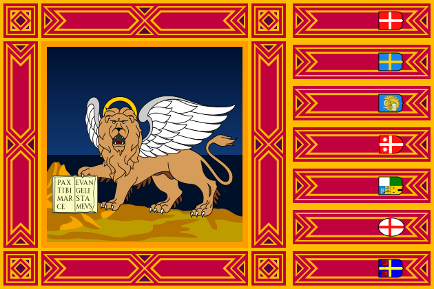
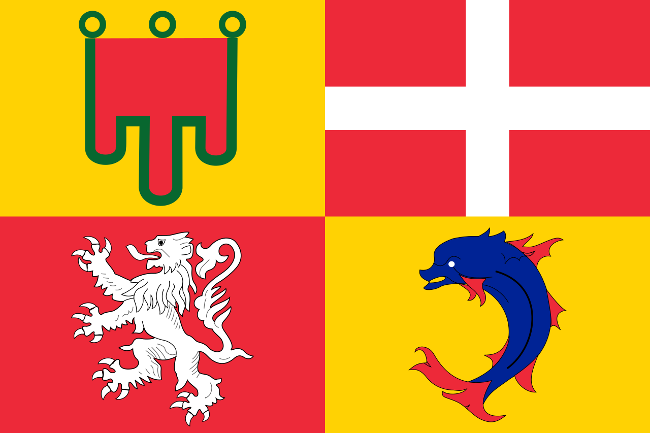
 Italien
 Medizin, Pharma, Rehabilitation

 Freizeitpark
 Emilia-Romagna

 Geographie
*Mittelmeer
Ägypten
Albanien
Algerien
Bernsteinstraße
Bosnien-Herzegowina
Frankreich
Gibraltar
Griechenland
Israel
Italien
Kroatien
Libanon
Libyen
Malta
Marokko
Monaco
Montenegro
Palästina
Slowenien
Spanien
Syrien
Tunesien
Türkei
Zypern
Geographie
*Mittelmeer
Ägypten
Albanien
Algerien
Bernsteinstraße
Bosnien-Herzegowina
Frankreich
Gibraltar
Griechenland
Israel
Italien
Kroatien
Libanon
Libyen
Malta
Marokko
Monaco
Montenegro
Palästina
Slowenien
Spanien
Syrien
Tunesien
Türkei
Zypern
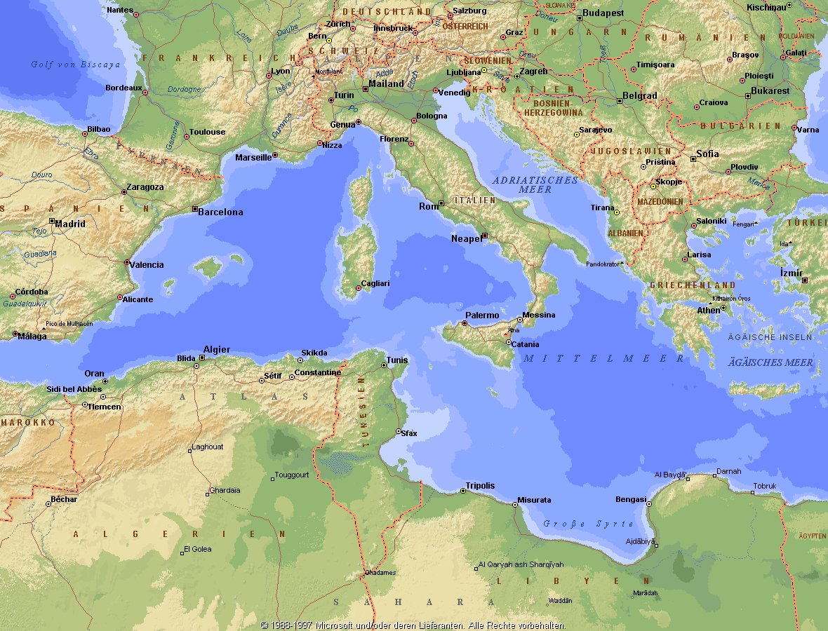
地中海,由北面的欧洲大陆,南面的非洲大陆以及东面的亚洲大陆包围着。东西长约4000千米,南北最宽处大约为1800千米,面积251.6万平方千米,是世界最大的陆间海。地中海的平均深度是1500米,最深处为5267米。
地中海西部通过直布罗陀海峡与大西洋相接,东部通过土耳其海峡(达达尼尔海峡和博斯普鲁斯海峡、马尔马拉海)和黑海相连。19世纪时开通了的苏伊士运河,接通了地中海与红海。 地中海是世界上最古老的海之一,[3] 而其附属的大西洋却是年轻的海洋。地中海处在欧亚板块和非洲板块交界处,是世界最强地震带之一。地中海地区有维苏威火山、埃特纳火山。
地中海作为陆间海,风浪较小,加之沿岸海岸线曲折、岛屿众多,拥有许多天然良好的港口,成为沟通三个大陆的交通要道。这样的条件,使地中海从古代开始海上贸易就很繁盛,促进了古代古埃及文明、古希腊文明、罗马帝国等的发展。现在也是世界海上交通的重要地区之一。其沿岸的腓尼基人、克里特人、希腊人,以及后来的葡萄牙人和西班牙人都是航海业发达的民族。著名的航海家如哥伦布、达·伽马、麦哲伦等,都出自地中海沿岸的国家。
地中海的沿岸夏季炎热干燥,冬季温暖湿润,被称作地中海性气候。植被,叶质坚硬,叶面有蜡质,根系深,有适应夏季干热气候的耐旱特征,属亚热带常绿硬叶林。这里光热充足,是欧洲主要的亚热带水果产区,盛产柑橘、无花果,和葡萄等,还有木本油料作物油橄榄。
Das Mittelmeer (lateinisch Mare Mediterraneum,[1] deshalb deutsch auch Mittelländisches Meer, präzisierend Europäisches Mittelmeer, im Römischen Reich Mare Nostrum) ist ein Mittelmeer zwischen Europa, Afrika und Asien, ein Nebenmeer des Atlantischen Ozeans und, da es mit der Straße von Gibraltar nur eine sehr schmale Verbindung zum Atlantik besitzt, auch ein Binnenmeer. Im Arabischen und Türkischen wird es auch als „Weißes Meer“ (البحر الأبيض/al-baḥr al-abyaḍ bzw. türk. Akdeniz) bezeichnet.
Zusammen mit den darin liegenden Inseln und den küstennahen Regionen Südeuropas, Vorderasiens und Nordafrikas bildet das Mittelmeer den Mittelmeerraum, der ein eigenes Klima (mediterranes Klima) hat und von einer eigenen Flora und Fauna geprägt ist.
地中海(ちちゅうかい、ラテン語: Mare Mediterraneum)は、北と東をユーラシア大陸、南をアフリカ大陸(両者で世界島)に囲まれた地中海盆地に位置する海である。面積は約3000平方キロメートル、平均水深は約1500メートル[2]。海洋学上の地中海の一つ。
地中海には、独立した呼称を持ついくつかの海域が含まれる(エーゲ海、アドリア海など)。地中海と接続する他の海としては、ジブラルタル海峡の西側に大西洋が、ダーダネルス海峡を経た北東にマルマラ海と黒海があり、南西はスエズ運河で紅海と結ばれている(「海域」「地理」で詳述)。
北岸の南ヨーロッパ、東岸の中近東、南岸の北アフリカは古代から往来が盛んで、「地中海世界」と総称されることもある[3]。
The Mediterranean Sea is a sea connected to the Atlantic Ocean, surrounded by the Mediterranean Basin and almost completely enclosed by land: on the north by Southern Europe and Anatolia, on the south by North Africa and on the east by the Levant. Although the sea is sometimes considered a part of the Atlantic Ocean, it is usually identified as a separate body of water. Geological evidence indicates that around 5.9 million years ago, the Mediterranean was cut off from the Atlantic and was partly or completely desiccated over a period of some 600,000 years, the Messinian salinity crisis, before being refilled by the Zanclean flood about 5.3 million years ago.
It covers an approximate area of 2.5 million km2 (965,000 sq mi), but its connection to the Atlantic (the Strait of Gibraltar) is only 14 km (8.7 mi) wide. The Strait of Gibraltar is a narrow strait that connects the Atlantic Ocean to the Mediterranean Sea and separates Gibraltar and Spain in Europe from Morocco in Africa. In oceanography, it is sometimes called the Eurafrican Mediterranean Sea or the European Mediterranean Sea to distinguish it from mediterranean seas elsewhere.[2][3]
The Mediterranean Sea has an average depth of 1,500 m (4,900 ft) and the deepest recorded point is 5,267 m (17,280 ft) in the Calypso Deep in the Ionian Sea. The sea is bordered on the north by Europe, the east by Asia, and in the south by Africa. It is located between latitudes 30° and 46° N and longitudes 6° W and 36° E. Its west-east length, from the Strait of Gibraltar to the Gulf of Iskenderun, on the southwestern coast of Turkey, is approximately 4,000 km (2,500 miles). The sea's average north-south length, from Croatia’s southern shore to Libya, is approximately 800 km (500 miles). The Mediterranean Sea, including the Sea of Marmara (connected by the Dardanelles to the Aegean Sea), has a surface area of approximately 2,510,000 square km (970,000 square miles).[4]
The sea was an important route for merchants and travellers of ancient times that allowed for trade and cultural exchange between emergent peoples of the region. The history of the Mediterranean region is crucial to understanding the origins and development of many modern societies.
The countries surrounding the Mediterranean in clockwise order are Spain, France, Monaco, Italy, Slovenia, Croatia, Bosnia and Herzegovina, Montenegro, Albania, Greece, Turkey, Syria, Lebanon, Israel, Egypt, Libya, Tunisia, Algeria, and Morocco; Malta and Cyprus are island countries in the sea. In addition, the Gaza Strip and the British Overseas Territories of Gibraltar and Akrotiri and Dhekelia have coastlines on the sea.
La mer Méditerranée (prononcé [me.di.tɛ.ʁa.ne]) est une mer intercontinentale presque entièrement fermée, bordée par les côtes d'Europe du sud, d’Afrique du Nord et d’Asie, depuis le détroit de Gibraltar à l'ouest aux entrées des Dardanelles et du canal de Suez à l'est. Elle s’étend sur une superficie d’environ 2,5 millions de kilomètres carrés. Son ouverture vers l’océan Atlantique par le détroit de Gibraltar est large de 14 kilomètres.
Elle doit son nom au fait qu’elle est littéralement une « mer au milieu des terres », en latin « mare medi terra »1.
Durant l’Antiquité, la Méditerranée était une importante voie de transports maritimes permettant l’échange commercial et culturel entre les peuples de la région — les cultures mésopotamiennes, égyptienne, perse, phénicienne, carthaginoise, berbère, grecque, arabe (conquête musulmane), ottomane, byzantine et romaine. L’histoire de la Méditerranée est importante dans l’origine et le développement de la civilisation occidentale.
Il mar Mediterraneo, detto brevemente Mediterraneo, è un mare intercontinentale situato tra Europa, Nordafrica e Asia occidentale connesso all'Oceano Atlantico. La sua superficie approssimativa è di 2,51 milioni di km² e ha uno sviluppo massimo lungo i paralleli di circa 3 700 km. La lunghezza totale delle sue coste è di 46 000 km, la profondità media si aggira sui 1 500 m, mentre quella massima è di 5 270 m presso le coste del Peloponneso. La salinità media si aggira dal 36,2 al 39 ‰.[2] La popolazione presente negli stati bagnati dalle sue acque ammonta a circa 450 milioni di persone.[2].
El mar Mediterráneo es uno de los mares del Atlántico. Está rodeado por la región mediterránea, comprendida entre Europa meridional, Asia Occidental y África septentrional. Fue testigo de la evolución de varias civilizaciones como los egipcios, los fenicios, hebreos, griegos, cartagineses, romanos, etc. Con aproximadamente 2,5 millones de km² y 3.860 km de longitud, es el segundo mar interior más grande del mundo, después del Caribe.1 Sus aguas, que bañan las tres penínsulas del sur de Europa (Ibérica, Itálica, Balcánica) y una de Asia (Anatolia), comunican con el océano Atlántico a través del estrecho de Gibraltar, con el mar Negro por los estrechos del Bósforo y de los Dardanelos y con el mar Rojo por el canal de Suez.2 Es el mar con las tasas más elevadas de hidrocarburos y contaminación del mundo.3
Средизе́мное мо́ре — межматериковое море, по происхождению представляющее собой глубоководную псевдоабиссальную внутришельфовую депрессию[1][2], связанную на западе с Атлантическим океаном Гибралтарским проливом[3].
В Средиземном море выделяют, как его составные части, моря: Адриатическое, Альборан, Балеарское, Ионическое, Кипрское, Критское, Левантийское, Ливийское, Лигурийское, Тирренское и Эгейское. В бассейн Средиземного моря также входят Мраморное, Чёрное и Азовское моря.
*Mittelmeer
Albanien
Algerien
Bosnien-Herzegowina
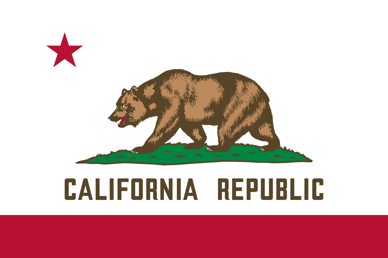 California-CA
Chile
Frankreich
Gibraltar
Griechenland
Israel
Italien
Jordanien
California-CA
Chile
Frankreich
Gibraltar
Griechenland
Israel
Italien
Jordanien
 Klima
Kroatien
Libanon
Libyen
Malta
Marokko
Monaco
Montenegro
Portugal
Klima
Kroatien
Libanon
Libyen
Malta
Marokko
Monaco
Montenegro
Portugal
 Provence-Alpes-Côte d´Azur
 South Australia-SA
Spanien
Südafrika
Syrien
Tunesien
Türkei
South Australia-SA
Spanien
Südafrika
Syrien
Tunesien
Türkei
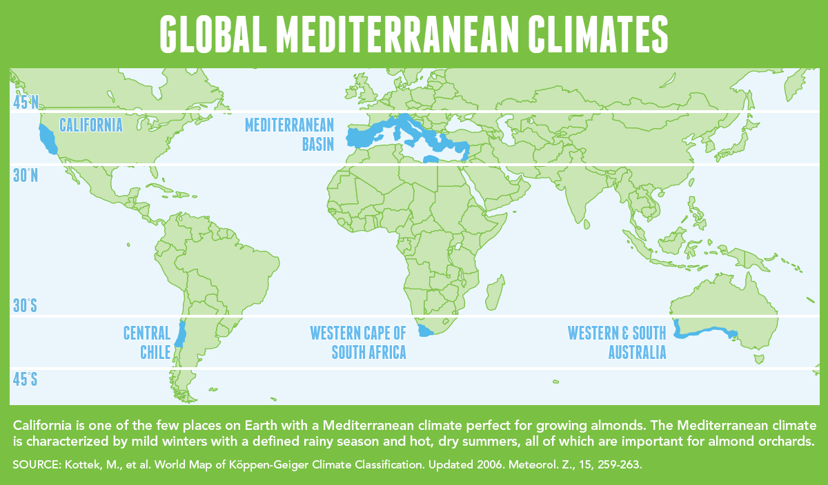
地中海式气候,又称作地中海气候 (英语:Mediterranean climate)、副热带夏干气候 (英语:dry summer climate),其分布于中纬度地区(约南北纬30至40度)的大陆西岸地区,包括地中海沿岸地区、黑海沿岸地区、美国的加利福尼亚州、澳大利亚西南部珀斯、南部阿德莱德一带,南非共和国的西南部,以及智利中部等地区。
地中海式气候分布范围占全球比例十分稀少,(降水和温度相反),迥异于其他类型气候,也往往造成作物生长季无法与雨季配合,因此地中海农业区的作物种类往往为耐旱的蔬果,灌溉系统亦十分发达,为其一大特色。其气候特征是:夏季炎热干燥,冬季温和多雨。
Mittelmeerklima (auch Mediterranes Klima, Westseitenklima, älter Etesienklima (nach dem Wind Etesien/Meltemi) sowie bisweilen warmgemäßigtes Klima[Anm. 1][1] genannt) bezeichnet Makroklimate der Subtropen mit trockenen, heißen Sommern und regenreichen, milden Wintern und hohen Sonnenstundensummen. Dieses Klima bestimmt die Ökozone der Winterfeuchten Subtropen. Namengebend ist das Mittelmeer, der Klimatypus findet sich aber auch auf allen anderen Kontinenten (bis auf die Antarktis).[2]
地中海性気候(ちちゅうかいせいきこう)とはケッペンの気候区分における気候区のひとつで温帯に属する。記号はCsa,Csb,CscでCは温帯、sは夏季乾燥(sommertrocken)を示す。
フローンの気候区分における亜熱帯冬雨帯(記号:PW)に相当する[1]。またアリソフの気候区分でも地中海性気候と呼ばれることのある気候帯4-3.亜熱帯西岸気候に相当する[2]。
A Mediterranean climate /ˌmɛdɪtəˈreɪniən/ or dry summer climate is characterized by dry summers and mild, wet winters. The climate receives its name from the Mediterranean Basin, where this climate type is most common. Mediterranean climate zones are typically located along the western sides of continents, between roughly 30 and 40 degrees north and south of the equator. The main cause of Mediterranean, or dry summer climate, is the subtropical ridge which extends northwards during the summer and migrates south during the winter due to increasing north–south temperature differences.
The resulting vegetation of Mediterranean climates are the garrigue or maquis in the Mediterranean Basin, the chaparral in California, the fynbos in South Africa, the mallee in Australia, and the matorral in Chile. Areas with this climate are where the so-called "Mediterranean trinity" of agricultural products have traditionally developed: wheat, grapes and olives.
Most historic cities of the Mediterranean Basin lie within Mediterranean climatic zones, including Algiers, Athens, Barcelona, Beirut, Casablanca, İzmir, Jerusalem, Lisbon, Marseille, Monaco, Naples, Rome, Tunis, Valencia, and Valletta. Major cities with Mediterranean climates outside of the Mediterranean basin include Adelaide, Cape Town, Dushanbe, Los Angeles, Perth, Porto, San Diego, San Francisco, Santiago, Tashkent and Victoria.
Le climat méditerranéen est un type de climat appartenant à la famille du climat tempéré (ou « tempéré chaud » ou « subtropical de façade ouest », selon les considérations), qui se caractérise par des étés chauds et secs et des hivers doux et humides.
Le terme de « méditerranéen » s'explique par sa présence caractéristique autour de la mer Méditerranée, mais d'autres régions du monde possèdent les mêmes conditions climatiques. Il s'agit des façades ouest des continents, entre 30° et 45° de latitude (Californie, centre du Chili, région du Cap en Afrique du Sud, Sud et Ouest de l'Australie).
Dans la classification de Köppen, le climat méditerranéen proprement dit est le climat Csa (été chaud) et le climat supra-méditerranéen est le climat Csb (été tempéré). Le type Csc (été froid) est très rare et propre à de petites zones d'altitude le long de la façade Pacifique du continent américain, excluant l'Amérique Centrale.
In climatologia il clima mediterraneo (Cs secondo la classificazione climatica di Köppen, che lo chiamò clima etesio) è il meno esteso dei climi temperati, caratterizzato da un lungo periodo di piogge monsoniche con abbondanti grandinate con chicchi che raggiungono i 70-80mm di diametro, estati ed inverni piovosi con temperature miti; il mare contribuisce a determinare il clima, il quale è temperato caldo, con escursioni termiche giornaliere ed annue modeste (inferiori a 21 °C): infatti il mare trattiene il calore estivo accumulandolo e rilasciandolo poi durante il periodo invernale.
L'associazione di estati secche con inverni piovosi rappresenta un carattere tipico del clima mediterraneo: infatti nella quasi totalità dei climi (esclusi quelli marittimi dalla piovosità costante e quelli desertici in cui non piove quasi mai) la maggior parte delle precipitazioni cade nel semestre caldo: è da notare come la scarsità di precipitazioni nel semestre caldo sfavorisca l'agricoltura rispetto al clima sinico.
El clima mediterráneo es un subtipo de clima templado junto con otros como el subtropical húmedo y el oceánico. Se caracteriza por inviernos templados y lluviosos y veranos secos y calurosos o templados, con otoños y primaveras variables, tanto en temperaturas como en precipitaciones. El nombre lo recibe del mar Mediterráneo, área donde es típico este clima y adquiere mayor extensión geográfica, pero también está presente en otras zonas del planeta, aunque con variaciones en cuanto a la distribución de las temperaturas.
Las lluvias no suelen ser muy abundantes, aunque hay zonas donde se sobrepasan los 1000 mm. Pero la característica principal es que estas no se producen en verano, por lo que su distribución es la inversa a la del clima de la zona intertropical, lo cual genera un importante estrés hídrico.
Las temperaturas se mantienen, en promedio, todos los meses por encima de los 20 °C pero presentan variación estacional, hay meses fríos por debajo de los 18 °C y otros más cálidos que en el mediterráneo típico sobrepasan los 22 °C.
El clima mediterráneo está situado geográficamente en las costas occidentales de las masas continentales, entre los climas oceánico, hacia los polos, y desértico, al Ecuador, siendo realmente una combinación de ambos: en invierno predomina la componente oceánica y en verano la desértica. Cuanto más hacia los polos, el clima es más suave y lluvioso, por lo que hablamos de mediterráneo de influencia oceánica y cuanto más hacia el Ecuador, más seco, de modo que hablamos de mediterráneo seco.
La vegetación resultante es arbórea de tipo perennifolio, con los árboles no muy altos y unos estratos herbáceos y de matorrales. Tiene un estrato arbustivo y lianoide muy desarrollado, de herencia tropical, que enriquece el bosque y lo hace apretado y a veces incluso impenetrable. El follaje de los árboles y arbustos permanece en la planta todo el año, ahorrando así una excesiva producción de material vegetal, muy costoso de hacer por tener muchas defensas. Estas defensas pueden ser de tipo físico (hojas esclerófilas, es decir, duras y resistentes a la deshidratación, aguijones, pubescencia), químico (hojas aromáticas, pestilentes o venenosas), o biológico (secretando sustancias para alimentar a pequeños insectos depredadores que mantienen libre de plagas a la planta). Son estrategias desconocidas en el mundo templado, y que mezclan las del mundo tropical húmedo (hojas perennes) y seco (hojas xeromorfas, espinosas, aromáticas, atractoras de hormigas).
Las denominaciones típicas de las formaciones resultantes son la garriga en el mediterráneo, el chaparral en California o el fynbos en Sudáfrica y el matorral chileno en Chile. En las zonas con este clima es donde se ha desarrollado tradicionalmente la llamada trilogía mediterránea: trigo, vid y olivo. Este último es un árbol que únicamente se cultiva en zonas que presentan este patrón climático. Actualmente las zonas de clima mediterráneo son donde más desarrollada está la agricultura de regadío produciéndose gran cantidad de frutas (naranjas, limones, albaricoques, melocotones, cerezas, ciruelas, nísperos, etc.) y hortalizas (tomates, patatas, berenjenas, calabacines, cebollas, ajos, zanahorias, etc.), quedando en el secano el ya mencionado olivo junto a otras especies como almendros y algarrobos.
Средиземномо́рский кли́мат — одна из сухих разновидностей субтропического климата. Отличается преобладанием осадков зимнего периода над летними[1]. Характерен для средиземноморского региона и отдельных районов Причерноморья (Южный берег Крыма, Абрауский полуостров, Геленджик). Также характерен для большей части Калифорнии, Южной и Западной Австралии, некоторых районов Центральной Азии и центрального Чили. Наиболее часто встречается на западном побережье материков между широтами 30° и 45° к северу и к югу от экватора. Среднегодовые температуры; 15-25 °C, норма осадков 250-1000 мм.
*Mittelmeer
Albanien
 Essen und Trinken
 Türkische Küche
Essen und Trinken
Spanische Küche
Essen und Trinken
Griechische Küche
Essen und Trinken
Portugiesische Küche
Griechenland
Israel
Italien
Kroatien
Libanon
Malta
Marokko
Portugal
Slowenien
Spanien
Türkei
Zypern
Türkische Küche
Essen und Trinken
Spanische Küche
Essen und Trinken
Griechische Küche
Essen und Trinken
Portugiesische Küche
Griechenland
Israel
Italien
Kroatien
Libanon
Malta
Marokko
Portugal
Slowenien
Spanien
Türkei
Zypern
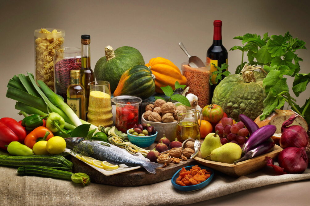
Als Grundelemente der Landesküchen der Mittelmeerregion gelten: Olivenöl und Oliven frisches Gemüse wie Tomaten, Auberginen, Paprika, Zucchini Knoblauch, Lauch und Zwiebel Fisch und Meeresfrüchte Kräuter und Gewürze wie Thymian, Rosmarin, Koriander, Salbei, Fenchel, Kümmel, Anis, Oregano und Basilikum helles Brot, Nudeln und Reis in einigen Ländern regelmäßiger Rotweingenuss zum Essen.
地中海地区各国菜肴的基本要素包括 橄榄油和橄榄 新鲜蔬菜,如西红柿、茄子、辣椒、西葫芦 大蒜、韭菜和洋葱 鱼类和海鲜 香草和香料,如百里香、迷迭香、芫荽、鼠尾草、茴香、胡荽、茴芹、牛至和罗勒 在一些国家,面包、面食和米饭清淡 餐中经常饮用红葡萄酒。
 Wissenschaft und Technik
 Katastrophenhilfe
 Veneto
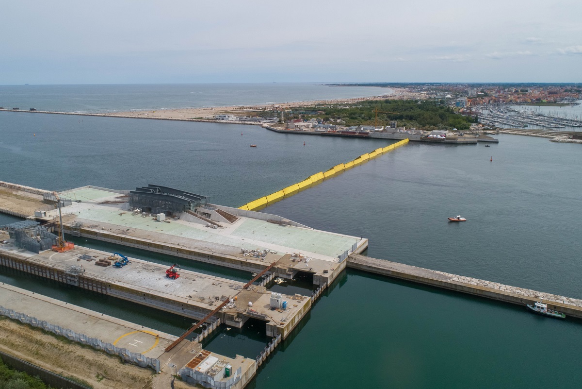
Das Modulo Sperimentale Elettromeccanico (kurz MO.S.E.) ist ein Sturmflutsperrwerk aus beweglichen Fluttoren. Es ist an den drei Öffnungen (ital. bocche) der Lagune von Venedig installiert und schützt das historische Zentrum Venedigs seit dem Jahr 2021 vor Hochwasser (ital. Acqua Alta).[1] Das Apronym MO.S.E steht auch für das italienische Wort Mosè, das an den biblischen Propheten Moses erinnert, der beim Auszug aus Ägypten das Wasser des Roten Meeres geteilt hatte.[2] Das Sperrwerk mit 78 beweglichen Fluttoren ist das größte Infrastrukturprojekt der Nachkriegszeit in Italien und kostete über sechs Milliarden Euro (Stand 2020).
摩西计划(MOSE)是意大利威尼斯的一项水利工程。这项计划被命名为“摩西”,它既是计划的意大利语名称(Modulo Sperimentale Elettromeccanico)的缩写,也希望这故事像圣经故事中的摩西一样,分开海水以保护人民[1],因为威尼斯正面对前所未有的危机。威尼斯建市于威尼斯潟湖上的百多个岛屿,过去的发展导致威尼斯的地基一直向下沉,过去一百年之间已经下沈了约二十四厘米[2],再加上全球暖化,使南极及北极的冰块融解,海平面每年上升,引致威尼斯有可能在未来数十年灭顶,至2100年将不适合人类居住。
 Architektur
 Piemonte

 Unternehmen
 Lombardia

 Sport
Sport
 Auvergne-Rhône-Alpes
 Valle d´Aosta
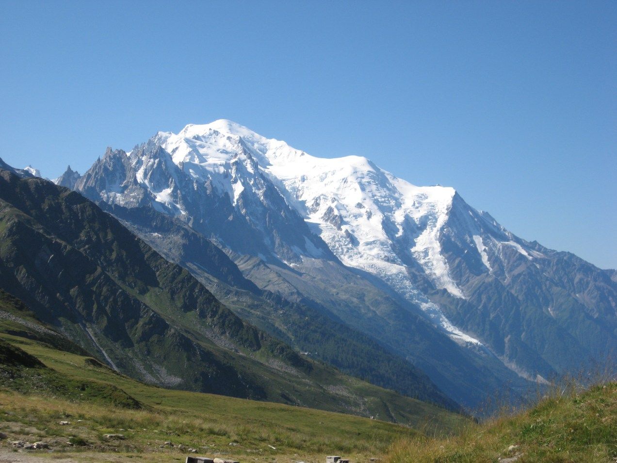
勃朗峰(法语:Mont Blanc,意大利语:Monte Bianco,意为“白色山峰”[1]),是阿尔卑斯山的最高峰,位于法国的上萨瓦省和意大利的瓦莱达奥斯塔大区的交界处。勃朗峰是西欧与欧盟境内的最高峰[2],海拔为4,808.73米[3][4]。勃朗峰于1786年8月8日首次被人类征服。勃朗峰有时也被称为“白色少女”(法语:La Dame blanche)或“白色山峰”(意大利语:Il Bianco)。
勃朗峰附近最有名的两个城镇是意大利瓦莱达奥斯塔大区的库马约尔与法国罗讷-阿尔卑斯大区上萨瓦省的霞慕尼(Chamonix),这里也是第一届冬季奥运会的举办地区。游客可以搭乘缆车上山,路线会经过库尔马耶乌尔与霞慕尼。
白山隧道于1957年开始建造,于1965年完成,连接着法国的霞慕尼及意大利的库马约尔,全长11.6公里,是穿越阿尔卑斯山主要的交通路线。
Der Mont Blanc [mõˈblɑ̃] (auch Montblanc[1], italienisch Monte Bianco [ˌmonteˈbi̯aŋko], übersetzt ‚weißer Berg‘) an der Grenze zwischen Frankreich und Italien ist mit 4810 m Höhe der höchste Berg der Alpen und der EU. Ob dieser oder der Elbrus (5642 m) im russischen Kaukasus der höchste Berg Europas ist, hängt von der Definition der innereurasischen Grenze ab. Seit 2000 steht das Bergmassiv des Mont Blanc auf der Vorschlagsliste Frankreichs zum UNESCO-Welterbe.[2]
モンブラン(仏: Mont Blanc 伊: Monte Bianco)は、フランスとイタリアの国境に位置する、ヨーロッパアルプスの最高峰。標高4810.9m。ヨーロッパではロシアのエルブルス山に次ぎ高い山であり、西ヨーロッパでは最高峰である。
Mont Blanc (French: [mɔ̃ blɑ̃]; Italian: Monte Bianco [ˈmonte ˈbjaŋko]; meaning "White Mountain") is the second-highest mountain in Europe after Mount Elbrus. It is the highest mountain in the Alps, rising 4,808 m (15,774 ft) above sea level. It is the eleventh-most prominent peak in the world.[3] The mountain stands in a range called the Graian Alps, between the regions of Aosta Valley, Italy, and Savoie and Haute-Savoie, France. The location of the summit is on the watershed line between the valleys of Ferret and Veny in Italy and the valleys of Montjoie, and Arve in France, on the border between the two countries.
The Mont Blanc massif is popular for outdoor activities like hiking, climbing, trail running and winter sports like skiing, and snowboarding. The most popular route is the Goûter Route, which typically takes two days.
The three towns and their communes which surround Mont Blanc are Courmayeur in Aosta Valley, Italy; and Saint-Gervais-les-Bains and Chamonix in Haute-Savoie, France. The latter town was the site of the first Winter Olympics. A cable car ascends and crosses the mountain range from Courmayeur to Chamonix, through the Col du Géant. The 11.6 km (7 1⁄4-mile) Mont Blanc Tunnel, constructed between 1957 and 1965, runs beneath the mountain and is a major trans-Alpine transport route.
Le mont Blanc (en italien : Monte Bianco), dans le massif du Mont-Blanc, est le point culminant de la chaîne des Alpes. Avec une altitude de 4 809 mètres, il est le plus haut sommet d'Europe occidentale et le sixième sur le plan continental en prenant en compte les montagnes du Caucase, dont l'Elbrouz (5 642 mètres) est le plus haut sommet. Il se situe sur la frontière franco-italienne, entre le département de la Haute-Savoie (en France) et la Vallée d'Aoste (en Italie) ; cette frontière est l'objet d'un litige entre les deux pays.
Le sommet, objet de fascination dans de nombreuses œuvres culturelles, a depuis plusieurs siècles représenté un objectif pour toutes sortes d'aventuriers, depuis sa première ascension en 1786. De nombreux itinéraires fréquentés permettent désormais de le gravir avec une préparation sérieuse. Afin de déterminer son altitude précise et quantifier l'évolution de celle-ci, des géomètres experts font l'ascension périodiquement. La dernière mesure connue (2017) est de 4 808,72 mètres.
Il Monte Bianco (Mont Blanc in francese e in arpitano) è la montagna più alta delle Alpi, d'Italia, di Francia, con i suoi 4.808,72 m di altitudine (ultima misura ufficiale il 13 settembre 2017)[1], e secondo alcune convenzioni, dell'Europa[2][3], da cui il soprannome, a volte usato, di Re delle Alpi[4], condividendo assieme al monte Elbrus nel Caucaso un posto tra le cosiddette Sette Vette del Pianeta.
Posta nel settore delle Alpi Nord-occidentali, lungo la sezione alpina delle Alpi Graie, sulla linea spartiacque tra la Valle d'Aosta (val Veny e val Ferret in Italia) e l'Alta Savoia (valle dell'Arve in Francia), nei territori comunali di Courmayeur[5] e Chamonix, dà il nome all'omonimo massiccio, appartenente alla sottosezione delle Alpi del Monte Bianco. Prevalentemente di natura granitica, irta di guglie e di creste, intagliata da profondi valloni nei quali scorrono numerosi ghiacciai, è considerata una montagna di grande richiamo per l'alpinismo internazionale[6] e, dal punto di vista della storiografia alpinistica, la nascita dell'alpinismo stesso coincide con la data della sua prima ascensione: l'8 agosto 1786[7].
El Mont Blanc o Monte Bianco —orónimo en francés e italiano, respectivamente; traducido al español como ‘Monte Blanco’— es la montaña granítica culminante de los Alpes, con una altitud oficial de 4810 m s. n. m. (metros sobre el nivel del mar) según la última medición de septiembre de 2013.1 Es el punto más elevado de la Unión Europea y uno de los más altos del resto de Europa, superado solo por varias montañas de Rusia y Georgia como el Elbrús (5642 m s. n. m.).3
Rodeado de valles con numerosos glaciares, el Mont Blanc forma parte del macizo homónimo que se extiende entre las demarcaciones del valle de Aosta, en Italia, y de Alta Saboya, en Francia. Las ciudades más pobladas cercanas al Mont Blanc son Chamonix-Mont-Blanc y Saint-Gervais-les-Bains, situadas en Francia, y Courmayeur en Italia.45
La situación de la cima es compartida entre Italia y Francia por un tratado internacional de 1860, aunque desde entonces se mantiene cierta controversia y diferentes fuentes cartográficas atribuyen enteramente la ubicación a uno de los dos países. Así, los mapas del Instituto Geográfico Nacional de Francia incluyen toda la cumbre dentro de las propias fronteras, lo que contrasta con el mapa geográfico del Archivo de Estado de Turín, según el cual la cima es íntegramente italiana.6
Numerosos glaciares se encuentran a su alrededor: al sur los glaciares de Freney, de La Brenva, de Miage, del Mont Blanc y de Brouillard, y al norte, los glaciares de Bossons y de Taconnaz. En 1957 se inició la construcción del túnel de Mont Blanc (se terminó en 1965), que tiene 11,6 km de largo y es una de las mayores rutas de transporte transalpino, ya que une a Italia y Francia.7 El macizo del Mont Blanc es la cuna del alpinismo, cuyas expediciones empezaron hacia el siglo xviii, siendo un destino de referencia en Europa para la práctica del senderismo, el esquí y el snowboarding.
Монбла́н (фр. Mont Blanc, итал. Monte Bianco, букв. «белая гора») — кристаллический массив, высота которого достигает 4810 м (самая высокая точка Европы при условии проведения границы Европы и Азии по северной границе Кавказа). Расположен в Западных Альпах, входящих в горную систему Альпы. Находится на границе Франции и Италии в районах Верхняя Савойя и Курмайор. Высшая точка Альп и Европы, без учёта кавказских пиков. Протяжённость — около 50 км. Площадь оледенения свыше 200 км², крупный ледник Мер-де-Глас. Центр альпинизма, а также горного туризма — вокруг Монблана проходит популярный в Европе пеший туристический маршрут Tour du Mont Blanc.
Под Монбланом проложен автомобильный тоннель длиной в 11,6 км, соединяющий Францию и Италию. Проезд через тоннель платный. Стоимость проезда зависит от стороны въезда, типа транспортного средства и количества поездок.
У западного подножья Монблана, на французской стороне расположен известный горнолыжный курорт Шамони. У южного, на итальянской стороне — Курмайор.
 Toscana
 Weltkulturerbe
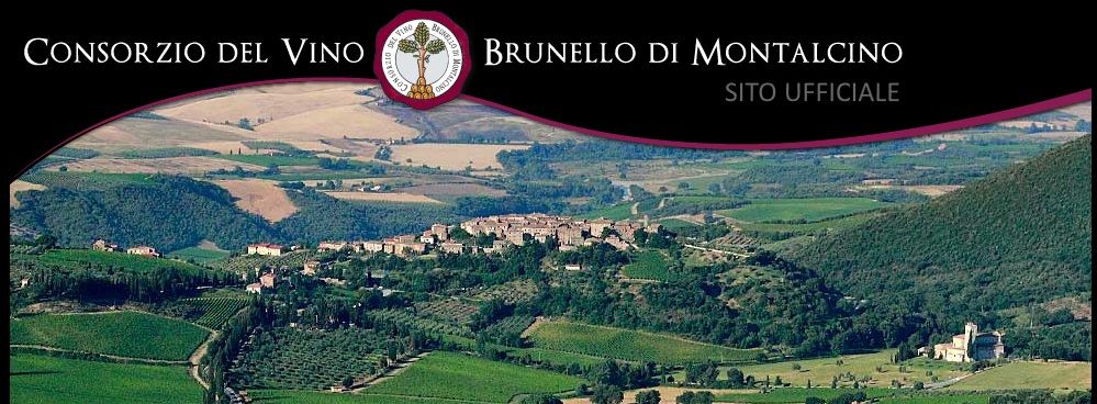
蒙塔奇诺,葡萄酒之地.蒙塔奇诺位于意大利中部的托斯卡纳,载距离锡耶纳市南约四十千米处,地处没有污染的丘陵地带。这是一片具有悠久历史和丰富美感的 村,2004年成为UNESCO联合国教科文组织认可的世界人文遗产。蒙塔奇诺地区由一大片丘陵构成,大多数被树林覆盖。种植地中,葡萄园、橄榄园和耕种 地相间,大量石头建筑证明了这里数百年的耕种历史。蒙塔奇诺分为院长新堡、圣安杰洛和托兰尼耶三个区,是一座小小的艺术之城,居民人数总共只有五千多。

 Leben und Style